Introduction to Nepal Trek Challenge
A Nepal trek challenge is not about finding the biggest number on a map. It is about matching one specific kind of difficulty to what your body, your experience and your calendar can handle. Some routes are hard because of altitude, some because of remoteness, some because three high passes arrive back to back, and some simply because they last three weeks. This guide ranks the most demanding routes by what actually makes them hard, so you can choose a trek that stretches you without putting you in over your head.
The short answer: the Everest Three Passes is the toughest of the lodge-based routes, Kanchenjunga is the most remote of the long treks, the Dhaulagiri Circuit is the most committing camping trek on this list, and the Manaslu Circuit is the best balance of challenge and support for people who already have a high-altitude trek behind them. The Annapurna Circuit with Tilicho Lake is the most accessible big test. Each section below gives verified altitudes, typical length, the real source of the difficulty and a clear fit-or-skip test.
What Makes a Nepal Trek Challenge Hard? Four Drivers of Difficulty
Most lists of the hardest treks in Nepal rank by maximum altitude alone. That misses what actually breaks plans. A trek can top out at 5,100 metres and still be harder than one that reaches 5,500, because the other drivers matter just as much.
- Altitude: how high you sleep, how fast you gain height and how many nights you spend above 4,000 metres. This is the biggest single risk on any high-altitude trekking route.
- Remoteness: how far you are from a road, a clinic or a helicopter landing. On remote treks a minor problem becomes a major one, because retreat takes days.
- Terrain and passes: scree, glacier crossings, exposed traverses and high passes. A pass day can run eight to ten hours or longer, and weather decides whether you cross at all.
- Duration: three weeks of cumulative fatigue is a different test from ten days, even at lower altitude.
Support style is a fifth factor worth naming. A teahouse trek gives you a bed, hot food and other people on the trail. A camping trek removes all three. The same pass feels very different when you arrive at a warm lodge than when you arrive at a tent that your crew is still pitching.
The Hardest Treks in Nepal at a Glance
The table compares the routes covered in this guide. Altitudes and lengths are typical figures from operator itineraries and trekking guides, and published numbers differ by tens of metres and by a few days, so treat them as planning values.
| Trek | Highest point | Typical length | Main challenge | Support style |
|---|---|---|---|---|
| Everest Three Passes | Kongma La, 5,535 m | About 17 to 22 days | Three high passes, icy Cho La | Teahouses |
| Annapurna Circuit with Tilicho | Thorong La, 5,416 m | About 16 to 18 days | Long pass day, scree near Tilicho | Teahouses |
| Manaslu Circuit | Larkya La, about 5,106 m | 12 to 16 days | Remote, windy pass, restricted area | Teahouses |
| Manaslu with Tsum Valley | Larkya La, about 5,106 m | 18 to 23 days | Distance and fatigue | Teahouses |
| Dhaulagiri Circuit | French Pass, 5,360 m | 18 to 21 days | Glaciers, two passes, no lodges | Camping |
| Upper Dolpo | Kang La, 5,151 m | About 20 to 21 days | Remote, restricted, camping | Mostly camping |
| Kanchenjunga Base Camps | Pangpema, 5,143 m | About 19 to 22 days | Distance, two base camps, remote | Teahouses plus some camps |
Everest Three Passes: The Toughest Teahouse Trek
The Everest Three Passes trek links the three highest passes of the Khumbu region into one loop: Kongma La at about 5,535 metres, Cho La at about 5,420 metres and Renjo La at about 5,360 metres. It also takes in Everest Base Camp at 5,364 metres and, on most itineraries, an optional climb of Gokyo Ri at about 5,357 metres. Published itineraries run from roughly 17 to 22 days.
What makes it hard is the lack of recovery. You spend long stretches above 4,800 metres, and the passes come one after another. A common clockwise shape runs from Lukla through Namche and Dingboche, over Kongma La to Everest Base Camp, across Cho La to Gokyo, over Renjo La and out through Thame. The loop can be walked in either direction, and many trekkers choose the order based on how they acclimatize.
Where the difficulty really sits
- Kongma La: rocky scrambling and a steep final stretch, sometimes with fixed ropes, and a real hazard when snow or ice covers the rock.
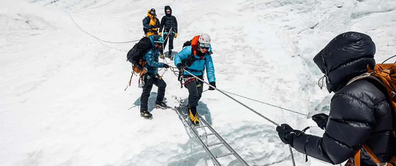
- Cho La: a glacier traverse that needs careful route-finding. Crampons are commonly advised for icy sections in winter and spring, and the eastern descent toward Thagnak crosses broken ice.
- Renjo La: no glacier crossing is described, which makes it the gentlest of the three, though it still comes after many days at altitude.
Our dedicated guide to Cho La Pass covers the glacier section and both approach routes in detail.
Season matters more here than on almost any other route. Spring and autumn are the main windows, and operators name October and April as the most stable months. Winter brings snow and some teahouse closures above 4,500 metres. The monsoon brings frequent flight cancellations at Lukla, which can wreck a schedule that has no spare days. You need the Sagarmatha National Park permit and the Khumbu local municipality permit, and operators generally say the old TIMS card is not required in the Everest region, though you should confirm that before you travel.
It suits you if you have already done a trek above 4,500 metres, you are comfortable with exposed scrambling and you can build spare days into your plan. Skip it if this would be your first high-altitude trek, or if you only have two weeks.
Annapurna Circuit with Tilicho Lake: The Most Accessible Big Test
If you want a serious Himalayan challenge with a well-developed lodge network, the Annapurna Circuit with the Tilicho Lake side trip is the usual answer. Thorong La, at 5,416 metres, is the high point, and operators plan the full route at around 16 to 18 days. Tilicho Lake sits at about 4,919 metres and adds a long, steep side trip with an exposed landslide traverse between Shree Kharka and Tilicho Base Camp.
The pass crossing is the headline test. You leave from the high camp at Thorong Phedi, around 4,500 metres, and climb in the dark before the wind picks up, then face a long descent to Muktinath. It is cold, thin and tiring, but the infrastructure on either side makes it far more manageable than a camping route. Our full guide to Thorong La Pass explains the crossing day by day.
It suits you if you want a high-altitude challenge with food, beds and company, and you can commit two to three weeks. Skip it if you dislike exposed trails: the Tilicho traverse and the pass day both demand focus.
Manaslu Circuit: Remote, Restricted and Rewarding
The Manaslu Circuit circles the eighth-highest mountain in the world, Manaslu at 8,163 metres, and crosses Larkya La. Most sources give the pass at about 5,106 metres, though some operators list 5,160 metres, which appears to reflect the cairn rather than the saddle. The classic circuit runs 12 to 16 days and covers roughly 177 kilometres, according to trek guides.
The route is hard for reasons that are not obvious from a map. The trail follows the Budhi Gandaki gorge, with narrow paths, stone steps, landslide-prone sections and a long climb into a high, cold valley. There is no road access beyond Machha Khola, so any evacuation depends on walking out or on a helicopter, which depends on weather. On the pass itself, wind often builds by mid-morning, so crossing days start very early and can run for many hours.
Manaslu is a restricted area. You need a restricted area permit through a registered agency, which operators quote at USD 100 for seven days from September to November and USD 75 from December to August, plus the Manaslu Conservation Area Permit at NPR 3,000. A licensed guide is mandatory. Spring from April to early May and the weeks from mid-October to mid-November are the realistic windows for the pass, while the monsoon brings landslides to the lower gorge and late November to February brings snow and closures.
It suits you if you have already completed a high-altitude trek and want quiet trails and cultural depth. Skip it if you need a short trip: even the classic route takes close to two weeks.
Dhaulagiri Circuit: Where the Teahouses Stop
The Dhaulagiri Circuit is the most committing route on this list because it removes the safety net. Past the first day or two from Darbang, there are no teahouses. Camping is required from Italian Base Camp onward, and the high circuit has no settlements, lodges or permanent trail. Published itineraries run 18 to 21 days.
The difficulty stacks up quickly. French Pass at 5,360 metres and Dhampus Pass at about 5,240 metres come on consecutive days, with glacier travel on the Dhaulagiri and Hidden Valley glaciers in between. Expect six to eight hour days for two to three weeks, cold nights in tents and a long retreat if something goes wrong. Altitude is described by operators as the biggest single risk, and a licensed guide with a full camp crew is required in practice, even though the route sits inside the Annapurna Conservation Area and uses the ACAP permit rather than a restricted area permit.
Prior multi-day high-altitude experience is not a suggestion here. Operators say you should have crossed a pass near 5,000 metres before. October and November are best, April and May are the secondary window, and the passes close in winter.
It suits you if you have camping experience, strong fitness and real altitude history. Skip it if you rely on lodges for warmth and recovery.
Tsum Valley: The Side Trip That Doubles the Manaslu Commitment
Tsum Valley is a restricted-area valley north of the Manaslu route, known for monasteries and a strong Tibetan Buddhist character. It is much lower than the passes on this list, with Chumling at about 2,386 metres, Chhokangparo at about 3,031 metres and Mu Gompa at about 3,700 metres, the highest point in the valley. Its challenge is time and distance, not altitude.
Combining Tsum Valley with the Manaslu Circuit stretches the trek to about 18 to 23 days and roughly 220 kilometres, with daily walking of six to nine hours. That cumulative load, plus about nine nights above 3,000 metres and a pass crossing late in the trip, makes the combined route harder than its altitude suggests. The advantage is acclimatization: the valley gives you days at moderate height before Larkya La.
Tsum Valley needs its own restricted area permit, quoted at USD 40 for the first seven days in September to November and USD 30 from December to August, on top of the Manaslu permits. As on the main circuit, a licensed guide and a registered agency are required.
It suits you if you want culture as much as altitude and have three weeks free. Skip it if you only want the pass and the mountain scenery.
Upper Dolpo and Nar Phu: Remote Restricted Valleys
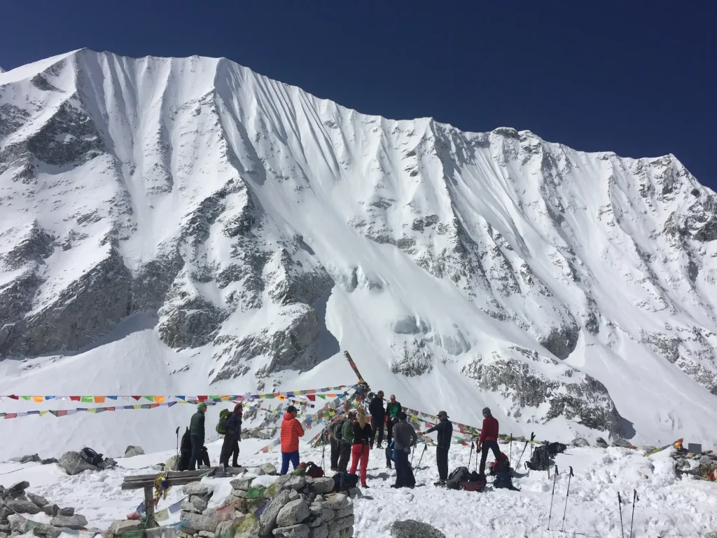
Upper Dolpo is among the most remote trekking regions in Nepal. Reaching it takes a flight to Juphal via Nepalgunj, followed by multi-day walking, with a typical itinerary running around 21 days and mostly camping. Kang La, at about 5,151 metres, is one of the high points, and the route includes exposed sections such as trails built on wooden pegs and narrow gorges. The area was opened to travellers only in 1989, and it remains largely untouched.
Dolpo is a restricted area, and operators commonly quote the permit at USD 500 for the first ten days and USD 50 for each day after that. Your agency arranges that permit, and the fee depends on how many days you spend inside the restricted zone.
Nar Phu Valley is a shorter, tougher alternative close to the Annapurna Circuit. It has a high pass, Kang La, listed by one source at about 5,320 metres, very limited teahouses and a restricted area permit on top of ACAP. If you want a remote experience without the full Dolpo commitment, it is worth a look.
They suit you if solitude matters more to you than comfort. Skip them if you want an easy exit route or reliable flights.
Kanchenjunga Base Camps: The Longest Walk to the Quietest Mountain
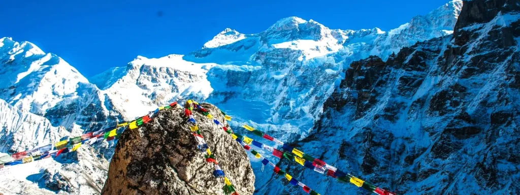
Kanchenjunga, at 8,586 metres, is the third-highest mountain in the world, and the trek to its base camps is one of the longest and quietest in Nepal. Most itineraries link both sides of the mountain. The north base camp, Pangpema, sits at about 5,143 metres and is the high point. The south base camp, Oktang, sits at about 4,730 metres, and Sele La, at about 4,480 metres, connects the two sides. Published plans run 19 to 22 days.
The challenge here is attrition. Days are long, the trail is lightly travelled and facilities thin out as you climb. One operator describes full days between Lhonak and Pangpema without passing another group. Teahouses reach as far as Lhonak on the north side and Ramche on the south, and quality drops above Ghunsa, with shared bathrooms and basic rooms. Some groups add tents at the top. Flights into the eastern hills are weather-dependent, and wet months bring leeches.
The region is restricted, so a licensed guide and a registered agency are required. Fees are where the sources disagree: published figures for the restricted area permit and the conservation area permit differ between operators, and the status of the TIMS card is described inconsistently. Ask your agency for the current numbers instead of relying on a single page. April, with rhododendrons in bloom, and October are the best months, while the monsoon and winter bring poor conditions and snow risk on Sele La.
It suits you if you want a long, quiet trek and have strong endurance. Skip it if you are short on time or want many fellow trekkers.
How to Choose the Right Challenge for You
The right Nepal trek challenge is the one that fits your experience, your time and your tolerance for risk, not the hardest one you can name. A simple way to decide is to answer four questions honestly.
- What is your highest sleeping altitude so far? If it is below 4,000 metres, start with a lodge-based trek that stays below about 5,000 metres, then step up.
- How many days can you take? Anything above ten days needs buffer for weather and rest.
- Do you want lodges or tents? Camping routes demand more from you and from your crew, and they remove the option of a quick bed and meal.
- How much remoteness can you accept? A trek with a helicopter-only exit needs more careful planning and insurance.
| If this describes you | Consider |
|---|---|
| First big Himalayan trek, 2 to 3 weeks available | Annapurna Circuit with Tilicho Lake |
| Prior trek above 4,500 m, strong on rough terrain | Everest Three Passes |
| Wants quiet trails and culture, prior altitude experience | Manaslu Circuit, with or without Tsum Valley |
| Camping experience and real altitude history | Dhaulagiri Circuit |
| Wants remoteness above all, three weeks free | Kanchenjunga or Upper Dolpo |
If you finish one of these and feel ready for more, the next step is usually a trekking peak. Our overview of peak climbing in Nepal explains how those objectives differ from a trek and which peaks suit first-timers.
Fitness and Training for a Tough Himalayan Trek
Altitude does not respond to training the way muscles do, but fitness still matters. Strong legs and good aerobic capacity make long days less punishing, and they leave you more energy for the nights when you sleep badly. Start months before departure, not weeks.
- Build an aerobic base: regular running, cycling, swimming or fast walking, several times a week.
- Train with load: hike with a loaded daypack on hills or stairs, so your legs and back are used to climbing and descending for hours.
- Practise back-to-back days: a long hike followed by another the next day trains the fatigue that high-pass routes create.
- Strengthen knees and ankles: lunges, step-ups and balance work protect joints on long descents.
- Break in your boots: blisters end more treks than lack of fitness.
Our guide on how to train for the Annapurna Base Camp trek lays out a full plan, and the principles carry over directly. For the harder routes in this article, add more weighted hiking and longer consecutive days.
Altitude Safety: The Rules That Keep You Moving
Every trek above is hard mainly because of altitude, so the safety rules matter more than any other planning step. The US Centers for Disease Control and Prevention gives guidance in its Yellow Book chapter on high-altitude travel and altitude illness. The core points are consistent across mountain medicine:
- Above 3,000 metres, avoid raising your sleeping altitude by more than about 500 metres per night.
- Add an extra acclimatization night for every 1,000 metres of sleeping altitude you gain.
- Keep exercise mild for the first 48 hours at altitude.
- Never ascend to sleep while you have symptoms of altitude illness, however minor they seem.
- Descend if symptoms worsen despite rest. A descent of about 300 metres often brings quick relief from mild altitude sickness.
Acute mountain sickness usually starts with a headache plus loss of appetite, dizziness, fatigue or nausea, often within 2 to 12 hours of ascent, and it typically resolves in 12 to 48 hours if you do not climb further. The serious conditions are different. Breathlessness at rest, a persistent cough or chest congestion can signal fluid in the lungs, and confusion, loss of balance or unusual drowsiness can signal swelling of the brain. Both require urgent descent.
Some trekkers discuss acetazolamide with a doctor before departure. That is a medical decision to make with a professional who knows your history, not a gear-list item. For a deeper look at acclimatization planning, our high altitude expedition guide covers how to structure the climb.
Packing for a High-Pass Trek: What Changes at 5,000 Metres
You do not need mountaineering gear for most routes in this article, but you do need equipment that works at sub-zero temperatures and on loose, icy ground. The difference between a good pass day and a bad one is often a single item, such as warm gloves or a pair of traction spikes.
- Sleeping bag: rated well below freezing, because nights above 4,000 metres are cold even in the best season. On camping routes it is the most important item you own.
- Layers: a base layer, a warm mid-layer, a down jacket and a windproof, waterproof shell. Wind on a pass can feel far colder than the thermometer suggests.
- Traction: lightweight spikes or crampons for icy sections. Operators advise crampons for Cho La in winter and spring, and many agencies do not provide them, so confirm before you go.
- Poles: they save knees on long descents and add balance on scree and moraine.
- Sun protection: glacier-grade sunglasses, a hat and high-factor sunscreen. Snow and thin air make sunburn and snow blindness real risks.
- Water treatment and insulated bottles: stay hydrated without relying on bottled water, and stop bottles freezing overnight.
- Headlamp and spare batteries: pass days start in the dark, and cold drains batteries quickly.
- Medical kit and insurance papers: carry blister care, painkillers, any prescribed medication and proof of cover that includes helicopter evacuation.
Pack light enough that you can carry your daypack comfortably for ten hours. A heavy pack is a hidden source of fatigue on exactly the days when you need energy most.
Permits and Guide Rules for Challenging Treks
The harder the trek, the more likely it is to cross a restricted area, and that changes the paperwork. A restricted area permit has to be arranged by a registered trekking agency, is tied to your itinerary dates and requires a licensed guide. That covers Manaslu, Tsum Valley, Upper Dolpo, Nar Phu and Kanchenjunga. The Everest Three Passes and Dhaulagiri Circuit use national park and conservation area permits instead, and the Annapurna Circuit uses ACAP.
Guide rules for other routes have been less stable. The Nepal Tourism Board decided in 2023 that licensed guides would be compulsory for solo foreign trekkers, as the Kathmandu Post reported on the guide mandate, but 2026 operator pages disagree on how it is enforced in different regions. Some operators also report that since March 2026 a single trekker can apply for a restricted area permit through an agency, with a guide still required. Because these details come from agency pages, confirm them before you plan around them.
For the full breakdown of fees, documents and what is disputed, read our complete guide to trekking permits in Nepal. For the toughest routes, the practical advice is simple: go with a registered agency and a licensed guide whatever the legal position on a particular day.
Best Season for a High-Pass Trek in Nepal
Spring and autumn are the safest windows for every route in this article, and several of them are almost unusable outside those seasons. The pattern is consistent across sources.
| Season | Months | What to expect on high routes |
|---|---|---|
| Spring | March to May | Warming days, rhododendrons at lower elevations, lingering snow on passes early in the season |
| Monsoon | June to August | Landslides on lower trails, cloud over views, flight cancellations at Lukla; most high-pass routes avoid it |
| Autumn | September to November | The most stable weather, clearest skies and the busiest permit offices and lodges |
| Winter | December to February | Snow and pass closures, cold nights, reduced teahouse service above about 4,500 m |
October stands out for stability on most routes, and April is the best spring month on several. If you can only travel in a shoulder month, ask your agency how the pass conditions look and build in at least two spare days.
When Weather Closes a Pass: Planning for the Day It Goes Wrong
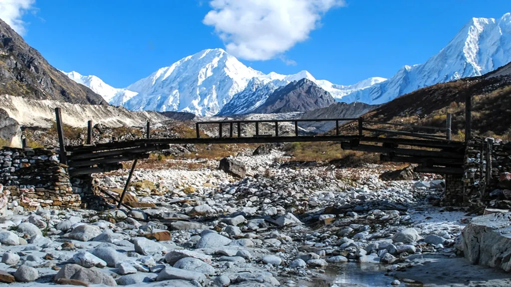
On every route in this guide, a pass day is a decision, not a schedule item. Wind, fresh snow or poor visibility can make a crossing unsafe, and the right response is to wait or turn around, not to push on. Trekkers who plan for that reality have a much better experience than those who plan for perfect weather.
- Build spare days into the plan. At least two buffer days on a three-week trek turns a closed pass into a delay, not a failed trip.
- Agree a turn-around rule before you start. Decide in advance that you will turn back if you have not reached a certain point by a certain time, and let your guide enforce it.
- Listen to local lodge owners. People who live and work on the trail know conditions better than any website, and their advice on whether to go is worth more than a forecast.
- Keep a flexible itinerary. Many agencies can reorder the loop or shorten the route if weather or health demands it. Ask about that before booking.
- Remember the flight risk. Lukla and eastern hill airstrips are weather-dependent, so leave slack at both ends if you can.
Turning back is not a failure. On remote routes, it is often the single smartest decision of the trip, and it preserves the option to try again.
The Mental Side of a Hard Trek
Most people prepare their legs and forget their heads. On long, high routes, the hardest moments are rarely the steepest. They are the cold dawn before a pass, the third day of poor sleep, the afternoon when the trail seems to go on forever. Knowing that in advance makes it easier to handle.
A few habits help. Break each day into short stages instead of thinking about the whole route. Eat and drink on a schedule, because low energy and dehydration feel like low morale. Keep your pace slow enough that you can talk, which also protects you against altitude problems. And talk to your guide early about how you feel, because small issues are much easier to manage than large ones.
It also helps to be honest about your motive. If you are doing this to prove something, you may push when you should rest. If you are doing it because you love the mountains, you are more likely to make sensible decisions when conditions change.
Common Mistakes on a Difficult Himalayan Trek
- Choosing by altitude alone. Remoteness, camping and duration often matter more than the highest pass.
- Skipping acclimatization days. Rest days feel like lost time and are actually what makes the pass crossing possible.
- Underestimating cold. Nights above 4,000 metres fall well below freezing, and a thin sleeping bag turns a good trek into a miserable one.
- Cutting spare days. A schedule with no slack turns one bad weather day into a failed trek.
- Starting pass days late. Wind and afternoon weather make early starts non-negotiable.
- Relying on one source for rules. Fees and guide requirements change. Confirm with an agency or the issuing office.
- Weak insurance. Check that cover includes the altitude you will reach and helicopter evacuation.
- Ignoring your own symptoms. A worsening headache is a reason to stop climbing, not to push through.
Agency or Independent: Which Route Makes Sense?
For restricted areas the choice is made for you, because a registered agency and a licensed guide are required. For other routes, the question is how much risk and logistics you want to carry yourself. An agency arranges permits, transport, guides, porters and, on camping routes, the whole crew, kitchen and equipment. That support is essential on Dhaulagiri and Dolpo and valuable on Three Passes.
Whatever you choose, ask direct questions before you pay. Which permits are included? How many acclimatization and spare days are built in? What is the evacuation plan? What insurance do you require? An operator who answers clearly and in writing is a good sign.
FAQs about Challenging Treks in Nepal
1. What is the hardest trek in Nepal?
There is no single answer, because difficulty depends on altitude, remoteness, terrain and length. The Great Himalaya Trail is the longest, spanning months, while the Dhaulagiri Circuit, Kanchenjunga and Upper Dolpo are among the most demanding standard routes. Among lodge-based treks, the Everest Three Passes is widely regarded as the toughest.
2. Which challenging trek is best for someone with some experience?
The Annapurna Circuit with Tilicho Lake is the usual step up, because it reaches 5,416 metres at Thorong La but keeps a developed lodge network. The Manaslu Circuit is the next step for people who want quieter trails and have already completed a high-altitude trek.
3. How fit do I need to be?
You should be comfortable walking six to eight hours a day for consecutive days, with a loaded pack, and recovering well. Train for months with aerobic work, weighted hiking and back-to-back long days. Fitness helps, but acclimatization and good judgement matter more than speed.
4. How many days does a challenging trek take?
Most take two to three weeks. Published itineraries run about 12 to 16 days for the Manaslu Circuit, 16 to 18 for the Annapurna Circuit with Tilicho, 17 to 22 for Everest Three Passes, 18 to 21 for Dhaulagiri and 19 to 22 for Kanchenjunga.
5. What is the best season for a high-pass trek?
Spring from March to May and autumn from September to November. October is the most stable month on many routes, and April is a strong spring choice. The monsoon and winter bring landslides, closures and snow on passes.
6. Do I need a permit for these treks?
Yes. Everest routes need the Sagarmatha National Park permit and the local municipality permit, Annapurna and Dhaulagiri need ACAP, and Manaslu, Tsum, Dolpo, Nar Phu and Kanchenjunga need restricted area permits through a registered agency. Confirm current fees before you travel.
7. Do I need a guide?
A licensed guide is mandatory in restricted areas. For other routes, rules have changed since 2023 and sources disagree on enforcement. On the hardest routes, a guide is strongly advisable whatever the legal position, because of weather, route-finding and altitude risk.
8. What drives the cost of a challenging trek?
Length, support style and remoteness. Camping routes need a crew, equipment and food carried in, and restricted areas add permit fees. Flights, extra days, insurance and gear all matter, so compare itemised quotes rather than headline prices.
9. How dangerous is altitude sickness on these treks?
It is the main risk, and it can affect anyone. Ascend gradually, take acclimatization days, never climb with symptoms and descend if they worsen. Severe signs such as breathlessness at rest, confusion or loss of balance require urgent descent.
10. Can I train my body for altitude?
Not directly. Fitness helps you cope with long days, but acclimatization happens only at altitude. The best preparation is a schedule with gradual gains, rest days and spare time, along with months of aerobic and strength training.
Plan Your Challenging Nepal Trek with Merriment Treks
Ready to turn a Nepal trek challenge into a real plan? Tell us your dates, your highest altitude so far and whether you prefer lodges or camping, and we will help you choose a route, work out the permits and build in the acclimatization days that make a hard trek achievable.
Message us on WhatsApp: +977 974-0262168