Introduction to Gokyo Peak Nepal
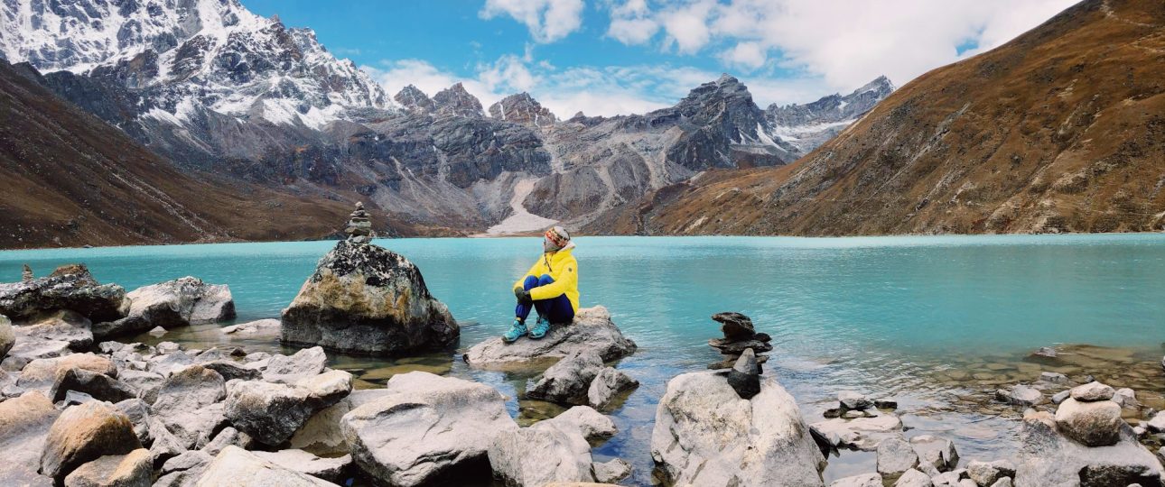
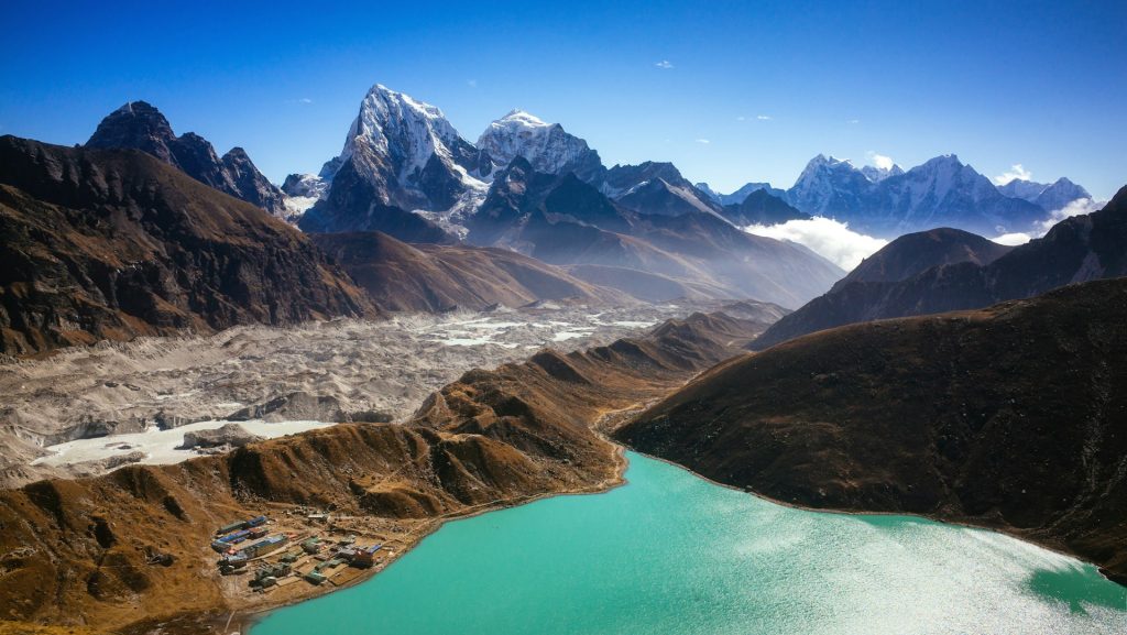
If you have searched for Gokyo Peak, you have found one of the best viewpoints in the Everest region, and one of the most confusingly named. Gokyo Peak is the common English name for Gokyo Ri, a steep, rocky summit of about 5,357 metres above the turquoise Gokyo Lakes in Nepal’s Khumbu. From the top you can see four of the world’s 8,000-metre mountains at once, which is why many trekkers rate it above the more famous viewpoints.
This guide explains what the peak is, how hard the climb really is, how to reach it, when to go and what to ask before you book.
Gokyo Peak Nepal at a Glance
Here are the numbers most readers want first. Sources differ slightly on the height and timings, so treat the figures as typical.
| Detail | What to expect |
|---|---|
| Other names | Gokyo Ri, Gokyo Peak |
| Location | Khumbu region, above Gokyo village and the Gokyo Lakes |
| Height | About 5,357 m (some sources quote 5,360 m or slightly more) |
| Gokyo village | About 4,750 to 4,790 m |
| Climb from the village | About 2 to 3.5 hours up, gaining roughly 570 to 720 m |
| Typical trek length | 12 to 15 days from Lukla to Lukla |
| Best seasons | March to May and autumn (late September to November) |
| Difficulty | Moderate to strenuous, with no technical climbing in normal conditions |
In short, it is a high walk-up viewpoint, not a technical climb. Do not let the word “peak” suggest ropes and crampons. The challenge is altitude and a very steep trail, not mountaineering skill.
What Is Gokyo Peak? The Name Explained
The confusion comes from the naming. In Nepali and Sherpa, “ri” means hill or ridge, so Gokyo Ri literally means the hill of Gokyo. English-language websites and trip pages often call it Gokyo Peak, and some call it a trekking peak, which makes it sound like a climbing objective. In practice it is a high point on the ridge above the lakes that trekkers walk up on a rough trail.
Its height is also reported in several ways. Wikipedia and many operators give 5,357 metres, some use 5,360 metres, and a few quote higher or lower figures such as 5,371 metres from a GPS track. These differences come from different survey methods and rounding, so there is no single perfect number. You can read the general summary on Wikipedia’s Gokyo Ri page. For planning, use “about 5,357 metres” and ask your operator which figure they use.
The View From the Top
The reason people climb it is the panorama. From the summit you can see Mount Everest, Lhotse, Makalu and Cho Oyu, four of the 14 peaks above 8,000 metres. Below you, the Gokyo Lakes sit in a glacial valley, and the long grey tongue of the Ngozumpa Glacier stretches away to the east. The glacier is often described as the largest in Nepal.
Many trekkers compare it with Kala Patthar, the famous viewpoint above Everest Base Camp. The two are different. Kala Patthar gives a closer look at Everest, while Gokyo Ri gives a wider, 360-degree panorama with the lakes in the foreground. Because Gokyo is a quieter valley than the main base camp trail, the summit is often less crowded, though you should still expect other trekkers at sunrise in peak season.
The Climb Itself
On paper the climb looks short. It is roughly 1.7 to 2 kilometres one way from Gokyo village, and most trekkers take about two to three and a half hours to reach the top. In reality it is one of the hardest parts of the whole trek, because the trail is steep from the first step and you are climbing at altitude.
The path is a rocky, zig-zagging ascent with loose stones in places, and you gain around 570 to 720 metres depending on where you start and how you measure it. Many people begin before dawn, often around 4 am, to reach the summit for sunrise. That means walking in the dark with a headlamp in freezing air, so warm layers, gloves and a hat matter.
How to pace it
- Go slowly. Short steps and regular breathing beat a fast start. There is no prize for arriving first.
- Take breaks. A pause every 15 to 20 minutes to drink and catch your breath helps.
- Use poles. They reduce strain on the way up and protect your knees on the way down.
- Watch the weather. Clouds often build later in the day, which is one reason sunrise is the popular time.
- Plan the descent. Coming down loose stones can be harder than going up, so keep your focus on your footing.
The summit can be windy and very cold, so do not linger too long. Many trekkers spend 20 to 30 minutes at the top, take photos and head down to a warm lodge for breakfast.
Sunrise or Afternoon? Choosing Your Summit Time
Most operators schedule the climb for sunrise, and it is easy to see why. Skies are often clearer in the early morning, the light on the peaks is dramatic and the lakes below look their best. The price is a very early start and the coldest part of the day.
An afternoon climb is possible and warmer, and some trekkers prefer it for sunset light and a slower start. The risk is cloud, which often builds as the day goes on and can hide the peaks. If your schedule allows two nights in Gokyo, you can choose based on the weather. Try sunrise on the clearest morning, or take the second day as a backup if the first is cloudy.
Whichever time you choose, check the forecast with your guide, carry water and extra layers, and set a turn-around time before you start. If you have not reached the top by that time, descend. The view is wonderful, but it is not worth exhaustion or a bad descent in failing light.
How to Reach Gokyo: Route Options
Almost everyone starts with the flight from Kathmandu to Lukla and the walk to Namche Bazaar. After Namche, the trail splits from the main Everest Base Camp route and heads northwest through Dole and Machhermo toward the Gokyo Lakes. A few alternatives exist.
- Gokyo Valley out and back. The most direct version, going up the valley to Gokyo and returning the same way or via a variation. It usually takes 12 to 14 days.
- Gokyo plus Cho La plus Everest Base Camp. A longer route that crosses the high Cho La pass and links Gokyo with the Everest Base Camp valley, often taking 16 to 18 days. Our Cho La Pass guide explains what the crossing involves.
- Part of the Three Passes Trek. Gokyo sits in the middle of the big Everest loop, between Cho La and Renjo La. If you want all three passes, read our Three Passes Trek guide to see how Gokyo fits in.
For a first visit, the Gokyo Valley out and back is the simplest plan. It keeps the route clear, includes acclimatisation days and avoids the glacier crossing on Cho La.
A Sample 12-Day Gokyo Itinerary
Itineraries differ by operator, but this outline shows the rhythm of a sensible trip. Treat the altitudes as approximate.
| Day | Route | Notes |
|---|---|---|
| 1 | Fly Kathmandu to Lukla, walk to Phakding | Lukla is about 2,840 to 2,860 m; Phakding about 2,610 m |
| 2 | Phakding to Namche Bazaar | Steep final climb to about 3,440 m |
| 3 | Acclimatisation in Namche | Hike high, sleep low |
| 4 | Namche to Dole | Leave the main trail and climb into the Gokyo valley |
| 5 | Dole to Machhermo | Shorter day to keep altitude gain gentle |
| 6 | Machhermo to Gokyo | Arrive at the lakes at about 4,790 m |
| 7 | Gokyo Ri and the lakes | Sunrise climb to about 5,357 m, then rest or visit the upper lakes |
| 8 | Gokyo to Dole or Machhermo | Long descent day |
| 9 | Down to Namche Bazaar | Thicker air and warmer nights |
| 10 | Namche to Lukla | Final trekking day |
| 11 | Fly to Kathmandu | Weather permitting |
| 12 | Buffer day | For flight delays or an extra rest day |
Some operators add a second acclimatisation day in Gokyo, which is a good idea. Others compress the plan to 10 or 11 days, which leaves less margin for altitude and weather.
What Each Stage Feels Like
A table shows distances and altitudes, but not how the days feel. Here is the rhythm to expect.
The first two days are the warm-up. You fly into Lukla, walk down to Phakding and then climb steadily to Namche Bazaar, the busy Sherpa town where most trekkers meet crowds for the last time. The final climb to Namche is steep and tiring, which is why a rest day there is so valuable.
After Namche, the trail turns toward the Gokyo valley and the crowds thin out. Villages are smaller and further apart, and the walking becomes quieter and more remote. The day from Machhermo to Gokyo can take around seven hours in some itineraries, with a climb beside the glacier before the lakes appear.
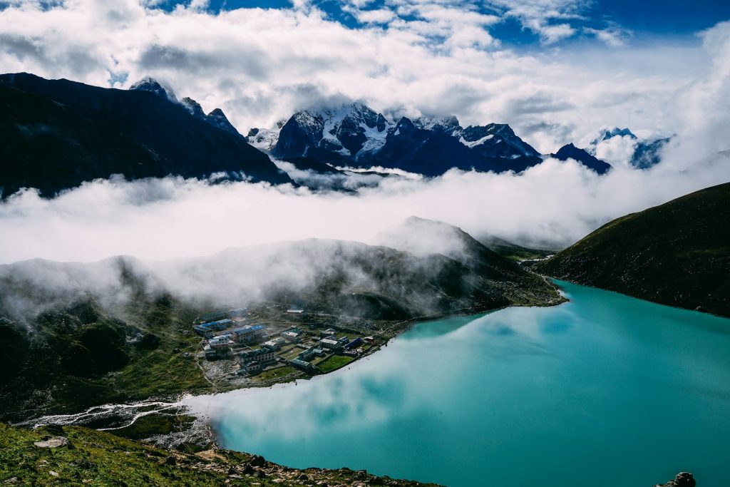
Gokyo itself is a small cluster of lodges beside a lake, with ice, wind and the huge moraine of the glacier nearby. The day of the summit climb is the highlight, followed by a long descent. Some itineraries combine the descent with a long walk back toward Machhermo or Dole, which can total eight or nine hours, so you finish the day tired but lower and in thicker air.
How Hard Is the Climb? Difficulty and Altitude
Operators rate the Gokyo trek anywhere from moderate to strenuous. A fair reading is moderate to challenging for a healthy walker. You do not need climbing experience, but you do need stamina, patience and a willingness to walk five to seven hours a day, often on steep or rocky ground.
Altitude is the real difficulty. Gokyo village sits at about 4,790 metres, and the summit adds more than 500 metres on top of that. Medical guidance says that above 3,000 metres you should increase your sleeping altitude by no more than about 500 metres a day and add an extra rest day for every 1,000 metres you gain. You can read the details in the CDC Yellow Book chapter on altitude illness.
Symptoms to take seriously
Mild altitude sickness usually starts with a headache, nausea, dizziness, poor sleep or unusual fatigue. Do not climb higher to sleep while you have symptoms. Rest, drink water, tell your guide and descend if things worsen. Severe symptoms such as confusion, loss of balance or breathlessness at rest need urgent descent and evacuation.
Pre-dawn starts add cold stress, so dress warmly and carry water. Do not try to climb with a headache or after a bad night’s sleep, and do not feel pressured to reach the top. A turn-around at the half-way point is not a failure, and the lakes and valley are worth the trip even if you skip the summit.
Who Should Think Twice
The Gokyo trek is achievable for many people, but it is not for everyone, and honesty helps. It is a poor choice as a first-ever trek, because the altitude and long days are demanding and there are few easy exit points. A lower, shorter route is a better way to learn how your body handles altitude.
Think carefully if you have a heart or lung condition, a history of altitude illness or any medical concern, and speak to a doctor who knows high-altitude travel before you commit. Think carefully too if your schedule is rigid. Flights to Lukla and weather on the trail are unpredictable, and a plan with no spare days turns every delay into a problem.
If you love the idea but not the altitude, you can still enjoy the Everest region at lower heights, with shorter treks that give mountain views without extreme commitment.
Gokyo Ri vs Kala Patthar vs Everest Base Camp
Many trekkers ask which is better. The answer depends on what you want.
| Feature | Gokyo Ri | Kala Patthar | Everest Base Camp |
|---|---|---|---|
| Height | About 5,357 m | About 5,545 to 5,644 m (sources vary) | About 5,364 m |
| Main reward | 360-degree panorama and lakes | Close view of Everest | The camp and Khumbu Glacier |
| Crowds | Quieter valley | Busy at sunrise | Busiest |
| Can you see Everest summit? | Yes, in the distance | Yes, up close | No, hidden by Nuptse |
If your priority is the closest, most dramatic view of Everest, Kala Patthar wins. If you prefer a wide panorama, glacial lakes and fewer people, Gokyo Ri is hard to beat. Our guide to Kala Patthar and Everest explains that hike in detail, so you can compare the two before choosing.
Gokyo Valley or Everest Base Camp: Which Trek Fits You?
Trekkers often treat these as rivals. They share the same start, so the choice is really about what you want from the days after Namche.
The Everest Base Camp route is the classic: more lodges, more trekkers, more famous places and a clear goal in the camp itself. It has more infrastructure, which can feel reassuring, and more company, which can feel crowded in peak season.
The Gokyo route is often described as the quieter alternative. It has fewer lodges, longer gaps between villages and a more remote feel, with lakes and a wide summit panorama as the reward. Altitude and commitment are comparable, so it is not an easier option, just a different one. If you value solitude and scenery over a famous destination, Gokyo is a strong choice. If you want the iconic base camp experience, the main route fits better. Some trekkers combine both with the Cho La crossing, which adds time and difficulty.
The Gokyo Lakes and Cho Oyu Base Camp
The summit is only part of the reward. The Gokyo Lakes are a chain of glacial lakes that sit between roughly 4,700 and 5,000 metres, with six main lakes usually listed. Gokyo Lake is part of a Ramsar-listed wetland system, which recognises its international importance.
Beyond the third lake, the trail continues to the fourth and fifth lakes, with the fifth giving a good view of Everest and the sixth sitting higher still. Walking to the upper lakes is a popular rest-day activity and a gentler way to acclimatise than a hard push.
Some trekkers also visit Cho Oyu Base Camp as a side trip. It is a long day, about eight hours in some itineraries, and not needed if you are short on time or energy. Choose it only if you feel strong and have spare days.
Best Time to Go
The best seasons are spring (March to May) and autumn (late September to November), when skies are clearer and weather is more stable. Operators commonly list the same months for Gokyo, and that matches the usual Everest region pattern.
Temperatures swing widely. Days can feel pleasantly mild in the sun, while nights at Gokyo are well below freezing. In winter, snow and extreme cold make the pre-dawn climb harder and some lodges close. During the monsoon, from roughly June to September, cloud and rain hide the views and trails become slippery. Plan for spring or autumn if you can.
Weather and Realistic Expectations
Mountain weather is the biggest wildcard. Even in the best seasons, a clear morning can turn cloudy by noon, and wind at the summit can make photos and waiting uncomfortable. Treat clear views as a bonus, not a guarantee.
Build flexibility into your plan. A spare day in Gokyo lets you pick the best weather for the climb, and a buffer day at the end covers delayed flights. If cloud hides the peaks on your first attempt, the lakes, the glacier and the valley still reward the walk, and the second morning may give you the view you came for.
Permits and Rules
The Gokyo valley lies inside Sagarmatha National Park, so you need the park entry permit and the local municipality permit. The park permit is about NPR 3,000 for most foreign trekkers, and the Khumbu Pasang Lhamu Rural Municipality permit is reported at NPR 2,000 to 3,000. Fees change, so confirm them before you travel. Our EBC trek permit guide explains where to collect them and what to carry.
On guides, the UK government’s current advice says foreign independent trekkers must use a local guide or porter in national parks and protected areas, and it recommends not trekking alone. You can read the advice on the UK government Nepal safety and security page. Other sources describe enforcement differently in the Khumbu, so confirm the current rule with a registered agency. For a high, remote valley like Gokyo, a guide is strongly advised in any case.
Flights and Getting to Lukla
The standard start is the short flight from Kathmandu to Lukla, followed by a walk to Phakding. Mountain flights are weather-dependent, and delays are common, which is why a buffer day at each end of the trip matters. Our guide to flying to Lukla explains costs, tips and why delays happen.
Check that your insurance covers delays and that your plan has a spare day before any international flight. If you have a tight schedule, ask your operator about alternatives, including helicopter options for the return.
What the Trek Costs
The cost of the Gokyo Peak Nepal trek depends on season, group size, length and service level. The main elements are flights, permits, a guide and porter, lodging, food and insurance. Operator quotes vary widely. Some Gokyo Ri trek listings quote roughly US$1,200 to US$1,800 per person, and one 14-day package is listed at around US$1,490, though inclusions differ from one operator to another.
- Flights. Lukla flights are commonly quoted at roughly US$160 to US$250 one way, with helicopter options costing considerably more.
- Guide and porter. Daily rates vary with experience and arrangements.
- Teahouses and food. Rooms are cheap, and meals cost more as you climb. Hot showers, charging and wifi usually cost extra.
- Permits. Park and local municipality permits together add several thousand rupees per person.
- Insurance and gear. Insurance with high-altitude and evacuation cover is essential.
Compare what is actually included, not just the headline price. A very cheap quote often means fewer rest days, bigger groups or less experienced staff.
Accommodation and Food in the Gokyo Valley
You sleep in teahouses, simple lodges run by local families. The valley has fewer lodges than the main Everest trail, and villages are spaced further apart, so long walking days between stops are common. Rooms are basic and cold at night, and the dining room is the only heated space.
Food is simple and filling. Dal bhat, the Nepali rice and lentil meal, is the staple, along with noodles, soups, eggs and pasta. Prices rise with altitude because supplies are carried up by porter or animal.
Carry Nepali rupees in cash, because cards and ATMs are not reliable in the valley. Bring a refillable bottle and purification tablets, and expect hot showers, charging and wifi to cost extra, with limited service at the top.
Trekking Responsibly in Sagarmatha National Park
The valley is a protected park and a working Sherpa homeland, and heavy trekking seasons put real pressure on it. Small habits help. Carry out plastic, batteries and hygiene waste, refill a treated bottle instead of buying bottled water and keep to the marked trail so you do not damage fragile ground.
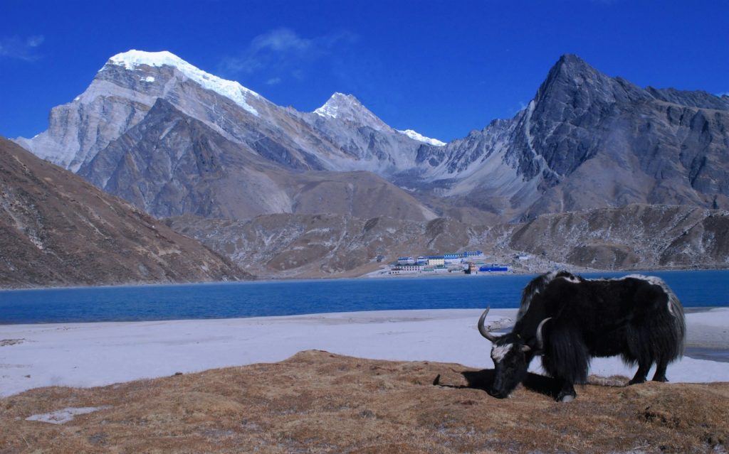
Step aside for yaks and porters on the uphill side, because a loaded animal cannot stop easily. Ask before photographing people or monastery interiors, and spin prayer wheels clockwise as locals do. Pay your guide and porter fairly, and choose operators who give their staff proper clothing and insurance. A trek that treats its crew well is almost always a better trek for you too.
Packing for Gokyo
Your kit needs to handle warm valley days and freezing nights at 4,700 metres and above. Use a layering system, with a base layer, an insulating mid layer, a warm down jacket and a waterproof shell. Add a warm hat, gloves, sunglasses with strong UV protection and sunscreen.
Choose broken-in boots with ankle support and warm socks, and take trekking poles, a headlamp with spare batteries for the pre-dawn climb, a warm sleeping bag and a small first-aid kit with your own medication. Our Everest Base Camp trek gear packing list is a good starting checklist, and you can add extra warmth for the colder nights at Gokyo.
How to Train
Start months before your trip. The goal is stamina, not speed. Long hikes with a loaded daypack, repeated on consecutive days, are the best preparation, because they mimic the accumulated fatigue of the trek. Add stair climbing or hill repeats, and cardio such as cycling, swimming or running.
Practise walking downhill, because long descents tire your knees and the Gokyo Ri descent is steep. If you can walk five to seven hours with a pack over varied terrain and feel fine the next day, you are close to ready. Training does not remove altitude risk, but it makes the long days easier.
Safety, Insurance and Emergency Numbers
Insurance is not optional for a trek like this. The UK government advises making sure your policy covers mountain rescue and helicopter costs, and US guidance recommends medical evacuation cover. Check that high-altitude trekking up to about 5,500 metres is included.
Save these numbers before you go: police 100, tourist police 1144, fire 101 and ambulance 102. Tell someone your route and expected dates, and keep digital copies of your passport and insurance policy. Mobile coverage can be limited in the valley, so agree a check-in plan with your guide.
Common Mistakes to Avoid
- Treating it as a short day hike. The summit is at nearly 5,400 metres and the trail is steep.
- Skipping acclimatisation. Cutting rest days is the most common cause of trouble.
- Starting without enough warm clothing. Pre-dawn temperatures are far colder than the valley.
- Pushing on with symptoms. A headache is information, not an inconvenience.
- Booking only on price. A low quote can mean fewer rest days or less support.
- Ignoring buffer days. Flights to Lukla are weather-dependent and delays are normal.
- Relying on a single height figure. Heights vary by source, so plan around the effort, not the number.
Frequently Asked Questions About Gokyo Peak
1. What is Gokyo Peak?
Gokyo Peak is the common English name for Gokyo Ri, a rocky viewpoint of about 5,357 metres above the Gokyo Lakes in Nepal’s Khumbu region. It is climbed on foot and does not usually need technical climbing skills.
2. How high is Gokyo Ri?
It is usually given as about 5,357 metres (17,575 feet). Some sources quote 5,360 metres or slightly different figures, depending on the survey or GPS used.
3. How long does it take to climb Gokyo Ri?
Most trekkers need about two to three and a half hours to climb from Gokyo village, depending on pace and acclimatisation. The descent usually takes roughly half of that.
4. Is Gokyo Ri difficult?
It is a steep, high-altitude walk. The trail is rocky and zig-zagging, and you gain around 570 to 720 metres at an altitude where breathing is hard. It needs good fitness and patience, but not climbing skills.
5. What can you see from the top?
You can see Everest, Lhotse, Makalu and Cho Oyu, four peaks above 8,000 metres, plus the Gokyo Lakes and the Ngozumpa Glacier below.
6. Is Gokyo Ri better than Kala Patthar?
It depends on what you want. Kala Patthar gives a closer view of Everest, while Gokyo Ri gives a wider panorama with glacial lakes and usually fewer people.
7. When is the best time to climb Gokyo Ri?
Spring (March to May) and autumn (late September to November) are best. Most people climb at sunrise, starting before dawn, to get the clearest views.
8. How many days do I need for the Gokyo trek?
Most itineraries take 12 to 15 days from Lukla to Lukla, with acclimatisation days. Shorter plans of 10 or 11 days exist, but they leave less room for altitude and weather.
9. Do I need a guide and permits?
You need the Sagarmatha National Park permit and the local municipality permit. UK government advice says foreign independent trekkers must use a local guide or porter in national parks, though enforcement is described differently by different sources, so confirm with a registered agency.
10. Is altitude sickness a risk at Gokyo?
Yes. Gokyo village is at about 4,790 metres and the summit is higher. Climb gradually, include rest days, drink water and report symptoms early. Never climb higher to sleep with worsening symptoms.
Plan Your Gokyo Peak Nepal Trek With Merriment
A good Gokyo trip comes down to the details: enough rest days, a sensible route, a reliable guide and clear communication about weather and altitude. Whether you want the quiet Gokyo Valley out and back or a longer loop with Cho La, the right plan makes the summit sunrise far more enjoyable.
The Merriment team can help you choose between the Gokyo Valley and other Everest region routes, explain permits and costs for your dates and arrange logistics and guides. Tell us when you want to travel, how many people are coming and what experience you have, and ask for a quote.
Enquire on WhatsApp: +977 974-0262168
Message us today and start planning your sunrise above the Gokyo Lakes.