Thorong La Pass is the defining moment of the Annapurna Circuit. At 5,416 meters (17,769 feet), it’s the highest point of the trek and the section that most trekkers remember long after they’ve left Nepal .
The pass connects the Manang Valley with the Mustang region near Muktinath, sitting between the Khatung Kang and Yakawa Kang mountains . It’s the lowest route crossing between the Annapurna and Dhaulagiri mountain ranges and has been a vital crossing for local traders and trekkers alike.
More than 11,800 foreign trekkers crossed Thorong La Pass in the 2025/26 fiscal year, making it one of the busiest high-altitude passes in the Himalayas. But popularity doesn’t mean easy. The crossing demands proper acclimatization, an early start, and respect for the altitude and weather.
This guide covers everything you need to know about Thorong La Pass in 2026: what the crossing actually feels like, how to prepare, and practical advice for a successful crossing.
Thorong La Pass at a Glance
| Detail | Information |
|---|---|
| Location | Annapurna Circuit, Nepal (between Manang and Mustang districts) |
| Elevation | 5,416 meters / 17,769 feet |
| Highest Point of | Annapurna Circuit Trek |
| Region | Annapurna Conservation Area |
| Difficulty | Strenuous — non-technical but physically demanding |
| Typical Crossing Duration | 7-9 hours (High Camp to Muktinath) or 8-10 hours (Thorong Phedi) |
| Starting Points | Thorong Phedi (4,450m) or High Camp (4,850m) |
| Ending Point | Muktinath (3,710m) |
| Best Trekking Seasons | March-May and September-November |
| Type of Trek | High-altitude trekking, fully non-technical |
| Technical Climbing Required | No |
What Is Thorong La Pass?
Thorong La Pass is the high point of the Annapurna Circuit, connecting the Manang side of the trek with the Mustang side near Muktinath . The pass sits between Khatung Kang and Yakawa Kang mountains and is the lowest route crossing between the Annapurna and Dhaulagiri mountain ranges.
The pass opened to international trekkers in 1970 and has since become one of the most iconic high-altitude trekking destinations in the world. The crossing marks a dramatic transition: from the lush, Buddhist-influenced Manang Valley on the east side to the arid, Tibetan-influenced Mustang region on the west.
Why it matters: Thorong La isn’t just a physical challenge. It’s the psychological centerpiece of the Annapurna Circuit. For many trekkers, reaching the pass with its prayer flags and stone cairns represents the culmination of days of preparation and walking.
Thorong La Pass Altitude: How High Is It?
Thorong La Pass stands at 5,416 meters (17,769 feet) above sea level .
To put that in perspective:
-
Thorong La is the highest point of the Annapurna Circuit.
-
At 5,416 meters, the air contains roughly 50% of the oxygen available at sea level.
-
The elevation is comparable to Everest Base Camp (5,364m) and slightly lower than Kala Patthar (5,545m).
Why altitude is the main challenge: The lack of oxygen makes every step harder. At 5,416 meters, you’re walking slower, breathing harder, and thinking less clearly than you would at sea level. This is why proper acclimatization is non-negotiable.
How Hard Is Thorong La Pass?
Thorong La is technically non-difficult — there’s no climbing, no ropes, no glacier travel . But technical ease doesn’t mean physical ease.
The main challenges:
| Challenge | What It Means |
|---|---|
| Altitude | 5,416m with ~50% oxygen — breathing is labored |
| Duration | 7-9 hours of walking on the crossing day |
| The climb | 536-876 meters of elevation gain from Thorong Phedi/High Camp |
| The descent | 1,600 meters of descent to Muktinath on tired legs |
| Cold | Temperatures can drop to -10°C or lower, with wind chill making it feel much colder |
| Wind | Strong winds pick up after 10 AM |
What “Hard” Actually Means in Practice
One trekker described it simply: “The altitude was rough, and I was just counting the steps. It was snowing and very cold at the top” . Another noted that the descent was “extremely tough” and harder on the body than the ascent itself .
The success rate: Approximately 85-90% of trekkers who arrive at Thorong Phedi in good health make a successful crossing. The 10-15% who turn back do so for:
-
Poor acclimatization (the most common reason)
-
Sudden bad weather
-
Serious altitude sickness symptoms
-
Starting too late (after 5-6 AM) and encountering afternoon winds
Thorong La vs. Everest Base Camp
Thorong La Pass sits slightly higher than Everest Base Camp (5,416m vs 5,380m) . In terms of difficulty:
| Aspect | Thorong La Pass | Everest Base Camp |
|---|---|---|
| Max Altitude | 5,416m | 5,364m (EBC) / 5,545m (Kala Patthar) |
| Challenge Type | One intense day | Sustained high altitude |
| Duration | 7-9 hours crossing | 12-14 days total |
| Hardest Part | Single day push, cold, wind | Multiple days above 4,000m |
What the Thorong La Pass Crossing Day Actually Feels Like
The Day Before: Preparation
You’ll spend the night at either Thorong Phedi (4,450m) or High Camp (4,850m). High Camp is the last refuge before Thorong La, located at 4,850 meters — sleeping here can be difficult .
The night before, you’ll:
-
Lay out everything you need for the morning (headlamp, layers, snacks, water)
-
Go to bed by 7:00-8:00 PM
-
Sleep poorly — altitude always makes sleeping difficult above 4,000m
-
Wake up freezing at 3:00-3:30 AM
3:30 AM: Wake Up in the Freezing Dark
Your alarm goes off while it’s still pitch black. The air is thin and cold. You put on layers you can barely feel because your fingers are numb from the cold.
The temperature at High Camp (4,850m) before sunrise: well below freezing, often -10°C or colder. At the pass itself, it’s often -10°C and quite windy (felt much colder) . Wind chill at the pass can make it feel like -20°C or below .
4:00 AM: The Headlamp Start
You step outside into darkness. The only light comes from headlamps of other trekkers. Everyone is quiet — too cold and too tired to talk.
The trail is a zigzag of dark shapes and bobbing headlamps. “Begin ascending in the dark with headlamps; temperatures are coldest but winds are calmest” .
4:00-7:00 AM: The Slow Climb
This is the hardest section of the day. You climb 536-876 meters over 3-5 hours. Your pace is painfully slow — maybe 100 vertical meters per hour. Every 20 steps, you stop to breathe. Your heart is pounding, your legs feel heavy, and the oxygen is thin.
A stopping point: After about an hour of climbing, there’s a seasonal tea house offering hot drinks and hot water bottles to revive frozen fingers and toes .
The mental challenge: The trail has false summits — points that look like the top but aren’t. Reaching one false summit after another tests your mental endurance more than the physical climb.
7:00-8:00 AM: Approaching the Top
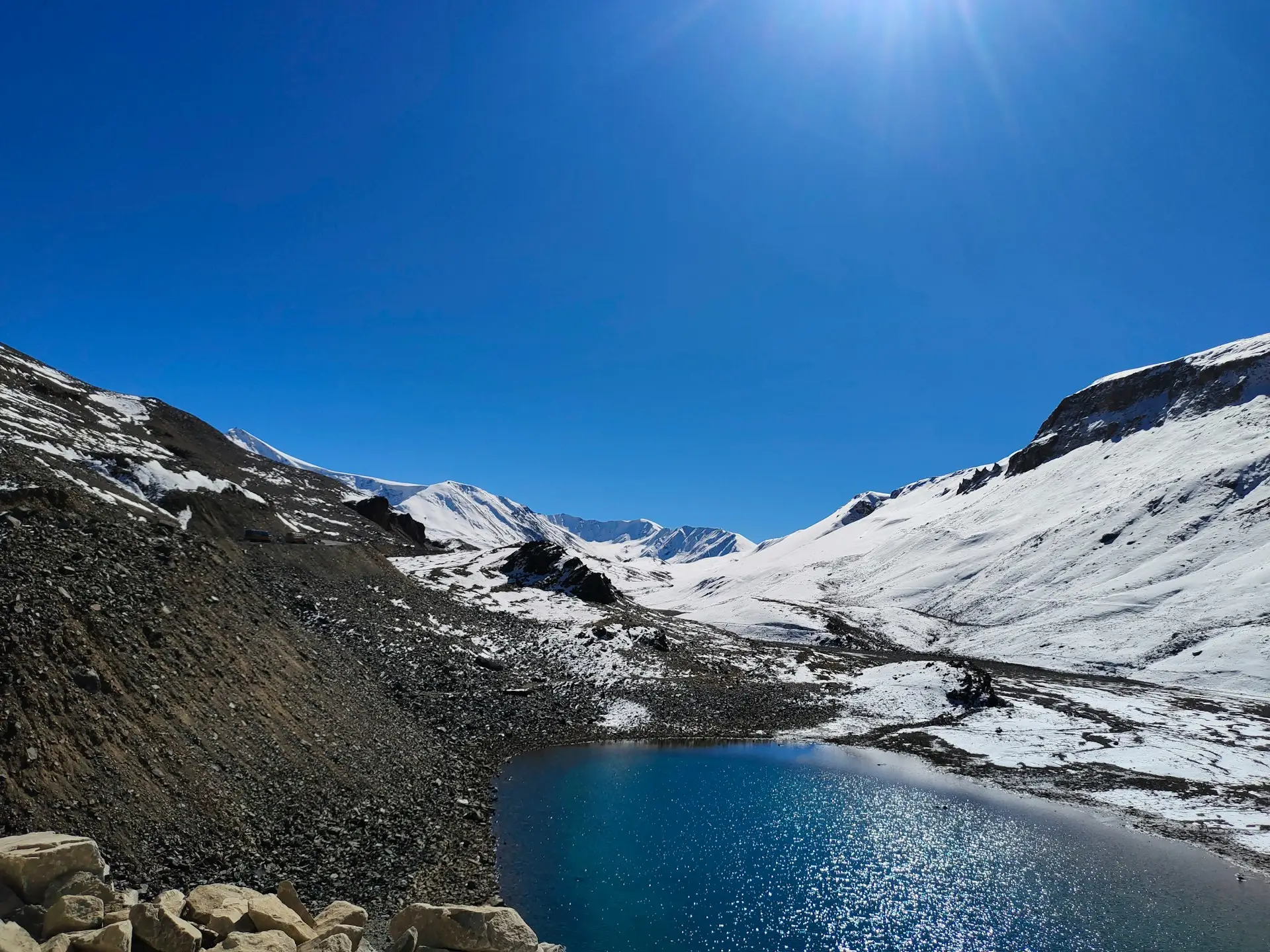
As the sun rises, the world around you begins to reveal itself. If the weather is clear, the views of the Annapurna and Dhaulagiri ranges are spectacular. The colors of the morning light on the mountains are something trekkers remember forever.
But the wind is also picking up.
8:00-8:30 AM: The Summit
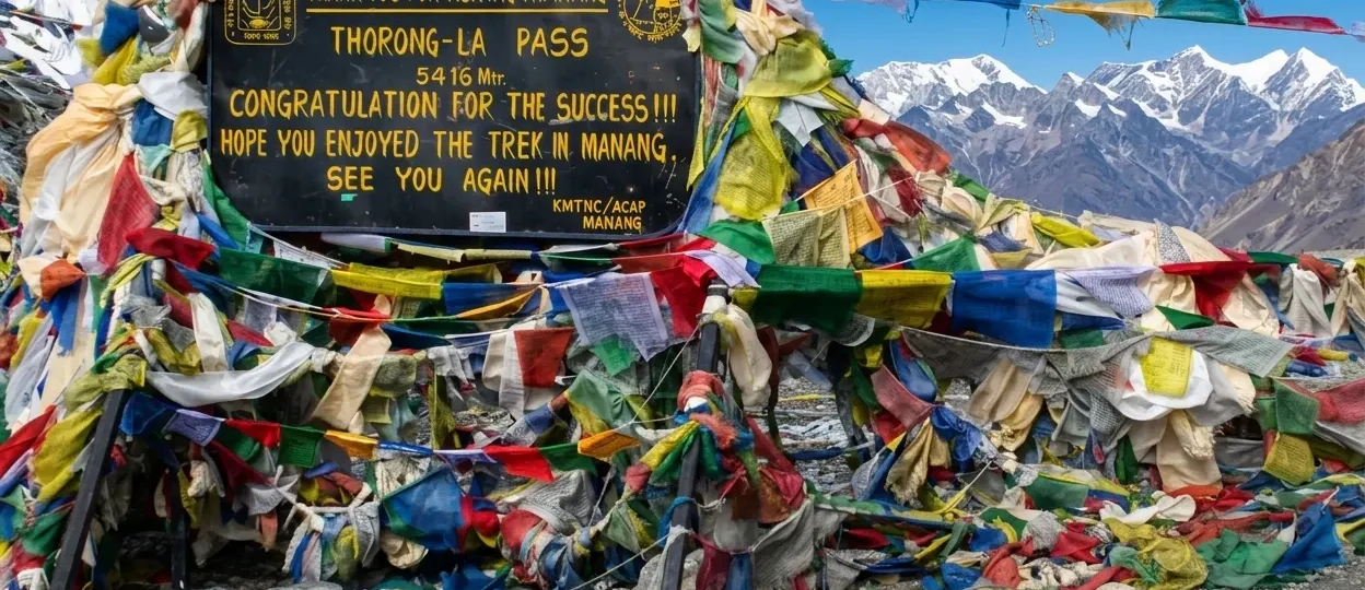
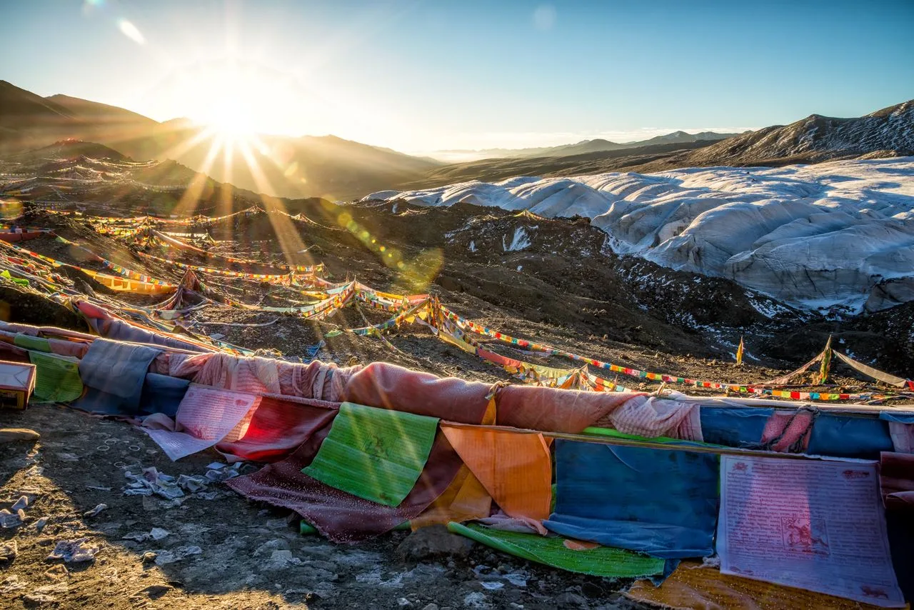
You reach the prayer flags at 5,416 meters.
What it looks like: prayer flags everywhere, a Buddhist chorten, trekkers taking photos.
What happens at the top:
-
Photos at the sign
-
A brief rest — but you can’t stay long
-
The wind picks up significantly after 10 AM
9:00 AM-1:00 PM: The Descent — The Real Challenge
This is where many trekkers suffer most.
You drop 1,600 meters over 7-8 kilometers to Muktinath (3,710m) . The trail is steep and rocky. You’re already exhausted from the climb, and now you have to manage a steep descent on tired legs.
The descent is brutal on your knees. “Trekking poles are strongly recommended for knee protection on the way down” .
1:00-2:00 PM: Arrival at Muktinath
After descending for hours, you see the white buildings of Muktinath in the valley below. The descent has felt endless.
Reaching Muktinath brings relief. You’ve crossed one of the highest trekking passes in the world. Your body is exhausted, your knees are sore, but you made it.
Where to Start the Crossing: Thorong Phedi vs. High Camp
| Factor | Thorong Phedi (4,450m) | High Camp (4,850m) |
|---|---|---|
| Altitude | Lower (easier sleep) | Higher (harder sleep) |
| Morning climb | ~966m (longer) | ~566m (shorter) |
| Day length | ~9-10 hours | ~7-9 hours |
| Risk | Better acclimatization | Higher altitude strain |
| Recommendation | Better for most trekkers | Better for time-pressed trekkers |
High Camp is “basic but sufficient for the night before crossing the pass” . However, at 4,850m, sleeping is difficult. Many trekkers prefer starting from Thorong Phedi and accepting the longer climb.
Gear You Need for Thorong La Pass
The most critical items for the crossing day :
| Item | Why You Need It |
|---|---|
| Down jacket (600+ fill) | The single most critical item for Thorong La — rated to -10°C minimum |
| Balaclava | The most underrated item — keeps face warm on Thorong La |
| Insulated waterproof gloves/mittens | Non-negotiable — frostbite risk is real |
| Thermal base layers | Moisture-wicking, no cotton |
| Waterproof shell jacket and trousers | Wind and potential snow on the upper approach |
| Sturdy trekking boots | Waterproof, ankle support |
| Trekking poles | Essential for the descent — “non-negotiable” |
| Headlamp with fresh lithium batteries | Lithium works at -15°C, alkaline does not |
| Sunglasses (UV400, glacier-rated) | Snow glare above 5,000m — prevents snow blindness |
| Snacks (2,000+ calories) | Energy drops fast above 5,000m |
| 3L water minimum | Dehydration accelerates AMS |
| Sun cream SPF 50+ | UV at 5,416m burns in 15 minutes |
| Micro-spikes | For icy sections, especially in spring or late autumn |
When Is the Best Time to Cross Thorong La Pass?
| Season | Months | Conditions | Recommended |
|---|---|---|---|
| Autumn | Sept-Nov | Stable, clear skies, best visibility | Yes — Best Season |
| Spring | Mar-May | Warmer, blooming rhododendrons, variable | Yes — Excellent |
| Monsoon | Jul-Aug | Heavy rain, trail risk, pass may close | Not Recommended |
| Winter | Dec-Feb | Heavy snow, extreme cold, pass often closed | Not Recommended |
What Makes the Seasons Risky
Winter: “Thorong La Pass is often closed from January to early February” due to heavy snowfall and extreme cold . Temperatures can drop to -25°C to -30°C at high altitudes.
Monsoon: Attempting to cross Thorong La outside the recommended seasons “is dangerous due to the increased risk of avalanches, frostbite and the likelihood of a storm or a whiteout, which can cause trekkers to become disoriented and lost” .
Acclimatization Strategy
The acclimatization stop at Manang (3,519m) is essential and should not be rushed or skipped .
The standard approach:
-
Manang (3,519m) — Spend two nights here. On the acclimatization day, hike up to a higher elevation (like Ice Lake at 4,600m) and then sleep back at Manang . “Our guides always follow the golden rule: ‘Climb high, sleep low'” .
-
Yak Kharka (4,050m) — One night
-
Thorong Phedi (4,450m) or High Camp (4,850m) — One night
-
Cross the pass
HRA recommendation: The Himalayan Rescue Association recommends that trekkers spend five nights between their arrival in Manang and the crossing to Muktinath . The extra time in Manang allows trekkers to acclimatize sufficiently to minimize the risk of acute mountain sickness .
What Is the Best Direction to Cross Thorong La Pass?
The safest and most common direction is East to West — from Manang (and Thorong Phedi / High Camp) to Muktinath .
Why?
-
The ascent on the Manang side is more gradual
-
Crossing West to East is significantly harder: trekkers must ascend at least 1,230 meters and descend at least 540 meters in one day
The standard route:
Yak Kharka (4,050m) → Ledar → Thorong Phedi (4,450m) / High Camp (4,850m) → Thorong La Pass (5,416m) → Muktinath (3,710m)
Safety Risks and Emergency Planning
Top safety risks at Thorong La Pass :
| Risk | What You Need to Know |
|---|---|
| Acute Mountain Sickness (AMS) | The most common risk at this altitude. Ascend slowly and don’t skip acclimatization |
| HAPE and HACE | Serious medical emergencies. Descend immediately if symptoms are severe |
| Sudden weather changes | Blizzards and whiteouts can develop rapidly. Always start before dawn |
| Exhaustion and hypothermia | The combination of altitude, cold, and long duration is physically taxing |
The Himalayan Rescue Association operates a medical clinic at Manang and periodically a small outpost at Thorong Phedi . This is a critical resource for trekkers experiencing AMS symptoms.
When to turn back: Never attempt the pass if you have AMS symptoms. Descend first, always .
Thorong La Pass in 2026: Current Status
More than 11,800 foreign trekkers crossed Thorong La Pass in the 2025/26 fiscal year, according to the Annapurna Conservation Area Project (ACAP).
Who crosses Thorong La:
-
6,446 men and 4,954 women from non-SAARC countries
-
325 men and 79 women from SAARC countries
The route remains active throughout the year, including winter. Nepali trekkers also increasingly use the route, though their numbers aren’t officially recorded.
Economic impact: The trekking route generated employment for 5,739 porters during the fiscal year, excluding guides.
How Merriment Treks Can Help
Merriment Treks specializes in guiding trekkers across Thorong La Pass as part of the Annapurna Circuit. Here’s how they can help:
-
Acclimatization planning — itineraries designed around the two-night Manang stop and proper altitude management
-
Experienced guides — licensed guides who know the pass conditions and timing for a safe crossing
-
Logistics — transportation, permits, and teahouse bookings
-
Safety — emergency oxygen and first aid supplies on all crossings
-
Gear advice — practical recommendations for weather conditions
Merriment Treks doesn’t just take you to the pass — they help you prepare for it, cross it safely, and celebrate it afterward.
Frequently Asked Questions about Thorong La Pass
1. How high is Thorong La Pass?
5,416 meters (17,769 feet) above sea level .
2. How long does it take to cross Thorong La Pass?
7-9 hours from High Camp to Muktinath, or 8-10 hours from Thorong Phedi .
3. Is Thorong La Pass dangerous?
It’s serious. The main risks are altitude sickness, cold, wind, and sudden weather changes. But with proper acclimatization and preparation, it’s manageable. It is fully non-technical .
4. Can a beginner cross Thorong La Pass?
Yes, with proper preparation. Most trekkers who complete the crossing are not mountaineers. You need a good level of cardiovascular fitness and must acclimatize properly .
5. What is the best time to cross Thorong La Pass?
March-May and September-November are the safest months . Autumn offers the most stable conditions.
6. Do I need a guide for Thorong La Pass?
Since April 2023, all foreign trekkers on standard Nepal trekking routes must use a licensed guide. For Thorong La, a guide is strongly recommended for safety.
7. What is the success rate of crossing Thorong La Pass?
About 85-90% of trekkers who arrive at Thorong Phedi in good health make a successful crossing.
8. What happens if weather conditions are bad?
The pass can close due to heavy snowfall or storms. In winter, it can be closed for weeks or months .
9. How cold is it on Thorong La Pass?
Temperatures can drop to -10°C or colder, with wind making it feel much colder . Wind chill can make it feel like -20°C .
10. Can you cross Thorong La Pass in winter?
It’s possible but extremely challenging. The pass is often closed from January to early February due to heavy snow .
11. Is Thorong La Pass harder than Everest Base Camp?
Thorong La Pass sits slightly higher than Everest Base Camp (5,416m vs 5,380m). In terms of difficulty, the pass is a single intense day, while EBC is more sustained high-altitude days .
12. Which is better, Thorong Phedi or High Camp?
Thorong Phedi (4,450m) is lower and easier to sleep at. High Camp (4,850m) shortens the morning climb but makes sleeping harder .
13. What should I pack for Thorong La Pass?
Insulated down jacket (600+ fill), balaclava, insulated waterproof gloves, thermal base layers, waterproof shell, trekking poles, headlamp with lithium batteries, glacier-rated sunglasses, 3L water, 2,000+ calories of snacks, micro-spikes, SPF 50+ sunscreen .
14. Why start at 4:00 AM?
The wind picks up significantly after 10 AM . Starting early allows you to descend before the worst winds arrive.
15. What happens if I get altitude sickness on Thorong La?
If you experience severe AMS symptoms (severe headache, vomiting, confusion, inability to walk), immediate descent is the only cure . The Himalayan Rescue Association operates a clinic at Manang and an outpost at Thorong Phedi .
16. How many trekkers cross Thorong La each year?
In the 2025/26 fiscal year, 11,806 foreign trekkers crossed the pass.
17. Is there any technical climbing required?
No. Thorong La is fully non-technical — it’s a walk, not a climb .
18. What is the scariest part of the crossing?
For many trekkers, it’s the combination of altitude and cold, or the discovery that reaching the top is only half the battle — the descent to Muktinath is steep, rocky, and punishing on tired legs .