Dingboche Nepal 2026
Dingboche Nepal is the village where the Everest Base Camp trek stops being a walk and starts being an altitude expedition. Sitting at 4,410 metres in the wide, sun-facing Imja Valley, it is the last permanent Sherpa settlement before the trail climbs into the moraine and glacier country toward Lobuche and Gorak Shep. Most trekkers spend an extra night here, and that rest day — usually a climb to Nangkartshang Peak at 5,083 metres — often decides whether the final push to Base Camp feels manageable or turns into a grind. This guide covers everything a trekker needs to know about Dingboche in 2026: what the altitude actually does to your body, where to sleep, what to eat, how the weather behaves month by month, and how the route connects to the rest of the Everest trail. Merriment Treks builds Everest region itineraries with proper acclimatization stops, and this article reflects that safety-first, route-specific approach.
Quick Facts About Dingboche
Dingboche Nepal at a glance: the numbers and practical details that matter before you arrive.
| Detail | Information |
|---|---|
| Location | Khumbu region, Solukhumbu District, Sagarmatha National Park |
| Altitude | 4,410 metres (14,470 feet) |
| Population | Approximately 200 (2011 estimate) |
| Ethnic group | Sherpa |
| Main treks | Everest Base Camp Trek, Three Passes Trek, Island Peak |
| Best seasons | Spring (March–May) and autumn (September–November) |
| Accommodation | Teahouses and lodges; twin rooms with shared bathrooms |
| Key acclimatization hike | Nangkartshang Peak (5,083m) |
| Nearest medical facility | Himalayan Rescue Association clinic, Pheriche (4,371m) |
| Oxygen level | Approximately 58–60% of sea-level oxygen |
| Wi-Fi & charging | Charged separately from Dingboche upward |
Where Is Dingboche Located?
Dingboche Nepal sits in the Imja Valley, a broad, open tributary valley that branches east from the main Khumbu corridor shortly above Pangboche. The village occupies a south-facing shelf, which gives it two practical advantages over its neighbour Pheriche: it catches sun from mid-morning until the shadow line crosses the ridge, and the surrounding ridges block most of the icy wind that funnels down the main Khumbu Valley. That microclimate is why Dingboche has become the standard acclimatization stop on the ascent.
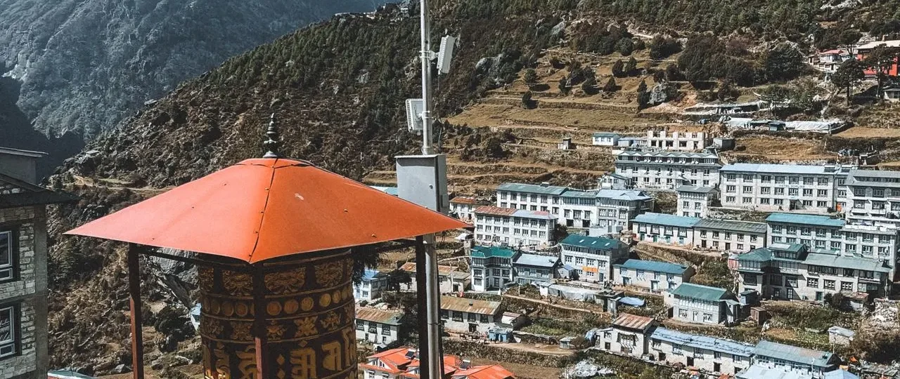
There are no roads to Dingboche. Everything the village consumes — food, fuel, building materials, and the supplies that keep the teahouses running — arrives by porter, yak, or mule. That logistical reality explains why prices for food, charging, and hot showers rise sharply here and stay high all the way to Gorak Shep. The village is part of Sagarmatha National Park, a UNESCO World Heritage Site inscribed in 1979, and the landscape is managed under national park regulations.
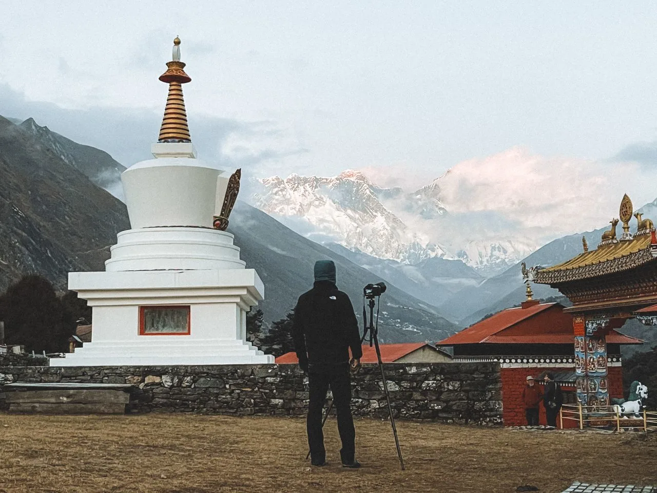
The surrounding peaks frame the village in every direction. Ama Dablam (6,812m) dominates the southern skyline, its hanging glacier visible from the teahouse windows. Lhotse (8,516m) and Nuptse (7,861m) appear to the north, and Island Peak (Imja Tse, 6,189m) rises at the head of the Chhukung Valley to the east. Stone-walled fields where locals grow barley and potatoes during the brief summer surround the settlement, and prayer flags flutter across the mani walls that line the trail.
Travel connection: Dingboche is not a destination in isolation. It is a mandatory waypoint on the Everest Base Camp trek and a launch point for side trips to Chhukung Valley, Island Peak Base Camp, and the Kongma La pass on the Three Passes route. Understanding its position helps you plan daily stages and decide whether to add the Chhukung detour.
Dingboche Altitude: What 4,410 Metres Does to Your Body
Dingboche altitude is 4,410 metres, which places it firmly in the high-altitude zone where acute mountain sickness (AMS) becomes a genuine risk. At this elevation, atmospheric pressure is roughly 58 to 60 percent of that at sea level, so each breath delivers significantly less oxygen to the bloodstream. The body responds by increasing breathing rate and, over time, producing more red blood cells — but that adaptation takes days, not hours.
Most trekkers reach Dingboche after sleeping at Namche Bazaar (3,440m) and Tengboche (3,860m). Even so, AMS can appear or worsen here. The classic symptoms are headache that does not clear with rest and paracetamol, nausea, dizziness, fatigue, and difficulty sleeping. The golden rules are simple: ascend slowly, hydrate constantly, and never ignore symptoms. If a headache persists or nausea develops, rest and hydration often help. If symptoms worsen — especially shortness of breath at rest, confusion, or loss of coordination — descent is the only reliable treatment.
The Himalayan Rescue Association (HRA) clinic in Pheriche, about 30 to 40 minutes away, is the nearest medical facility. Volunteer doctors run free daily talks on altitude sickness throughout the trekking season, and the clinic is the oldest and most established trailside medical post in the Khumbu region. Trekkers at Dingboche are within easy reach if needed.
Travel connection: The acclimatization day at Dingboche is not optional for most trekkers. Standard 14-day EBC itineraries build in two acclimatization stops — Namche Bazaar and Dingboche — and the Dingboche rest day is what makes the jump to Lobuche (4,910m) and Gorak Shep (5,160m) tolerable. Skipping it significantly increases the risk of altitude sickness on the final push to Base Camp.
Dingboche Weather: Seasons, Temperatures, and What to Pack
Dingboche weather is a tundra climate (Köppen ET): cool and rainy summers, dry and very cold winters, shaped by altitude and the monsoon. The table below shows mean daily maximum and minimum temperatures based on long-term climate data for Dingboche.
| Month | Mean High (°C) | Mean Low (°C) | Trekking Notes |
|---|---|---|---|
| January | 1.0 | −15.3 | Very cold; many teahouses above Tengboche closed |
| February | 1.5 | −14.2 | Cold; quiet trail |
| March | 4.7 | −10.0 | Spring begins; rhododendrons bloom lower down |
| April | 8.5 | −7.0 | Excellent visibility; peak spring season |
| May | 11.1 | −3.5 | Warm days; pre-monsoon haze possible |
| June | 13.7 | 1.1 | Monsoon approaches; cloud and rain |
| July | 13.0 | 2.9 | Monsoon; wet, cloudy, leeches lower down |
| August | 12.6 | 2.3 | Monsoon continues |
| September | 11.5 | 0.3 | Post-monsoon clearing; excellent views |
| October | 8.9 | −3.5 | Peak autumn season; clear skies, stable weather |
| November | 5.3 | −8.0 | Cold but clear; fewer trekkers |
| December | 3.2 | −12.0 | Winter; cold, some teahouses close |
Dingboche Nepal weather for trekking is best in spring (March–April) and autumn (October–November) , when visibility is clearest and temperatures are manageable. Winter trekking is possible, but many teahouses above Tengboche close, and daytime temperatures rarely rise above freezing. The monsoon (June–August) brings cloud, rain, and slippery trails, though some trekkers still attempt the route.
Travel connection: Dingboche sits at 4,410 metres, so nights are below freezing from October through April. Pack a sleeping bag rated to at least −10°C, thermal layers, a down jacket, a warm hat and gloves, and a headlamp. Teahouse dining rooms are heated by yak-dung stoves, and that is where everyone gathers in the evenings. A power bank, a water purification system, and cash for charging and showers are essential.
The Acclimatization Day: What to Do in Dingboche
Dingboche acclimatization is the reason most itineraries include two nights here. The rest day is not a day of total inactivity. The best acclimatization follows the principle of “climb high, sleep low”: gain altitude during the day, then return to Dingboche to sleep. This stimulates red blood cell production and improves oxygen transport without the risks of sleeping too high too soon.
Nangkartshang Peak Hike (5,083m)
The Nangkartshang Peak hike is the most popular acclimatization option in Dingboche and one of the best side hikes on the entire Everest trail. The trail starts from the upper end of the village and climbs a ridge to a summit marked by prayer flags at roughly 5,083 metres. The round trip takes three to five hours, depending on pace and how long you spend at the top. The ascent gains about 670 metres from Dingboche, which is significant at this altitude.
The views from the summit are panoramic: Makalu (8,485m) to the east, Everest (8,848.86m) and Lhotse to the north, Ama Dablam to the south, and the entire Imja Valley unfolding below. An early start — around 7:00 AM — gives the clearest weather and calmest conditions. The purpose is acclimatization, not summit conquest. Go slowly, drink water, and turn back if altitude symptoms worsen.
Chhukung Valley Walk
A gentler alternative is walking toward Chhukung Valley, a side valley that leads toward Island Peak and Kongma La Pass. The walk is relatively flat compared to the Nangkartshang climb and takes about two to three hours one way, or four to five hours round trip. The valley offers close views of Island Peak (Imja Tse, 6,189m) and the surrounding glaciers. Many trekkers preparing for Island Peak use Chhukung as a further acclimatization stop, and the village itself sits at 4,730 metres.
Rest and Hydration
Some trekkers choose to spend the acclimatization day resting in the teahouse, drinking water, reading, and sleeping. This is not ideal — active days are more effective — but it is better than pushing too hard and risking altitude sickness. If you are feeling unwell, rest is the right choice. Drink four to five litres of water, avoid alcohol, and eat even if you do not feel hungry. Carbohydrates are easier to digest at altitude than fats.
Travel connection: The acclimatization day at Dingboche is when many trekkers first feel altitude seriously. Pay attention to your body. If a headache persists, nausea develops, or you feel dizzy, speak to your guide or visit the HRA clinic in Pheriche. Do not push on to Lobuche if you are unwell.
Teahouses and Accommodation in Dingboche
Dingboche teahouses mark the threshold where accommodation quality becomes consistently basic. From Tengboche through Dingboche, twin rooms with shared bathrooms are standard, and hot showers cost an additional NPR 200 to 400. Above Dingboche, facilities become simpler still.
Rooms are unheated and cold. The dining room has a central stove that staff light in the evening — it is the only warm space in the building. Walls are plywood or thin partition material, so you will hear your neighbours and the wind. Blankets are provided, but they are rarely enough above Dingboche, which is why a sleeping bag rated to at least −10°C is essential gear from this point onward.
Wi-Fi and charging are charged separately from Dingboche upward. Up to Tengboche, Wi-Fi is often free; from Dingboche on, expect to pay NPR 300 to 500 for a full device charge and similar for Wi-Fi access. Hot showers cost NPR 200 to 400.
Popular teahouses in Dingboche include Hotel Summit 4410, Hotel Bright Star, Snow Lion, and Peaceful Lodge. The dining halls are the social heart of the village, with yak-dung stoves, communal tables, and menus that range from dal bhat to pasta, pancakes, and apple pie. Dal bhat is the most reliable choice: it is nutritious, refillable at most teahouses, and provides the carbohydrates and protein you need at altitude.
Travel connection: Book your Dingboche teahouse through your trekking agency if you are on a guided trek. Independent trekkers can usually find a room on arrival, but in peak season (October–November), the village fills up and options may be limited. Arriving by early afternoon improves your chances of getting a good room.
Trekking from Tengboche to Dingboche
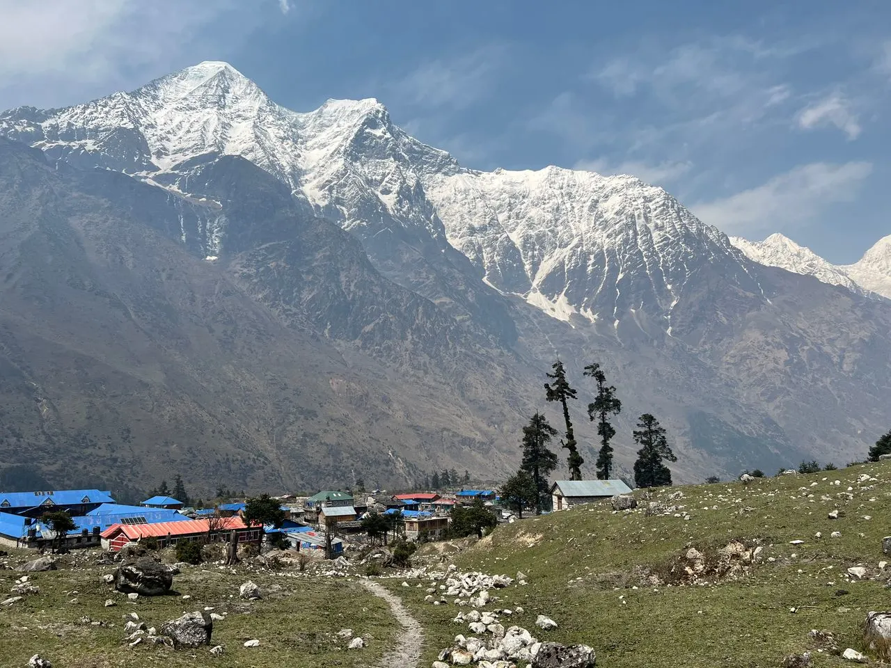
Tengboche to Dingboche is one of the most scenic stages of the Everest Base Camp trek. The distance is approximately 10 to 12 kilometres, and most trekkers cover it in five to six hours. The trail descends from Tengboche (3,860m) through rhododendron forest to Deboche, crosses the Imja Khola on a suspension bridge, and then climbs gradually through Pangboche (3,930m) before reaching Dingboche. The elevation gain is about 550 metres, but the terrain is relatively gradual compared to the steep climbs earlier in the trek.
The route passes mani walls, prayer flags, and traditional Sherpa villages. The Imja Valley opens up as you approach Dingboche, and the first views of Ama Dablam from the village are one of the visual highlights of the trek.
Travel connection: This stage is a good opportunity to practice pacing. Start early, walk slowly, and take breaks. The altitude is beginning to bite, and arriving in Dingboche without feeling exhausted makes the acclimatization day more effective.
Trekking from Dingboche to Lobuche
Dingboche to Lobuche is the next major stage on the Everest Base Camp trek, and it is a demanding day. The distance is approximately 7 to 8 kilometres, and it takes five to six hours. The elevation gain is about 500 metres, from 4,410 metres at Dingboche to 4,910 metres at Lobuche.
The trail leaves Dingboche, crosses a saddle with chortens and prayer flags, and follows the ridgeway above the Pheriche valley to Duglha (4,620m). From there, it passes a cluster of memorial shrines — stone chortens built in memory of climbers who died on Everest and other peaks — and then climbs through the Dughla Pass (4,830m) before reaching Lobuche. The terrain is rocky and exposed, with little shelter from wind or sun.
Travel connection: This is the day when the acclimatization from Dingboche matters most. Trekkers who skipped the rest day often struggle on the climb to Dughla Pass. Start early, pace yourself, and drink water. The memorial shrines at Dughla are a sobering reminder of the risks at altitude.
Dingboche vs Pheriche: Which Acclimatization Stop?
Dingboche and Pheriche sit roughly three kilometres apart and serve the same physiological purpose on the Everest Base Camp trek. Both are acclimatization stops above 4,200 metres. Both have teahouses. Yet they do different jobs for your body, and the choice between them matters.
Dingboche is higher (4,410m), sunnier, busier, and home to the Nangkartshang Peak hike. It sits on a south-facing shelf in the Imja Valley, sheltered from the wind that funnels down the main Khumbu corridor. The village has more teahouses, better food options, and a livelier atmosphere. Most standard itineraries route trekkers through Dingboche for the second acclimatization night on the way up.
Pheriche sits at 4,371m — slightly lower — in a narrower, windier basin. The village is quieter, with fewer teahouses and simpler food. Its key advantage is the Himalayan Rescue Association clinic, the oldest and most established trailside medical post in the Khumbu region. Volunteer doctors run free daily talks on altitude sickness throughout the season.
Travel connection: Most well-built itineraries use Dingboche going up and Pheriche coming down. This gives trekkers the best of both: the sunnier, livelier acclimatization stop on the ascent and the medical infrastructure of Pheriche on the descent if needed. If you are choosing between them for the acclimatization night itself, Dingboche is the better choice, primarily because of the Nangkartshang hike and the more comfortable environment.
Dingboche to Everest Base Camp: How Far and How Long?
Dingboche to Everest Base Camp is not a single day’s walk. The distance is approximately 20 kilometres via Lobuche and Gorak Shep, and it takes two to three days, depending on your itinerary and acclimatization needs.
| Stage | Distance | Time | Elevation Gain |
|---|---|---|---|
| Dingboche to Lobuche | 7–8 km | 5–6 hrs | +500m |
| Lobuche to Gorak Shep | 4–5 km | 3–4 hrs | +250m |
| Gorak Shep to EBC | 3–4 km | 2–3 hrs | +150m |
Most trekkers spend a night in Lobuche and a night in Gorak Shep before walking to Everest Base Camp and returning to Gorak Shep. The walk from Gorak Shep to EBC is not technically difficult, but the altitude (5,364m at EBC) makes it exhausting. The views of the Khumbu Icefall and the surrounding peaks are the reward.
Travel connection: The Dingboche acclimatization day is what makes the final push to Everest Base Camp possible for most trekkers. Without it, the jump from 4,410 metres to 5,364 metres in two days is too fast for many people. Do not skip it.
Altitude Sickness at Dingboche: What to Watch For
Dingboche elevation of 4,410 metres is high enough that altitude sickness is a genuine risk, even for trekkers who felt fine at Namche Bazaar and Tengboche. The most common symptoms are headache, nausea, dizziness, fatigue, and difficulty sleeping. More serious symptoms include shortness of breath at rest, confusion, and loss of coordination, which may indicate high-altitude pulmonary edema (HAPE) or high-altitude cerebral edema (HACE). These are medical emergencies requiring immediate descent.
The Himalayan Rescue Association clinic in Pheriche is the nearest medical facility, about 30 to 40 minutes away. Volunteer doctors provide consultations and run free daily talks on altitude sickness. If you are experiencing symptoms, do not wait. Visit the clinic or descend.
Travel connection: Prevention is better than treatment. Ascend slowly, hydrate constantly, avoid alcohol, and do not skip acclimatization days. If you are taking Diamox (acetazolamide), start it before you reach Dingboche and follow your doctor’s advice. Do not use Diamox as a substitute for proper acclimatization.
Things to Do in Dingboche Beyond Acclimatization
Things to do in Dingboche extend beyond the Nangkartshang hike and the Chhukung Valley walk. The village itself is worth exploring on your rest day.
Visit the monastery. Dingboche has a small monastery that offers a quiet place for reflection and a glimpse of Sherpa Buddhist practice. Prayer flags and mani stones are scattered throughout the village.
Walk through the stone-walled fields. The village is surrounded by stone-walled fields where locals grow barley, potatoes, and other hardy crops during the brief summer. Walking through these fields offers a close look at high-altitude agriculture and Sherpa village life.
Photograph Ama Dablam. Ama Dablam (6,812m) is one of the most photographed peaks in the Everest region, and Dingboche offers some of the best views. The peak is particularly striking at sunrise and sunset, when the light hits its distinctive hanging glacier.
Enjoy the teahouse atmosphere. The dining halls in Dingboche are where trekkers from around the world gather to share stories, compare notes on the trail, and warm up by the stove. It is a social experience as much as a practical one.
Travel connection: The village itself is part of the experience. Sherpa hospitality, the rhythm of daily life at altitude, and the views from the teahouse windows are all reasons to slow down and spend the extra day.
Merriment Treks: Planning Your Everest Region Trek
Dingboche Nepal is a key stop on any Everest Base Camp or Three Passes itinerary, and proper planning makes all the difference. Merriment Treks builds Everest region itineraries that include the acclimatization stops at Namche Bazaar and Dingboche, with realistic daily stages, experienced guides, and clear information about teahouse accommodation and altitude safety. If you are planning an Everest Base Camp trek, a Three Passes adventure, or an Island Peak climb, we are happy to help you build an itinerary that respects the altitude and gives you the best chance of a safe, enjoyable trek. Contact us for route-specific planning support.
Frequently Asked Questions
1. What is the altitude of Dingboche Nepal?
Dingboche sits at 4,410 metres (14,470 feet) above sea level.
2. Why is Dingboche important on the Everest Base Camp trek?
Dingboche is the second major acclimatization stop on the trek, after Namche Bazaar. Most itineraries include a rest day here to help trekkers adjust to the altitude before continuing to Lobuche and Gorak Shep.
3. What is there to do on the acclimatization day in Dingboche?
The most popular activity is the hike to Nangkartshang Peak (5,083m), which takes three to five hours round trip and offers panoramic views of Makalu, Everest, Lhotse, and Ama Dablam. A gentler alternative is walking toward Chhukung Valley.
4. How long does it take to trek from Tengboche to Dingboche?
The trek from Tengboche (3,860m) to Dingboche (4,410m) covers approximately 10 to 12 kilometres and takes five to six hours.
5. How long does it take to trek from Dingboche to Lobuche?
The trek from Dingboche to Lobuche (4,910m) covers approximately 7 to 8 kilometres and takes five to six hours, with an elevation gain of about 500 metres.
6. What is the weather like in Dingboche?
Dingboche has a tundra climate. Summers are cool and rainy, winters are dry and very cold. Best trekking seasons are spring (March–May) and autumn (September–November).
7. Are there teahouses in Dingboche?
Yes. Dingboche has several teahouses and lodges, including Hotel Summit 4410, Hotel Bright Star, Snow Lion, and Peaceful Lodge. Rooms are basic twin-share with shared bathrooms. Hot showers, charging, and Wi-Fi are available for extra fees.
8. Is altitude sickness a risk in Dingboche?
Yes. At 4,410 metres, altitude sickness is a genuine risk. Symptoms include headache, nausea, dizziness, and fatigue. The Himalayan Rescue Association clinic in nearby Pheriche provides medical support.
9. What is the difference between Dingboche and Pheriche?
Dingboche is higher (4,410m), sunnier, busier, and home to the Nangkartshang hike. Pheriche is slightly lower (4,371m), windier, quieter, and home to the HRA clinic. Most itineraries use Dingboche going up and Pheriche coming down.
10. How far is Dingboche from Everest Base Camp?
Dingboche to Everest Base Camp is approximately 20 kilometres via Lobuche and Gorak Shep, taking two to three days.
11. Can I trek to Dingboche without a guide?
Yes, Dingboche is not in a restricted area, so you can trek independently. However, a guide is recommended for navigation, altitude safety, and logistics.
12. What should I pack for Dingboche?
Pack a sleeping bag rated to at least −10°C, thermal layers, a down jacket, warm hat and gloves, a headlamp, a water purification system, and cash for teahouse extras.
13. Is there Wi-Fi in Dingboche?
Some teahouses offer Wi-Fi, but it is charged separately (usually NPR 300–500) and can be unreliable due to the remote location.
14. What is the best time to visit Dingboche?
Spring (March–May) and autumn (September–November) offer the best weather and clearest mountain views.
15. Is Dingboche worth staying an extra day?
Yes. The acclimatization day at Dingboche is one of the most important stages of the Everest Base Camp trek. Skipping it increases the risk of altitude sickness at higher elevations.