There are easier ways to get from the Gokyo Valley to the Everest Base Camp route. You could retrace your steps to Namche Bazaar and approach from the south. You could take the longer valley trail around. Almost nobody does, because Cho La Pass exists — a 5,420-meter glacial crossing that connects two of the most famous trekking destinations in the Himalayas in a single long, demanding, unforgettable day.
Cho La is not the highest of the three passes in the Khumbu region. That title belongs to Kongma La at 5,535 meters. It is not the easiest. That is Renjo La. What Cho La is, consistently and specifically, is the most technically interesting — a real glacier crossing with crevasses, a steep ascent on rock and snow, and the kind of views from the top that make the effort feel not just worthwhile but inevitable.
This guide covers everything relevant to crossing it in 2026: the altitude and location, the terrain by section, the glacier facts, what gear you genuinely need, how it fits into the Three Passes circuit, the best direction to cross it and why, the seasonal window, and how it compares to the other two Khumbu passes.
The Basics: Where Cho La Pass Is and What It Connects
Cho La Pass sits at 5,420 meters (17,782 feet) above sea level in the Solukhumbu District of northeastern Nepal. Its coordinates place it at 27°57′44″N, 86°45′07″E, in the heart of the Khumbu region within Sagarmatha National Park.
The pass connects two villages: Dzongla at 4,830 meters to the east, and Thagnak (also written Dragnag or Dragnag) at 4,700 meters to the west. The total distance between these two villages, via the pass, is approximately 9.4 kilometers. The crossing takes between 6 and 8 hours depending on conditions, pace, and the state of the glacier on the day.
Geographically, Cho La sits between two of the most visited areas of the Everest region. To the east, the trail from Dzongla joins the main Everest Base Camp route near Lobuche. To the west, the trail from Thagnak continues to the Gokyo Lakes and the Ngozumpa Glacier. For trekkers doing the Everest Three Passes route, Cho La is the critical bridge between these two worlds.
The name “Cho La” in Tibetan relates to the pass’s position and geography. The peak rising directly above the pass on the south side is Cholatse (6,440 meters), a dramatic and technically difficult peak whose north face dominates the view from the western approach.
Altitude Context: Where Cho La Sits Among the Three Khumbu Passes
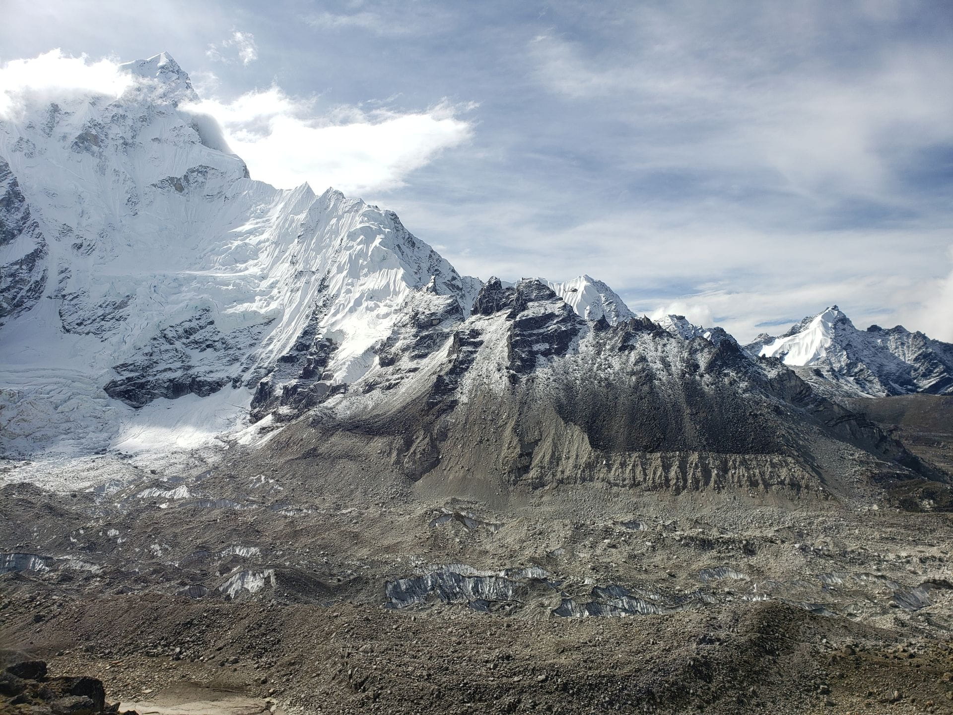
Understanding Cho La in relation to the other two passes clarifies where the difficulty comes from and where it doesn’t.
Kongma La, at 5,535 meters, is the highest of the three Khumbu passes. It crosses between Chukhung and Lobuche and is consistently described as the most exhausting — largely because the altitude gain is concentrated and the terrain is steep loose scree for extended sections. It is also the most remote of the three in terms of rescue accessibility.
Cho La, at 5,420 meters, is the middle pass in terms of elevation but the most technically complex in terms of terrain. The glacier crossing involves genuine crevasses and requires more active engagement with the terrain than either of the other two passes.
Renjo La, which various sources cite at 5,360 meters (some sources give a higher figure around 5,465 meters — the exact elevation varies in the literature), is generally considered the most scenic and the most straightforward of the three, with a steep but non-glaciated approach and descent.
At 5,420 meters, Cho La puts you 56 meters above Everest Base Camp — a fact that becomes viscerally real during the approach when breathing feels noticeably more labored than it did even at the EBC camp the previous day.
The Terrain: What the Crossing Actually Involves
The crossing from west to east — Thagnak to Dzongla — is the direction used by the majority of trekkers doing the Three Passes route anticlockwise, and the direction most itineraries recommend for acclimatization reasons. The description below follows this direction.
From Thagnak to the Glacier (West Side Approach)
The day starts at Thagnak at 4,700 meters, typically with a very early morning departure — 4:00 to 5:00 AM is standard, and experienced guides push for the earlier end of that window. The reason is practical: the glacier crossing is safer when temperatures are still cold and the ice surface is firmer. Afternoon sun softens the snow and ice, increasing the risk of postholing through the surface layer and destabilizing snow bridges over crevasses.
The initial trail from Thagnak climbs gradually through rocky moraine terrain — the accumulated debris left by glacial retreat over decades. The path is clear but steep in sections, gaining altitude steadily on loose rock. Above the moraine, the trail crosses a ridge and an old lateral moraine before the glacier comes into view.
The Glacier Crossing: The Defining Section
The glacier crossing is what makes Cho La genuinely distinct from most trekking passes in Nepal. This is a true glacier, not a snowfield. The difference matters: a glacier is a slow-moving mass of ice with internal structure, crevasses formed by differential movement, and surface features — including snow bridges that can conceal gaps in the ice below — that require active navigation.
The route across the glacier is marked with cairns and poles during the main trekking season, and in good conditions the crossing is technically manageable for trekkers without formal mountaineering training. The word “manageable” is doing real work in that sentence: the glacier is marked, the route is established, and hundreds of trekkers cross it every season. But conditions on glaciers change day to day, the marking can be obscured by recent snowfall, and the consequences of a slip or a snow bridge collapse are serious.
Crampons are not universally required, but microspikes are strongly recommended and full crampons are the sensible choice for trekkers crossing in shoulder season (late October, March, early November) when ice is harder and less forgiving than mid-season conditions. Guides who know this glacier will make the gear call based on current conditions. Following that judgment, rather than pre-deciding your gear based on a summary in a travel blog, is the correct approach.
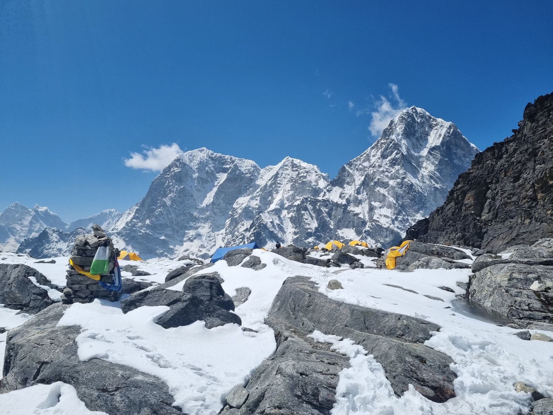
The glacier crossing covers approximately 1 to 2 kilometers of distance but involves sustained altitude — you are above 5,300 meters throughout. The thin air makes even flat traverses more demanding than equivalent terrain at lower elevation.
The Final Ascent to the Pass
After the glacier, the trail steepens sharply toward the pass itself. This section involves mixed terrain — rock, snow, and ice — with the gradient increasing significantly in the final 200 to 300 meters. There is a narrow rocky gully or rib on the direct approach to the saddle that can be icy and requires careful foot placement. In hard conditions, an ice axe is useful here. Guides rope clients across the most technical sections when conditions warrant.
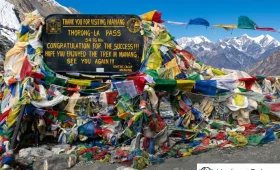
The summit of the pass — the actual high point at 5,420 meters — is marked by prayer flags strung from a cairn, which is the standard Himalayan marker for a high pass. The crossing point is a relatively narrow saddle rather than a broad plateau, and the exposure to wind at the top can be significant.
The East Side Descent: Steep and Technical
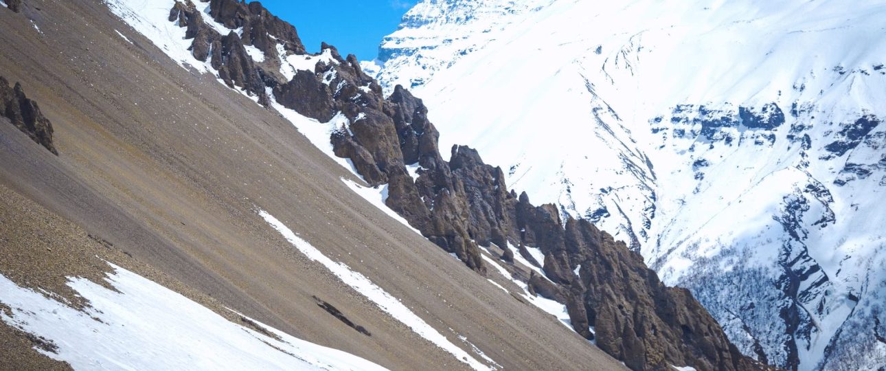
The descent from Cho La toward Dzongla on the east side is consistently described by experienced guides as the more technically demanding direction of travel. The initial descent from the saddle is steep, with rocky terrain that becomes icy in cold conditions and requires attentive foot placement. The trail works its way down through boulder fields and moraine before easing onto the valley trail toward Dzongla.
Some sources note that the east side descent involves crossing a smaller glacier section below the saddle. In good conditions this is straightforward. In icy conditions, crampons are again the sensible choice.
From the base of the descent, the trail continues approximately 3 to 4 kilometers to Dzongla village, where teahouses offer the rest and food that everyone deserves after this crossing.
Views From the Top: What You See at 5,420 Meters
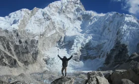
The views from Cho La Pass are worth the approach in their own right. From the saddle at 5,420 meters, the panorama includes some of the most dramatic peaks in the Khumbu.
Directly above the pass to the south rises Cholatse (6,440 meters), a pyramid-shaped peak whose technical walls are visible in exceptional detail from this close vantage point. To the east, Lobuche East (6,119 meters) and Lobuche West (6,145 meters) define the valley wall. Ama Dablam (6,812 meters), one of the most distinctive mountain profiles in the world, appears to the southeast — its characteristic double summit and sweeping ridges particularly dramatic from this high vantage point. The Khumbu Glacier is visible to the east, and across the distance, the walls of Nuptse (7,861 meters) and the southern flanks of Everest form the backdrop.
On the western approach before the summit, the north face of Cholatse dominates — a sheer wall of ice and rock that experienced climbers describe as one of the more serious technical faces in the Khumbu. From the trail, you’re close enough to see the individual ice features on the face.
Direction of Travel: Why Anticlockwise Is Recommended
The direction in which you cross Cho La matters, and most experienced guides and operators recommend the anticlockwise direction — doing Renjo La first, then descending to Gokyo Lakes, crossing Cho La from west to east (Thagnak to Dzongla), and finishing with Kongma La last.
The primary reason is acclimatization. Doing Renjo La first allows your body to adapt to high-altitude passes before the more technical terrain of Cho La. The acclimatization day at Gokyo, combined with the Gokyo Ri ascent, reinforces altitude adaptation before the glacier crossing. By the time you reach Cho La, your body has had multiple days at pass altitude and responds more competently to the physical demands.
The secondary reason is that the east side descent from Cho La — toward Dzongla and then Lobuche — is the steeper and more technical direction. Coming from west to east means you ascend the glacier (technically demanding but manageable with uphill momentum and clear footing) and descend the rocky east side (requiring careful foot placement but with gravity assisting). Crossing east to west means ascending the steep east side first, which some trekkers find more demanding.
There is also an argument that the clockwise direction offers better views at certain points — specifically, the first glimpse of Cholatse’s north face coming from the east is striking. This is a genuine visual argument, and some experienced trekkers prefer the clockwise direction for this reason. But the acclimatization benefits of anticlockwise travel are the more significant practical consideration for most trekkers.
Cho La and the Everest Three Passes Trek
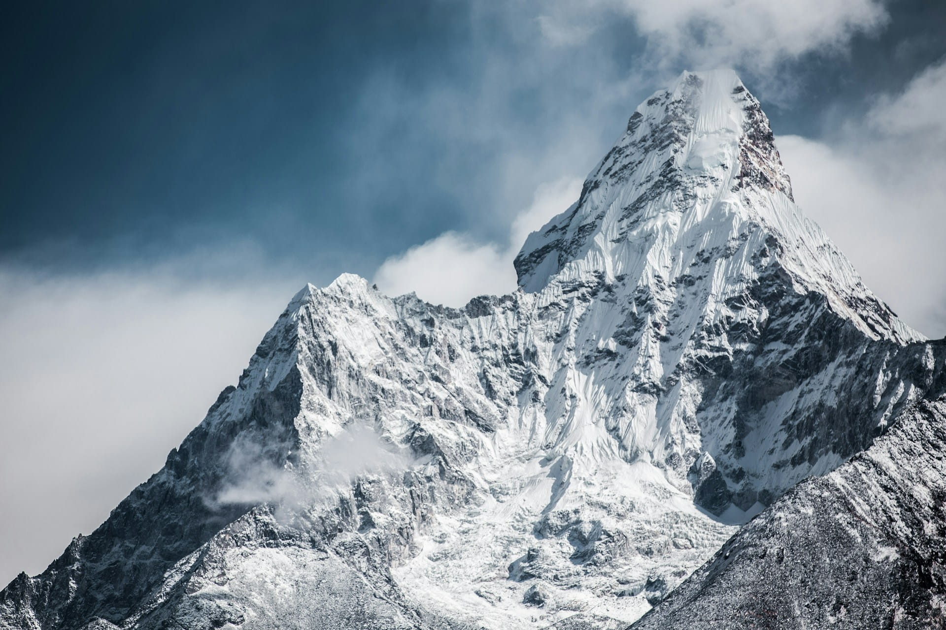
Cho La Pass is one of the three high passes that together form the Everest Three Passes Trek, the premier high-altitude circuit in the Khumbu region. The other two passes are Renjo La (approximately 5,360 meters) and Kongma La (5,535 meters). Together, the three passes circuit covers the Gokyo Valley, Gokyo Lakes, the Gokyo Ri viewpoint, Everest Base Camp, and the Chukhung Valley — essentially a grand loop around the Khumbu’s most significant destinations.
The Three Passes Trek takes between 17 and 21 days from Lukla depending on the itinerary, pace, and whether optional side trips are included. It is consistently rated as one of the more challenging long-distance treks in Nepal — harder than the standard EBC trek specifically because it involves three high passes above 5,300 meters rather than a single approach and return.
Gear: What You Actually Need for Cho La
The gear requirements for Cho La are slightly more specific than for most Nepal trekking passes, and the distinction matters.
- Microspikes are the minimum recommended traction device for crossing the Cho La glacier. They are more useful than standard trekking poles alone for maintaining grip on firm snow and ice, and their weight is minimal. Many teahouses in the Gokyo area and some trekking supply shops in Namche Bazaar rent or sell them. Packing your own from home is more reliable.
- Full crampons — strap-on or step-in — are worth carrying in shoulder season (October beyond mid-month, November, March, early April) when the glacier surface is harder. In mid-season (October’s first two weeks, April’s middle weeks) microspikes may suffice in good conditions. Your guide will make this call based on what the glacier looks like on the specific morning of crossing.
- An ice axe is not strictly required for most crossings in good mid-season conditions, but is carried by guides and is the correct safety item for self-arrest if a slip occurs on the steeper approach to the pass or the east side descent. Trekkers with no ice axe experience don’t need to bring one, but trekkers with the training to use one correctly should consider it for shoulder season crossings.
- Warm, layered clothing is essential — you leave before dawn and are on the glacier in the coldest part of the morning. The wind at the pass summit can be significant. Insulated jacket, windproof outer layer, warm gloves, and a hat that covers your ears are functional requirements, not optional comfort items.
- Trekking poles with snow baskets assist balance on the glacier and on the rocky descent. If you’ve been using poles earlier in the trek, they’re already in your hands.
- Gaiters prevent snow and slush from entering your boots on the glacier, which matters both for comfort and for the warmth of your feet during the long crossing day.
Seasonal Conditions: When Cho La Is Crossable
The seasonal window for Cho La aligns with the main Khumbu trekking season, but with specific considerations around the glacier that other passes don’t share.
- October and early November are the best conditions for Cho La. Post-monsoon, the glacier surface is at its most stable, the trail marking is clear, daytime temperatures allow relatively comfortable crossing once the sun reaches the glacier, and the sky clarity is exceptional. Peak October is when the most trekkers attempt the pass — which also means the trail is well-worn and route-finding is easier.
- Late November and December become increasingly difficult. Snow on the approach trail and on the pass itself deepens, the glacier surface hardens, and temperatures at the saddle drop to a range where wind chill is a genuine safety concern. The pass does not formally close, but trekking agencies and experienced guides become increasingly cautious about crossing conditions from late November onward.
- March and April represent the spring window. In March, leftover winter snow can be substantial and the glacier surface is icy from months of cold temperatures — this is arguably the most technically demanding time to cross, requiring crampons reliably and caution about avalanche risk from the slopes above the approach. By April, conditions improve considerably, snow consolidates or melts on lower sections, and the crossing becomes more similar to peak autumn conditions.
- May is possible but the pre-monsoon cloud pattern builds in the afternoons, making early starts even more critical to avoid weather catching you on the glacier or at the saddle.
- June through September (monsoon) is not recommended. The glacier receives fresh snow and becomes more unstable, trail visibility drops significantly in cloud, and the moraine sections on both approaches become slippery. The pass is not impassable in all monsoon conditions, but the risk-reward ratio is unfavorable and most operators do not run Three Passes itineraries during this period.
Altitude and Physical Demands: Who Should Attempt Cho La
The altitude of 5,420 meters makes Cho La genuinely demanding for anyone, and the technical terrain adds a dimension beyond the altitude alone. But “demanding” does not mean “restricted to specialists.”
The profile of a trekker for whom Cho La is appropriate: prior multi-day trekking experience (the standard EBC trek or equivalent), a demonstrated ability to function above 5,000 meters without serious AMS symptoms, reasonable physical fitness with cardiovascular conditioning, comfort on uneven and slippery terrain, and the judgment to follow guide instructions about timing and retreat without ego-driven resistance.
The profile of a trekker for whom Cho La is not appropriate: first-time high-altitude trekkers, anyone who has shown significant AMS symptoms earlier on the same itinerary, trekkers who have not allowed adequate acclimatization time before the crossing day, and those unwilling to turn back if conditions at the glacier or at the approach are unsafe on the day.
The total elevation gain on the crossing day from Thagnak (4,700 meters) to the pass (5,420 meters) is 720 meters, followed by a descent of approximately 590 meters to Dzongla (4,830 meters). The total walking time of 6 to 8 hours at altitude, on mixed and technical terrain, requires sustained cardiovascular effort across a full day.
The most common reason for turnarounds on Cho La — based on reported experiences from guides and trekkers — is not technical inability but poor conditions at the glacier combined with inadequate acclimatization. Both of these are manageable with proper itinerary planning and honest physical assessment before the crossing day.
What Happens If the Pass Is Closed
The Cho La glacier section can become impassable after heavy snowfall, in poor visibility, or when surface conditions make the crossing unsafe. This is not a rare scenario — it happens every season to some degree of frequency.
If Cho La is reported closed or unsafe on the day you planned to cross, the standard contingency is to return from Thagnak to Gokyo and take the valley trail south toward Phortse and the main EBC route. This adds one to two days to the itinerary and requires going back rather than forward, which is psychologically difficult after investing in the Three Passes objective.
A well-designed itinerary builds a buffer day somewhere in the Three Passes schedule for exactly this reason. Trekkers who have no schedule flexibility and zero buffer days are the ones who either attempt dangerous crossings or miss the pass entirely because they cannot afford the extra time. Building one to two buffer days into the Three Passes itinerary is not over-caution — it’s correct planning for a route where one of the three central objectives is weather-dependent.
Frequently Asked Questions About Cho La Pass
- How high is Cho La Pass?
Cho La Pass sits at 5,420 meters (17,782 feet) above sea level. It is located in the Solukhumbu District of Nepal in the Khumbu region of the Himalayas. - What does Cho La Pass connect?
Cho La Pass connects the village of Dzongla (4,830 meters) on the east with the village of Thagnak (also called Dragnag, 4,700 meters) on the west. Effectively it bridges the Everest Base Camp route with the Gokyo Valley. - Is Cho La Pass the highest of the three Khumbu passes?
No. Kongma La at 5,535 meters is the highest of the three Khumbu passes. Cho La at 5,420 meters is the middle in terms of elevation. Cho La is, however, the most technically complex due to the glacier crossing. - Do you need crampons for Cho La Pass?
Microspikes are strongly recommended as a minimum. Full crampons are the sensible choice in shoulder season (late October, November, March) when the glacier surface is hard ice. In mid-season conditions, microspikes may be sufficient, but the decision should be based on actual glacier conditions on the day, ideally assessed by your guide. - How long does it take to cross Cho La Pass?
The crossing from Thagnak to Dzongla takes between 6 and 8 hours depending on pace, group fitness, and conditions. An early start — departing Thagnak between 4:00 and 5:00 AM — is standard to reach the glacier before it warms and to descend the east side before any afternoon weather change. - Can you see Everest from Cho La Pass?
Views from the top of Cho La include Cholatse, Ama Dablam, Lobuche East, and the surrounding Khumbu peaks. Some sources include Everest in the panorama list, but the view of Everest from Cho La is partial rather than a full summit view — the better Everest viewpoints in the Khumbu remain Kala Patthar (5,545 meters) and Gokyo Ri (5,357 meters). - Which direction should you cross Cho La Pass?
The recommended direction for acclimatization purposes is west to east — Thagnak to Dzongla — which is the anticlockwise direction for the Three Passes Trek. This allows better altitude adaptation before the glacier crossing and is the direction used in the majority of Three Passes itineraries. - Is Cho La Pass open year-round?
No. The best seasons are October to early November and April. The pass can be crossed in late September and May with more caution. Late November through March carries significant winter risk on the glacier, and monsoon season (June to September) is not recommended due to unstable conditions on the glacier and poor visibility. - What is the Ngozumpa Glacier that appears in Cho La descriptions?
The Ngozumpa Glacier is the largest glacier in Nepal by area, running south from Cho Oyu through the Gokyo Valley. Trekkers approaching Cho La from the Gokyo side cross sections of the Ngozumpa Glacier in the approach from Gokyo to Thagnak before the Cho La glacier proper begins above Thagnak. - What peaks are visible from Cho La Pass?
From the pass at 5,420 meters, prominent peaks include Cholatse (6,440 meters) immediately above to the south, Ama Dablam (6,812 meters) to the southeast, Lobuche East (6,119 meters) and Lobuche West (6,145 meters) to the east, and the surrounding Khumbu peaks. The view toward the Rolwaling Valley is visible to the west from the saddle. - Do I need a guide to cross Cho La Pass?
Yes — the pass involves glacier travel and route-finding that varies with snow and ice conditions season to season, making a guide essential regardless of the general mandatory-guide requirements now in effect across Nepal’s trekking regions. Even experienced trekkers benefit from a guide’s day-of assessment of the glacier surface, since conditions can shift meaningfully between early morning and midday. - How difficult is Cho La Pass compared to the other Khumbu passes?
Cho La is generally considered the most technically demanding of the three despite not being the highest, because of the glacier crossing near the pass itself, which requires careful footing and sometimes microspikes or crampons. Kongma La and Renjo La are higher or comparable in altitude but involve straightforward scree and rock terrain rather than glacier travel, making Cho La the pass where technical conditions matter more than raw elevation. - What should I pack specifically for the Cho La crossing?
Beyond standard cold-weather trekking gear, bring microspikes or crampons depending on season, trekking poles for the loose rock sections on both approaches, sunglasses or glacier goggles for the intense glare off the snow and ice, and enough water and snacks for a 6-8 hour day with no teahouses along the crossing itself. A headlamp is also necessary given the pre-dawn departure standard for this crossing. - Is Cho La Pass part of a standalone trek, or only done as part of a longer itinerary?
Cho La is almost always crossed as part of the Everest Three Passes Trek or as a connector for trekkers combining the EBC route with the Gokyo Valley, rather than as a standalone objective. Its remote position between Dzongla and Thagnak means there’s no practical reason to cross it outside one of these longer combined itineraries. - What happens if weather or glacier conditions make Cho La too dangerous to cross on a given day?
Guides will typically delay the crossing by a day or reroute the group back the way they came if conditions look unsafe, rather than push through a marginal weather window. Building a buffer day into the itinerary around the Cho La crossing specifically is standard practice for exactly this reason, since the glacier surface and visibility can change enough overnight to turn a manageable crossing into a genuinely risky one.
Final Word: Why Cho La Is the Pass People Remember

The Khumbu has three passes above 5,300 meters that can be crossed without technical mountaineering equipment. Kongma La is higher and more exhausting. Renjo La is more panoramic and more forgiving. Cho La is the one people talk about.
Part of this is the glacier — the specific and somewhat irreducible reality of standing at 5,420 meters on actively moving ice, watching a guide check the snow bridge ahead of you, and placing your feet with the kind of attention that 200 meters of exposure below you naturally produces. Part of it is the approach from the Gokyo side, with Cholatse’s north face filling your field of vision as you ascend. Part of it is the view from the saddle — Ama Dablam and the great Khumbu peaks arranged around you at an elevation where their scale is fully apparent. And part of it is the descent to Dzongla, rocky and steep and deeply satisfying once your feet are back on solid moraine and Lobuche is visible below.
You don’t cross Cho La Pass to check it off a list. You cross it because the Gokyo Valley is on one side and the Everest Base Camp route is on the other, and the mountain between them has a pass at 5,420 meters that connects those two worlds in a single demanding, technical, extraordinary day.