Introduction to Tilicho Tal Nepal
Tilicho Tal Nepal is a glacial lake sitting at roughly 4,919 metres in the Manang district of the Annapurna Conservation Area, and it is one of the most demanding and most rewarding side trips in the Himalayas. Most trekkers reach it as a three- to four-day detour from Manang, walking up to Tilicho Base Camp and then making a long day hike to the shore. This guide gives you the planning detail that short blog posts skip: where the lake really is, whether it deserves the “highest lake in the world” label, the routes, a realistic itinerary, the landslide section everyone talks about, the best season, permits, costs and an honest view on who should skip it.
The short version for planners: it is a strenuous, non-technical high-altitude walk. The lake itself is not the hard part. The hard parts are the altitude, one exposed scree traverse above Shree Kharka, and the temptation to rush the acclimatization. Give yourself a proper rest day in Manang, start early on the exposed stretch, and the trek is very doable for a fit, well-prepared walker.
Tilicho Tal Nepal at a Glance
These are the numbers most trekkers ask about first. Elevations vary by a few tens of metres between sources and GPS devices, so treat them as close approximations rather than survey-grade figures.
| Detail | What to know |
|---|---|
| Location | Manang District, Gandaki Province, inside the Annapurna Conservation Area |
| Lake elevation | About 4,919 m (16,138 ft); some sources list 4,949 m, and trekkers’ GPS readings differ |
| Size | Around 4 km long and 1.2 km wide, roughly 4.8 km² of surface area, average depth often quoted as 85 m |
| Type | Glacial lake, fed by the glaciers of the Tilicho massif |
| Tilicho Base Camp | About 4,150 m, where the lodges are |
| Tilicho Peak above the lake | 7,134 m |
| Typical time | 3 to 4 days as a side trip from Manang; roughly 11 days as a standalone trek from Kathmandu |
| Best seasons | Spring (March to May) and autumn (September to November) |
| Permits | ACAP; a TIMS card where checked (see the permits section) |
| Difficulty | Strenuous because of altitude and one landslide-prone section, but not a technical climb |
What Is Tilicho Tal?
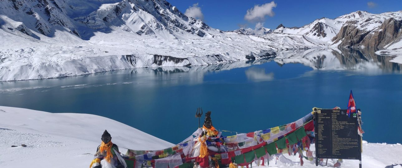
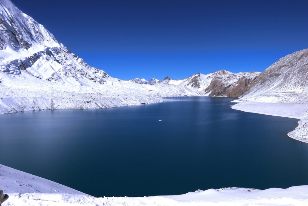
“Tal” simply means lake in Nepali, so Tilicho Tal and Tilicho Lake are the same place. It sits in a bare, wind-scoured basin on the northern side of the Annapurna massif, about 55 kilometres from Pokhara as the crow flies, but a world away in feel. The valley that holds it is cold, dry and almost treeless. The water is a milky turquoise that changes shade through the day, and the walls around it are a mix of rock, ice and hanging glacier.
Several big names stand around the basin: Khangsar Kang, the Muktinath peak, Nilgiri and Tilicho Peak itself, which rises to 7,134 metres. The lake is fed by glacial melt and has no recorded aquatic life; the Department of Hydrology and Meteorology reported none in 2003. Many sources give its length as about four kilometres, which makes it large by Himalayan standards. You can read the basic physical data on the Tilicho Lake Wikipedia entry, and the mountain that dominates the skyline has its own page on Tilicho Peak.
The lake also has spiritual weight. Operators describe it as a pilgrimage destination for both Hindus and Buddhists, and Nepali visitors treat the walk with a seriousness you do not always see on other trekking routes. That is worth remembering when you arrive: this is a quiet place, and the quietness is part of the reward.
Is Tilicho Lake the Highest Lake in the World?
No, and this is the single most repeated mistake in travel writing about the lake. Social media posts and many tour pages call it the highest lake on Earth. A fact-check by Snopes on the Tilicho Lake claim found that, depending on the source, the lake sits somewhere between about 16,000 and 16,800 feet, which makes it one of the highest large lakes in the world but nowhere near the top of the list. At least ten other lakes are, or were, higher, including crater lakes in the Chilean Andes. The highest of all is usually given as a tiny crater lake on the Ojos del Salado volcano at about 6,390 metres.
Closer to home, a lake called Kajin Sara near Chame was reported by local teams as sitting above 5,000 metres, with figures from about 5,000 to 5,200 metres appearing in press coverage. That would put it higher than Tilicho, and it also lies in Manang district. Reports on it differ and it is not a destination most trekkers visit.
So what is the fair way to describe Tilicho? Here are the claims you can safely make:
- It is among the highest lakes of its size anywhere in the world.
- It is among the best-known high-altitude lakes in Nepal, and a classic add-on to the Annapurna Circuit.
- It is reachable by lodge-to-lodge trekking, which very few lakes at this elevation can claim.
That last point is the real reason it is famous. You do not need a mountaineering permit, ropes or an expedition to stand beside a lake above 4,900 metres. You need fitness, patience and a sensible schedule.
Where Is Tilicho Lake and How Do You Get There?
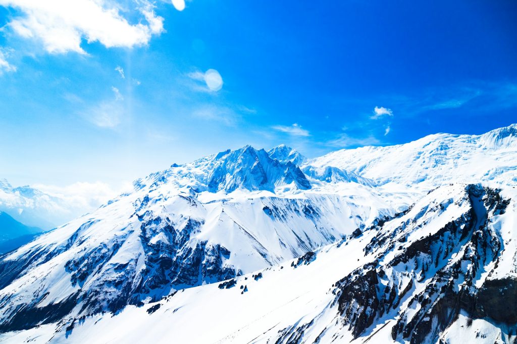
The lake lies north of Manang village, on the Manang side of the Annapurna range. There is no road to it. Everything starts with getting to Manang, which most people do by road along the Marsyangdi valley from Kathmandu to Besisahar and then onward, either by jeep or on foot through villages such as Tal, Dharapani, Chame and Pisang.
The drive is long. One published 13-day itinerary lists roughly ten hours of driving from Kathmandu to Tal at 1,700 metres on the first day. Road conditions change with the seasons, so ask your operator how far vehicles can currently go. Walking the lower valley is not wasted time: the forest, the waterfalls, the change from rice terraces to pine and then to high, dry Tibetan-style landscapes is part of the pacing that prepares your body.
There is also a second approach from the western side. Jomsom, in Mustang, is connected to Pokhara by a flight of about half an hour, and a high, demanding trail runs from near Thini over Mesokanto La to the lake. That route is covered below, and it is a very different proposition from the standard approach.
Tilicho Lake Trek Routes Compared
There is more than one way to reach the shore. Here is how the main options stack up for a trekker choosing between them.
1. The standard route from Manang
This is the classic. From Manang (about 3,540 m) you walk via Khangsar to Shree Kharka, then on to Tilicho Base Camp at about 4,150 metres. The following day you hike up to the lake and either return to base camp or continue down to Shree Kharka. It follows the Annapurna Circuit trail until Shree Kharka, and from there branches off. Lodges exist along the way, so you do not need to camp.
2. A standalone out-and-back trek
If you do not want to cross Thorong La, you can go in and out via Manang. Operators typically plan this at around 9 to 11 days from Kathmandu, with the lake as the climax and the same valley as the return. It suits people short on time, or those who want the lake without the pass.
3. Tilicho added to the Annapurna Circuit
This is the most popular version for first-time visitors to the region. After the lake you go back to Shree Kharka, continue to Yak Kharka and Thorong Phedi, and cross Thorong La at 5,416 metres. Published circuit-with-Tilicho itineraries run from about 13 to 17 days depending on pace and acclimatization stops. If you are weighing that bigger commitment, our breakdown of Annapurna Circuit difficulty explains what the extra days involve.
4. Over Mesokanto La to Jomsom
An alternative to Thorong La is to cross from the lake’s basin over Mesokanto La and descend to Thini and Jomsom. This route is more demanding. There are no teahouses between Tilicho Base Camp and Thini, so at least one night of camping is needed, and operators describe the descent from the pass as steep and loose. Published figures for the pass vary widely, from about 5,100 metres to over 5,400 metres, so confirm the current number with your operator. It is closed by snow more often than Thorong La, and it is not a good choice for beginners.
5. A newer approach from Thini
Local officials have reported a newer trail from Thini in Mustang that passes Namakhu Lake, the Nilgiri icefall and Chema Tal before joining Mesokanto La. Online Khabar’s report on the new Tilicho route says domestic tourists have started using it and that a quick return visit is possible. Treat that as an early report, not a settled itinerary, and check conditions with locals before relying on it.
A Realistic 11-Day Tilicho Lake Itinerary
Itineraries differ between operators, and road conditions change how many days you spend driving. The outline below follows the general structure of the standalone out-and-back trek and keeps the acclimatization logic intact. Treat the times as estimates; actual walking times depend on fitness, weather and group pace.
- Day 1, Kathmandu to Besisahar or beyond. A long road day along the Marsyangdi. Depending on the road, you may sleep near Besisahar or further up the valley at Tal (1,700 m).
- Day 2, to Chame. Forest, suspension bridges and the first real mountain views. Chame is around 2,600 metres.
- Day 3, Chame to Upper Pisang. The valley opens up and the landscape turns drier and more Tibetan.
- Day 4, Pisang to Manang. You arrive at about 3,540 metres, the last proper village before the climb to the lake.
- Day 5, acclimatization in Manang. Do not skip this. A gentle hike toward Khangsar (about 3,750 m) and a return to sleep in Manang is the classic “climb high, sleep low” pattern.
- Day 6, Manang to Shree Kharka. Pass through Khangsar and sleep at roughly 4,000 metres. Published itineraries give figures between about 3,850 and 4,070 metres for this stop.
- Day 7, Shree Kharka to Tilicho Base Camp. A short distance but the committing day, because it crosses the landslide-prone traverse. Start early. Base camp is around 4,150 metres.
- Day 8, Tilicho Lake and back. A climb of about three to four hours takes you to the shore at roughly 4,919 metres. Most groups return to base camp, and many continue down to Shree Kharka the same day, which makes for a long day of seven to ten hours.
- Day 9, back to Manang. A descent that feels easy after the altitude of the previous days.
- Day 10, Manang to Besisahar. Another road day, weather and landslides permitting.
- Day 11, back to Kathmandu.
If you prefer to split Day 8, sleeping a second night at Tilicho Base Camp after the lake gives your body more time, but it means a colder, higher night. Some travellers also add a buffer day in Manang for bad weather, which is a smart insurance policy in a mountain landscape.
Lake Day: What the Final Climb Involves
Everything in the plan leads to one day, so it is worth knowing how it unfolds. From Tilicho Base Camp the path climbs steadily toward a saddle above the valley. Published itineraries put the ascent at about three to four hours, and a full round trip from base camp as a long day, with return legs to Shree Kharka stretching it to nine or ten hours in some schedules. The lodge at base camp is where you eat breakfast and start, usually in the dark, because the weather is calmest early and the return needs daylight.
The gradient is the main challenge, not technical difficulty. Switchbacks climb the slope, the air thins, and the pace drops to a crawl for most people. One published trek diary notes that two first-time trekkers in their group did not continue above base camp, a useful reminder that turning around is a legitimate decision rather than a failure. Weather matters too: wind can build by midday, and snow on the upper trail may need microspikes.
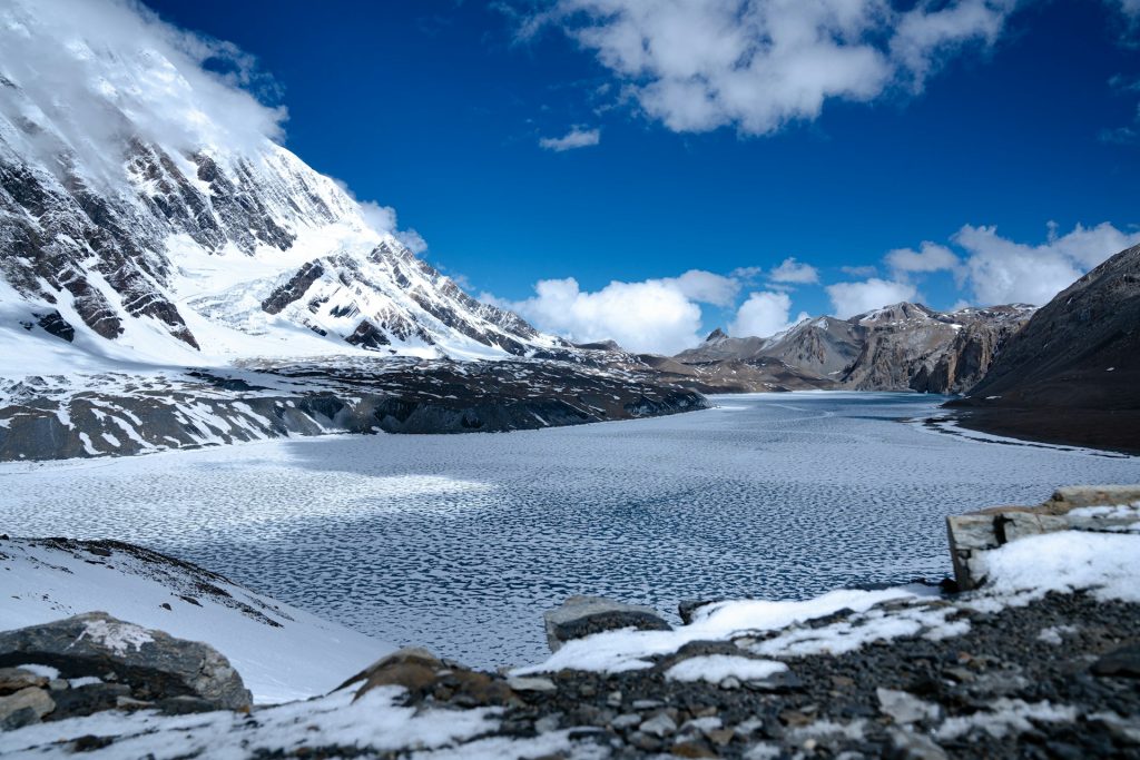
When you reach the shore, the reward is large. The basin opens suddenly, with the turquoise water laid out below Tilicho Peak and the surrounding ridges. There is no easy path around the lake itself. Cliffs and glaciers block the usual alternatives, so most visitors enjoy the viewpoint, take photographs, eat a snack and start back down. Plan for 30 to 60 minutes at the top, no more. Cold, wind and altitude all argue against lingering, and your descent time matters more than your photo count.
How Hard Is the Tilicho Lake Trek?
Operators rate it from moderate-to-challenging to strenuous. Both descriptions are fair. The route is not technical. You do not need ropes or crampons for the standard approach in good conditions. What makes it hard is a combination of factors that stack up:
- You sleep above 4,000 metres for at least one night, and the lake itself is nearly 5,000 metres.
- The day to the lake is long and steep in its final stretch.
- The weather up there can change quickly, with strong afternoon wind.
- The landslide-prone traverse requires focus and good timing.
For a more detailed breakdown by stage, read our guide on Tilicho Lake trek difficulty. The main message is that fitness helps, but acclimatization and judgement matter more than speed.
The landslide section, explained honestly
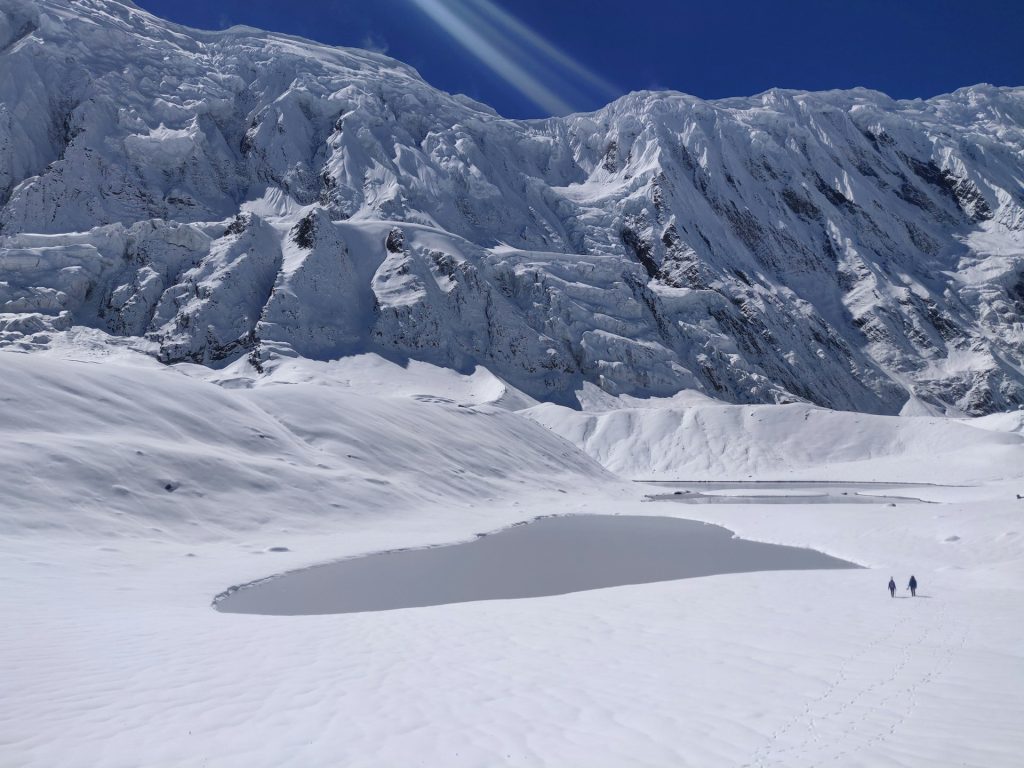
Between Shree Kharka and Tilicho Base Camp the trail crosses a long, steep slope of loose rock and scree. Rocks come down here, especially when the wind picks up in the afternoon or after rain. Trekkers’ accounts describe the crossing as taking around two hours, and some are surprised at how wide the path has become. Others call it the most nerve-racking part of the whole circuit. Both reactions are understandable, because conditions change by season and year.
Practical rules that keep coming up from operators and from people who have walked it:
- Cross early. One operator advises crossing before about 10 AM because wind and rockfall increase later in the day.
- Do not cross in rain or fresh snow. Wet scree is less stable and visibility drops.
- Ask in Khangsar. Lodge owners in the village know the current state of the trail better than any website. If they advise waiting, wait.
- Keep gaps between walkers. Do not stop in the middle of the slope to take photos. Move to a safe spot first.
- Expect no phone signal on this stretch, so tell someone your plan before you go.
Some seasons there is also a higher, longer alternative to the lower track, and local guides may choose it when the lower route is unstable. Ask your guide and the Khangsar lodge owners which option is in use.
Altitude and Acclimatization: How Not to Get Sick
Altitude is the real gatekeeper on this trek. The lake is above 4,900 metres, and the base camp where you sleep is above 4,100 metres. Acute mountain sickness (AMS) can affect anyone, regardless of age or fitness. The route has a built-in advantage: the standard plan lets you climb high on the lake day and then sleep lower, which is the pattern doctors recommend.
These widely accepted principles keep most people out of trouble:
- Above about 3,000 metres, aim to raise your sleeping altitude by no more than about 500 metres a day.
- Take a rest day in a place like Manang, and use it for an easy hike rather than lying in bed.
- Drink water steadily, eat even when appetite is low, and avoid alcohol while you are still ascending.
- Walk slowly. You should be able to hold a conversation as you climb.
Mild AMS usually shows up as headache, nausea, dizziness or broken sleep. If symptoms are mild, stop climbing, rest and see whether they ease. If they get worse, descend. Severe signs such as breathlessness at rest, a wet cough, confusion or loss of balance are emergencies and need immediate descent and medical help. Some trekkers discuss acetazolamide with their doctor before travel; that is a conversation for a medical professional, not a packing-list decision.
Also check that your travel insurance covers trekking to at least 5,000 metres, including helicopter evacuation. If you want a deeper grounding in how the body adapts, our high altitude expedition guide covers training and acclimatization in more detail.
Best Time to Visit Tilicho Lake
Spring and autumn are the safest windows, with the clearest views and the most stable ground. Autumn (late September to November) tends to be popular for settled weather, while spring (March to May) brings warmer days and more variety in the landscape. Winter and the monsoon are possible in principle but come with real trade-offs.
| Season | Months | What to expect |
|---|---|---|
| Spring | March to May | Good visibility, rising temperatures, some snow near the lake early in the season |
| Monsoon | June to August | Manang sits in a rain shadow, but lower trails turn muddy and the landslide section becomes more hazardous; clouds often hide the views |
| Autumn | September to November | Stable, clear weather and the busiest lodges; cold nights at base camp |
| Winter | December to February | Heavy snow can close high sections and passes such as Mesokanto La; lodges at the top are seasonal |
One practical note: even in the best months, temperatures at base camp drop below freezing at night, and snow near the lake may call for microspikes. Our dedicated article on the best time to visit Tilicho Lake in Nepal goes month by month if you are still choosing dates.
Permits and Rules for the Tilicho Lake Trek
Tilicho is not in a restricted area, and there is no separate “Tilicho permit”. Operators generally say the same permits that cover the Annapurna region cover the lake. Here is the practical picture:
- ACAP (Annapurna Conservation Area Permit). This is mandatory. For foreign nationals the fee has been quoted at NPR 3,000 per person, payable in Nepali rupees. One operator guide notes it doubles if issued at a checkpoint instead of in Kathmandu or Pokhara, and that children under 10 are exempt.
- TIMS card. The status is unclear. Some operators say it is still checked, some say it is being replaced by a digital system, and one 2026 guide describes it as inconsistent. Ask your operator for the current position rather than assuming.
- Guide rules. This is the most confusing part. Nepal has announced and revised guide requirements more than once, and sources disagree on how they apply in the Annapurna region. Some say a licensed guide is now required for most trails; others say Annapurna was excluded; others describe patchy enforcement. Check the current rule with your operator or the permit office before you travel.
Operators usually need a digital copy of your passport and a passport-size photo to issue permits. Because rules have moved quickly, rely on a recent answer from someone who is processing permits this season, not on a blog post, including this one.
Accommodation and Food Along the Route
The standard route is a teahouse trek. Manang has a wide choice of lodges, bakeries and cafés, and the places further up are simpler. Between Manang and Tilicho Base Camp, newer lodges have been built, so you do not need to camp on the standard approach. Tilicho Base Camp has seasonal lodges, which are basic, cold and busy during the peak months.
Expect dal bhat, noodles, soup, eggs and tea in most places, with menus getting shorter and prices rising as you climb. Rooms at the top are often simple with shared facilities, and heating is limited. A sleeping bag rated for sub-zero nights makes a real difference, even if the lodge supplies blankets.
Beyond Tilicho Base Camp, if you are heading to Jomsom over Mesokanto La, the picture changes. There are no teahouses until Thini, so you need a camping setup, food and a team that knows the ground.
What Does the Trek Cost?
Published prices vary widely between operators, and quoting one headline figure would be misleading. What you pay depends on trek length, group size, season and what is included. A few elements account for most of the budget:
- Permits: ACAP at NPR 3,000, plus any other permit your operator confirms for the year.
- Transport: road travel from Kathmandu to Besisahar and back, or flights from Jomsom to Pokhara if you finish over Mesokanto La.
- Lodging and meals: prices climb with altitude, and extra days in Manang or Shree Kharka add up.
- Guide and porter: depending on current rules and your preference, these can be a major line item.
- Insurance: a policy that covers trekking above 5,000 metres and helicopter rescue.
- Gear: rental or purchase of a sleeping bag, down jacket and poles.
When comparing quotes for the Annapurna Circuit with Tilicho Lake, check what is actually included. Packages at very different price points may not cover the same number of days, rest stops or services. A cheaper trek that skips the Manang rest day is not a bargain; it is a risk.
What to Pack for the Lake Trek
You do not need specialist mountaineering equipment for the standard route, but you do need to be properly equipped for cold and for the scree traverse. The essentials:
- Layers: a base layer, a warm mid-layer, a down jacket and a windproof shell.
- Footwear: sturdy boots with good grip, broken in before the trip, plus warm socks.
- Trekking poles: useful on the scree and on the long descent.
- Microspikes: a lightweight safeguard if there is snow or ice near the lake.
- Sun protection: sunglasses, a hat and high-factor sunscreen, because the light is intense at altitude.
- Sleeping bag: warm enough for freezing nights at base camp.
- Water treatment and a bottle: to stay hydrated without relying on bottled water.
- Headlamp, gloves and a warm hat: for early starts and cold mornings.
- Offline maps and cash: there is no signal on parts of the route and the lodges take rupees.
Common Mistakes That Ruin the Lake Trek
Most problems on this route come from planning decisions made weeks before the first step. These are the ones that come up most often in operator advice and trekkers’ accounts.
- Skipping the Manang rest day. A single night at 3,540 metres is not acclimatization. Treat the extra day as part of the route, not a luxury.
- Starting the landslide section late. Wind and rockfall increase later in the day, so a late departure from Shree Kharka adds risk. Get moving at first light.
- Underestimating the cold. Nights at base camp fall well below freezing. A thin sleeping bag and a light jacket turn a good trek into a miserable one.
- Relying on phone signal. Coverage disappears on the traverse. Share your plan, carry offline maps and agree on a check-in time with your guide or lodge.
- Pushing on with symptoms. A headache that worsens with every hour is information, not an obstacle. Rest, hydrate and descend if it does not improve.
- Booking only the cheapest option. A low price that cuts acclimatization days or support quietly transfers the risk to you.
- Ignoring the calendar. Arriving in June, July or January with a spring plan leads to closed sections, hidden views or unstable ground.
None of this makes the trek unreasonable. It simply means preparation beats bravado. If you leave a buffer day, respect early starts and listen to local advice at Khangsar, you remove most of the risk that makes this route sound intimidating online.
Who Should Do This Trek, and Who Should Skip It
Tilicho Tal Nepal rewards people who have some mountain experience, accept the need to go slowly and can handle exposure on a steep scree slope without panic. If you have already walked at altitude, such as the Annapurna Base Camp trek, Langtang or the Everest region, you probably have the background to handle it.
It is a good fit if you:
- Are comfortable walking six to ten hours on consecutive days.
- Have slept above 3,500 metres before without serious trouble.
- Can build rest days into your plan and respect weather delays.
- Are happy to follow your guide’s call on the landslide section.
You should think twice, or choose another trek, if you:
- Have a history of severe altitude sickness and no medical clearance.
- Are uneasy on exposed, loose ground.
- Only have a few days and plan to rush up from Manang without acclimatizing.
- Plan to go in the monsoon or deep winter without an experienced team.
If the lake is appealing but this level of commitment is not, there are other high lakes in Nepal that ask less of you. Our guide to Gosaikunda Lake covers a sacred alpine lake with a more forgiving profile.
Frequently Asked Questions about Tilicho Lake Trek
1. Where is Tilicho Lake located?
Tilicho Lake is in the Manang district of Nepal’s Gandaki Province, inside the Annapurna Conservation Area. It sits north of Manang village, beneath Tilicho Peak, and is about 55 kilometres from Pokhara in a straight line. The standard way to reach it is on foot from Manang via Khangsar and Shree Kharka to Tilicho Base Camp.
2. How high is Tilicho Lake?
Most sources give about 4,919 metres, or 16,138 feet. Some list 4,949 metres, and GPS readings from trekkers differ by a few tens of metres. Tilicho Base Camp, where you sleep before the lake hike, is around 4,150 metres. The summit of Tilicho Peak above it is 7,134 metres.
3. Is Tilicho the highest lake in the world?
No. It is among the highest large lakes, but fact-checkers note that at least ten other lakes are, or were, higher, including crater lakes in the Andes. A newly reported lake near Chame in Manang has also been described as higher than Tilicho. The accurate claim is “one of the highest”, not “the highest”.
4. How many days does the Tilicho Lake trek take?
As a side trip from Manang it adds three to four days. As a standalone trek from Kathmandu, operators plan around 9 to 11 days. If you add Thorong La and combine it with the Annapurna Circuit, published itineraries run from about 13 to 17 days, depending on how much rest you build in.
5. How difficult is the Tilicho Lake trek?
It is rated moderate-to-challenging or strenuous. It is not technical, but the altitude, cold and the landslide-prone section between Shree Kharka and Tilicho Base Camp make it harder than the typical lodge trek. Good fitness, a proper rest day in Manang and early starts matter more than speed.
6. What is the best month to go?
Spring (March to May) and autumn (September to November) are the best windows, with clearer views and more stable ground. Avoid the monsoon (June to August) if you can, because the landslide section becomes more hazardous. Deep winter brings heavy snow and may close high sections and passes.
7. What permits do I need?
You need an Annapurna Conservation Area Permit, quoted at NPR 3,000 for foreign nationals. There is no separate Tilicho permit. A TIMS card has been checked in some seasons and not others, so confirm its status with your operator. Bring a passport copy and a passport photo for the paperwork.
8. Do I need a guide?
Nepal’s guide rules have changed several times and sources disagree on how they apply in the Annapurna region. Because of the landslide section, the altitude and the lack of signal, most operators recommend going with a licensed guide whatever the legal position. Check the current requirement before you book.
9. How much does the Tilicho Lake trek cost?
There is no single price. Costs depend on length, season, group size and inclusions. The fixed items are the ACAP permit (NPR 3,000 for foreigners), road transport, lodging, meals, insurance and, where used, a guide and porter. Compare what each quote includes rather than just the headline number.
10. Can beginners do the Tilicho Lake trek?
It is better suited to people with some trekking and altitude experience. A fit first-time trekker can manage it with a slow itinerary, a rest day in Manang and a good guide, but the exposure and altitude make it a poor choice for a first-ever trek. If in doubt, start with a lower route and build up.
Plan Your Tilicho Lake Trek with Merriment Treks
Ready to see Tilicho Tal Nepal for yourself? Tell us your dates, your trekking experience and whether you want the standalone trek, the Annapurna Circuit with Tilicho, or the Mesokanto La crossing, and we will help you shape a route with a realistic acclimatization plan and an up-to-date answer on permits and guide rules.
Message us on WhatsApp: +977 974-0262168