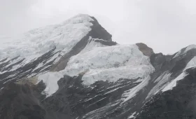
Most people meet Mardi Himal by accident. They come to the Annapurna region for Machhapuchhre — the “Fishtail” — or for Annapurna Base Camp, and somewhere along a quiet ridge east of the main trail they realise the sharp, snow-hung wall in front of them has its own name. That wall is Mardi Himal: a 5,587-metre peak that hides in plain sight beneath a more famous neighbour, carries a disputed first ascent, and has quietly become the reason thousands of trekkers now walk this ridge every season.
This is a guide to the mountain itself — where it sits, what its name means, who climbed it and when (the answer is messier than the internet claims), why you can climb it but not the peak beside it, and what it takes to stand at its foot. If you already know you want to walk to it, our 5-day Mardi Himal Trek covers the itinerary, cost and logistics. This page is about the mountain those trekkers are actually walking toward.
Mardi Himal at a Glance
| Detail | Information |
|---|---|
| Elevation | 5,587 m (18,330 ft); some older surveys list 5,553 m |
| Location | Annapurna Himal, Gandaki Province, Nepal |
| Coordinates | 28°28′25″N, 83°55′39″E |
| Parent peak | Machhapuchhre (Fishtail), separated by a ~5,200 m col |
| Range position | The southernmost peak of the Annapurna massif |
| Distance from Pokhara | Under 25 km (roughly 15 miles) as the crow flies |
| Name meaning | “Mardi” ≈ spine / backbone; “Himal” = snow mountain |
| First ascent | Credited to 1961 (Basil Goodfellow) — but see the dispute below |
| Climbing status | Open. NMA Group “B” trekking peak |
| Trekking route opened | 2012 |
| Protected area | Annapurna Conservation Area |
Where Is Mardi Himal, Exactly?
Mardi Himal is the last peak at the southern tip of the Annapurna range, the closest of the big Annapurna summits to Pokhara. Look north from the lakeside city on a clear morning and the serrated skyline you see is built from Annapurna South, Hiunchuli, Machhapuchhre and, tucked low and forward of them, Mardi Himal.
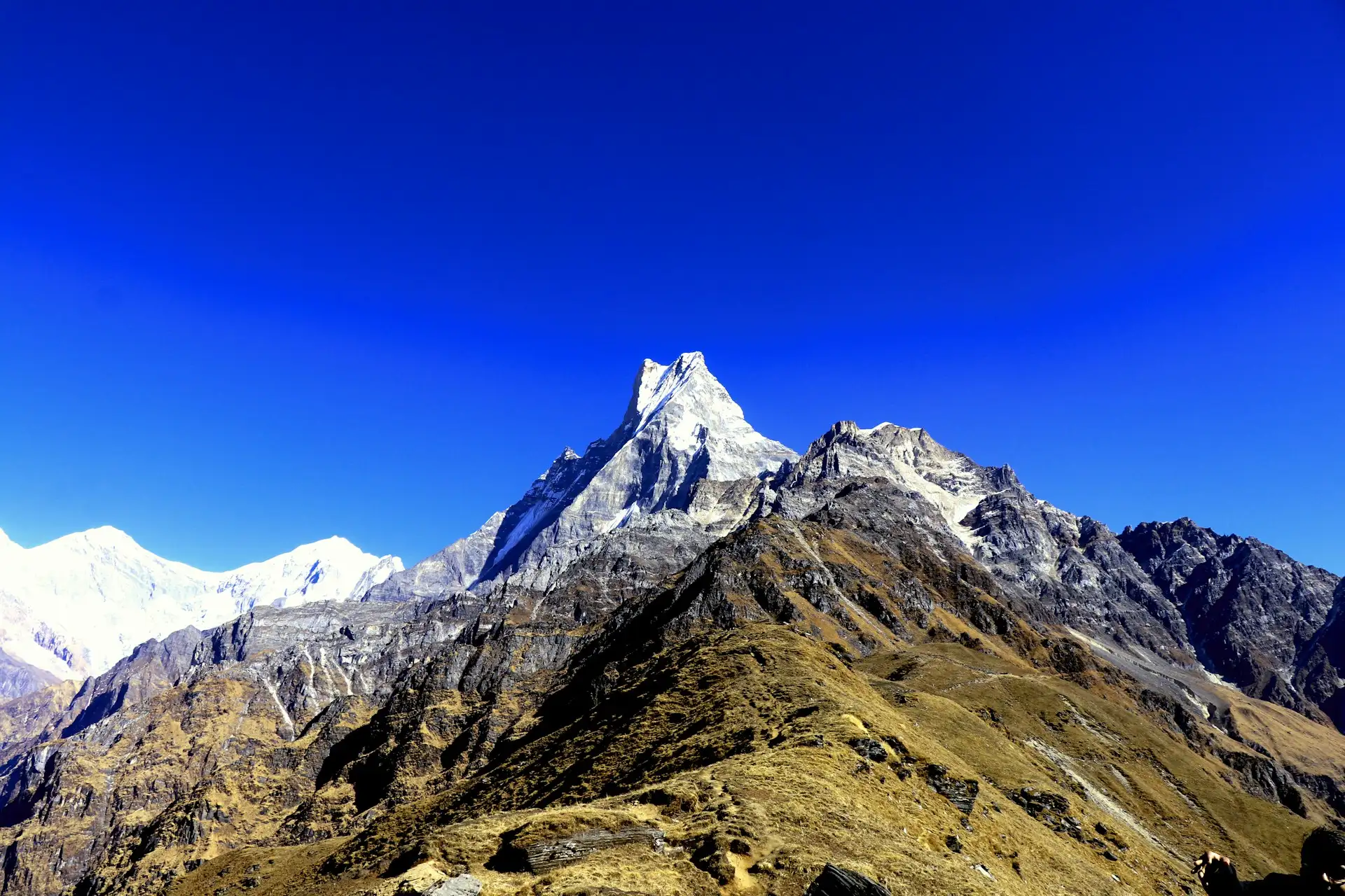
Geographically it is not a free-standing giant. It rises off the south-west ridge of Machhapuchhre as a distinct mass set almost at a right angle to it, separated from its parent by a high col of around 5,200 metres. From certain angles it reads as little more than an outlier on Machhapuchhre’s flank; from the south it stands clear as its own mountain, terminating the ridge in three well-defined spurs divided by hanging glaciers. That “forward” position is the whole secret of its appeal. Because Mardi Himal sits ahead of the higher peaks rather than deep inside the range, walkers on the ridge below get an unusually close, unobstructed line of sight to Machhapuchhre and the Annapurna wall — the payoff that has made this corner of the Annapurnas so popular so fast.
What Does “Mardi Himal” Mean?
Himal is simply the Nepali word for a snow mountain — the same root that names the Himalaya itself. Mardi is the more interesting half. Locally it is understood to mean something close to spine or backbone, a reference to the mountain’s long, single south ridge that runs like a vertebral column down toward the foothills. The mountain also lends its name to the Mardi Khola, the river draining its slopes, and you will occasionally see the older phonetic spelling Mardi Hymal in early expedition records, a reminder that these names were written down by outsiders transcribing sounds they half-caught.
That “spine” is not just poetry. The ridge is the defining physical feature of the whole area — it is what you walk along, what you sleep on, and what carries you up toward the peak. When people describe the experience of being here as “walking the backbone of the mountains,” they are, without knowing it, translating the name.
The First Ascent: A Story the Internet Gets Wrong
Search almost any page about this mountain and you will read the same tidy sentence: first summited in 1961 by Basil Goodfellow. It is repeated on Wikipedia, on operator sites, in guidebooks. It is also probably wrong — or at least a compression of a much stranger story.
Here is what the primary sources actually say. In March 1953, the British climber Basil Goodfellow walked north from Pokhara, reached a ridge west of Siklis, and photographed an unnamed 17,000-foot peak at the head of the Mardi Khola. He identified it on the map. He did not climb it. Those 1953 photographs are what first drew Western mountaineers’ attention to the peak at all.
The actual summit push is documented by Lieutenant Colonel J. O. M. “Jimmy” Roberts — the man later called the father of Nepali trekking tourism — who in his own account in the Alpine Journal reached the top with two Sherpas, Angcherring and Tenzing Nindra, via a frozen couloir. Roberts dates that climb to Easter Monday, 23 April 1962, not 1961, and files it as the first-ascent report.
So the widely copied “1961, Goodfellow” almost certainly conflates a photograph (1953) with a summit (1962) and attributes the whole thing to the wrong man in the wrong year. It is a small error, endlessly duplicated — a good example of how a single misprint becomes “fact” once enough websites echo it. When you stand below the peak, it is worth knowing that the men who first documented it disagreed with the internet about who did what.
Whichever date you accept, the human thread that matters is Jimmy Roberts. He founded Nepal’s first commercial trekking company, Mountain Travel Nepal, in 1965, and he named the high glaciated basin below the summit “The Sanctuary” — not to be confused with the Annapurna Sanctuary further west. That basin is the base camp trekkers aim for today.
Mardi Himal and Machhapuchhre: Why You Can Climb One and Not the Other
You cannot talk about Mardi Himal without its towering neighbour, and the relationship between the two peaks is one of the more revealing things about trekking in Nepal.
Machhapuchhre — the Fishtail — is sacred. It is associated with the god Shiva, and out of respect it has been officially closed to climbers for decades. No permit to stand on its summit exists. The one attempt in 1957, led by Wilfrid Noyce on an expedition Roberts organised, famously stopped short of the top, and the mountain has been off-limits ever since.
Mardi Himal, rising directly off Machhapuchhre’s ridge, carries no such prohibition. It is open. The Nepal Mountaineering Association classifies it as a Group “B” trekking peak, meaning it can be climbed with the right permit and a modest expedition set-up. In a sense, Mardi Himal exists as a destination because its sacred neighbour does not: climbers and trekkers drawn to Machhapuchhre’s face found, in the smaller peak just beside it, a summit and a ridge they were actually allowed to reach. The forbidden mountain gave rise to an open one.
Can You Climb Mardi Himal? Trekking Peak vs Trekking Trail
This is where terminology trips people up, so it is worth being precise. There are two very different ways to engage with Mardi Himal.
1. Climbing the peak (5,587 m). This is genuine, if small-scale, mountaineering. It requires a Nepal Mountaineering Association trekking-peak permit — with fees that vary by season (broadly in the region of USD 250–500 depending on spring, autumn or winter) — plus ropes, crampons, ice axe, a climbing guide and glacier travel above the col. It is the least-visited and least-climbed of the Annapurna peaks, which is part of its appeal to mountaineers who prefer analytical, quiet objectives over crowded fixed-line summits.
2. Trekking to its foot. The overwhelming majority of people who say they are “doing Mardi Himal” are not climbing anything technical. They are walking the ridge trail opened in 2012 up to the high viewpoints below the peak. No climbing permit, no crampons — just a conservation-area permit, a licensed guide and good legs.
The rest of this page, and the trek most travellers book, is about option two.
The Landmarks Below the Summit — And a Common Altitude Mix-Up
The trekking route ends well short of the true summit, at a series of named high points. Because operators use these names loosely, trekkers routinely book expecting one thing and get another. Here is the honest layout, from the last teahouses upward:
| Point | Approx. altitude | What it is |
|---|---|---|
| High Camp | ~3,550 m | The highest cluster of teahouses; the overnight base for a dawn push |
| Upper Viewpoint | ~4,200 m | The point most trekkers reach; the ridge’s high panorama |
| Mardi Himal Base Camp (“The Sanctuary”) | ~4,500 m | A longer, harder 4–5 hr round trip beyond the viewpoint |
Two corrections worth carrying with you. First, “Base Camp” is not the viewpoint — a lot of marketing blurs them, but Base Camp at ~4,500 m sits meaningfully higher and further than the Upper Viewpoint and demands a longer, more committing day. Second, neither is the summit; the peak proper rises roughly another thousand metres above the Sanctuary and belongs to climbers, not trekkers. When you compare itineraries, ask an operator plainly which of these three points their price actually reaches. Our own Mardi Himal Trek itinerary states the exact turnaround point and altitude for each day, precisely so there is no surprise on the ridge.
The View: What You Actually See From Mardi Himal
The reason this mountain punches so far above its modest height is the angle it gives you on everything around it.
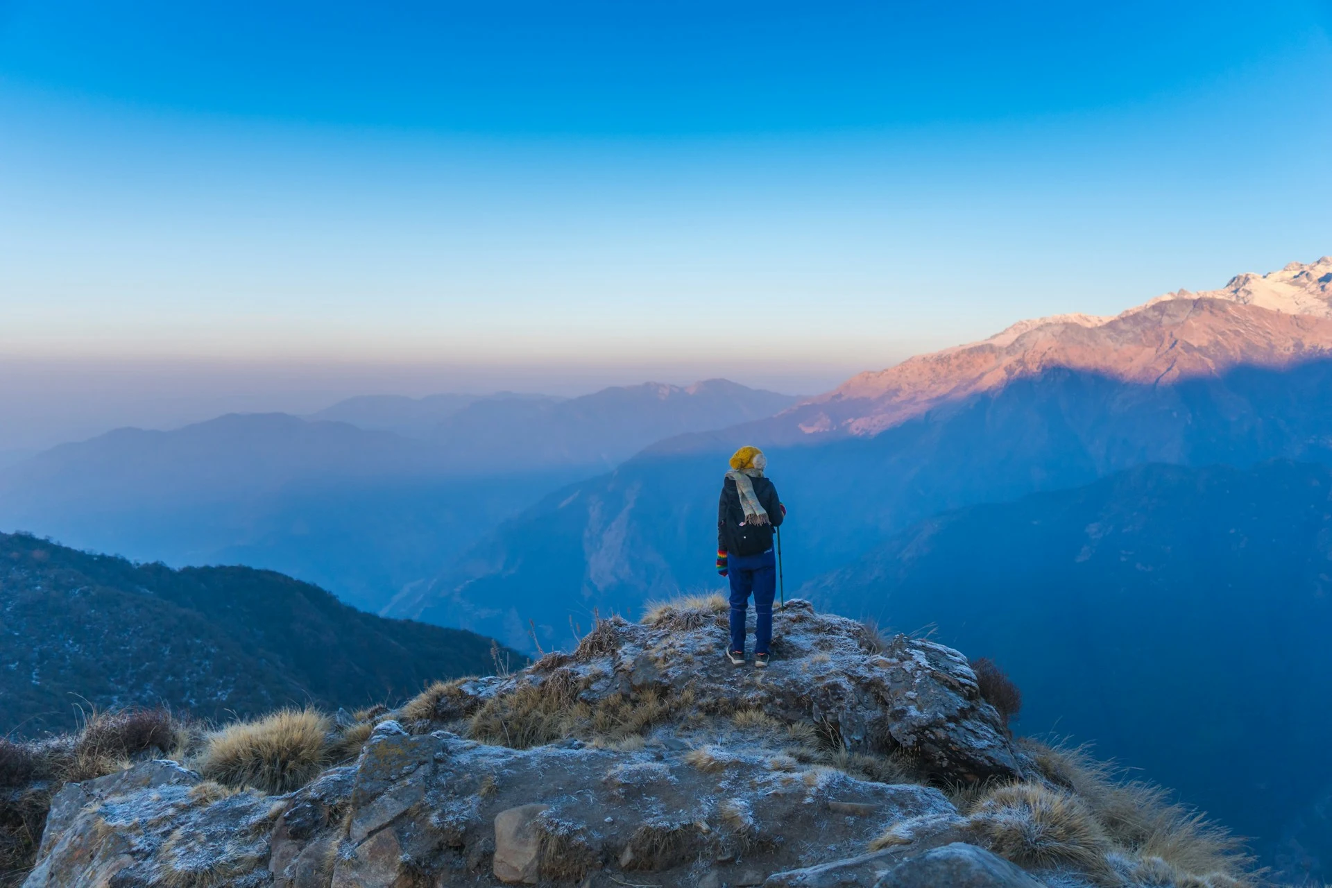
From the Upper Viewpoint on a clear morning, the south face of Machhapuchhre fills the sky to the north — closer here than from almost any other trekking-accessible point in Nepal, close enough that the fluting on its ice looks touchable. To the west stand Annapurna South and Hiunchuli; the broader Annapurna wall ranges behind, and on the clearest days Dhaulagiri shows far to the west. Because you are on a ridge rather than in a valley, the views open on both sides at once — the Modi Khola valley falling away toward Annapurna Base Camp on one flank, the Mardi Khola on the other.
Timing is everything. In the strong autumn and spring seasons the peaks are typically clear at dawn and cloud builds from the valleys by mid-to-late morning; on a meaningful share of October mornings Machhapuchhre can sit under cloud entirely. This is why serious viewpoint-goers sleep at High Camp and climb in the dark for a sunrise arrival, and why an extra buffer day is the single best insurance against a clouded-out view.
The Human Landscape: Gurung and Magar Country
Mardi Himal is not wilderness in the empty sense. Its lower ridges and the villages below — Dhampus, Pothana, Siding, Lwang — are the highland home of Gurung and Magar communities, peoples with a long history of mountain farming and, famously, of service in Gurkha regiments. The ridge and its basin are part of their working landscape, not a blank playground, and the teahouse economy that now lines the trail is run largely by these families.
The whole area falls inside the Annapurna Conservation Area, Nepal’s largest protected region, managed to balance tourism with the ecosystems and communities that depend on it. Everyone who walks here enters that protected zone under an ACAP permit, and the low-impact expectations — carry out your waste, treat your own water, stay on the marked ridge where alpine vegetation regenerates slowly — are the price of keeping the place worth visiting.
When to See Mardi Himal at Its Best
The mountain is visible year-round from a distance, but the window for standing beneath it splits cleanly:
| Season | Months | What the mountain looks like |
|---|---|---|
| Autumn | Sep–Nov | The clearest, most stable skies of the year; crisp air, cold nights, the strongest odds of an unclouded sunrise |
| Spring | Mar–May | Rhododendron forests in bloom on the lower ridge; warmer days, with more afternoon cloud building late in the season |
| Winter | Dec–Feb | Snow above ~3,500 m and hard cold; the peak is stunning and empty, but the upper ridge can be genuinely serious |
| Monsoon | Jun–Aug | Cloud, rain, leeches and largely hidden peaks — the mountain mostly stays behind a curtain |
If your single goal is to see Mardi Himal and its neighbours clearly, late October and November are the reliable answer; March and April trade a little sky clarity for the reward of blooming rhododendrons on the climb.
Frequently Asked Questions About Mardi Himal
How high is Mardi Himal? Mardi Himal stands at 5,587 metres (18,330 feet), though some older survey figures give 5,553 m. That makes it the lowest and southernmost of the major Annapurna peaks — and, because it sits forward of the range, one of the best natural viewpoints onto the higher summits.
Is Mardi Himal a real, separate mountain or part of Machhapuchhre? It is a distinct peak. Mardi Himal rises off the south-west ridge of Machhapuchhre but stands as its own mass, separated from it by a high col of roughly 5,200 metres. From the south it is clearly independent; from some angles it can look like an outlier of the Fishtail.
What does the name “Mardi Himal” mean? “Himal” is the Nepali word for a snow mountain. “Mardi” is locally understood to mean spine or backbone, after the mountain’s long, single south ridge — the same ridge trekkers walk up.
Who first climbed Mardi Himal, and when? It is popularly credited to Basil Goodfellow in 1961, but the primary sources complicate that. Goodfellow photographed the peak in 1953 without climbing it; Jimmy Roberts’s own Alpine Journal account records reaching the summit with two Sherpas on Easter Monday, 1962. The widely repeated “1961 Goodfellow” appears to be a long-standing conflation.
Can you climb Mardi Himal? Yes. Unlike sacred, off-limits Machhapuchhre next to it, Mardi Himal is open and classified by the Nepal Mountaineering Association as a Group “B” trekking peak. Reaching the true summit is a genuine mountaineering objective requiring a permit and glacier climbing gear. Most visitors instead trek to the viewpoints below it, which need no climbing permit.
Why can’t you climb Machhapuchhre but you can climb Mardi Himal? Machhapuchhre is sacred to Hindus as a home of Shiva and has been officially closed to climbers for decades. Mardi Himal, right beside it, carries no such ban — which is a large part of why it became a destination in the first place.
Is Mardi Himal the same as Mardi Himal Base Camp? No. Mardi Himal is the 5,587 m peak. “Mardi Himal Base Camp” (also called The Sanctuary) is the ~4,500 m basin below it that trekkers can reach. The Upper Viewpoint, at around 4,200 m, is a separate and slightly lower point that many itineraries stop at — be sure you know which one your trek actually includes.
How far is Mardi Himal from Pokhara? Under about 25 km (15 miles) as the crow flies, making it the closest of the great Annapurna peaks to the city. Trekkers typically drive from Pokhara to a trailhead such as Kande in around an hour before starting up the ridge.
Walk to Mardi Himal
Reading about the spine of the Annapurnas is one thing; standing on it at dawn while Machhapuchhre turns gold a few kilometres in front of you is another. If this mountain is now on your list, the practical next step — itinerary, daily distances, cost, permits and the exact viewpoint you’ll reach — lives on our dedicated 5-Day Mardi Himal Trek page.
Merriment Treks arranges the ACAP permit, a licensed guide with specific Mardi ridge experience, transport from Pokhara and every teahouse night, so the only thing you bring to the mountain is the fitness to enjoy it. Contact us with your dates and group size and we’ll match you to the right itinerary and season.