How High Is Everest Base Camp
The answer most people are looking for: Everest Base Camp on the Nepal side sits at 5,364 meters (17,598 feet) above sea level. That’s the confirmed, widely accepted figure used by Nepal’s mountaineering authorities, trekking agencies, and every serious expedition that has staged there.
But that single number, while accurate, answers only the simplest version of the question. Once you understand what 5,364 meters actually means — how it compares to the summit of Everest above it, what happens to your body at that altitude, how the South Base Camp differs from the North, where the highest point of the standard trek really is, and what the elevation profile from Lukla looks like in stages — you’ll understand not just how high Everest Base Camp is, but what that height actually demands.
The Exact Altitude of Everest Base Camp in 2026
Everest Base Camp (South), located in Nepal within Sagarmatha National Park, stands at 5,364 meters (17,598 feet) above sea level. This is the base camp that trekkers walk to, the one that appears on every itinerary, and the staging point for all expeditions climbing Everest via the Southeast Ridge — the standard South Col route.
This figure has not changed. The elevation of Base Camp itself is a geographic location on the Khumbu Glacier, and no measurement revision has altered it. It is the same number used by the Nepal Tourism Board, the Himalayan Database, and every reputable trekking operator.
To put that number in context before anything else: 5,364 meters is higher than the summit of Mont Blanc, the highest peak in the Alps at 4,808 meters. It is higher than the summit of Mount Kilimanjaro in Tanzania at 5,895 meters? No — Kilimanjaro’s summit at 5,895 meters is actually higher than EBC, which is a fact worth knowing for comparison purposes. But Everest Base Camp is higher than every peak in the Alps, the entire Rocky Mountains in North America, and the vast majority of summits in the Andes south of the very highest elevations. You are standing, at base camp, higher than most mountains in the world have summits.
South Base Camp vs North Base Camp: Two Different Altitudes

There are two Everest Base Camps, not one, and they are at different elevations. This distinction matters for anyone comparing trekking options or reading expedition literature.
Everest Base Camp South, in Nepal, sits at 5,364 meters (17,598 feet). This is the base camp reached by the standard EBC trek from Lukla and the starting point for the Southeast Ridge (South Col) route. It is located on the Khumbu Glacier, which means the ground itself is moving ice — the glacier shifts slowly each year, which is one reason the physical camp location is not a fixed permanent structure but a seasonal assembly of expedition tents.
Everest Base Camp North, in Tibet (China), sits at approximately 5,150 meters (16,900 feet). This is 214 meters lower than the Nepal side. The North Base Camp is the staging point for expeditions climbing via the Northeast Ridge route. Unlike the Nepal side, the Tibetan Base Camp is accessible by vehicle on a road that approaches from the north, meaning visitors can theoretically reach it without the multi-day trek that the Nepal approach requires. This road accessibility, while convenient, is also why rapid ascent to North Base Camp by vehicle poses altitude sickness risk — the natural acclimatization that comes from walking up gradually over 8 to 10 days is absent.
When people talk about the “Everest Base Camp trek,” they universally mean the South Base Camp in Nepal at 5,364 meters. The North Base Camp in Tibet is not a standard trekking destination accessible to independent tourists.
How High Is Mount Everest’s Summit Above Base Camp?
Mount Everest’s official summit height is 8,848.86 meters (29,031.7 feet). This figure was established on December 8, 2020, when Nepal’s Foreign Minister Pradeep Gyawali announced the result of a joint Nepal-China survey — the first time Nepal had conducted its own official measurement of the world’s highest mountain using GPS technology, gravity meters, and ground-penetrating radar to measure both the rock base and the snow cap.
Before 2020, the widely accepted height was 8,848 meters, based on a 1954 Survey of India measurement. The new joint figure of 8,848.86 meters is 0.86 meters higher — roughly the height of a desk — and is now the standard used by mountaineering authorities worldwide.
The difference between EBC at 5,364 meters and the summit at 8,848.86 meters is approximately 3,484 meters of vertical distance. Put differently, after arriving at Base Camp, climbers still need to ascend nearly 3.5 kilometers vertically to reach the top. Base Camp is, by this measure, roughly 61 percent of the way up the mountain’s total height from sea level. The remaining 39 percent — the Khumbu Icefall, the Western Cwm, the Lhotse Face, the South Col, and the final ridge to the summit — is where the actual mountaineering begins and where the serious dangers of Everest climbing are concentrated.
The Highest Point of the EBC Trek: Kala Patthar, Not Base Camp
This is the most important altitude fact that most people don’t know before they start planning: Everest Base Camp is not the highest point you reach on the standard EBC trek. Kala Patthar is.
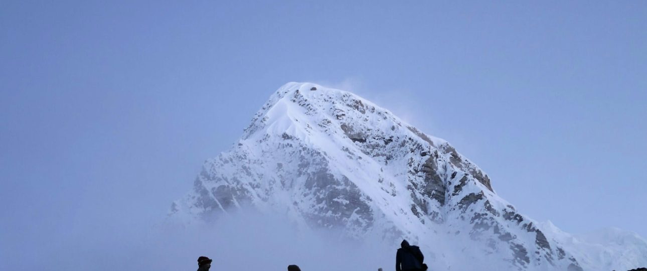
Kala Patthar is a prominent rocky peak on the southern flank of Pumori mountain, and it sits at 5,545 meters (18,192 feet) above sea level. That is 181 meters higher than Everest Base Camp. Virtually every standard EBC itinerary includes an ascent of Kala Patthar — typically on the morning after reaching Base Camp, departing Gorak Shep before dawn to catch sunrise from the summit.
The reason Kala Patthar is included in every itinerary has nothing to do with altitude records. It is the best accessible viewpoint for seeing Mount Everest’s summit from trekking elevation. This is counterintuitive but true: from Everest Base Camp itself, you cannot see the summit of Mount Everest. The Khumbu Icefall directly above the camp, and the West Ridge rising to the right, block the line of sight to the top of the mountain. From Base Camp, what you see is the lower flanks of Everest, the chaotic broken ice of the Khumbu Icefall, and the surrounding peaks including Nuptse (7,861 meters) and Changtse (7,583 meters) to the north.
From Kala Patthar at 5,545 meters, the view is entirely different. Everest’s summit pyramid rises above the surrounding ridgeline and is visible clearly, particularly in the early morning before cloud builds. The first light catches the summit — turning it a distinct orange before the lower peaks receive any color — creating one of the most-photographed moments in Himalayan trekking.
Kala Patthar’s name translates as “black rock” in Nepali and Hindi, referring to the dark-colored slate that makes up the summit area.
The Complete Altitude Profile: Every Key Point from Lukla to Base Camp
Understanding the altitude of each major stop on the route helps you understand why the standard itinerary takes the shape it does. The route doesn’t simply climb continuously — it goes up, descends slightly, climbs again, and builds in deliberate rest days at specific altitudes. Each of these choices serves the acclimatization process.
- Kathmandu: 1,400 meters (4,593 feet). Where the flight to Lukla departs from.
- Lukla — Tenzing-Hillary Airport: 2,860 meters (9,383 feet). The most common starting point of the trek, reached by a short domestic flight. The airport is built into a hillside and operates on a short runway with a steep gradient — one of the more distinctive landings in commercial aviation.
- Phakding: 2,610 meters (8,563 feet). The first day’s destination is actually slightly lower than Lukla, a descent of 250 meters. The trail follows the Dudh Koshi River valley downward before the sustained climbing begins.
- Namche Bazaar: 3,440 meters (11,286 feet). The main commercial hub of the Khumbu region and the first serious altitude challenge of the trek. The climb from Phakding to Namche gains approximately 830 meters. A mandatory acclimatization rest day is built into every responsible itinerary here. The standard acclimatization activity is a hike to higher elevation above Namche — the Hotel Everest View ridge at approximately 3,962 meters is a common destination — before returning to sleep at Namche. This walk-high, sleep-low pattern is one of the most effective altitude acclimatization strategies available.
- Tengboche: approximately 3,860 meters (12,664 feet). Home to the famous Tengboche Monastery, the largest Buddhist monastery in the Khumbu region. The approach from Namche involves a descent into the Imja Khola valley followed by a sustained climb to the monastery ridge.
- Dingboche: 4,410 meters (14,469 feet). A second acclimatization day is scheduled here on well-designed itineraries, often with a hike toward Nangkartshang Peak above the village to reinforce altitude adaptation before pushing higher.
- Lobuche: approximately 4,910 meters to 4,940 meters (16,109 to 16,175 feet). The altitude figures for Lobuche vary slightly across sources in this range. At this elevation the landscape has become stark and treeless, the air is noticeably thin, and distances that would feel easy at lower elevation start to take considerably more time and effort.
- Gorak Shep: approximately 5,140 to 5,190 meters (16,863 to 17,024 feet). The last permanent settlement before Base Camp, and where most trekkers sleep on the night before the base camp push and the Kala Patthar ascent. Figures for Gorak Shep vary in the source literature between 5,140 and 5,190 meters depending on the measurement methodology and location within the settlement.
- Everest Base Camp (South): 5,364 meters (17,598 feet).
- Kala Patthar: 5,545 meters (18,192 feet). The highest point reached on the standard EBC trek.
The total elevation gain from Lukla to Everest Base Camp is approximately 2,504 meters of net ascent. This happens across roughly 65 kilometers of one-way trail, with the return journey on the same route adding another 65 kilometers — approximately 130 kilometers round trip in total. Most itineraries complete this in 12 to 14 days from Lukla, including the two acclimatization days.
What 5,364 Meters Does to Your Body
The altitude of Everest Base Camp puts it squarely in the zone where oxygen availability becomes a genuinely significant physiological challenge. Understanding exactly what happens at this elevation is more useful than abstract warnings about “altitude sickness.”
At sea level, each breath delivers roughly 21 percent oxygen — the same percentage as anywhere else in the atmosphere. What changes with altitude is not the percentage of oxygen in the air but air pressure. As you ascend, atmospheric pressure drops, meaning each breath contains fewer air molecules — and therefore fewer oxygen molecules — than the same breath at sea level. At 5,364 meters, air pressure is approximately half of what it is at sea level. Each breath delivers roughly half the oxygen it would at the bottom of the mountain.
Your body responds to this in several ways. Breathing rate increases to compensate. Heart rate elevates. Over days, red blood cell production increases as the body attempts to carry more oxygen per unit of blood. This adaptation process — acclimatization — is why the multi-day approach from Lukla is not just a trekking preference but a physiological necessity. People who arrive at Base Camp by helicopter from lower elevations without gradual altitude gain are at high risk of Acute Mountain Sickness (AMS) and more serious conditions including High Altitude Pulmonary Edema (HAPE) and High Altitude Cerebral Edema (HACE).
Common symptoms at the altitudes above 3,500 meters include headache, fatigue, loss of appetite, difficulty sleeping, and shortness of breath during activity. These are normal acclimatization responses. The symptoms that require immediate descent are a worsening headache that doesn’t improve with rest or ibuprofen, loss of coordination, confusion, and any wet cough or breathlessness at rest — these are the warning signs of HAPE or HACE, which are medical emergencies.
At Base Camp specifically, at 5,364 meters, even well-acclimatized trekkers notice that simple activities — walking 50 meters to a teahouse, putting on boots, standing up from a seated position — require noticeably more effort than they would at normal elevation. This is not a symptom of illness. It is how the body functions when the air contains half the oxygen it does at sea level.
Why EBC Is on a Moving Glacier — And What That Means
Everest Base Camp is not built on solid ground. It sits on the Khumbu Glacier, a slowly moving river of ice that descends from the Western Cwm above. The glacier moves approximately one meter per day, which means the physical surface of Base Camp shifts over time. This is why there is no permanent structure at Base Camp — no buildings, no markers built into the ground. During climbing season, the area fills with expedition tents, communication equipment, and the logistics of multiple simultaneous summit attempts. Outside of climbing season, Base Camp is largely empty, with only the glacial ice and rock moraine remaining.
The moving glacier also means that the iconic “signboard” location at EBC has been a point of periodic confusion. In March 2024, authorities installed a new signboard at base camp that was removed in May 2024 following strong negative reactions from trekkers and mountaineers who preferred the long-established graffiti-coated rock that had served as the symbolic marker for years. As of 2026, the painted rock remains the most commonly photographed location at Base Camp.
The Khumbu Glacier is also retreating due to climate change, a process that is actively studied by glaciologists. The retreat of the glacier and the associated instability of the Khumbu Icefall above Base Camp are ongoing environmental changes, though they have not altered the official altitude of EBC at 5,364 meters.
The Khumbu Icefall: What Climbers Face Directly Above Base Camp
While trekkers turn back at base camp, summit expeditions immediately face the Khumbu Icefall beginning just above. Understanding what the Icefall is puts the position of Base Camp in proper geographical context.
The Khumbu Icefall is the most dangerous section of the standard South Col route on Everest. It is a chaotic, constantly moving mass of ice blocks — called seracs — some reaching 50 meters in height, with crevasses between them ranging from 10 to 50 meters deep. The Icefall moves and shifts, meaning the aluminum ladders placed across crevasses by the Icefall Doctors (a team of experienced Sherpa climbers hired specifically for this purpose at the start of each climbing season) must be repositioned repeatedly as the ice changes.
Base Camp sits immediately below the Icefall. Climbers move through it typically in the very early pre-dawn hours when colder temperatures firm the ice and reduce the risk of serac collapse. Above the Icefall is the Western Cwm — a broad, relatively flat glacier basin between the walls of Everest, Lhotse, and Nuptse — leading eventually to the higher camps on the Lhotse Face.
How EBC Compares to Other Famous High-Altitude Points
These comparisons are factually accurate and help put the altitude in perspective.
- Mont Blanc, the highest peak in the Alps and Western Europe: 4,808 meters. Everest Base Camp is 556 meters higher than the summit of Mont Blanc.
- Kilimanjaro summit (Uhuru Peak), the highest point in Africa: 5,895 meters. Kilimanjaro’s summit is 531 meters higher than Everest Base Camp.
- Denali (Mount McKinley) summit, the highest point in North America: 6,190 meters. Denali’s summit is 826 meters higher than EBC.
- Aconcagua summit, the highest point in South America: 6,961 meters. Aconcagua’s summit is 1,597 meters higher than EBC.
- Annapurna Base Camp, Nepal: 4,130 meters. EBC is 1,234 meters higher than ABC.
- Tilicho Lake, Nepal — one of the highest lakes in the world: 4,919 meters. EBC is 445 meters higher than Tilicho Lake.
- Kala Patthar, the highest point of the EBC trek: 5,545 meters. Kala Patthar is 181 meters higher than EBC itself.
The summit of Mount Everest: 8,848.86 meters. The summit is 3,484.86 meters above EBC.
The Trek Duration and What Altitude Gain Looks Like Per Day

The standard 12 to 14 day itinerary from Lukla to Base Camp and back is not arbitrary in its length — it is calibrated to the altitude gain that a healthy adult body can safely acclimatize to over time. The widely cited guideline above 3,000 meters is to gain no more than 300 to 500 meters of sleeping altitude per day, with a rest day every third day or every 600 to 1,000 meters of gain. The standard EBC itinerary follows this closely, with deliberate rest days at Namche Bazaar and Dingboche.
Pushing the itinerary to reach Base Camp faster — in 9 or 10 days instead of 12 to 14 — is one of the most consistent risk factors for AMS and evacuation on the route. The altitude is fixed. The acclimatization timeline is not negotiable in any meaningful way. A body that hasn’t had time to produce additional red blood cells and adjust its respiratory response will struggle at 5,364 meters regardless of the trekker’s fitness level at sea level.
It is worth emphasizing: fitness and altitude response are not the same thing. Extremely fit athletes sometimes acclimatize poorly at altitude, while less athletically trained individuals sometimes adapt remarkably well. The physiological response to altitude has genetic components and is not reliably predicted by cardiovascular fitness at sea level.
Frequently Asked Questions About How High is Everest Base Camp
- How high is Everest Base Camp in meters and feet?
Everest Base Camp (South, Nepal) is 5,364 meters (17,598 feet) above sea level. This is the universally accepted and officially recognized figure. - Is Everest Base Camp the highest point of the EBC trek?
No. Kala Patthar at 5,545 meters (18,192 feet) is the highest point reached on the standard EBC trek, sitting 181 meters above Base Camp. Kala Patthar is climbed the morning after reaching Base Camp and offers the best accessible view of Everest’s summit. - Can you see Everest’s summit from Everest Base Camp?
No. The Khumbu Icefall and the West Ridge block the line of sight to the summit from Base Camp. The best trekking viewpoint for Everest’s summit is Kala Patthar at 5,545 meters, which is why it is included in every standard itinerary. - How does Everest Base Camp altitude compare to the summit?
The summit of Everest stands at 8,848.86 meters (29,031.7 feet) — the official height confirmed by the joint Nepal-China survey on December 8, 2020. Base Camp at 5,364 meters is approximately 3,484.86 meters below the summit, meaning Base Camp is roughly 61 percent of the mountain’s total height from sea level. - How high is the North Base Camp (Tibet side)?
The North Everest Base Camp in Tibet sits at approximately 5,150 meters (16,900 feet), which is 214 meters lower than the South Base Camp in Nepal. The North Base Camp is accessible by road from the Tibetan side. - How high is Gorak Shep, the last stop before Base Camp?
Gorak Shep, the last permanent settlement before Everest Base Camp, sits at approximately 5,140 to 5,185 meters above sea level (the figure varies slightly depending on the source and specific measurement point within the settlement). It is where most trekkers sleep on the night before the base camp push. - What is the altitude of Lukla, where the trek begins?
Lukla (Tenzing-Hillary Airport) sits at 2,860 meters (9,383 feet) above sea level. This means the net elevation gain from the trek’s starting point to Everest Base Camp is approximately 2,504 meters. - What is the official height of Mount Everest in 2026?
8,848.86 meters (29,031.7 feet), as officially announced on December 8, 2020, based on a joint survey by Nepal and China. This figure has not been revised since and remains the current official height. - What happens to your body at 5,364 meters?
At 5,364 meters, atmospheric pressure is approximately half of sea level, meaning each breath delivers roughly half the oxygen it would at the bottom. Well-acclimatized trekkers at this altitude experience shortness of breath during activity, reduced appetite, disturbed sleep, and significantly higher effort required for simple physical tasks. Symptoms that require immediate descent — worsening headache, loss of coordination, confusion, or wet cough at rest — indicate serious altitude illness and must be acted on immediately. - How long does it take to reach Everest Base Camp from Lukla?
The standard route from Lukla to Base Camp takes 8 to 9 days walking, with the full round trip of approximately 130 kilometers taking 12 to 14 days including two acclimatization rest days. Attempting to compress this significantly increases altitude sickness risk. - How does the altitude gain per day work on the standard EBC itinerary?
Most itineraries follow the “climb high, sleep low” principle, limiting sleeping-altitude gains to roughly 300-500 meters per day above 3,000 m, with built-in rest days at Namche Bazaar (3,440 m) and Dingboche (4,410 m) for acclimatization. This pacing is the main reason the trek takes 8-9 days each way rather than being physically compressible into a shorter window, since the body simply needs time to adjust regardless of fitness level. - Is there a higher viewpoint than Kala Patthar on the EBC trek?
Not on the standard itinerary — Kala Patthar at 5,545 m is the highest point most trekkers reach. Some extended itineraries add Chhukung Ri (5,550 m) or Island Peak base camp for those combining the trek with a climbing objective, but neither is part of the core EBC route and each requires additional permits and preparation. - How does the altitude of EBC compare to other famous high-altitude trekking destinations?
At 5,364 m, Everest Base Camp is higher than Kilimanjaro’s summit (5,895 m is actually higher, so EBC sits below it) but higher than most other trekking peaks reached without technical climbing, such as Everest Base Camp’s counterpart on Aconcagua’s base camps or the highest points on Africa’s other major trekking routes. Within Nepal itself, it’s comparable in altitude to Thorong La pass on the Annapurna Circuit (5,416 m) and lower than Kala Patthar and most Everest region trekking peaks like Island Peak (6,189 m). - Why does Everest’s summit height keep getting re-measured?
Because the Himalayas are still tectonically active, with the Indian plate continuing to push into the Eurasian plate, causing gradual uplift and lateral shift in the region over time. Snow depth at the summit also varies between survey attempts, which is part of why Nepal and China conducted a joint remeasurement in 2019-2020 to produce a single agreed figure rather than relying on older, separately calculated numbers. - What is the elevation gain if I do the Everest Base Camp trek via Gokyo Valley instead of the standard route?
The Gokyo route adds a crossing of the Cho La Pass at 5,420 m before rejoining the standard trail near Lobuche, making it both longer and slightly more physically demanding due to the extra pass and the Ngozumpa Glacier crossing. Total elevation gain across the full Gokyo-to-EBC combination itinerary is noticeably higher than the standard out-and-back route, though it rewards trekkers with the Gokyo Ri viewpoint and turquoise lakes not seen on the direct trail.
Final Word: The Altitude Is the Whole Story

The altitude is also the reason arriving at Base Camp feels the way it does. You haven’t reached the summit of anything. You’re standing on a glacier at 5,364 meters, looking up at a moving wall of broken ice, surrounded by peaks that dwarf anything else in the world, breathing air that contains half the oxygen you were breathing at home. Above you, the world’s highest mountain continues for another 3,484 meters that you won’t climb.
That combination — the achievement of the altitude, the humility of what remains above — is what makes Everest Base Camp one of the most visited and most emotionally resonant trekking destinations on earth. The number tells you how high. The experience tells you what high actually means.