Pangboche Nepal
Most trekkers meet Pangboche in a hurry. They climb up from the Imja Khola, drop their packs at a teahouse, drink a pot of lemon tea, glance at the monastery on the hill, and leave within the hour with their eyes already fixed on Dingboche and the higher ground beyond. What they miss is that they have just walked through the oldest permanent Sherpa village in the Khumbu — the keeper of the region’s oldest monastery, the launch point for one of its finest side-hikes, and the setting for one of the strangest true stories in Himalayan history.
Pangboche rewards the trekker who slows down. If you are planning an Everest Base Camp or Ama Dablam trek and want to understand where you are rather than just tick off a waypoint, this guide covers the practical detail — altitude, route, permits, acclimatization, connectivity — alongside what actually makes the village worth your time.
Pangboche at a glance
| Detail | Information |
|---|---|
| Region | Khumbu (Everest region), Solukhumbu District, eastern Nepal |
| Protected area | Sagarmatha National Park (UNESCO World Heritage Site) |
| Altitude | ~3,900 m (Lower Pangboche ~3,930 m; Upper Pangboche ~3,985 m) |
| Position on trail | Between Tengboche (below) and Dingboche (above) |
| Known for | Oldest monastery in the Khumbu; Ama Dablam views; the Yeti-hand story |
| River / valley | Imja Khola valley |
| People | Sherpa; Nyingma Tibetan Buddhism |
| Best seasons | Spring (Mar–May) and autumn (late Sep–Nov) |
Where Pangboche sits
Pangboche lies deep in the Khumbu, on the eastern flank of the Imja Khola valley, inside Sagarmatha National Park. On the standard Everest Base Camp route it comes roughly two days above Namche Bazaar, after Tengboche and Deboche, and about an hour or so below the turn-off toward Dingboche.
The altitude is worth getting right, because published figures disagree — and the reason is geography, not carelessness. Pangboche is really two settlements. Lower Pangboche, where most lodges and the main trail run, sits near 3,900–3,930 metres. Upper Pangboche, the older cluster of stone houses around the ancient monastery, sits a little higher at about 3,985 metres. So when one source says 3,930 m and another says 3,985 m, both are essentially right; they are describing different parts of the same village. In practical terms you will most likely sleep in Lower Pangboche and climb a short way up to reach the old gompa.
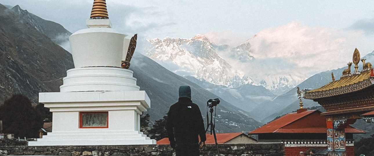
The setting is what makes the village special. Pangboche sits at the junction of the main Everest trail and the quieter path to Ama Dablam Base Camp, which gives it an unusually open horizon: Ama Dablam’s sharp pyramid to the south, the great wall of Lhotse and Nuptse to the north, and Everest itself appearing from the ridges just above.
| Nearby point | Approx. altitude | From Pangboche | Typical walking time |
|---|---|---|---|
| Tengboche / Deboche | 3,860 m / 3,770 m | Below, to the west | 2–3 hours down |
| Dingboche | 4,410 m | Above, north-east | ~3 hours up |
| Pheriche (HRA aid post) | 4,240 m | Above, north | ~3 hours up |
| Ama Dablam Base Camp | ~4,570 m | South, across valley | 5–6 hours return |
| Phortse (high traverse) | 3,810 m | West, high route | 3–4 hours |
The oldest village in the Khumbu
The Sherpa people crossed the high passes from eastern Tibet into the Khumbu roughly five hundred years ago and settled the sheltered valleys below Everest. Pangboche is widely regarded as the oldest of those settlements — a claim supported both by Sherpa oral tradition and by the age of its monastery.
For centuries this was a working stop on the trade routes between Tibet and the Nepali lowlands. The village took root where it did for practical reasons: water from the Imja Khola, a defensible slope, and terraced ground just warm enough at nearly 4,000 metres to grow potatoes, buckwheat and barley in soil that freezes for months. Those stone-walled fields, the mani walls carved with mantras, the ranks of prayer flags, and the low houses built to trap heat are not staged heritage. They are the working fabric of a high-altitude farming and herding community, and Pangboche has kept more of that older texture than the busier villages downhill. That is the quiet reason it feels different when you stop long enough to notice.

Pangboche Monastery: the spiritual heart of the upper Khumbu
The centrepiece of the village is Pangboche Monastery — Pangboche Gompa — widely held to be the oldest monastery in the entire Khumbu. Tradition attributes its founding to Lama Sangwa Dorje, a revered early teacher of the Nyingma school of Tibetan Buddhism, and most accounts place the gompa at somewhere between three and four centuries old. As with much of the region’s early religious history, the precise date lives in legend rather than in a dated inscription, which is part of its atmosphere rather than a flaw in it.
Sangwa Dorje is remembered as the “Flying Lama,” credited with the power to travel through the air across the Khumbu. One of the most loved local stories tells how he scattered strands of his own hair around the settlement, and from them grew the juniper trees that still surround Pangboche — trees the community has protected ever since, never cutting them for firewood and burning only their fallen leaves as incense. Whatever you make of the legend, the result is real: a village that has guarded its sacred groves for generations.
Inside, the gompa follows the pattern of a Khumbu monastery — a main prayer hall rich with murals and butter lamps, thangka paintings, and the deep resonance of ritual instruments during puja. A small donation (around 250 Nepali rupees) helps maintain the building. Visitors are welcome to sit quietly, especially at morning prayers, provided they observe a few courtesies: remove shoes and hat inside, walk clockwise around shrines and mani walls, keep your voice low, and ask before photographing monks or the interior. This is a living place of worship first and a visitor attraction a distant second.
Pangboche is also the birthplace of Dumje, one of the Khumbu’s most important Sherpa festivals. Local tradition holds that Lama Sangwa Dorje established it here in honour of Guru Rinpoche, and it is still celebrated around the start of the monsoon, in May or June, with masked rituals, feasting and dance, its sponsorship rotating between households across many years. It is worth clearing up a common mix-up: the larger, more tourist-famous Mani Rimdu festival takes place at nearby Tengboche, not at Pangboche.
The real story of the Yeti hand
No account of Pangboche is complete without its most improbable claim to fame. For generations, the monastery kept two relics said to have come from a Yeti — a mummified hand and a piece of skull, or skullcap. In Sherpa tradition they were tied to Lama Sangwa Dorje himself: the story goes that a Yeti served the meditating lama in his mountain cave, bringing food and firewood, and that when the creature died the lama carried its hand and scalp back to Pangboche, where they were kept as sacred objects and carried through the village in blessings.
The relics were an open secret in the Khumbu for centuries. Then the outside world arrived. In 1957 the Texas oil millionaire and adventurer Tom Slick heard of the hand during one of his early “Abominable Snowman” expeditions, and his teams were the first to bring photographs of it back to the West. The photographs showed something genuinely unsettling — dark, oily, hooked bones wired crudely together and blackened by decades of temple-candle smoke.
What followed reads like fiction but is well documented. On a later Slick-backed expedition around 1958–59, the explorer Peter Byrne — after the monks refused to let the relic leave — removed a single finger, replaced it with a human bone so the theft would go unnoticed, and rewrapped the hand. To get the fragment out of Nepal, it was reportedly smuggled with the help of the Hollywood actor James Stewart, concealed in his luggage past customs. Laboratory analysis in London concluded the material was human, or close to it — not the remains of an unknown species.
The rest of the story is sadder. Sometime in the early 1990s, thieves broke into the monastery and took the entire remaining hand and the skullcap. Both vanished into the underground antiquities trade and have never been recovered. For a community whose relics had drawn pilgrims and curious visitors for centuries, the loss was felt as theft in the fullest sense — of heritage and of identity, and of the modest income the relics had brought.
There is a gentler coda. In 2010 the New Zealand film-effects studio Wētā Workshop — the team behind the props for The Lord of the Rings — reconstructed a replica hand and skull from the old photographs, and in May 2011 the pilot and adventurer Mike Allsop carried them back to Pangboche and returned them to the monks. The replicas stand today where the originals once did.
The honest takeaway for a curious traveller is this: the science does not support a Yeti, but the relics were never really about zoology. They were about a village’s relationship with the mountains and the mysteries that live in them. Standing in the gompa where the story unfolded is worth far more than the myth ever needed to be true.
Ama Dablam and the view that stops people in the trail
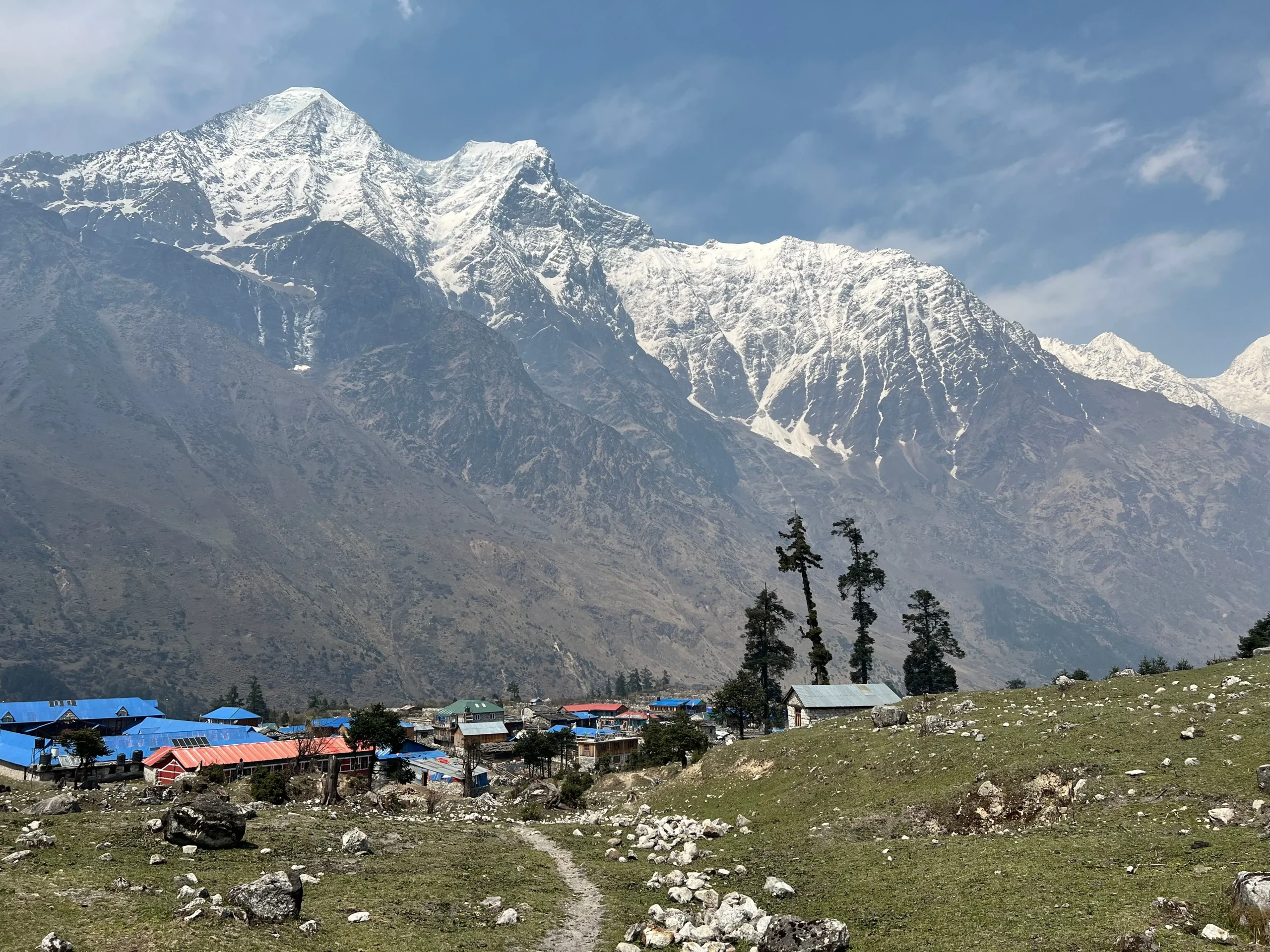
If the monastery is Pangboche’s soul, Ama Dablam is its horizon. At 6,812 metres, this is the peak trekkers fall in love with — a sharp, hanging-glaciered pyramid so distinctive it is often called the “Matterhorn of the Himalayas.” From Pangboche you do not glimpse it in the distance; you live beneath it. The village looks straight up at the mountain’s face, and the light on it at dawn and dusk is the reason many trekkers say Pangboche gave them their best morning of the whole trek. If you sleep here, set an alarm for first light and step outside before breakfast.
For those with a spare day, Pangboche is the natural launch point for the day hike to Ama Dablam Base Camp at around 4,570 metres. The route drops to the Imja Khola, crosses a suspension bridge, and climbs through yak pastures onto open meadow beneath the mountain’s ramparts — a round trip of roughly five to six hours on a trail that stays almost empty because it leaves the main Everest highway behind. It is one of the best acclimatization side-trips in the region: genuine altitude gain, a spectacular reward, and a quiet return to the same warm bed.
Stronger walkers can also use Upper Pangboche as the start of the high traverse to Phortse, a beautiful and underrated Sherpa village that is home to many working Everest climbers. Either option turns Pangboche from a corridor into a base. Between the village and its trails you can pick out Everest, Lhotse, Nuptse, Ama Dablam, Thamserku, Kangtega and Taboche — one of the most complete mountain panoramas in the Khumbu.
Why sleeping in Pangboche is a smart move
There is a strategic case for an overnight here that goes beyond the scenery. The golden rule of high-altitude trekking is to climb high and sleep low, and to raise your sleeping altitude gradually. At around 3,900 metres, Pangboche sits exactly where careful acclimatization starts to matter. Stopping here softens the jump toward Dingboche at 4,410 metres, and it puts you in a quieter, less crowded village than the ones on either side — which usually means better sleep, and sleep is part of acclimatizing well.
Watch yourself and your group for the early signs of acute mountain sickness: headache, nausea, poor appetite, disturbed sleep, and unusual breathlessness. The sensible responses are simple and boring, which is why they work — ascend slowly, drink far more water than feels natural, don’t climb higher to sleep while symptoms are building, and descend if they worsen. Some trekkers use acetazolamide (Diamox) as a preventive aid; that is a decision to make with a doctor before you travel, not something to improvise on the trail.
Medical care in Pangboche itself is basic. The nearest dedicated facility is the Himalayan Rescue Association aid post at Pheriche, a few hours up the trail, staffed by volunteer doctors during the spring and autumn seasons; it also runs daily altitude-awareness talks in season. Knowing where that help is — and carrying travel insurance that explicitly covers high-altitude helicopter evacuation — is part of trekking here responsibly.
Teahouses, food and daily comforts
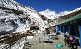
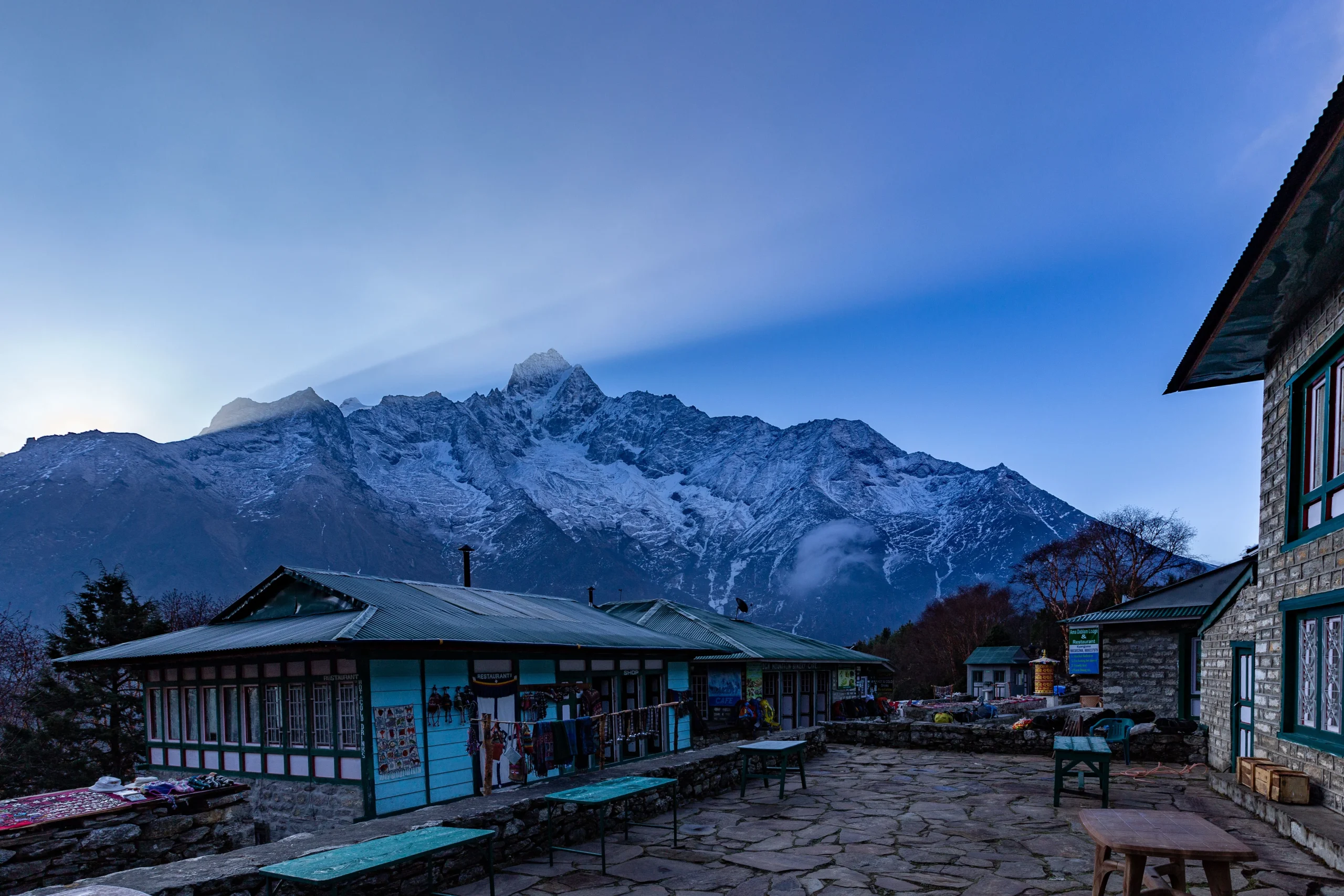
Accommodation in Pangboche means teahouses: simple lodges with basic twin rooms, shared bathrooms, and a communal dining hall warmed in the evening by a stove, usually burning yak dung and wood. Rooms are unheated, so a good sleeping bag matters more than the room does. A handful of lodges offer a more comfortable, upgraded room, but the standard experience is honest and modest — and the dining hall, where trekkers and guides gather over dinner, is often the best part of the day.
Food follows the pattern of the whole trail. The staple is dal bhat — rice, lentil soup, vegetable curry and pickle — reliable, filling, and usually served with free refills, which makes it the best-value fuel on the mountain. Menus are broadly standardized across teahouses and also run to noodles, fried rice, potatoes in many forms, soups, Sherpa stew, momos and pancakes. Two practical notes: prices rise steadily with altitude because everything is carried up by porter or yak, and higher on the trail it is wise to lean vegetarian, since meat has travelled a long way without refrigeration. Hot showers and device charging are usually available for an extra fee.
Staying connected in Pangboche
Connectivity in the Khumbu thins out with the air. Two Nepali networks matter: Nepal Telecom (NTC) and Ncell. Ncell tends to give faster data lower down (Lukla, Namche, and often as far as Tengboche), while NTC generally holds a signal higher and more reliably. At Pangboche’s altitude you can often still get mobile data, but expect it to be patchy — and above Dingboche, mobile coverage largely disappears. Buy a tourist SIM with a data package at Kathmandu airport on arrival; it’s cheap and doubles as a safety tool.
For internet where mobile fails, most teahouses sell prepaid Everest Link (satellite Wi-Fi) cards; the same login often works across lodges as you move up. Wi-Fi is sometimes free at lower villages but usually paid higher up, and it slows to a crawl when a full dining hall is online. Electricity in Pangboche’s lodges typically comes from solar or micro-hydro, and charging your phone or camera costs a little extra, with the price climbing as you go higher. The reliable move is to carry a power bank, keep devices in airplane mode while walking, and tuck batteries into your sleeping bag at night so the cold doesn’t drain them.
Permits and rules for 2026
Reaching Pangboche means trekking the Khumbu, and the Everest region has its own permit system. For the standard route through Lukla you need two permits, and — a point many outdated guides still get wrong — the TIMS card is no longer required in the Khumbu.
| Permit | Approx. foreign fee (2026) | Where to get it |
|---|---|---|
| Sagarmatha National Park Entry Permit | NPR 3,000 (~US$23); SAARC ~NPR 1,500 | Nepal Tourism Board, Kathmandu, or the Monjo checkpoint |
| Khumbu Pasang Lhamu Rural Municipality Entry Permit | NPR 3,000 (~US$20–23) | Lukla or Monjo (not Kathmandu) |
That’s roughly NPR 6,000 (about US$45) per foreign trekker. Both permits are single-entry and non-refundable if your trek ends early. Fees are set in rupees and revised periodically, so treat the figures as current-at-writing and confirm the live rate before you go. Note also that, under rules introduced in 2023, foreign trekkers are generally required to trek with a licensed guide in Nepal’s national-park trekking areas, including the Khumbu; if you’re going with an operator like Merriment Treks, the permits and guide are arranged for you, and there is no restricted-area process for the standard EBC route.
When to visit
Season shapes the Pangboche experience more than almost anything else.
| Season | Months | What to expect |
|---|---|---|
| Spring | March–May | Warming days, clearing skies, rhododendron blooming lower down, and the busy pre-monsoon climbing season on Everest and Ama Dablam. |
| Autumn | Late Sep–Nov | The most stable, crisp mountain views of the year, cold nights, and the most popular trekking window. |
| Winter | Dec–Feb | Clear spells and few trekkers, but hard cold and very cold nights at this altitude; some higher lodges thin out. |
| Monsoon | Jun–Aug | Cloud and rain lower down and unreliable views — though this is when Dumje brings the village to life. |
For most trekkers, autumn offers the best odds of clear Ama Dablam mornings, while spring adds colour to the lower trail and a livelier climbing scene.
Getting there
Reaching Pangboche starts with reaching the Khumbu, and that almost always begins with the mountain flight to Lukla, the region’s gateway airstrip (flights sometimes route via Ramechhap in the peak seasons). From Lukla the classic route climbs to Namche Bazaar, the Sherpa capital, where trekkers usually take a rest and acclimatization day. From Namche it is roughly two days on to Pangboche by way of Tengboche and Deboche, with the final stretch a two-to-three-hour walk that drops to the Imja Khola, crosses a suspension bridge, and rises to the village.
Helicopters can also land near Pangboche, most often for medical evacuations or for higher-end fly-in itineraries — useful to know, but weather-dependent and not a substitute for proper acclimatization on the way up. Whichever way you arrive, build a schedule that treats the walk in as part of the acclimatization, not an obstacle to rush through.
Common mistakes to avoid
The biggest mistake at Pangboche is the one this article opened with: treating it as a one-hour stop. The second is ascending too fast — pushing from a low sleeping altitude straight past Pangboche to Dingboche without letting your body catch up. A few others are worth naming plainly. Trekkers routinely underestimate how much cash to carry; there are no reliable ATMs above Namche, so bring enough rupees from there for the whole upper trail. Many overestimate connectivity and are frustrated to find signal and Wi-Fi slow or absent — plan to be offline and treat any connection as a bonus. Some skimp on warmth, forgetting that a sunny 4,000-metre afternoon becomes a sub-zero night. And a surprising number miss the monastery’s etiquette — walking anticlockwise around mani walls, photographing the interior without asking, or arriving in the prayer hall mid-ritual in a loud group. None of these are hard to get right once you know them.
Trekking Pangboche responsibly
Pangboche is a living Sherpa village, not an attraction laid on for visitors, and small choices add up. Leave the juniper alone — those groves are sacred and protected, and buying firewood or fires fuelled by local wood adds pressure to a fragile landscape. Carry out what you carry in, refill from boiled or treated water rather than buying stacks of plastic bottles, and be mindful of water and power, both of which are hard-won at this altitude. Ask before photographing people. And spend a little of your money in the village itself — a meal, a night, a donation at the gompa — so that your visit gives something back to the community that keeps this place standing.
Making the most of Pangboche
The difference between passing through Pangboche and actually arriving in it is mostly time and attention. Sleep here rather than rushing on. Wake for first light on Ama Dablam. Climb into Upper Pangboche, away from the lodges, where the juniper and the old stone houses tell you plainly how long people have lived at this height. Sit in the monastery for morning prayers before the trail fills. And if your schedule and acclimatization allow, give yourself the Ama Dablam Base Camp day — one of the finest quiet hikes in the Khumbu.
At Merriment Treks, we build our Everest and Ama Dablam itineraries around exactly this idea: that the Khumbu is best walked slowly, with enough margin to acclimatize safely and enough time to understand the places you pass through. Pangboche is a village we deliberately linger in — for the altitude logic, and because it is one of the last places on the trail where the older Khumbu is still fully itself. If you’re planning an Everest Base Camp or Ama Dablam trek and want a route that treats Pangboche as a destination rather than a corridor, our team in Nepal is glad to help you shape one, sort the permits and guide, and get the pacing right.
FREQUENTLY ASKED QUESTIONS
1. Where is Pangboche, Nepal?
Pangboche is a Sherpa village in the Khumbu (Everest) region of Solukhumbu District, eastern Nepal, inside Sagarmatha National Park. It sits on the Everest Base Camp trail between Tengboche and Dingboche, on the eastern side of the Imja Khola valley.
2. How high is Pangboche?
About 3,900 metres. Lower Pangboche, where most lodges are, is near 3,930 m (roughly 12,900 ft), while Upper Pangboche and the old monastery are slightly higher at about 3,985 m (roughly 13,070 ft).
3. Why is Pangboche famous?
For three things: it is widely regarded as the oldest Sherpa village in the Khumbu, it is home to the region’s oldest monastery, and it once held the legendary “Yeti hand” relics. It also offers some of the best close-up views of Ama Dablam on the whole trail.
4. Is the Yeti hand real, and is it still in Pangboche?
The monastery long kept a mummified hand and skullcap said to be from a Yeti. A finger smuggled out in the late 1950s tested as human in London, and the remaining relics were stolen in the early 1990s and never recovered. What you can see today is a faithful replica returned to the monks in 2011.
5. Should I sleep in Pangboche or just pass through?
Sleeping here is well worth it. Beyond the acclimatization benefit of breaking the climb to Dingboche, an overnight lets you catch dawn light on Ama Dablam, sit in the monastery before the crowds, and — with a spare day — hike to Ama Dablam Base Camp.
6. How far is Pangboche from Tengboche and Dingboche?
Roughly 2–3 hours’ walk up from the Tengboche/Deboche area, and about 3 hours further up to Dingboche.
7. Can I visit Pangboche Monastery, and is there a fee?
Yes. Visitors are welcome, especially at morning prayers, and a small donation of around 250 Nepali rupees helps maintain the gompa. Dress modestly, remove shoes and hat inside, walk clockwise around shrines, and ask before taking photos.
8. Is Pangboche a good place to acclimatize? Yes. At around 3,900 m it is well placed to break the ascent toward Dingboche (4,410 m), and the day hike to Ama Dablam Base Camp is an ideal climb-high, sleep-low acclimatization outing.
9. What permits do I need to reach Pangboche in 2026?
Two: the Sagarmatha National Park Entry Permit and the Khumbu Pasang Lhamu Rural Municipality Entry Permit — together about NPR 6,000 (~US$45) for foreign trekkers. A TIMS card is no longer required in the Khumbu. Confirm current fees before you travel.
10. Do I need a guide to trek to Pangboche?
Under rules introduced in 2023, foreign trekkers are generally required to use a licensed guide in Nepal’s national-park trekking areas, including the Khumbu. An operator arranges this along with your permits.
11. When is the best time to visit Pangboche?
Spring (March–May) and autumn (late September–November) are best for clear skies and stable weather. Autumn is prized for crisp mountain views; spring adds rhododendron colour lower down.
12. Is there Wi-Fi and mobile signal in Pangboche?
Sometimes. Mobile data (NTC tends to reach higher than Ncell) can work at Pangboche’s altitude but is patchy, and teahouses sell Everest Link Wi-Fi cards. Above Dingboche, connectivity largely disappears — plan to be mostly offline.
13. What is the accommodation and food like?
Simple teahouses with basic unheated rooms, shared bathrooms, and a warm communal dining hall. Food centres on dal bhat plus noodles, fried rice, soups, momos and pancakes; prices rise with altitude, and vegetarian is the safer choice higher up.
14. How do I get to Pangboche?
Fly to Lukla, trek up to Namche Bazaar (usually with a rest day), then continue via Tengboche to Pangboche — about two days above Namche. Helicopters can also land nearby, mainly for rescues or fly-in tours.
15. What is there to do in and around Pangboche?
Visit the ancient monastery, watch sunrise on Ama Dablam, explore Upper Pangboche’s old stone houses and juniper groves, and — with time — day-hike to Ama Dablam Base Camp or take the high route toward Phortse.