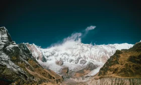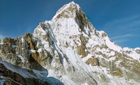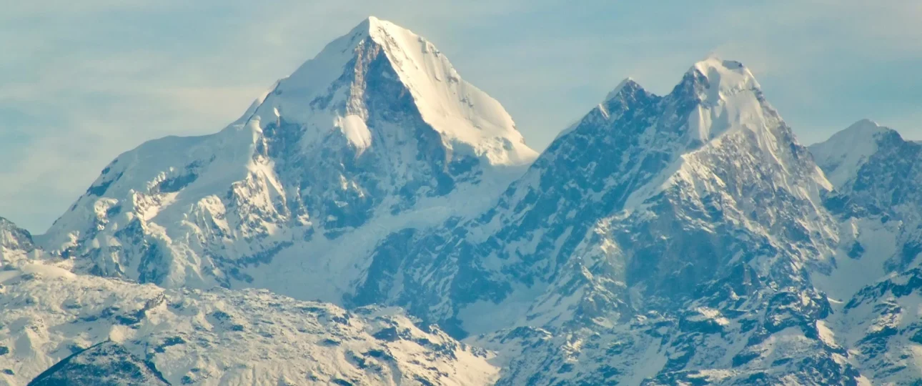
Langtang Himal is a Himalayan mountain range in central Nepal, located approximately 60 kilometers north of Kathmandu along the Nepal-Tibet border. The range’s highest peak is Langtang Lirung at 7,234 meters (23,734 feet). The entire range lies within Langtang National Park, established in 1976 as Nepal’s first Himalayan national park, and is home to the Tamang people who have inhabited its valleys for centuries.
Langtang Himal mountain range includes several significant peaks beyond Langtang Lirung: Langtang Ri (7,205 m), Dorje Lakpa (6,966 m), Langshisa Ri (6,427 m), and Gangchenpo (6,387 m). These peaks surround the Langtang Valley, creating the dramatic alpine landscape that trekkers experience at Kyanjin Gompa.
Langtang Himal Nepal significance extends beyond mountaineering. The range is accessible by road from Kathmandu, making it one of the most approachable high Himalayan ranges in the country. Unlike Everest or Annapurna regions, no domestic flight is required to reach the trailhead. This accessibility, combined with substantial peaks and rich Tamang culture, makes Langtang Himal uniquely important for both trekkers and mountain enthusiasts.
Langtang Himal trekking is the primary way most visitors experience the range. The Langtang Valley Trek takes trekkers from Syabrubesi through forest and villages to Kyanjin Gompa at 3,870 meters, with optional viewpoint climbs to Kyanjin Ri (4,773 m) or Tserko Ri (4,984 m). Merriment Treks operates guided treks through this region, handling permits, logistics, and safety while providing access to the heart of the Langtang Himal range.
What Is Langtang Himal?
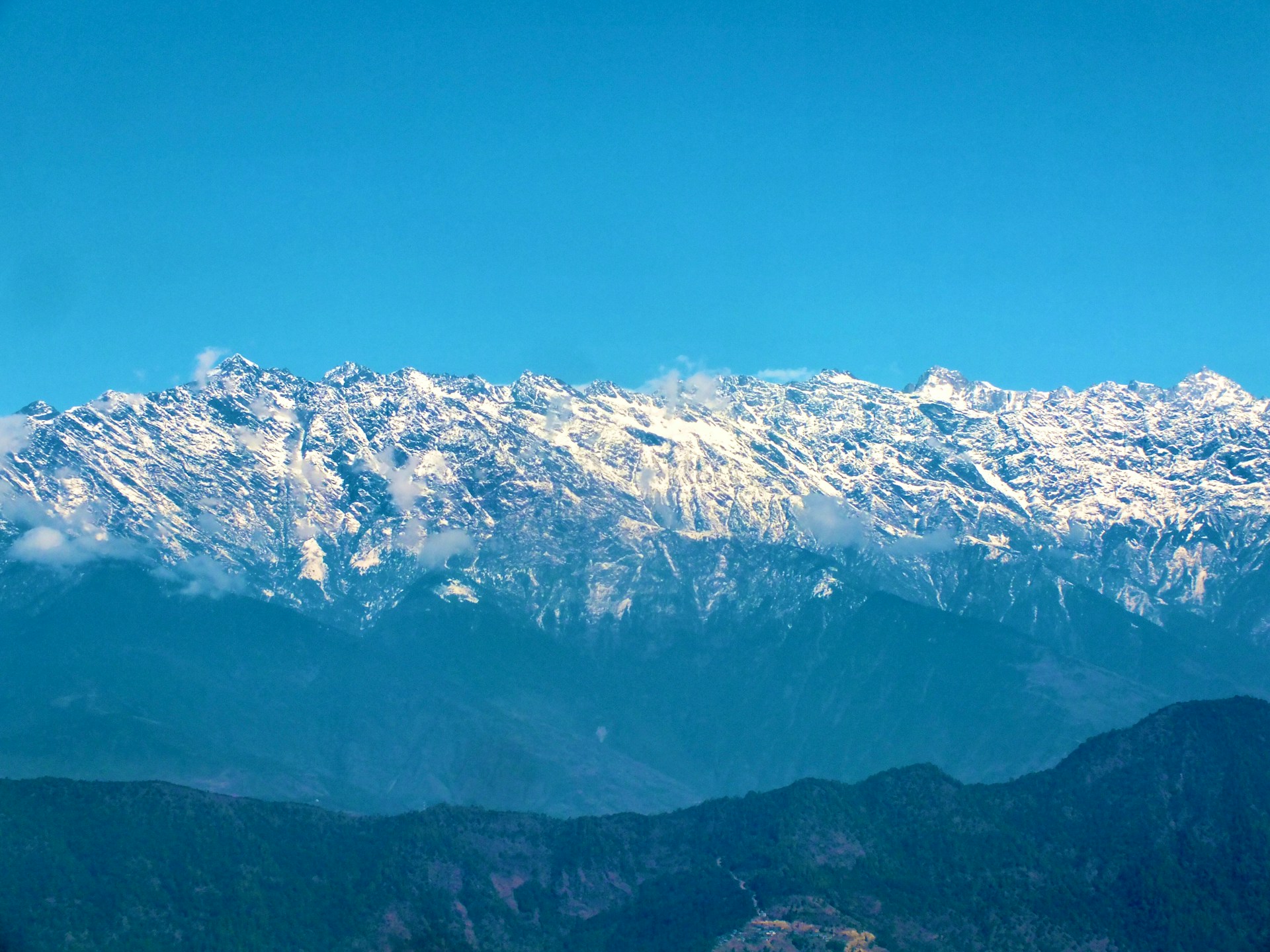
Langtang Himal is a subrange of the greater Himalayan mountain system in central Nepal. The term “Himal” means “mountain range” or “snow mountain” in Nepali. Langtang Himal specifically refers to the chain of peaks running east-west along the northern boundary of Langtang Valley, separating Nepal from Tibet.
The range extends approximately 50 kilometers from west to east. It includes the Langtang Lirung massif as its dominant feature, along with multiple peaks exceeding 6,000 meters. The southern slopes of these mountains feed the Langtang Khola river, which flows through the valley before joining the Bhote Koshi and eventually the Trishuli river system.
Langtang Himal mountain range characteristics include steep glacial valleys, high mountain passes, and significant glacial coverage. The range forms part of the Langtang National Park’s northern boundary, with the park extending southward to include forests, alpine meadows, and river valleys.
Understanding the distinction between Langtang Himal and Langtang Valley matters. The Himal refers to the mountain range itself — the peaks, glaciers, and high terrain. The Valley refers to the inhabited corridor below, where trekkers walk and where villages like Langtang and Kyanjin Gompa exist.
Where Is Langtang Himal Located?
Langtang Himal location places it in Rasuwa District, Bagmati Province, central Nepal. The range sits directly north of Kathmandu, with the capital city visible from the range’s southern foothills on clear days.
The geographic coordinates place Langtang Lirung, the range’s highest peak, at approximately 28°15′N latitude and 85°31′E longitude. The range forms a natural border between Nepal and the Tibet Autonomous Region of China.
The closest major settlement is Syabrubesi, a small town at 1,550 meters that serves as the gateway to Langtang Valley and the trekking routes into the range. From Syabrubesi, the trail follows the Langtang Khola upstream, passing through forest, villages, and eventually reaching the high alpine terrain beneath the main peaks.
Langtang Himal map perspective: The range sits between the Ganesh Himal to the west and the Jugal Himal to the east. To the south lies the Kathmandu Valley. To the north, across the Tibet border, lies the Tibetan Plateau.
Langtang Himal Nepal accessibility is exceptional for high Himalayan terrain. While Everest requires a flight to Lukla and Annapurna requires a long road journey, Langtang’s trailhead is reachable by road in 6–10 hours from Kathmandu.
How High Is Langtang Himal?
Langtang Himal elevation ranges from valley floors around 1,500 meters to the summit of Langtang Lirung at 7,234 meters. This vertical difference of nearly 6,000 meters creates dramatic ecological diversity, from subtropical forest to permanent ice.
The range contains multiple peaks exceeding 6,000 meters, with Langtang Lirung being the only peak above 7,000 meters. This places Langtang Himal lower than the Everest range (which has several 8,000-meter peaks) but comparable to many other significant Himalayan subranges.
Langtang Himal peaks elevation table:
| Location | Elevation |
|---|---|
| Syabrubesi | 1,550 m |
| Lama Hotel | 2,470 m |
| Ghodatabela | 3,020 m |
| Langtang Village | 3,430 m |
| Kyanjin Gompa | 3,870 m |
| Kyanjin Ri | 4,773 m |
| Tserko Ri | 4,984 m |
| Yala Peak | 5,520 m |
| Dorje Lakpa | 6,966 m |
| Langtang Lirung | 7,234 m |
The elevation profile explains why Langtang is popular for trekking: you can reach 5,000-meter viewpoints without technical climbing skills, while the higher peaks remain the domain of mountaineers.
Langtang Lirung: The Highest Peak of Langtang Himal
Langtang Lirung is the highest peak of Langtang Himal at 7,234 meters (23,734 feet). The mountain dominates the northern skyline of Langtang Valley and is visible from Kyanjin Gompa, where trekkers gather to observe its massive south face.
The name “Langtang Lirung” combines “Langtang” (the regional name) with “Lirung” (possibly referring to its sharp ridge or prominence). The mountain sits at the eastern end of the Langtang Himal range, with its summit forming the border between Nepal and Tibet.
Langtang Lirung elevation is sometimes listed differently in older sources, with variations of 7,234 meters, 7,227 meters, or 7,205 meters appearing in different references. The currently accepted figure is 7,234 meters, though climbers should verify current maps before planning expeditions.
Langtang Lirung climbing history: The peak was first climbed in 1978 by a Japanese expedition via the east ridge. Since then, multiple routes have been established, though the mountain remains a serious technical challenge due to steep ice, rockfall hazard, and complex glacier terrain.
For trekkers, Langtang Lirung is not a climbing objective — it is a visual landmark. The mountain’s south face rises directly above Kyanjin Gompa, creating one of the most dramatic backdrops in Nepal trekking.
Major Peaks of Langtang Himal
Langtang Himal peaks include several mountains beyond Langtang Lirung. Each has distinct characteristics, climbing histories, and significance.
| Peak | Elevation | Location | Notable Features |
|---|---|---|---|
| Langtang Lirung | 7,234 m | Eastern end of range | Highest peak, dominant south face |
| Langtang Ri | 7,205 m | Western section | Technical climbing objective |
| Dorje Lakpa | 6,966 m | Eastern section | Visible from Kathmandu on clear days |
| Langshisa Ri | 6,427 m | Central section | Distinctive pyramid shape |
| Gangchenpo | 6,387 m | Central section | Also called “Fluted Peak” |
| Yala Peak | 5,520 m | Southern outlier | Popular trekking peak |
| Naya Kanga | 5,844 m | Southern outlier | Climbable with basic mountaineering skills |
Dorje Lakpa deserves special mention. At 6,966 meters, it is visible from Kathmandu on clear winter days, serving as a landmark for residents of the capital. The mountain sits at the eastern end of the Langtang range, closer to the Kathmandu Valley than any other 6,000-meter peak.
Yala Peak is the most accessible climbing objective in the region. At 5,520 meters, it can be climbed without extensive technical experience, making it popular among trekkers wanting to combine a Langtang trek with a summit attempt.
Langtang Himal mountains remain less climbed than peaks in the Everest or Annapurna regions. This relative solitude adds to the range’s appeal for mountaineers seeking less crowded objectives.
Langtang Himal and Its Glaciers
Langtang Himal glaciers are significant geographic features shaping the landscape. The most important is the Langtang Glacier, which descends from the flanks of Langtang Lirung and neighboring peaks into the upper Langtang Valley.
The Langtang Glacier is a debris-covered glacier, meaning its lower section is coated in rock and sediment, making it appear more like a rocky plain than ice. Trekkers walking from Kyanjin Gompa toward Tserko Ri cross or pass alongside glacial moraines — the rocky debris left by glacial movement.
Lirung Glacier descends more steeply from Langtang Lirung’s south face. This glacier is visible from Kyanjin Gompa and presents a dramatic wall of ice and rock. Glacial meltwater from both glaciers feeds the Langtang Khola, the river that trekkers follow throughout their journey.
Glacial significance: The glaciers of Langtang Himal are retreating, consistent with global climate patterns. Scientific monitoring stations in the region have documented glacial retreat over recent decades. This has implications for water resources, landslide risk, and the long-term landscape of the valley.
For visitors, the glaciers are visible but should not be approached closely without proper training. Glacial terrain contains hidden crevasses, unstable ice, and falling rock danger. Viewing from established trails and viewpoints is safe; direct glacial exploration requires mountaineering expertise.
Langtang National Park
Langtang National Park encompasses much of Langtang Himal and the surrounding valleys. Established in 1976, it was Nepal’s first Himalayan national park and covers 1,710 square kilometers.
The park extends from subtropical forest at lower elevations through temperate forest, subalpine zones, and alpine tundra to permanent ice on the highest peaks. This elevation range supports remarkable biodiversity.
Wildlife in Langtang National Park:
-
Red panda (endangered, elusive)
-
Himalayan black bear
-
Snow leopard (rarely seen)
-
Himalayan tahr
-
Musk deer
-
Langur monkeys
-
Over 250 bird species
The park’s forests include rhododendron, oak, pine, and bamboo. Spring brings extensive rhododendron blooms, painting hillsides in red, pink, and white.
Langtang National Park permit: Foreign visitors must purchase an entry permit (NPR 3,000, approximately USD 23). A TIMS card (NPR 2,000) is also required. Since April 2023, all foreign trekkers must hire a licensed guide — a regulation that remains in effect for 2026.
Merriment Treks handles all park permits and guide arrangements as part of Langtang trekking packages, ensuring compliance with current regulations.
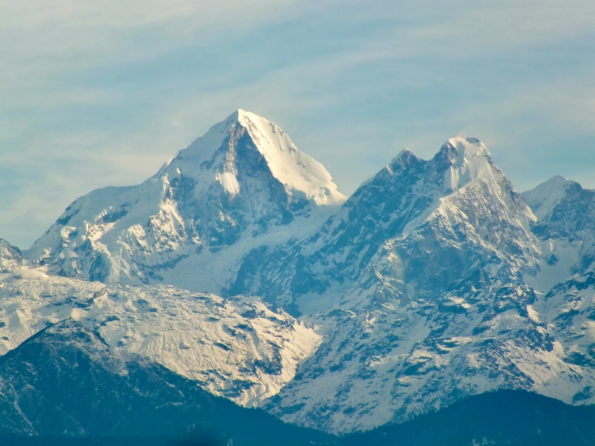
Langtang Himal and Tamang Culture
Langtang Himal is inseparable from the Tamang people who have inhabited its valleys for centuries. The Tamang are an indigenous ethnic group of Tibetan origin, and their culture is deeply woven into the mountain landscape.
Tamang villages throughout the Langtang region reflect Tibetan Buddhist traditions. Mani walls (stone structures carved with prayers), prayer flags, chortens (Buddhist shrines), and monasteries are common along trekking routes. The monastery at Kyanjin Gompa is an active religious site where trekkers can observe Buddhist practice.
Cultural significance of mountains: The Tamang view the high peaks as sacred. Langtang Lirung, Dorje Lakpa, and other summits are associated with local deities and spiritual beliefs. Trekkers should respect these traditions by walking clockwise around religious structures and asking permission before photographing people or ceremonies.
The Tamang language, part of the Tibeto-Burman family, is still spoken in villages. Most younger residents also speak Nepali, and some speak English due to tourism interaction.
Post-2015 cultural context: The 2015 earthquake disproportionately affected Tamang communities in Langtang. The avalanche that destroyed Langtang Village killed hundreds of residents and displaced survivors. While the village has been rebuilt and tourism has returned, the event remains part of collective memory and identity.
Langtang Himal and the 2015 Earthquake
Langtang Himal was directly affected by the April 2015 earthquake that struck Nepal. The magnitude 7.8 earthquake triggered a massive avalanche from the mountains surrounding Langtang Village, destroying the settlement and causing hundreds of deaths.
The avalanche originated from the peaks above the valley and swept through the village with devastating force. The event was one of the deadliest single incidents of the 2015 earthquake, with the entire village of Langtang effectively destroyed.
Recovery since 2015: Langtang Village has been rebuilt, though the new settlement is smaller than before. Teahouses are operating, trails have been restored, and tourism has returned. However, the landscape changed — the avalanche deposited massive amounts of debris, altering the valley floor and creating new terrain features.
For trekkers, the rebuilt village serves as both an overnight stop and a reminder of the region’s vulnerability. Visiting Langtang contributes to the local economy’s ongoing recovery. The trek reopened fully within two years of the earthquake, and infrastructure has continued improving through 2026.
Geological context: The 2015 earthquake was caused by the ongoing collision of the Indian and Eurasian tectonic plates, the same process that created the Himalaya. Langtang Himal sits directly on this collision zone, making seismic activity an inherent part of the region’s geology.
Langtang Himal for Trekking
Langtang Himal trekking is the primary way most visitors experience the range. The Langtang Valley Trek is the classic route, taking trekkers from Syabrubesi through forest and villages to Kyanjin Gompa at 3,870 meters.
The trek offers proximity to high peaks without technical difficulty. From Kyanjin Gompa, trekkers can climb Kyanjin Ri (4,773 m) or Tserko Ri (4,984 m) for panoramic views of Langtang Lirung, Dorje Lakpa, and the surrounding range.
Typical Langtang Valley Trek itinerary:
| Day | Route | Elevation |
|---|---|---|
| 1 | Kathmandu to Syabrubesi (drive) | 1,550 m |
| 2 | Syabrubesi to Lama Hotel | 2,470 m |
| 3 | Lama Hotel to Ghodatabela | 3,020 m |
| 4 | Ghodatabela to Langtang Village | 3,430 m |
| 5 | Langtang Village to Kyanjin Gompa | 3,870 m |
| 6 | Acclimatization at Kyanjin Gompa | 3,870 m |
| 7 | Return to Lama Hotel | 2,470 m |
| 8 | Return to Syabrubesi | 1,550 m |
| 9 | Drive to Kathmandu | — |
Trekking vs climbing distinction: The Langtang Valley Trek requires no technical skills. Kyanjin Ri and Tserko Ri are steep hikes, not climbs. In contrast, peaks like Langtang Lirung, Dorje Lakpa, and Langtang Ri require full mountaineering expeditions with technical equipment, permits, and experience.
Merriment Treks offers guided Langtang Valley Trek packages with licensed guides, permits, transportation, and teahouse accommodation included. Trekking is accessible to fit beginners, making it the most realistic way to experience Langtang Himal for most visitors.
Kyanjin Gompa, Kyanjin Ri and Tserko Ri
Kyanjin Gompa is the high point of the Langtang Valley Trek at 3,870 meters. This small settlement serves as the base for exploring the upper reaches of Langtang Himal. The name combines “Kyanjin” (a local term) with “Gompa” (monastery).
The village has several teahouses, a small monastery, and a seasonal cheese factory. It sits in a broad glacial valley surrounded by peaks, with Langtang Lirung’s south face dominating the view to the north.
Kyanjin Ri (4,773 m) is a viewpoint peak accessible by a steep hike from Kyanjin Gompa. The climb takes 3–4 hours and offers excellent panoramas of Langtang Lirung and the Langtang Valley below.
Tserko Ri (4,984 m) is higher and more demanding. The climb takes 4–5 hours and approaches 5,000 meters, making it a significant altitude achievement. Views are wider, encompassing more of the Langtang Himal range.
Comparison:
| Factor | Kyanjin Ri | Tserko Ri |
|---|---|---|
| Elevation | 4,773 m | 4,984 m |
| Climbing time | 3–4 hours | 4–5 hours |
| Difficulty | Moderate-strenuous | Strenuous |
| Altitude risk | Moderate | Higher |
| Views | Langtang Lirung, valley | Wider panorama |
Both viewpoints are non-technical hikes. Neither requires climbing equipment. Both require good acclimatization and reasonable fitness.
Langtang Himal for Mountaineering
Langtang Himal climbing opportunities exist for mountaineers with appropriate experience. The range offers technical peaks, trekking peaks, and expedition objectives.
Trekking peaks (climbable with basic mountaineering skills):
-
Yala Peak (5,520 m): The most popular climbing objective. Requires crampons, ice axe, and rope skills but no extreme technical climbing.
-
Naya Kanga (5,844 m): More challenging, requires solid mountaineering experience.
Technical peaks (require expedition-level experience):
-
Langtang Lirung (7,234 m): Serious expedition objective with significant objective danger
-
Langtang Ri (7,205 m): Remote and rarely climbed
-
Dorje Lakpa (6,966 m): Technical climbing with steep ice and rock sections
-
Langshisa Ri (6,427 m): Challenging terrain, infrequently attempted
Climbing permits: Mountaineering permits are required for peaks above 5,500 meters in Nepal. These are separate from trekking permits and are issued by the Department of Tourism. Costs vary by peak elevation and season.
Merriment Treks does not organize technical mountaineering expeditions but can connect interested climbers with appropriate specialist operators. The company focuses on trekking experiences within Langtang National Park.
Best Time to Visit Langtang Himal
Langtang Himal seasons affect both trekking and mountaineering conditions.
March to May (Spring): Best overall conditions. Stable weather, clear mornings, blooming rhododendrons at lower elevations. Daytime temperatures at Kyanjin Gompa reach 10–15°C. Nights remain cold.
October to November (Autumn): Excellent visibility and stable weather. The most popular season. Busier than spring but manageable. Daytime temperatures similar to spring.
December to February (Winter): Cold but clear. Temperatures at Kyanjin Gompa can drop below -15°C at night. Snow covers higher trails. Fewer trekkers. Requires proper gear and cold tolerance.
June to September (Monsoon): Not recommended. Heavy rain, leeches, landslides, limited visibility. The road to Syabrubesi is prone to disruption. Some teahouses close.
For mountaineering, spring and autumn offer the best climbing windows. Winter attempts are rare due to extreme cold and high winds. Monsoon climbing is generally not attempted.
How to Reach the Langtang Region
Langtang Himal access begins in Kathmandu. The trailhead at Syabrubesi is reached by road — no domestic flight required.
Transportation options from Kathmandu to Syabrubesi:
| Transport Option | Cost (per person) | Duration | Comfort |
|---|---|---|---|
| Public bus | USD 10–14 | 8–10 hours | Basic |
| Tourist bus | USD 18–25 | 7–9 hours | Moderate |
| Shared jeep | USD 20–30 | 6–8 hours | Moderate |
| Private jeep | USD 120–180 (total) | 6–7 hours | Best |
The road passes through Trishuli Bazaar and Dhunche. Conditions vary seasonally; monsoon landslides can cause delays.
Merriment Treks arranges transportation as part of Langtang trekking packages, typically using tourist bus or shared jeep with private jeep available as an upgrade.
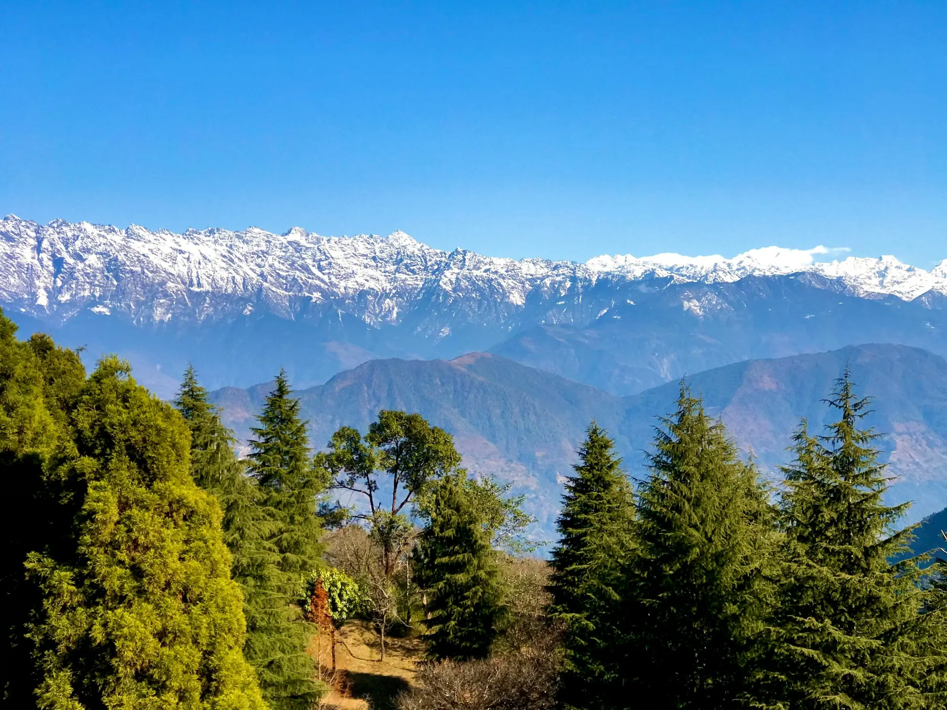
Langtang Himal vs Langtang Valley
Langtang Himal vs Langtang Valley distinction is important for understanding the region.
| Aspect | Langtang Himal | Langtang Valley |
|---|---|---|
| What it is | Mountain range | River valley below the range |
| Elevation | Up to 7,234 m | 1,550–3,870 m |
| Accessibility | Technical climbing required | Trekking accessible |
| Main features | Peaks, glaciers | Villages, forests, trails |
| Visitor experience | Mountaineering | Teahouse trekking |
The Langtang Valley Trek takes place within the valley, not on the mountain range itself. Trekkers see the Himal from below and from viewpoints like Kyanjin Ri and Tserko Ri. Climbing the peaks requires separate mountaineering expeditions.
Langtang Himal vs Everest and Annapurna
Langtang Himal comparison with other major Nepal ranges provides context for travelers.
| Factor | Langtang Himal | Everest Region | Annapurna Region |
|---|---|---|---|
| Highest peak | 7,234 m | 8,848 m | 8,091 m |
| Domestic flight required | No | Yes (Lukla) | No (road access) |
| Trekking difficulty | Moderate | Challenging | Moderate-difficult |
| Crowds | Moderate | Heavy | Heavy |
| Cost | Lower | Higher | Moderate |
| Cultural group | Tamang | Sherpa | Gurung, Thakali |
Langtang offers the best accessibility-to-altitude ratio. You reach high Himalayan scenery without flights, at lower cost, and with fewer crowds than Everest or Annapurna.
Current Langtang Himal Conditions in 2026
Langtang Himal 2026 conditions reflect ongoing recovery and development since the 2015 earthquake.
Trail conditions: The trekking route from Syabrubesi to Kyanjin Gompa is open and well-maintained. Teahouses are operating throughout the route. The rebuilt Langtang Village offers accommodation and meals.
Regulations: The mandatory guide rule remains in effect for 2026. All foreign trekkers must hire a licensed guide. TIMS cards and park permits are required.
Infrastructure: Road access to Syabrubesi has improved, though the journey remains slow by road standards. Mobile connectivity exists at lower elevations and intermittently at Kyanjin Gompa.
Environmental considerations: Glacial retreat continues, consistent with climate patterns. Trail erosion and waste management remain challenges. Responsible trekking practices are important.
Merriment Treks monitors conditions throughout the year and provides updated information to clients before departure. The company adjusts itineraries when weather or trail conditions require changes.
Responsible Tourism in Langtang
Langtang Himal responsible tourism practices protect the environment and support local communities still recovering from 2015.
Environmental practices:
-
Carry reusable water bottles and purification systems
-
Pack out all non-biodegradable waste
-
Stay on marked trails
-
Avoid disturbing wildlife
-
Use established teahouses rather than camping
Cultural practices:
-
Walk clockwise around mani walls and chortens
-
Ask permission before photographing people
-
Dress modestly, especially at religious sites
-
Learn basic Nepali or Tamang greetings
-
Support local businesses
Economic practices:
-
Hire local guides and porters through reputable agencies
-
Eat at locally owned teahouses
-
Consider purchasing local products
-
Tip fairly for good service
Merriment Treks follows responsible tourism principles, ensuring guides and porters receive fair wages and working conditions, and minimizing environmental impact.
Frequently Asked Questions about Langtang Himal
1. What is Langtang Himal?
Langtang Himal is a Himalayan mountain range in central Nepal, approximately 60 kilometers north of Kathmandu. Its highest peak is Langtang Lirung at 7,234 meters.
2. Where is Langtang Himal located?
Langtang Himal is in Rasuwa District, Bagmati Province, central Nepal. It forms part of the Nepal-Tibet border and lies within Langtang National Park.
3. What is the highest peak of Langtang Himal?
Langtang Lirung is the highest peak at 7,234 meters (23,734 feet). It was first climbed in 1978.
4. Is Langtang Himal the same as Langtang Valley?
No. Langtang Himal refers to the mountain range. Langtang Valley is the inhabited river valley below the range where trekking takes place.
5. Can I trek in Langtang Himal without climbing experience?
Yes. The Langtang Valley Trek requires no technical skills. You can reach viewpoints above 4,700 meters through hiking alone.
6. What peaks can I climb in Langtang Himal?
Yala Peak (5,520 m) and Naya Kanga (5,844 m) are trekking peaks accessible to those with basic mountaineering skills. Technical peaks like Langtang Lirung require expedition experience.
7. How do I get to Langtang Himal?
Drive from Kathmandu to Syabrubesi (6–10 hours by road). No domestic flight is required. From Syabrubesi, trek into the valley.
8. Do I need a guide for Langtang Himal trekking?
Yes. Since April 2023, all foreign trekkers in Langtang National Park must hire a licensed guide.
9. What permits are required?
Langtang National Park Entry Permit (NPR 3,000) and TIMS Card (NPR 2,000). Mountaineering peaks require separate climbing permits.
10. What is the best time to visit Langtang Himal?
March to May and October to November offer the best weather. Winter is cold but clear. Monsoon (June–September) is not recommended.
11. How did the 2015 earthquake affect Langtang Himal?
The earthquake triggered a massive avalanche that destroyed Langtang Village. The village has been rebuilt, and trekking has resumed.
12. What wildlife lives in Langtang National Park?
Red pandas, Himalayan black bears, snow leopards, Himalayan tahr, musk deer, and over 250 bird species inhabit the park.
13. What is Kyanjin Gompa?
Kyanjin Gompa is a settlement at 3,870 meters serving as the destination for the Langtang Valley Trek. It sits directly beneath Langtang Lirung.
14. Is Langtang cheaper than Everest Base Camp?
Yes. Langtang costs 40–50% less than Everest Base Camp because no domestic flight is required and the trek is shorter.
15. Can I see Langtang Himal from Kathmandu?
On clear winter days, Dorje Lakpa (6,966 m) and other Langtang peaks are visible from Kathmandu.