

Why the Mardi Himal Trek Map Matters in 2026
The Mardi Himal Trek map is not a decorative illustration. It is a planning tool that determines whether you pack correctly, pace yourself safely, and understand where you are sleeping each night. In 2026, with updated trekking regulations in Nepal, the route has not fundamentally changed, but the way you navigate it has. This guide from Merriment Treks is built around one clear objective: to make the Mardi Himal route map readable, practical, and genuinely useful before you set foot on the trail.
Unlike generic travel blogs that embed a low-resolution screenshot and call it a map, this article explains the route point by point, shows the elevation gains between each stop, and distinguishes the three high-altitude locations that cause the most confusion: High Camp, Upper Viewpoint, and Mardi Himal Base Camp.
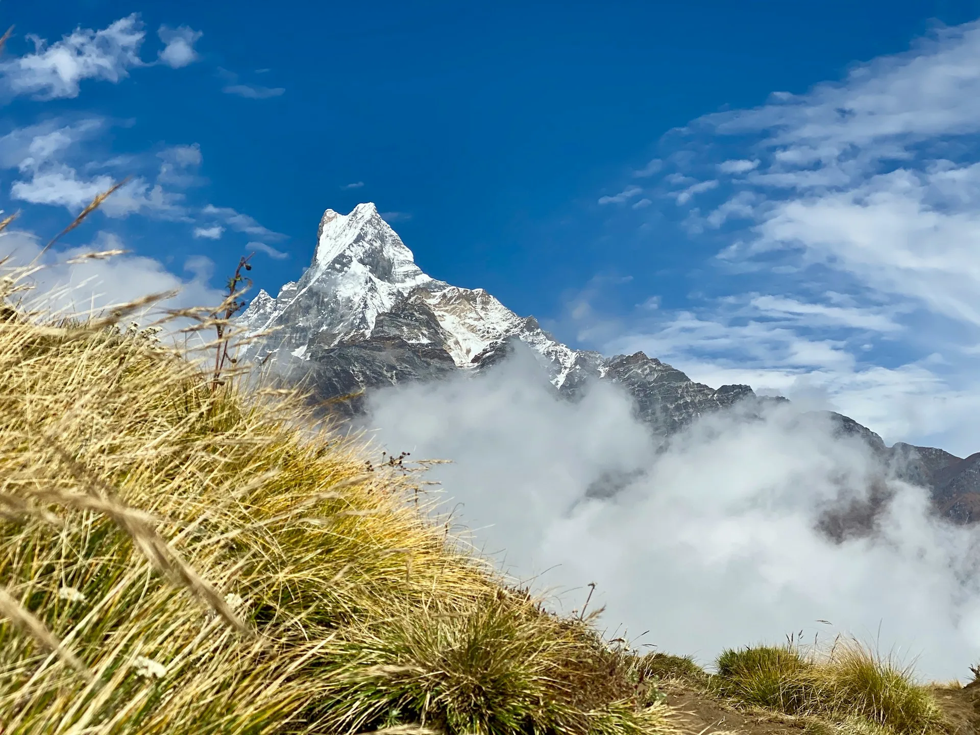
Mardi Himal Trek Map at a Glance
The standard Mardi Himal trek begins at Kande, a roadside village on the Pokhara–Baglung highway, and ends at Lumre or Siding, with a road transfer back to Pokhara. The route climbs through rhododendron forest, opens into alpine meadows, and finally reaches a ridge overlooking the Annapurna massif.
Route Overview Table
| Location | Approx. Elevation | Route Role | Typical Walking Context |
|---|---|---|---|
| Pokhara | 820 m | Start/end city | Lake city, permit processing, transport hub |
| Kande | 1,770 m | Trailhead | Roadside start, stone steps lead upward |
| Australian Camp | 2,060 m | Optional first stop | Open meadows, panoramic views |
| Pothana | 1,950 m | Route junction | Tea houses, connects to Dhampus |
| Pitam Deurali | 2,100 m | Forest entry | Dense rhododendron begins |
| Forest Camp (Kokar) | 2,600 m | Lower forest stop | Quiet, damp, sheltered |
| Low Camp | 2,990 m | Mid-elevation stop | Tree line begins to thin |
| Badal Danda | 3,210 m | Ridge shoulder | Cloud layer often sits here |
| High Camp | 3,580 m | Last accommodation | Exposed, cold, short final climb |
| Upper Viewpoint | 4,200 m | Main panoramic point | Sunrise viewpoint, steep climb |
| Mardi Himal Base Camp | 4,500 m | Official high point | Rocky, close to Mardi Himal peak |
| Siding | 1,750 m | Descent end point | Village trail exit |
| Lumre | 1,600 m | Roadhead | Jeep or bus back to Pokhara |
Elevation figures vary between sources because some measurements are taken at the tea house, others at the trail junction, and others at the nearest ridge point. The table above uses the most commonly cited tea house elevations, rounded to the nearest 10 meters. GPS measurements on the trail can differ by 20–50 meters depending on satellite accuracy and where the reading is taken.
What the Mardi Himal Trek Map Actually Shows
The Mardi Himal trek route map shows a north-south ridge that runs parallel to the Modi Khola valley. On the map, you see the trail climbing from the Pokhara valley floor into the Annapurna foothills. The route does not enter the Annapurna Sanctuary. It stays on a separate ridge that offers direct views of Machhapuchhre (Fishtail), Annapurna South, Hiunchuli, and the Mardi Himal peak itself at 5,587 meters.
The map reveals something that text descriptions often miss: the trail is not a loop. The ascent and descent use different trails. You climb the eastern flank of the ridge and descend the western flank. This is why the standard itinerary finishes at Siding or Lumre rather than returning to Kande.
A useful Mardi Himal trail map should show:
-
The road connection from Pokhara to Kande
-
The ascent trail with all named stops
-
The upper ridge section from High Camp to Base Camp
-
The descent trail to Siding and Lumre
-
The elevation changes between each point
-
The location of tea houses and water sources
-
The junction where Australian Camp and Pothana connect
Most published maps fail at least three of these.
Complete Mardi Himal Trek Route: Stage by Stage
Pokhara to Kande
Map context: The trek begins with a one-hour drive from Pokhara, heading northwest on the Baglung Highway. Kande is a small roadside settlement. On the map, it sits at the southern end of the Mardi Himal ridge.
What happens here: You leave the lake basin of Pokhara and climb abruptly into the foothills. The trail starts directly from the road. There is no flat warm-up.
Practical note: Arrange transport the evening before. Shared jeeps and private taxis both run this section. The road is paved and reliable in 2026.
Kande to Australian Camp or Pothana
Map context: From Kande, the trail climbs steeply through forest to a ridge junction. Australian Camp sits slightly higher to the north. Pothana sits slightly lower to the east.
Route decision: This is the first route choice on the Mardi Himal map. Trekkers heading to Australian Camp take the right fork after about 45 minutes. Trekkers heading directly toward Pitam Deurali take the left fork toward Pothana.
Walking time: Kande to Australian Camp is approximately 2–2.5 hours. Kande to Pothana is approximately 1.5–2 hours. The two paths meet later at Pitam Deurali.
Terrain change: Stone steps dominate this section. The forest is mixed oak and rhododendron. In spring, the rhododendron flowers are dense and visible from the trail.
Pothana to Pitam Deurali
Map context: From Pothana, the trail undulates along a forested contour. Pitam Deurali is a saddle where the Australian Camp trail and the Pothana trail rejoin.
What changes: The foot traffic thins. The trail becomes quieter. The forest deepens.
Walking time: Approximately 1.5–2 hours.
Navigation note: The junction at Pitam Deurali is marked, but the signs are small. Carry an offline map on your phone. The Mardi Himal GPS map for this section is straightforward, but fog can reduce visibility.
Pitam Deurali to Forest Camp
Map context: The trail now enters the densest section of rhododendron forest. Forest Camp, also called Kokar, sits at the base of the steepest forest climb.
What changes: The trail narrows. Stone steps become uneven. The air cools noticeably.
Walking time: Approximately 2–3 hours.
Elevation gain: 2,100 m to 2,600 m. This is one of the most sustained climbs on the lower half of the route.
Accommodation: Forest Camp has a small number of tea houses. It is quieter than Pothana or Australian Camp. Many trekkers skip staying here and continue to Low Camp, but that makes for a long first day.
Forest Camp to Low Camp
Map context: The trail climbs out of the dense forest into a more open mix of mossy trees and scrub. Low Camp marks the approximate point where the forest begins to break apart.
What changes: The valley opens on the left side. You begin to see the Annapurna ridgeline through gaps in the trees. The temperature drops more rapidly.
Walking time: Approximately 2–2.5 hours.
Elevation gain: 2,600 m to 2,990 m.
Accommodation note: Low Camp has more tea house capacity than Forest Camp. It is the standard first-night stop for trekkers who start at Kande and do not stop at Australian Camp.
Low Camp to Badal Danda
Map context: The trail climbs a steeper ridgeline. Badal Danda sits on a shoulder where the forest gives way to open grassland and scrub.
What changes: Tree cover becomes patchy. The trail is more exposed. In the morning, this section often sits inside the cloud layer, which is what gives Badal Danda its name — “cloud hill.”
Walking time: Approximately 1.5–2 hours.
Elevation gain: 2,990 m to 3,210 m.
Safety note: If visibility is poor, stay on the marked trail. The ridgeline has steep drop-offs on both sides in places. A downloaded Mardi Himal offline map is useful here.
Badal Danda to High Camp
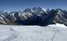
Map context: This is one of the shortest and most scenic sections on the Mardi Himal trek map. The trail climbs along an open ridge with direct views of Machhapuchhre and Annapurna South.
What changes: The terrain becomes alpine. Grasses replace trees. The trail is rocky in sections. High Camp appears ahead as a small cluster of lodges on a windswept slope.
Walking time: Approximately 1.5–2 hours.
Elevation gain: 3,210 m to 3,580 m.
High Camp significance: High Camp is the last place with accommodation. There is no tea house above this point. If you are planning to reach Upper Viewpoint or Base Camp for sunrise, High Camp is where you sleep.
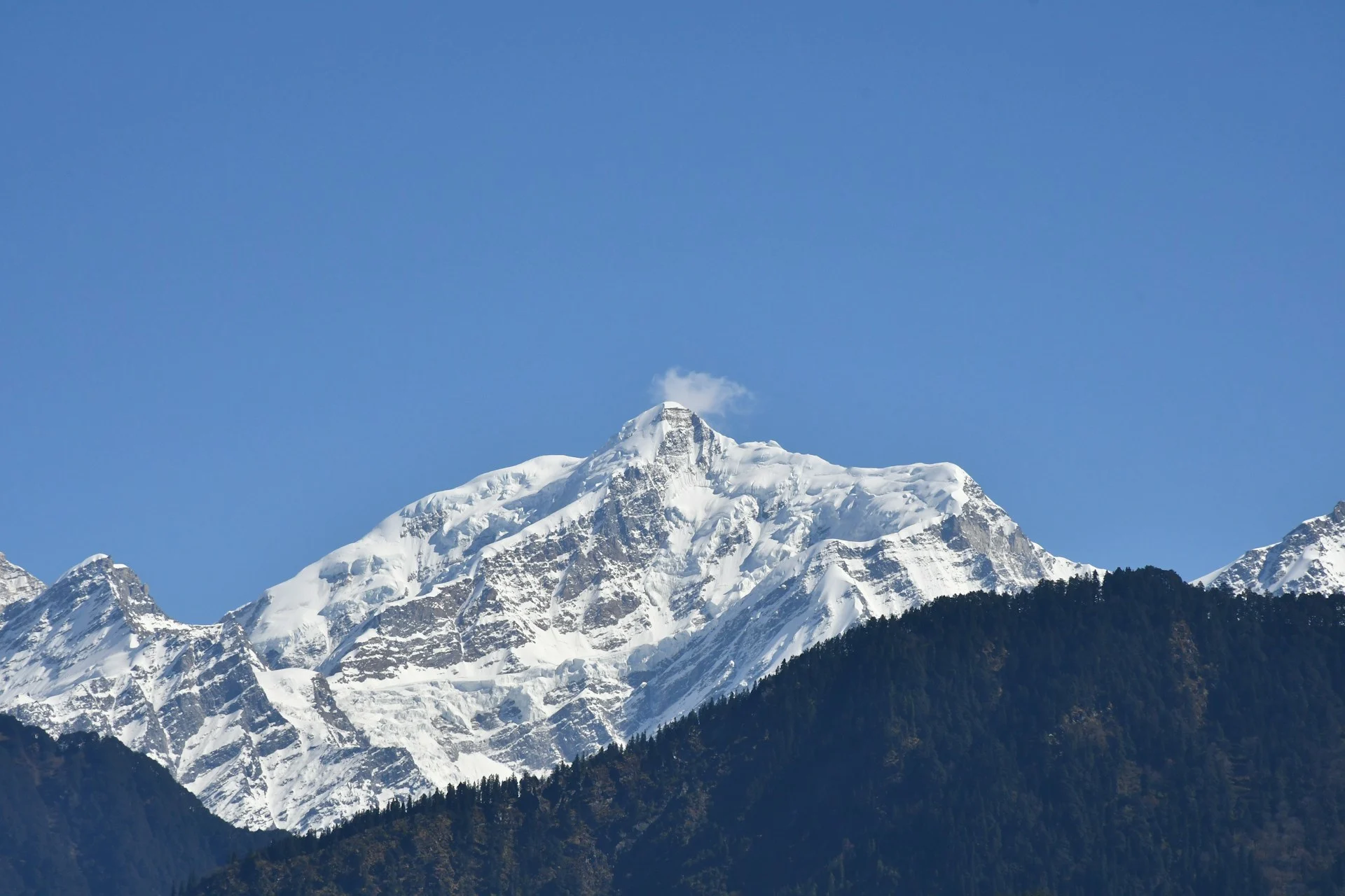
High Camp, Upper Viewpoint, and Mardi Himal Base Camp: The Three Confusing Points
This is the section that most existing Mardi Himal trek maps get wrong. The three places are separate and serve different purposes.
High Camp (3,580 m)
High Camp is a sleeping point. It has tea houses, a dining hall, and basic rooms. It is not a viewpoint. The view from High Camp is good, but it is not the main goal. High Camp exists so trekkers can start the final climb before dawn.
Upper Viewpoint (4,200 m)
Upper Viewpoint is a sunrise destination. It is a steep 1.5–2 hour climb from High Camp. The trail is exposed, rocky, and well-defined but unmarked in places. The viewpoint offers a panoramic view of the Annapurna massif and the deep valley below. Many trekkers stop here, take photos, and descend. This is the practical high point for most itineraries.
Mardi Himal Base Camp (4,500 m)
Mardi Himal Base Camp is a formal geographic point at the head of the ridge. It is not a campsite. There are no lodges. The terrain is rocky and desolate. From Upper Viewpoint, the trail continues for another 1–1.5 hours. The final section is steeper and more exposed. Weather moves quickly here. The view from Base Camp is similar to Upper Viewpoint but more immersive, with Mardi Himal peak rising directly ahead.
Comparison Table
| Point | Elevation | Purpose | Accommodation | Walking Time from High Camp |
|---|---|---|---|---|
| High Camp | 3,580 m | Sleeping point | Yes | — |
| Upper Viewpoint | 4,200 m | Main sunrise viewpoint | No | 1.5–2 hours |
| Mardi Himal Base Camp | 4,500 m | Official route end | No | 2.5–3.5 hours |
Key clarity: Upper Viewpoint and Mardi Himal Base Camp are not the same place. Some trekking agencies advertise “Mardi Himal Base Camp” but only take clients to Upper Viewpoint. If reaching the official Base Camp matters to you, confirm this with your operator before booking.
Upper Viewpoint to Mardi Himal Base Camp
Map context: The trail continues along the narrowing ridge. On a good day, the path is visible from Upper Viewpoint. On a cloudy day, it disappears into fog.
What changes: The terrain becomes looser. The path is less defined. Altitude effects are more noticeable above 4,000 meters.
Walking time: Approximately 1–1.5 hours one way.
Safety note: Start this section only if visibility is reasonable and the weather forecast is stable. If clouds roll in, turn back. The ridge is not technical, but in fog the path can be difficult to follow.
Descent Route to Siding and Lumre
Map context: From High Camp, instead of retracing the entire ascent to Kande, the standard route descends west toward the villages of Siding and Lumre.
What happens: The trail drops steeply through forest. It is quieter than the ascent route. The descent is hard on the knees.
Walking time: High Camp to Siding is approximately 4–5 hours. Siding to Lumre is another 1–1.5 hours.
Route alternative: Some trekkers descend to Low Camp and then retrace to Kande. This is useful if transport has been arranged from the original trailhead, but it adds time and loses the advantage of a circular route.
End point: From Lumre, a jeep or bus returns to Pokhara in approximately 2–2.5 hours.
Mardi Himal Trek Distance and Duration
The total distance varies depending on the route.
| Route Variation | Approx. Distance | Typical Duration |
|---|---|---|
| Kande to High Camp (ascent only) | 25–30 km | 3–4 days |
| High Camp to Lumre (descent only) | 15–18 km | 1–2 days |
| Full trek without Base Camp | 40–45 km | 4–5 days |
| Full trek with Base Camp | 45–50 km | 5–6 days |
These figures are approximate because GPS trackers measure path length differently from map-based estimates. The distance from Upper Viewpoint to Base Camp is often underestimated. Include an extra hour for that section if you plan to go all the way.
Elevation Profile: Practical Meaning
The Mardi Himal trek has a moderate overall altitude profile, but the ascent is concentrated in short sections.
| Segment | Elevation Gain | Difficulty Note |
|---|---|---|
| Kande to Australian Camp | ~290 m | Steep start |
| Australian Camp to Pitam Deurali | ~40 m gain, some loss | Undulating |
| Pitam Deurali to Forest Camp | ~500 m | Sustained climb |
| Forest Camp to Low Camp | ~390 m | Steady |
| Low Camp to Badal Danda | ~220 m | Shorter, exposed |
| Badal Danda to High Camp | ~370 m | Scenic, open |
| High Camp to Upper Viewpoint | ~620 m | Steep, early morning |
| Upper Viewpoint to Base Camp | ~300 m | High altitude, exposed |
The highest sleeping point is High Camp at 3,580 meters. This is below the altitude where acute mountain sickness becomes a serious concern for most people, but the climb to Upper Viewpoint and Base Camp takes you above 4,000 meters. Descending the same day is the standard approach.
Mardi Himal Trek Map for Navigation: Offline and GPS Options
In 2026, most trekkers carry a smartphone with a downloaded map. Cellular signal is unreliable above Pothana. Do not depend on live data.
Recommended offline map apps:
-
Maps.me — free, reliable offline maps, good trail coverage
-
Gaia GPS — better for elevation profiles and GPX import
-
AllTrails — good for finding user-uploaded tracks, requires download before trek
GPX files: Several trekking forums and mapping sites host Mardi Himal GPX tracks. These vary in accuracy. Check the date of the upload. Trails in the upper section shift slightly each season due to erosion and rockfall.
Merriment Treks provides current GPX files to clients before departure. This is one of the most practical ways to ensure your map matches the actual trail in 2026.
Permits and Regulations for 2026
The Mardi Himal trek lies entirely within the Annapurna Conservation Area. You need two documents:
Guide requirement: Since 2023, the Nepal Tourism Board has required foreign trekkers to hire a licensed guide or porter for most trekking routes, including Mardi Himal. This regulation remains in effect for 2026. Independent trekking without a guide is not permitted under current rules.
Merriment Treks arranges permits and licensed guides as part of standard trek packages. If you prefer to handle permits yourself, they can be obtained in Pokhara at the Nepal Tourism Board office or the ACAP counter. Processing takes 30–60 minutes on a normal day.
Route Variations Worth Knowing
Standard Route
Kande → Australian Camp/Pothana → Pitam Deurali → Forest Camp → Low Camp → Badal Danda → High Camp → Upper Viewpoint → Base Camp → High Camp → Siding → Lumre
This is the recommended route for most trekkers. It balances acclimatization, scenery, and practical logistics.
Short Route
Kande → Pothana → Pitam Deurali → Forest Camp → Low Camp → Badal Danda → High Camp → Upper Viewpoint → return to Low Camp → Kande
This route skips Base Camp and shortens the trek by one day. It is useful if you have limited time.
Extended Route
Dhampus → Australian Camp → Pothana → standard route
Starting from Dhampus adds a half day and a gentler first stage. It is a better option for trekkers who want a shorter first day or prefer a village start.
Alternative Descent
High Camp → Low Camp → Kande
This is a retracing route. It is longer and less varied than the Siding/Lumre descent, but it is useful if transport has already been arranged to Kande.
What Merriment Treks Offers
Merriment Treks is a local trekking operator based in Pokhara that specializes in the Mardi Himal route. The company provides:
-
Current route maps and GPX files
-
ACAP and TIMS permit processing
-
Licensed, English-speaking guides
-
Porter arrangements
-
Transport from Pokhara to Kande and from Lumre back to Pokhara
-
Customized itineraries from 3 to 6 days
-
Altitude-aware scheduling
If you are planning the Mardi Himal trek in 2026 and want route clarity before you book, contacting Merriment Treks directly is a practical first step. The team can answer specific questions about current trail conditions, weather windows, and accommodation availability.
Frequently Asked Questions about Mardi Himal Trek Map
1. Where does the Mardi Himal Trek start?
The standard trailhead is Kande, a roadside village on the Pokhara–Baglung Highway, approximately one hour from Pokhara.
2. Where does the Mardi Himal Trek end?
The trek ends at Lumre or Siding, with a road transfer back to Pokhara.
3. Is Upper Viewpoint the same as Mardi Himal Base Camp?
No. Upper Viewpoint is at approximately 4,200 meters. Mardi Himal Base Camp is at approximately 4,500 meters. The two are separated by a 1–1.5 hour walk.
4. How far is the Mardi Himal Trek?
The full route is approximately 45–50 kilometers depending on whether you include Base Camp and which descent you take.
5. How many hours do you walk each day?
Most days involve 4–6 hours of walking. The summit day from High Camp to Upper Viewpoint and back is typically 4–5 hours.
6. What is the highest sleeping point on the trek?
High Camp is the highest accommodation at approximately 3,580 meters.
7. Do I need a guide for the Mardi Himal Trek in 2026?
Yes. Under current Nepal Tourism Board regulations, a licensed guide is required for foreign trekkers.
8. Can I use an offline map on the trail?
Yes. Download maps on Maps.me, Gaia GPS, or AllTrails before leaving Pokhara. Cellular signal is unreliable above Pothana.
9. What permits are required?
You need an Annapurna Conservation Area Permit (ACAP) and a TIMS card.
10. What is the most confusing part of the route?
The section from High Camp to Upper Viewpoint to Base Camp causes the most confusion. Many maps fail to distinguish the three points.
11. Is the descent different from the ascent?
Yes. The standard descent goes from High Camp to Siding and Lumre, not back to Kande.
12. How difficult is the Mardi Himal Trek?
The trek is moderate. The main challenges are steep stone steps on the first day and the high-altitude section above 4,000 meters.
13. What is Badal Danda?
Badal Danda is a ridge shoulder at approximately 3,210 meters between Low Camp and High Camp. It is often covered in cloud.
14. Can I do the trek in 3 days?
It is possible but not recommended. A 3-day itinerary skips acclimatization and makes the altitude gain feel rushed.
15. Does Merriment Treks provide route maps?
Yes. Merriment Treks provides clients with current route maps, GPX files, and route briefings before departure.
Final Notes for 2026
The Mardi Himal Trek map is not complicated once you understand the structure: one main ascent ridge, three upper points, and a separate descent trail. The key is to know which points are for sleeping, which are for viewpoints, and which are formal destinations. Use a downloaded map, carry the right permits, and clarify whether your itinerary includes the official Base Camp or only Upper Viewpoint.
Merriment Treks can help you plan the Mardi Himal trek with accurate route information, current permit processing, and local guide support. Contact the team in Pokhara for the most up-to-date trail conditions and itinerary advice.
Hello,
We are planning to travel from Spain next week and do this trek from September 10th to 14th (5 days).
My question concerns the descent from High Camp to Siding via the east face of Mardi Himal; I’ve read in some places that the path can be very indistinct, steep, and sometimes difficult to follow.
What is the current condition of this section? Will we find lodges to rest at in this area?
Many thanks, and best regards,