Langtang Valley Trek Map: Quick Answer
Langtang Valley Trek map shows an out-and-back route from Syabrubesi (1,550m) to Kyanjin Gompa (3,870m), covering approximately 32 kilometers one way with 2,300 meters of elevation gain. The route passes through Lama Hotel, Ghoda Tabela, Langtang Village, and Mundu before reaching Kyanjin Gompa.
If you’re looking at a Langtang Trek map for the first time, the most important thing to understand is the route structure. Unlike circuit treks such as Annapurna Base Camp or Manaslu, the Langtang Valley route follows a single valley northward and returns along the same path. This makes navigation straightforward, but it also means every kilometer you walk uphill, you’ll walk downhill on the return.
Merriment Treks provides detailed Langtang Valley Trek route maps to all clients before departure. Understanding the map before you begin eliminates confusion and helps you appreciate the landscape as it unfolds.
The Langtang Valley Trek map serves three purposes for trekkers. First, it shows the geographic location of the trek relative to Kathmandu and the Langtang National Park. Second, it displays the route sequence—which villages you’ll pass through and in what order. Third, it reveals the elevation progression, helping you understand where the challenging climbs occur and where the trail flattens out.
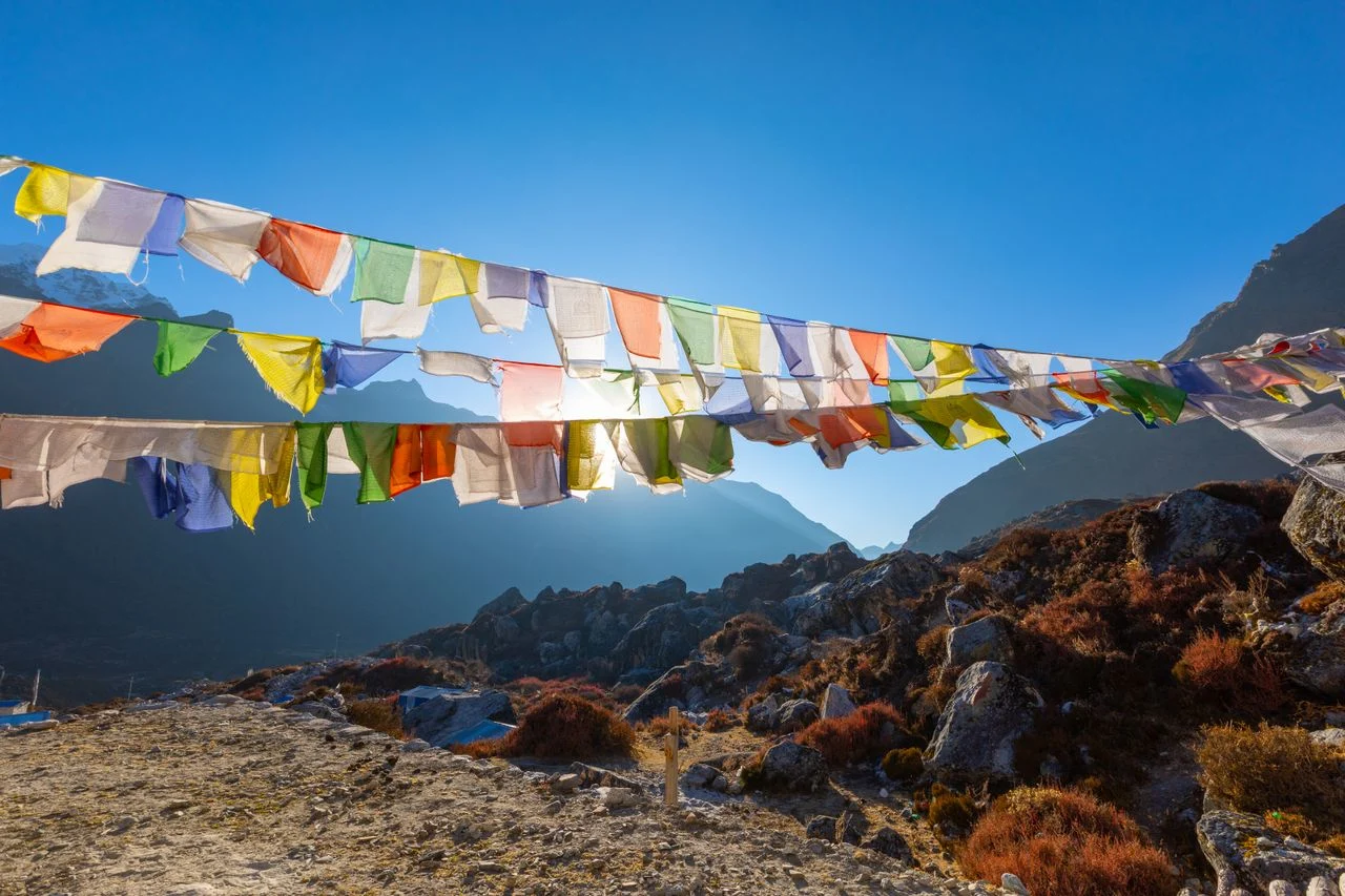
Langtang Valley Trek Route Map: Where Is the Trek Located?
Langtang Valley Trek map places the route in the Rasuwa District of Nepal, approximately 80 kilometers north of Kathmandu. The trek begins at Syabrubesi, accessed by a 7-8 hour road journey from Kathmandu through Dhunche.
The Langtang region appears on maps of Nepal as a prominent valley system directly north of Kathmandu, running toward the Tibetan border. The Langtang River flows south through this valley, eventually joining the Trisuli River system. The entire trekking route falls within Langtang National Park, Nepal’s first Himalayan national park established in 1976.
Langtang National Park map boundaries encompass 1,710 square kilometers across the Rasuwa, Nuwakot, and Sindhupalchok districts. The park extends from subtropical forests near Syabrubesi to alpine zones and glaciers near Kyanjin Gompa and beyond.
Understanding the geographic context helps explain why the Langtang route has a particular character. The valley runs north-south, meaning you walk up-valley (northward) on the approach and down-valley (southward) on the return. The trail generally follows the Langtang River, sometimes alongside it and sometimes climbing above it on valley walls.
Langtang Trek map from Syabrubesi to Kyanjin Gompa shows the trail following natural terrain features rather than a straight line. The path winds along valley contours, climbs over ridges, and crosses suspension bridges over the Langtang River at several points.
Langtang Trek Route Map: Complete Village Sequence
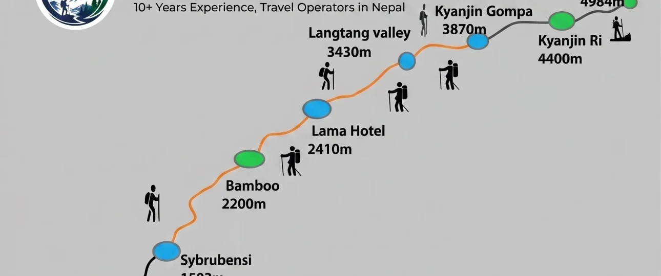
Langtang Valley Trek route map displays the following village sequence: Syabrubesi → Lama Hotel → Bamboo → Ghoda Tabela → Thangsyap → Langtang Village → Mundu → Kyanjin Gompa. These are the primary stopping points along the standard route.
Looking at a detailed Langtang Trek map with villages marked, you’ll notice the settlements are spaced at intervals that correspond to natural walking rhythms. Most trekkers stop at major villages for overnight stays, while smaller settlements serve as lunch spots or brief rest points.
The route can be divided into three distinct sections based on terrain and elevation. Understanding these sections helps you read the map more effectively and anticipate what each day will bring.
Lower Forest Section: Syabrubesi to Ghoda Tabela
Langtang Trek map shows the lower section climbing through dense forest from Syabrubesi (1,550m) to Ghoda Tabela (2,950m), gaining approximately 1,400 meters over two days of walking.
The trail from Syabrubesi initially follows the Langtang River closely, crossing several suspension bridges. After Lama Hotel, the path continues through bamboo groves and rhododendron forest. The forest provides shade, which is welcome during warm lower-altitude walking.
On the map, this section appears as a winding trail following the river, with tight contour lines indicating steep sections near the river crossings. The villages of Lama Hotel and Bamboo appear as small clusters along the trail.
Middle Valley Section: Ghoda Tabela to Langtang Village
The middle section of the Langtang Trek route map shows the valley opening up as the trail emerges from dense forest between Ghoda Tabela (2,950m) and Langtang Village (3,430m).
This section passes through areas heavily affected by the 2015 earthquake. Landslide scars remain visible on surrounding slopes, and the rebuilt Langtang Village stands as a testament to community resilience.
The map shows the trail running more directly along the valley floor, with fewer sharp elevation changes than the lower section. The walking becomes easier as the gradient moderates, though the terrain becomes rockier and more exposed.
Upper Valley Section: Langtang Village to Kyanjin Gompa
Langtang Valley Trek map shows the upper section crossing alpine meadows from Langtang Village (3,430m) to Kyanjin Gompa (3,870m), passing through Mundu (3,540m) along the way.
The final approach to Kyanjin Gompa is relatively gentle, following a broad valley floor. The map shows widely spaced contour lines in this section, indicating flat or gently sloping terrain. This is the most scenic part of the trek, with panoramic mountain views opening on all sides.
Merriment Treks guides carry detailed topographic maps and explain each section’s terrain features. Understanding the map sections helps trekkers pace themselves appropriately and know what to expect.
Langtang Trek Distance: Understanding the Numbers
Langtang Trek distance totals approximately 32-35 kilometers one way from Syabrubesi to Kyanjin Gompa. The return journey follows the same route, making the total trekking distance 65-70 kilometers round trip.
Langtang Trek map with distance information often confuses trekkers because different sources provide different numbers. This variation occurs for legitimate reasons that are worth understanding before you commit to the trek.
Langtang Valley Trek map with distance and elevation should include both measurements because they work together. Distance alone doesn’t tell you how difficult a day will be. Elevation gain is equally important—a 5-kilometer section with 800 meters of climbing feels very different from a 5-kilometer section that’s flat.
The table below shows the standard route distances and elevation changes:
| Route Section | Approx. Distance | Elevation Change | Typical Walking Time |
|---|---|---|---|
| Syabrubesi to Lama Hotel | 8-10 km | +830m | 5-7 hours |
| Lama Hotel to Bamboo | 3-4 km | +270m | 1.5-2 hours |
| Bamboo to Ghoda Tabela | 4-5 km | +300m | 2-3 hours |
| Ghoda Tabela to Thangsyap | 3-4 km | +190m | 1-1.5 hours |
| Thangsyap to Langtang Village | 3-4 km | +290m | 1.5-2 hours |
| Langtang Village to Mundu | 1-2 km | +110m | 30-45 minutes |
| Mundu to Kyanjin Gompa | 4-5 km | +330m | 1.5-2 hours |
Total one-way distance: 26-34 km (variation due to exact route choices and measurement methods)
Total elevation gain: 2,320-2,500m (accounting for minor descents along the way)
Why Langtang Trek distance varies between sources:
GPS vs. paper maps: GPS tracks capture every switchback and curve, while paper maps often measure simplified distances. A GPS device might record 10 kilometers on a section that a paper map shows as 8 kilometers.
Route variations: Some trekkers take shortcuts or alternate paths around landslide areas or washed-out sections. These variations affect total distance measurements.
Starting point differences: Some sources measure from Syabrubesi town center, others from the National Park checkpoint, which can add or subtract a kilometer.
Side trips included: Some published distances include side trips to Kyanjin Ri or Tserko Ri, while others measure only the main valley route.
Merriment Treks provides clients with consistent route measurements based on actual guide experience. We tell trekkers to focus on walking time and elevation gain rather than distance alone—these better predict how challenging each day will feel.
Langtang Trek Elevation: The Real Story
Langtang Trek elevation profile shows a steady climb from Syabrubesi at 1,550 meters to Kyanjin Gompa at 3,870 meters, with the highest optional viewpoint being Tserko Ri at 4,984 meters.
Langtang Trek map with elevation information reveals the route’s fundamental character—it’s a steady uphill walk with no extreme altitude challenges. Unlike treks that cross high passes (Thorong La at 5,416m on the Annapurna Circuit) or climb aggressively (Everest Base Camp at 5,364m), Langtang’s elevation profile is moderate and manageable for most fit trekkers.
Langtang Valley Trek route and elevation should be understood together. The elevation gain is spread across multiple days, with no single day requiring more than 1,000 meters of climbing. This makes the trek accessible to beginners while still offering meaningful high-altitude experience.
Elevation Milestones
The critical elevation points on the Langtang Trek map are:
| Location | Elevation | Significance |
|---|---|---|
| Syabrubesi | 1,550m | Trailhead, starting elevation |
| Lama Hotel | 2,380m | First night, +830m gain |
| Ghoda Tabela | 2,950m | Second night, +570m gain |
| Langtang Village | 3,430m | Third night, +480m gain |
| Kyanjin Gompa | 3,870m | Final destination, +440m gain |
| Kyanjin Ri | 4,773m | Optional viewpoint, +903m from Kyanjin |
| Tserko Ri | 4,984m | Higher viewpoint, +1,114m from Kyanjin |
The highest overnight point on the standard Langtang Valley Trek is Kyanjin Gompa at 3,870 meters. However, the highest point you might reach is Tserko Ri at 4,984 meters if you choose that side trip. Understanding this distinction helps with acclimatization planning.
Merriment Treks recommends spending at least two nights at Kyanjin Gompa before attempting either Kyanjin Ri or Tserko Ri. This allows your body to acclimatize to 3,870 meters and improves your chances of enjoying the viewpoints rather than suffering from altitude symptoms.
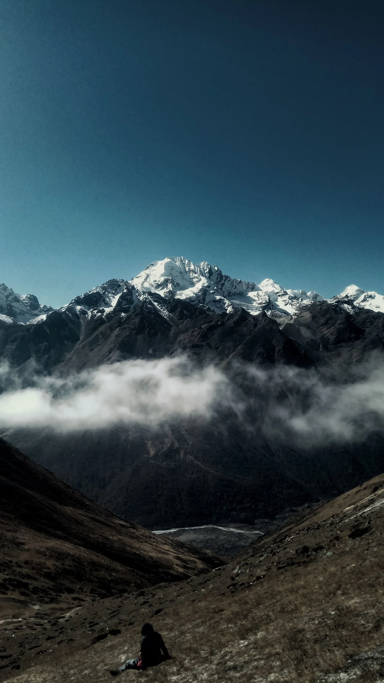
Kyanjin Gompa, Kyanjin Ri and Tserko Ri: Map Distinctions
Langtang Valley Trek map shows Kyanjin Gompa as the main destination village at 3,870 meters. Kyanjin Ri (4,773m) and Tserko Ri (4,984m) are separate viewpoint peaks reached by steep climbs from Kyanjin Gompa.
Many trekking maps confuse these three locations or fail to distinguish between them clearly. Understanding the difference is essential for planning your time in the upper valley and setting realistic expectations.
Kyanjin Gompa (3,870m) – The Destination
Kyanjin Gompa is the highest overnight point on the standard Langtang route. This alpine settlement sits at the head of the Langtang Valley, surrounded by mountains including Langtang Lirung (7,227m). The name comes from the Buddhist monastery (gompa) that stands here.
On the Langtang Trek map, Kyanjin Gompa appears as the final destination at the end of the valley. The settlement includes teahouses, a seasonal cheese factory, and the monastery. Most trekkers spend two nights here, using the full day in between for rest and optional side trips.
Kyanjin Ri (4,773m) – The Lower Viewpoint
Kyanjin Ri is a viewpoint peak reached by a steep climb from Kyanjin Gompa, gaining 903 meters of elevation. The round trip takes 3-4 hours.
The trail to Kyanjin Ri climbs steeply from behind Kyanjin Gompa, following a ridge line with several false summits. The final section is rocky and requires careful footing, but no technical climbing skills are needed.
From the summit of Kyanjin Ri, you can see the entire Langtang Valley stretching southward, the glacier system at the valley head, and the surrounding Himalayan peaks. The panorama makes the challenging climb worthwhile.
Tserko Ri (4,984m) – The Higher Viewpoint
Tserko Ri is the higher and more demanding viewpoint, requiring 6-8 hours round trip with 1,114 meters of elevation gain from Kyanjin Gompa.
Tserko Ri stands nearly 5,000 meters tall and provides a more complete mountain panorama than Kyanjin Ri. However, the climb is significantly more challenging. The trail approaches from the valley behind Kyanjin Gompa, following a longer but less steep route initially before the final steep ascent.
Reaching Tserko Ri requires:
-
Good acclimatization (at least 2 nights at Kyanjin Gompa)
-
Good weather conditions (the route is exposed)
-
Appropriate fitness level
-
Early start (4-5 AM departure recommended)
Merriment Treks guides assess client fitness and weather before recommending either viewpoint climb. Neither Kyanjin Ri nor Tserko Ri is mandatory—both are optional extensions of the standard trek.
Is Langtang Trek a Loop or Out-and-Back?
Langtang Trek is an out-and-back route, not a loop. You walk up the valley to Kyanjin Gompa and return along the same trail to Syabrubesi.
Looking at a Langtang Trek route map, this simple structure is immediately apparent. There’s no circular route, no alternate return path, and no trail junction requiring route-finding decisions. You follow the Langtang River northward, then turn around and walk back south.
Advantages of the out-and-back structure:
Familiarity on return: You’ll recognize the trail, know where the steep sections are, and have realistic expectations for each day’s walking.
Timing predictability: Your downhill pace will be faster than your uphill pace, making it easier to plan return-day logistics.
Accommodation flexibility: You can choose different villages for overnight stops on the return if you want to break up the descent differently.
No navigation stress: You cannot get lost on an out-and-back route that you’ve already walked once.
Disadvantages:
Repeat scenery: You’ll see the same landscapes twice, though downhill views differ from uphill views.
Return motivation: Some trekkers find the return journey less exciting than the approach.
Merriment Treks customizes return itineraries based on client preferences. Some trekkers prefer to descend quickly in 2 days, while others take 3 days to enjoy the forest sections at a relaxed pace.
How to Read a Langtang Trek Map: Practical Skills
Learning how to read a Langtang Trek map transforms a flat image into a three-dimensional mental model of the route. Key skills include understanding contour lines, identifying landmarks, and tracking elevation gain.
Most Langtang trekking maps are topographic maps showing elevation through contour lines. These lines connect points of equal elevation. When lines are close together, the terrain is steep. When they’re far apart, the terrain is flat or gently sloping.
Understanding Contour Lines on Langtang Maps
On a Langtang Trek map with elevation contours, you’ll notice:
Tight contour lines near river crossings: The trail descends steeply to suspension bridges and climbs steeply up the other side. These sections require more effort despite covering little horizontal distance.
Widely spaced contours in the upper valley: The approach to Kyanjin Gompa crosses a broad, flat valley floor. This section feels easier despite being at high altitude.
Closely spaced contours climbing to viewpoints: The trails to Kyanjin Ri and Tserko Ri show tight contour lines, indicating steep climbing.
Identifying Key Landmarks
When examining your Langtang Valley Trek route map, look for:
The Langtang River: The blue line running through the valley. The trail generally follows this watercourse, sometimes alongside it and sometimes above it.
Village locations: Marked with building symbols or place names. These are your potential stopping points.
Bridge crossings: Where the trail crosses the river. These are often marked with specific symbols.
Viewpoints: Peaks like Kyanjin Ri and Tserko Ri are marked with elevation data.
Glacier: Shown at the valley head near Kyanjin Gompa, indicating the source of the Langtang River.
Tracking Your Progress
Using your Langtang Trek map during the trek:
Identify current location: Match terrain features with map symbols—a bridge crossing, a village, a distinctive ridge line.
Look ahead: See what’s coming next—steep sections, river crossings, villages, or open terrain.
Estimate remaining distance: Use the map scale to calculate how far you still need to walk.
Monitor elevation gain: Check the contour lines to anticipate upcoming climbs or descents.
Merriment Treks guides teach basic map reading during the trek. Understanding the map enhances your experience and helps you feel more connected to the landscape you’re walking through.
Offline Maps, GPS and Navigation for Langtang Trek
Langtang Trek offline map options include several reliable apps that work without cellular service. GPS navigation is generally effective in the Langtang Valley, though the trail is well-defined enough that navigation is rarely challenging.
The Langtang trail is well-established and easy to follow in most conditions. However, offline maps provide confidence, help track progress, and serve as backup navigation if you become separated from your guide or lose the trail in poor visibility.
Recommended Offline Map Apps for Langtang
Maps.me: Free, downloadable offline maps with trail data. Works without cell service. Good for general navigation and location tracking on the Langtang route.
AllTrails: Offers downloadable trail maps with elevation profiles. Some Langtang routes are available as community-created tracks with helpful photos and reviews.
Gaia GPS: More advanced topographic maps with detailed contour lines. Subscription required for premium features, but the detail is excellent for understanding terrain.
Organic Maps: Open-source alternative to Maps.me with similar functionality. Lightweight and works well on older phones.
GPS Navigation on Langtang Trek
Langtang Trek GPS map functionality works well throughout the valley. The open valley provides good satellite visibility, and GPS signals are generally reliable even in the forest sections.
Important GPS considerations:
Battery management: Cold temperatures drain batteries faster. Carry a power bank and keep devices warm in your sleeping bag at night.
Offline downloads: Download maps before leaving Kathmandu. WiFi in the mountains is unreliable and often unavailable.
Multiple map sources: Download at least two different map apps in case one fails or has inaccurate data.
Paper backup: Carry a physical map as backup. Technology can fail, and a paper map never runs out of battery.
Merriment Treks provides clients with recommended offline map downloads before departure. We help ensure your devices are properly configured for the trek.
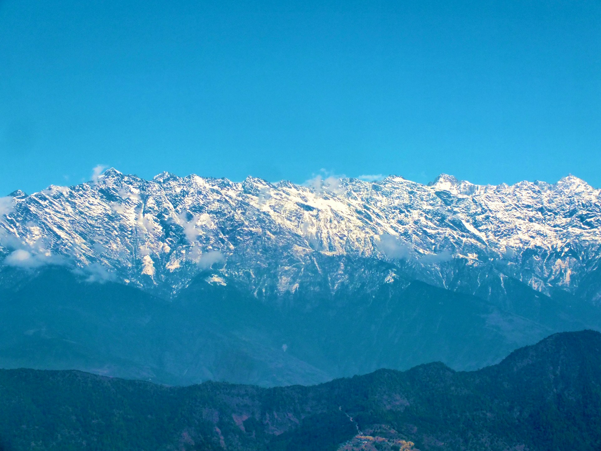
Langtang Trek Route Extensions: Beyond the Standard Map
Langtang Trek route extensions include the Gosaikunda Lakes crossing, the Tamang Heritage Trail combination, and the Helambu connection. These extensions significantly change the map and require additional planning.
The standard Langtang Valley Trek map shows only the main valley route. However, the broader Langtang region offers several extensions that can be combined with the standard trek to create longer, more diverse journeys.
Gosaikunda and Langtang Trek Map
Gosaikunda and Langtang Trek maps show a connecting route between the Langtang Valley and the sacred Gosaikunda Lakes. This combined trek typically takes 14-16 days.
The Gosaikunda extension involves crossing a high pass (Laurebina La at 4,610m) that connects the Langtang Valley with the Gosaikunda Lake area. This extension significantly increases the trek’s difficulty and requires additional acclimatization considerations.
Langtang National Park map boundaries include both the Langtang Valley and Gosaikunda areas, so no additional park permit is required for this combination. However, the route is fundamentally different from the standard Langtang trek and should be planned as a separate expedition.
Tamang Heritage Trail Connection
Tamang Heritage Trail and Langtang Trek maps show a cultural route through traditional Tamang villages that can be combined with the standard Langtang Valley route.
The Tamang Heritage Trail explores villages between Syabrubesi and the surrounding hills, offering cultural immersion before joining the main Langtang Valley route. This combination adds 3-4 days to the standard trek.
Helambu Extension
Langtang and Helambu trek maps show a route connecting the Langtang Valley with the Helambu region via Gosaikunda. This creates a longer loop rather than an out-and-back route.
The Helambu extension transforms the Langtang trek into a circuit, descending from Gosaikunda through the Helambu region to reach the Kathmandu Valley. This trek typically takes 18-21 days and requires significant additional planning.
Merriment Treks provides detailed route maps for all Langtang extensions. If you’re interested in combining the standard trek with additional routes, contact us for customized planning and current information.
Common Langtang Map Mistakes to Avoid
Common Langtang Trek map mistakes include confusing road distance with trekking distance, misunderstanding the out-and-back structure, and failing to distinguish between the main route and side trips.
Even experienced trekkers make map interpretation errors. Understanding these common mistakes helps you avoid them and plan more effectively.
Mistake 1: Including Road Distance in Trekking Distance
The road journey from Kathmandu to Syabrubesi is not part of the trekking distance. Some sources include this 7-8 hour road journey in total “Langtang distance” figures, creating confusion.
Langtang Trek map from Syabrubesi to Kyanjin Gompa shows only the walking route. The road journey is a separate consideration that affects your overall trip timeline but not your trekking distance.
Mistake 2: Expecting a Loop Route
Many trekkers assume the Langtang Trek is a loop because other Nepal treks like Annapurna Base Camp are out-and-back, while others like Manaslu Circuit are loops. Langtang is definitively an out-and-back route.
On the map, this means you’ll see the same trail twice—once going up and once coming down. Understanding this before you book prevents disappointment and helps you plan return-day logistics.
Mistake 3: Confusing Main Route with Side Trips
Kyanjin Ri and Tserko Ri are optional side trips, not part of the main Langtang Valley Trek route. Some maps show these viewpoints prominently, leading trekkers to believe they’re mandatory stopping points.
The main route ends at Kyanjin Gompa. The viewpoints are additional challenges you can choose to attempt based on your fitness, acclimatization, and weather conditions.
Mistake 4: Underestimating Elevation Gain
Langtang Trek distance measurements can be misleading without elevation context. A 10-kilometer day with 800 meters of climbing feels very different from a 10-kilometer day that’s relatively flat.
Always consider both distance and elevation gain when planning your Langtang trek. Merriment Treks provides elevation profiles for every section of the route.
Mistake 5: Ignoring the Return Journey
Some trekkers focus entirely on the approach to Kyanjin Gompa and forget that they must walk back. The return journey adds another 30+ kilometers of trekking.
Plan your itinerary to include sufficient time and energy for the descent. Many trekkers find the return harder than expected because they’ve already expended energy on the approach.
Langtang Valley Trek Map FAQs
1. What does the Langtang Valley Trek map show?
The Langtang Valley Trek map shows the route from Syabrubesi (1,550m) to Kyanjin Gompa (3,870m), including all intermediate villages, elevation changes, river crossings, and optional side trips to Kyanjin Ri and Tserko Ri.
2. Where does the Langtang Trek start?
The Langtang Trek starts at Syabrubesi (1,550m), reached by a 7-8 hour road journey from Kathmandu through Dhunche.
3. Where does the Langtang Trek end?
The Langtang Trek ends at Kyanjin Gompa (3,870m), the highest overnight point on the standard route. You return to Syabrubesi along the same trail.
4. Is the Langtang Trek a loop?
No, the Langtang Trek is an out-and-back route. You walk up the valley to Kyanjin Gompa and return along the same trail.
5. How long is the Langtang Valley Trek?
The standard Langtang Valley Trek takes 7-10 days from Kathmandu, including transportation days. The trekking distance is approximately 65-70 kilometers round trip.
6. How far is Kyanjin Gompa from Syabrubesi?
Kyanjin Gompa is approximately 32-35 kilometers from Syabrubesi one way. The total round-trip distance is 65-70 kilometers.
7. What is the highest point on the Langtang Trek?
The highest point on the standard Langtang Trek is Kyanjin Gompa at 3,870 meters. If you choose the Tserko Ri side trip, the highest point is 4,984 meters.
8. How high is Kyanjin Gompa?
Kyanjin Gompa is at 3,870 meters elevation, making it the highest overnight point on the standard Langtang Valley Trek.
9. How high is Kyanjin Ri?
Kyanjin Ri is at 4,773 meters elevation, a gain of 903 meters from Kyanjin Gompa. The round-trip climb takes 3-4 hours.
10. How high is Tserko Ri?
Tserko Ri is at 4,984 meters elevation, a gain of 1,114 meters from Kyanjin Gompa. The round-trip climb takes 6-8 hours.
11. Which villages are on the Langtang route?
The main villages on the Langtang route are Syabrubesi, Lama Hotel, Bamboo, Ghoda Tabela, Thangsyap, Langtang Village, Mundu, and Kyanjin Gompa.
12. Can I combine Langtang with Gosaikunda?
Yes, Langtang can be combined with Gosaikunda Lakes via the Laurebina La pass (4,610m). This combined trek typically takes 14-16 days.
13. Is the Langtang trail easy to navigate?
Yes, the Langtang trail is well-defined and easy to follow. It’s an out-and-back route following the Langtang River, making navigation straightforward compared to circuit treks.
14. Can I use an offline map for Langtang Trek?
Yes, offline maps work well for Langtang Trek. Apps like Maps.me, AllTrails, and Gaia GPS provide downloadable maps that work without cellular service.
15. Do I need a guide for Langtang Trek?
Yes, since April 2023, all foreign trekkers require a licensed guide for the Langtang Valley Trek. Merriment Treks provides licensed guides for all treks.
Final Takeaway: Your Langtang Trek Map Understanding
Langtang Valley Trek map reveals a straightforward out-and-back route through one of Nepal’s most accessible high-altitude valleys. The route from Syabrubesi to Kyanjin Gompa covers 32-35 kilometers one way with 2,300 meters of elevation gain.
Understanding the map before you begin transforms the trek from an abstract plan into a concrete journey. You’ll know which villages to expect, where the challenging climbs occur, and how the landscape changes as you gain elevation.
Key points to remember:
-
The route follows the Langtang River northward from Syabrubesi
-
Major stops include Lama Hotel, Ghoda Tabela, Langtang Village, and Kyanjin Gompa
-
The trek is an out-and-back route, not a loop
-
Kyanjin Ri and Tserko Ri are optional viewpoints, not mandatory destinations
-
Offline maps and GPS work well, but the trail is easy to follow
-
Route extensions to Gosaikunda and Tamang Heritage are possible but require additional planning
Merriment Treks provides detailed Langtang Valley Trek maps, elevation profiles, and route guidance to all clients. Our licensed guides know the route intimately and can help you understand each section’s terrain, difficulty, and scenic highlights.
Contact Merriment Treks for current Langtang Valley Trek map resources, customized itineraries, and complete trekking packages. We’re happy to answer questions about the route, distances, elevations, and any other planning considerations.