Introduction to Syabrubesi
Syabrubesi, the Tamang town in Rasuwa that has long been the roadhead for the Langtang Valley, Gosaikunda and Tamang Heritage Trail treks, was badly damaged by a sudden flood on 26 August 2026. If you are searching for it now, you probably want to know three things: what happened, whether you can still trek from there and what to do instead. This guide answers those questions with dates, explains how the Langtang region is being reached today and helps you plan a trip that does not depend on a printed itinerary that may no longer run.
Syabrubesi Right Now: The Short Answer
The town was one of the worst-hit places in the 26 August flood, and the road that served it was heavily damaged. Reports since then are mixed and have changed week by week, so treat any single statement as a snapshot, not a promise.
- The trail above the town is largely intact. Operators and the Trekking Agencies’ Association of Nepal reported that the Langtang valley itself was not destroyed, and the damage was concentrated at the road gateway.
- The classic trailhead is not the same. Many operators now start and end Langtang treks at Thulo Syabru or reach the valley from Dhunche via Thulo Bharkhu, Brabal and Thulo Syabru, avoiding the damaged town.
- Reopening was reported in late October. Onlinekhabar reported on 29 October 2026 that the Langtang Valley trekking route had reopened using alternative trails.
- Information conflicts. Reports on whether the road to the old trailhead works, and whether lodges are open there, differ between sources.
The practical advice is simple: do not book a trek that starts at the old trailhead without written confirmation from your operator, and reconfirm road and lodge conditions two to three weeks before you travel.
What Syabrubesi Is and Why Trekkers Go There
The town sits on the Bhote Koshi river in Rasuwa district, north of Kathmandu and close to the Tibet border. It lies at roughly 1,460 to 1,550 metres depending on the source, which is far lower than the high Langtang valley above it. It is also the entrance to Langtang National Park, and park and TIMS checks have traditionally taken place at Dhunche and at the trailhead.
For decades it worked as a simple, practical base: a place to arrive after a long drive, sleep in a lodge, eat dal bhat and start walking the next morning. Several major routes began here, including the Langtang Valley trek, the Gosaikunda trek and the Tamang Heritage Trail. In peak seasons it was one of the busiest trekking gateways in Nepal, with large numbers of trekkers passing through each day.
That role is why the flood mattered so much. The town was not only a place with homes and businesses. It was the bottleneck through which almost every Langtang-area trek passed. For background on the protected area itself, our guide to Langtang National Park covers its geography, wildlife and trekking routes.
What Happened on 26 August 2026
On Wednesday, 26 August 2026, a sudden flood struck Rasuwa district and damaged settlements and market areas, including the trailhead town. The Kathmandu Post reported that the government mobilised the army, armed police and police, with medical teams, the Nepal Scouts, the Red Cross and helicopters on standby, while downstream residents were moved to safer ground. You can read that report on the Kathmandu Post coverage of the Rasuwa flood.
The damage was not limited to the town. Reports described a stretch of road between Nuwakot and the Chinese border washing away, with the Trishuli and Bhote Koshi rivers eroding road sections and a landslide blocking the Pasang Lhamu Highway at one point. Satellite mapping cited by one trekking publication counted hundreds of affected buildings, several destroyed bridges and about nine and a half kilometres of primary road lost across the town and nearby Timure. Treat those figures as indicative, since they come from a secondary source.
The area had already been hit in July 2025, when a flood destroyed the Miteri Bridge and severely damaged the road toward Rasuwagadhi and nearby customs facilities. The 2026 flood was far more serious for trekkers because it cut the main approach to Langtang.
The human cost is the most important part. The affected communities are largely Tamang families whose homes, lodges and livelihoods depended on trekking. That is worth remembering when you plan your trip.
What Is Open Now? A Dated Timeline
Because the situation moved quickly, the safest way to understand it is as a timeline of what different sources reported. These are not guarantees of today’s conditions.
| Date | What was reported |
|---|---|
| 26 August 2026 | Flood and landslides block the road; one operator pauses all Langtang departures and reports that the upper valley villages were undamaged. |
| 4 September 2026 | The Trekking Agencies’ Association of Nepal lists the Langtang and Kyanjin valleys and Gosaikunda as safe but says the road through Dhunche to the old trailhead remains closed. |
| Mid to late September 2026 | Operators begin using Thulo Syabru by 4WD jeep as the start and end point; the road to the old trailhead still has no reopening date. |
| 2 October 2026 | A temporary track opens on the Galchhi to Betrawati section of the road, according to one operator. |
| 15 October 2026 | One operator reports the road to Dhunche and the old trailhead open again, but says no hotels are running in the town. |
| 29 October 2026 | Onlinekhabar reports that the Langtang Valley route has reopened via alternative trails from Dhunche through Thulo Bharkhu, Brabal and Thulo Syaphru. |
Read the table carefully. It shows that “open” can mean different things: the valley trail, the road to Dhunche, the road to the old trailhead and lodges in the town are all separate questions. A trek can be possible while the town itself is not a practical place to stay.
You can read the local report on the reopening on Onlinekhabar’s Langtang Valley reopening story, which quotes a local rural municipality chair saying alternative routes were made safe and that teahouses and hotels were ready to welcome tourists.
How to Read Conflicting Trek Updates
After a disaster, information spreads faster than it can be checked, and operators have their own reasons to sound reassuring or cautious. A few habits help you separate useful updates from noise.
- Check the date first. A page written in September may be wrong by November. If an update has no date, treat it as unreliable.
- Look at what exactly is being described. “The trek is open” can refer to the valley trail, a road, a start point or a single lodge.
- Prefer local and official voices. Local officials, the national trekking association and local news outlets are closer to the ground than a booking page.
- Notice who benefits. A company selling a trek has an interest in saying it is open, while an operator that is paused may be cautious for good reasons.
- Ask for written, specific answers. A named start point, a named lodge and a named backup plan are much more useful than “everything is fine”.
What to Do If You Have Already Booked a Trek From the Old Trailhead
If you paid a deposit before the flood, or booked a package that still lists the old start point, you are not stuck, but you should act early. Contact your operator and ask for the current plan in writing, including the new start and end points, the driving or walking time, the lodges and any change in price or days.
Ask what your options are if you are not comfortable with the new plan. Reasonable operators offer a change of dates, a switch to another region or a refund or credit, and the terms should be clear before you decide. Check your travel insurance too, because some policies treat natural disasters and road closures differently.
If you have flexible dates, waiting for conditions to settle may be the least stressful choice. If your dates are fixed, switching to a region the flood did not touch is often easier than adapting a route that is still being rebuilt.
How a Langtang Trek Works Without the Old Trailhead
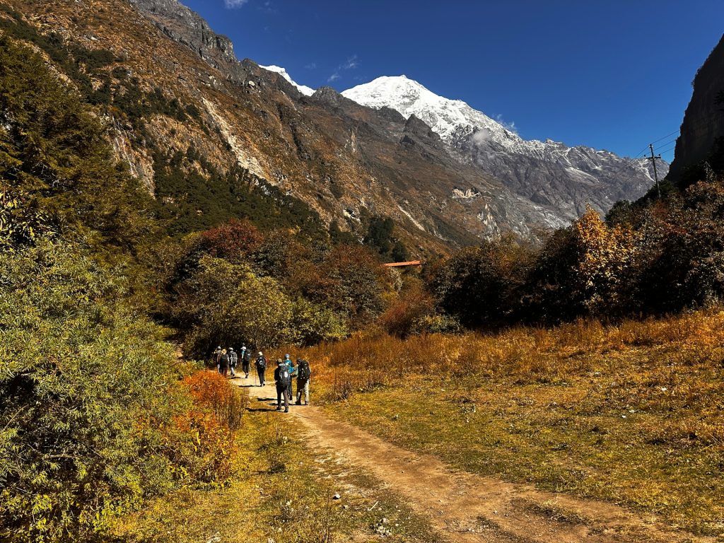
Until the flood, a standard Langtang Valley trek began with a seven- to eight-hour drive from Kathmandu to the roadhead, followed by a first day of about six to seven hours of walking to Lama Hotel. After the flood, the pattern changed.
The common workaround is to drive to Dhunche or to Thulo Syabru by 4WD jeep and rejoin the Langtang trail higher up, reaching Bamboo, Lama Hotel and Langtang village from there. Operators also describe a longer approach on foot from Sundarijal over Helambu and Gosaikunda. Routes, timings and lodges vary by operator, so ask for a written itinerary and the exact start and end points.
If you have not planned a Langtang trek before, our Langtang Valley trek guide explains the route, difficulty and costs. Our Langtang Valley trek itinerary shows the standard day-by-day pattern. Because those pages describe the classic route, use them to understand the valley and then ask your operator how the start has been adjusted.
Expect two practical differences. Your first and last days may be different, and your driving or walking time to the valley may change. Both can alter total cost and days, so confirm them before you pay a deposit.
A Sample Post-Flood Itinerary Outline
Every operator builds this differently, so treat the outline below as a way to understand the shape of a trip, not as a booking. It follows the alternative route reported by Onlinekhabar and several operators.
- Kathmandu to Dhunche or Thulo Syabru. A long drive by road or 4WD jeep, depending on conditions, with an overnight in the first confirmed lodge.
- Thulo Syabru to the main Langtang trail. Walk via Thulo Bharkhu and Brabal to rejoin the valley route, then continue toward Bamboo and Lama Hotel.
- Lama Hotel to Langtang village. A gradual climb through forest into the open valley.
- Langtang village to Kyanjin Gompa. The final stretch to the monastery, where most itineraries spend an acclimatisation day.
- Return by the same or a similar route. Descend through the valley and retrace the alternative approach, with a spare day built in for delays.
Ask your operator how many days this takes compared with the classic itinerary, and what the plan is if the road or a section of trail is closed on the day.
Does the Changed Route Change the Cost?
Possibly, and it is worth asking before you pay. A different start point can change the driving distance, the type of vehicle needed, the number of nights and the price of lodging. Four-wheel-drive jeeps on rough roads usually cost more than a standard bus seat, and an extra day of walking or a spare day for delays adds guide, porter and food costs.
Compare quotes on what is actually included: transport, permits, meals, lodging, guide and porter, and any extra night. A low price that leaves out the jeep or the spare day can end up costing more. Ask each operator to list the cost of each element, so you can compare like with like. Our Langtang Valley trek permits guide helps you check the permit part of the budget.
Kathmandu to Syabrubesi: The Old Road and Why It Matters
The traditional approach was about 117 to 122 kilometres by road, and it typically took seven to eight hours by bus or jeep, depending on traffic and road conditions. Common routes ran via Trishuli Bazaar, Betrawati and Dhunche, on the Pasang Lhamu Highway, which crosses steep, geologically unstable terrain.
Public buses left from Kathmandu’s bus parks, and many trekkers preferred a private or shared jeep, which can stop for photos and is usually quicker. That road is why Langtang became such an accessible trek: you could leave Kathmandu in the morning and sleep at the trailhead that night.
It is also why the flood had such an outsized effect. Without the road, the trail itself was almost beside the point, because nobody could reach it. This is a useful lesson for any trek that depends on a single road: ask what the plan is if the road is blocked, and build spare days into your trip.
Why Mountain Roads Fail, and What It Means for You
The road to Rasuwa follows river valleys through steep terrain, and that combination is vulnerable. Rivers such as the Trishuli and Bhote Koshi swell quickly in the monsoon, landslides drop onto narrow sections, and bridges and road edges can be undercut. The 2025 flood and the 2026 flood both showed how fast that can happen.
For trekkers, the lesson is practical. Roads in the hills are not guaranteed, even in good seasons, so treat the drive as part of the trek, not a formality. Travel in daylight, avoid the monsoon, listen to your driver and guide about conditions and accept delays calmly. If your schedule has no slack, a closed road becomes a crisis. If it has a spare day or two, it is just a story.
Treks That Started From the Trailhead Town
Langtang Valley Trek
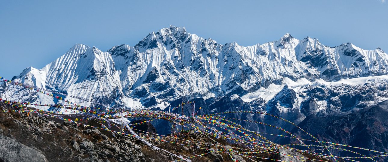
This is the most popular route. It follows the Langtang Khola through forest and villages such as Bamboo and Lama Hotel to Langtang village and Kyanjin Gompa, with views of Langtang Lirung and surrounding peaks. Typical itineraries run seven to ten days. Our guide to Kyanjin Gompa in Langtang describes the monastery, the surrounding viewpoints and what the upper valley is like.
Gosaikunda Trek
The Gosaikunda trek climbs through Thulo Syabru to a sacred alpine lake system. It is often combined with Langtang or Helambu. After the flood, operators highlighted the Gosaikunda and Sundarijal approach as a way to reach the region on foot while avoiding the damaged town. Read our Gosaikunda Lake guide for the route, altitude and season.
Tamang Heritage Trail
This cultural route visits Tamang villages such as Gatlang, at about 2,238 metres, and has traditionally started from the same trailhead. After the flood, operators reported that it was not possible for a time because parts of the route and the access road were affected. If it interests you, ask directly whether your operator can run it on your dates and what condition the trail is in.
The People Behind the Trailhead
It is easy to think of a trailhead as a transport stop, but this one is a living community. The town is a Tamang village on the river, with homes, shops, schools and lodges, and many of the families who run teahouses higher up the valley have connections to it. When the flood hit, it was a disaster for the people who live there before it was a problem for trekkers.
That context changes how a visit feels. Greet people warmly, ask before taking photographs, respect prayer flags and religious sites, and understand that some locals may still be recovering. If you visit, spending money locally is one of the most direct ways to help.
Altitude on the Langtang Route
The Langtang trek climbs from a low trailhead to a high valley, so altitude still matters even though the route is often described as moderate. Lama Hotel sits at roughly 2,450 to 2,470 metres, and the upper valley around Kyanjin Gompa is well above 3,000 metres, high enough that altitude illness is a real possibility if you climb too quickly.
The usual rules apply. Increase your sleeping altitude gradually, include an acclimatisation day in the upper valley, drink water, walk slowly and tell your guide about headaches, nausea or dizziness. Never climb higher to sleep with worsening symptoms. If the alternative start changes your first days, ask how the itinerary protects acclimatisation, because a shorter or faster plan can raise risk.
If Rasuwa Does Not Fit Your Dates
The flood was localised. Operators reported that the Everest, Annapurna and Manaslu regions were not affected by the Rasuwa event, though Manaslu had its own disruption and reopened on a temporary bridge on 9 September, according to one operator. For a November or spring trip, popular alternatives include Everest Base Camp, Annapurna Base Camp, Poon Hill and Mardi Himal.
If your heart is set on Langtang, the better choice may be to wait a season, or to choose an operator that is transparent about conditions and flexible about changes. Both options are better than forcing a trek into a route that is still recovering.
Permits and Rules for the Langtang Region
Langtang is not a restricted area, so you do not need a special restricted-area permit. The usual requirements are a Langtang National Park entry permit and a TIMS card. One recent operator guide listed about NPR 3,000 for the park permit and NPR 2,000 for TIMS for foreigners, with a Shivapuri-Nagarjun fee added if you finish via Sundarijal. Fees and TIMS rules change, so confirm them before you travel.
On guides, the UK government’s current advice says foreign independent trekkers must use a local guide or porter in national parks and protected areas, and it warns against trekking alone. You can read the advice on the UK government Nepal safety and security page. Other sources describe enforcement differently, so confirm the current position with a registered agency. After a disaster, a local guide who knows the changed route is especially valuable.
Best Season to Visit the Region
Spring (March to May) and autumn (about late September to November) are the main trekking seasons, with clearer skies and more stable weather. The flood happened in the monsoon, which runs roughly June to October according to the UK government and brings flooding, landslides and disrupted roads. That is a strong reason to avoid the monsoon for this region.
Recovery also affects timing. Roads and trails that were repaired in autumn can be sensitive to rain, so ask your operator how the route has been rebuilt and how it will be monitored. A trip in spring 2027 may feel more settled than one in the first months after the disaster, but that depends on repair progress, which you should confirm closer to the time.
Lodging, Food and Supporting Local People
Before the flood, the trailhead town offered simple lodges and restaurants that mostly served trekkers. One operator reported in mid-October that no hotels were running there, so you should not assume you can book a room. Ask your operator where you will sleep on the first and last night, and whether the lodge is confirmed.
Higher up the valley, teahouses in places like Lama Hotel, Langtang village and Kyanjin Gompa were reported undamaged, and local officials said lodges were ready to welcome visitors. Rooms are basic, meals are simple, and the staple is dal bhat. Carry cash in rupees, because cards and ATMs are unreliable outside towns.
Responsible travel matters here. The local rural municipality chair told Onlinekhabar that the arrival of trekkers would be crucial to reviving the local economy and supporting the disaster-affected Tamang community. If you do travel, use local lodges, hire local guides and porters, pay fairly and buy from local businesses. Visiting thoughtfully can help recovery, while visiting carelessly can add pressure to a fragile area.
Planning a Flood-Aware Trip
The best preparation is flexibility. A few habits will protect your plans and your money.
- Reconfirm before you travel. Ask your operator for current road and trail conditions two to three weeks before departure, and again a few days before.
- Get the itinerary in writing. It should name the start and end points, driving or walking times and where you sleep each night.
- Build spare days. Roads in this region can close with little warning, and a spare day can save a connecting flight.
- Check your insurance. Make sure it covers trekking, helicopter evacuation and disruption.
- Understand the refund terms. Ask what happens if the route closes or the start point changes.
- Keep a backup plan. Know which other region you could switch to.
The UK government also advises checking weather and road conditions, and it notes that landslides and flooding are a hazard in the monsoon. Following local advice and the instructions of your guide is more important than sticking to a schedule.
Safety, Insurance and Emergency Numbers
Beyond altitude and roads, the main safety measures are the boring ones: a licensed guide, good insurance and a plan for emergencies. The UK government advises making sure your policy covers mountain rescue and helicopter costs, and it notes that mobile coverage can be limited in remote areas, so tell someone your route and expected dates.
Save the main emergency numbers in your phone before you leave: police 100, tourist police 1144, fire 101 and ambulance 102. Your operator should also give you a direct contact and an explanation of what happens if someone becomes ill or a road closes. After a disaster, that clarity is a sign of a well-run trip.
Packing for Langtang After the Flood
Your packing list is much the same as before, with a few additions. Bring sturdy, broken-in boots, warm layers, a waterproof jacket, a headlamp, sun protection and a first-aid kit. Add a dry bag for the possibility of rain, spare socks and a small amount of extra cash in case you need to adjust plans.
Because lodges and facilities may be limited in places, carry a few snacks, a water bottle with purification tablets and a power bank. A standard teahouse trekking list, adapted for cold mornings and changeable weather, covers everything else.
Questions to Ask an Operator Before You Book
A reliable operator should answer these clearly and in writing.
- Where does the trek start and end now, and how do we get there?
- Is the road you plan to use open, and what is the backup if it closes?
- Where do we sleep on the first and last nights?
- Which villages and lodges on the route are confirmed open?
- How has the trail been repaired or rerouted, and who has walked it recently?
- What is the cancellation and refund policy if conditions change?
- Are guides and porters local, licensed and insured?
- How many spare days are built into the itinerary?
Clear, specific answers are a good sign. Vague promises, pressure to pay immediately or claims that nothing has changed are reasons to compare other operators.
Common Mistakes When Planning Around the Flood
- Using old guides without checking dates. Many articles still describe the old road and trailhead as if nothing had happened.
- Assuming the trail is closed. The valley trail was reported largely intact, and the problem was access.
- Assuming everything is normal. Access, lodges and start points have changed, and conditions differ by source.
- Skipping spare days. A road closure or landslide can easily eat a day.
- Booking on price alone. The cheapest option may cut corners on logistics or safety.
- Ignoring the monsoon. The flood is a reminder of why July to September is a poor time for this region.
Frequently Asked Questions About Syabrubesi
1. What is Syabrubesi?
It is a Tamang town on the Bhote Koshi river in Rasuwa district, northern Nepal, near the Tibet border. It has long been the roadhead for the Langtang Valley, Gosaikunda and Tamang Heritage Trail treks.
2. What happened to the town in August 2026?
A sudden flood struck Rasuwa on 26 August 2026 and damaged settlements and market areas, including the trailhead town, along with roads and bridges in the area. The government launched a major rescue and relief effort.
3. Is Syabrubesi open to trekkers now?
Reports conflict. Some operators say the town is still heavily damaged and not usable as a start point, while others report the road reopening and trekkers using alternative starts. Ask your operator for current written confirmation.
4. Can I still trek in Langtang?
Yes, according to reports. The valley trail above the town was described as largely intact, and Onlinekhabar reported on 29 October 2026 that the route had reopened using alternative trails. Confirm conditions before you book.
5. Where do Langtang treks start now?
Many operators start and end at Thulo Syabru, or reach the valley from Dhunche via Thulo Bharkhu, Brabal and Thulo Syaphru. Some use a longer approach on foot from Sundarijal. Routes vary by operator.
6. How far is it from Kathmandu?
The traditional road distance was about 117 to 122 kilometres, and the drive typically took seven to eight hours. Current road conditions can change that, so confirm with your operator.
7. What permits do I need for Langtang?
Langtang is not a restricted area. You normally need a Langtang National Park permit and a TIMS card, with one recent guide quoting NPR 3,000 and NPR 2,000. Fees and rules change, so confirm them before you travel.
8. When is the best time to go?
Spring (March to May) and autumn (about late September to November) are the best seasons. The monsoon is generally avoided, and the August flood is a reminder of the risks of flooding and landslides.
9. Is the trek safe after the flood?
Operators reported the upper valley as safe, but the risks are in access, road conditions and weather. Use a licensed guide, check insurance, build in spare days and follow local advice.
10. How can I support the local community?
Travel with a reputable operator, stay in local lodges, hire local guides and porters, pay fairly and buy from local businesses. Local officials have said that returning trekkers are important for the recovery of the Tamang community.
Plan Your Langtang Trip With Merriment
The situation around Syabrubesi is still developing, and the right answer depends on your dates, your flexibility and the latest conditions. That is why a clear plan with an operator who tells you the truth matters more than ever.
The Merriment team can talk you through the current options for Langtang, Gosaikunda and alternative regions, explain how the start and end points have changed and help you choose dates and a route that suit you. Tell us when you want to travel, how many people are coming and what experience you have, and ask for a quote.
Enquire on WhatsApp: +977 974-0262168
Message us today and start planning a trek that fits the situation on the ground.