Langtang National Park: What You Need to Know
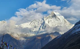
Langtang National Park is Nepal’s first Himalayan national park, established in 1976. It covers 1,710 square kilometers across the Rasuwa, Nuwakot, and Sindhupalchok districts, with elevations ranging from 1,000 meters to 7,245 meters at the summit of Langtang Lirung.
If you’re researching Langtang National Park, you’re likely considering a trek through one of Nepal’s most accessible high-altitude regions. The park sits just 80 kilometers north of Kathmandu, making it significantly easier to reach than Everest or Annapurna regions. This accessibility, combined with remarkable ecological diversity and cultural significance, makes Langtang National Park a compelling destination for trekkers seeking authentic Himalayan experiences without extreme logistical complexity.
Langtang National Park location places it directly south of the Tibetan border, encompassing the entire Langtang Valley and the sacred Gosainkunda Lake area. The park’s proximity to Kathmandu means trekkers can reach the trailhead in a single day of road travel, then begin walking the following morning.
Merriment Treks has been guiding trekkers through Langtang National Park for years. We understand the park’s rhythms, its challenges, and what makes it genuinely special. This guide provides current 2026 information to help you plan your visit with confidence.

| Quick Facts | Details |
|---|---|
| Established | 1976 (Nepal’s first Himalayan national park) |
| Core Area | 1,710 km² |
| Buffer Zone | 420 km² |
| Elevation Range | 1,000m – 7,245m |
| Highest Peak | Langtang Lirung (7,227m) |
| Districts | Rasuwa, Nuwakot, Sindhupalchok |
| Headquarters | Dhunche, Rasuwa District |
| Distance from Kathmandu | ~80 km north |
| Key Wildlife | Red panda, snow leopard, Himalayan tahr |
| Bird Species | 250+ recorded |
| Major Sites | Langtang Valley, Gosainkunda Lake, Kyanjin Gompa |
Langtang National Park Location: Geography and Access
Langtang National Park is located in north-central Nepal, approximately 80 kilometers north of Kathmandu, bordering the Tibet Autonomous Region of China. The park spans parts of three districts: Rasuwa (the majority), Nuwakot, and Sindhupalchok.
The park’s geographic position makes it one of Nepal’s most accessible high-altitude protected areas. The primary trailhead at Syabrubesi is reached by a 7-8 hour road journey from Kathmandu. This is significantly shorter than the journeys required to reach Everest Base Camp trailheads (Lukla flight or days of road travel) or Annapurna trailheads (Pokhara plus additional transport).
Langtang National Park map reveals a park oriented along a north-south axis, following the Langtang River valley. The southern boundary begins near Dhunche at approximately 1,000 meters elevation. From there, the park extends northward through the Langtang Valley to the high peaks of the Langtang Himal range. The eastern boundary includes the Gosainkunda Lake area, while the western boundary follows ridgelines separating the Langtang and Ganesh Himal ranges.
Understanding this geography helps explain the park’s ecological diversity. Within a relatively compact area, visitors experience subtropical forests, temperate woodlands, alpine meadows, and glacial terrain—a compression of ecosystems that makes Langtang particularly rewarding for naturalists and photographers.
The Langtang River flows southward through the park, providing water for the entire valley system and eventually joining the Trisuli River. This river system supports both wildlife and human communities throughout the region.
Langtang National Park History: Establishment and Recovery
Langtang National Park was established in 1976 as Nepal’s first Himalayan national park. The park was created to protect the unique ecosystems of the Langtang Valley and surrounding areas, including the sacred Gosainkunda Lake.
The park’s establishment represented a significant milestone in Nepal’s conservation history. Unlike Chitwan National Park (established 1973) which focused on lowland wildlife and tiger habitat, Langtang was the first protected area specifically designed to preserve high-altitude ecosystems and their associated species.
The Tamang people have inhabited the Langtang region for centuries. Their cultural heritage is deeply intertwined with the landscape. Traditional Tamang villages, Buddhist monasteries, and agricultural practices form an integral part of the park’s character. The park’s creation recognized the importance of balancing conservation with the needs of local communities, establishing a buffer zone where traditional activities continue.
The 2015 Earthquake and Ongoing Recovery
The April 25, 2015 earthquake profoundly affected Langtang National Park. A massive avalanche triggered by the earthquake buried Langtang Village, killing hundreds of residents and trekkers. The village was completely destroyed, and the surrounding landscape was significantly altered.
The earthquake also damaged trails, bridges, and teahouses throughout the park. Landslide scars remain visible on surrounding slopes, serving as permanent reminders of the disaster. However, significant reconstruction has occurred in the years since.
By 2026, most trekking routes are fully operational. Trails have been rebuilt, new teahouses constructed, and infrastructure upgraded. Communication networks have improved, with mobile coverage now available in many sections of the valley that previously had no connectivity.
The rebuilt Langtang Village stands as a testament to community resilience. While the original village site remains as a memorial, a new settlement has been established nearby, providing accommodation for trekkers and homes for returning residents. Staying in Langtang Village supports the community’s ongoing recovery and provides important cultural context for the trek.
Understanding this history adds depth to any visit. The Langtang Valley you see today is not the valley that existed before 2015. It is a landscape of recovery, resilience, and ongoing adaptation—a place where natural beauty and human determination intersect.
Langtang National Park Geography: Ecosystems and Terrain
Langtang National Park spans an extraordinary elevation range from approximately 1,000 meters to 7,245 meters at the summit of Langtang Lirung. This elevation gradient creates multiple distinct ecosystems, from subtropical forests to high alpine tundra and permanent ice.
The park’s geography is defined by the Langtang Valley, a north-south oriented valley carved by the Langtang River. The valley provides a natural corridor through multiple vegetation zones, allowing visitors to experience dramatic ecological transitions over relatively short distances.
Elevation Zones and Vegetation
Subtropical Zone (1,000m – 2,000m): The lowest elevations of the park feature subtropical vegetation including sal forest, various fig species, and bamboo. This zone is most accessible near the park’s southern boundary and provides habitat for rhesus macaque, wild boar, and numerous bird species. Most trekkers pass through this zone quickly, as the trailhead at Syabrubesi sits near the upper boundary of this range.
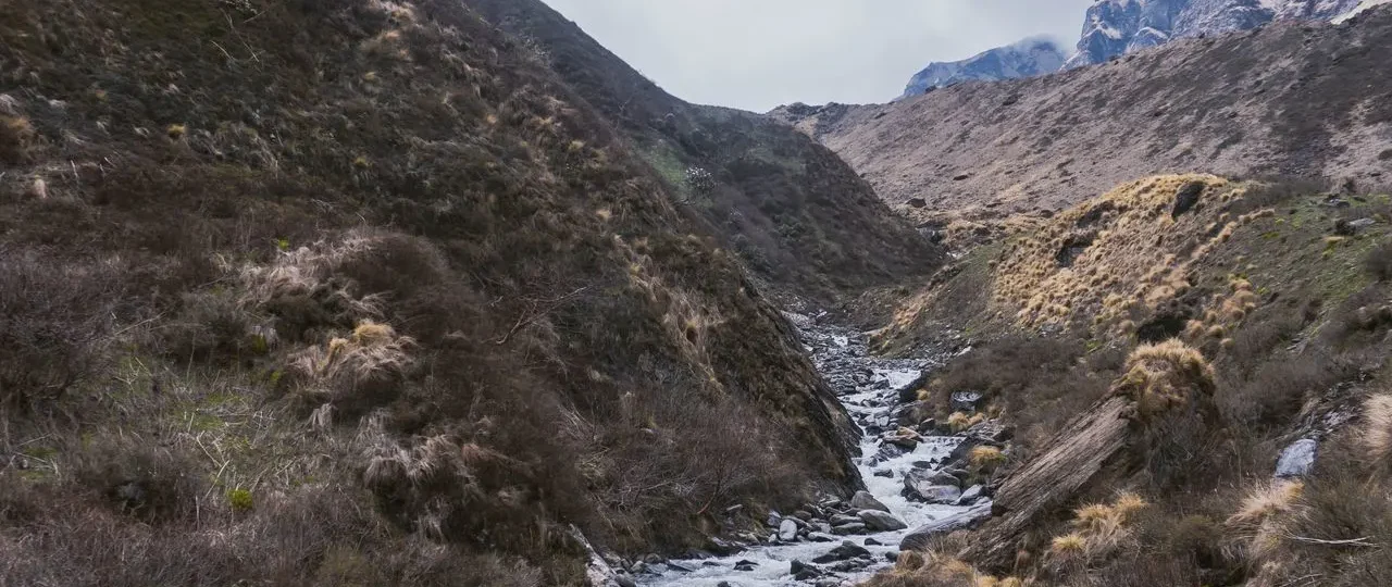
Temperate Forest Zone (2,000m – 3,000m): The temperate zone features oak, rhododendron, and pine forests. This is the zone most trekkers encounter during their first days of walking. Spring brings spectacular rhododendron blooms, with red, pink, and white flowers transforming the forest. The trail through this zone often follows the Langtang River, crossing suspension bridges and winding through dense vegetation.
Subalpine Zone (3,000m – 4,000m): Above the temperate forests, the subalpine zone features fir, birch, and juniper. The forest thins, and meadows begin to appear. This zone includes the areas around Langtang Village and Kyanjin Gompa. Views open up significantly, revealing surrounding peaks and the glacier at the valley head.
Alpine Zone (4,000m – 5,000m): The alpine zone is characterized by low-growing vegetation, alpine grasses, and hardy shrubs. This is the zone above Kyanjin Gompa, including the slopes of Kyanjin Ri and Tserko Ri. The landscape becomes rocky and exposed, with panoramic views in all directions.
Glacial Zone (Above 5,000m): The highest elevations feature permanent ice, snow, and bare rock. The glaciers that feed the Langtang River are visible from Kyanjin Gompa and higher viewpoints. This zone is not part of standard trekking routes but provides the dramatic backdrop that defines the upper valley’s character.
Glaciers and Water Systems
The Langtang Glacier system feeds the Langtang River, which flows southward through the park. The glacier is visible from Kyanjin Gompa and the surrounding viewpoints, providing a dramatic backdrop to the upper valley. The glacier has been retreating in recent decades, a visible indicator of climate change impacts in the region.
Gosainkunda Lake holds profound religious significance for both Hindus and Buddhists. Located in the eastern section of the park at 4,380 meters, this sacred lake attracts pilgrims during the Janai Purnima festival each August. According to Hindu tradition, the lake was created when Lord Shiva thrust his trident into the mountain to obtain water.
The park contains over 70 glaciers and numerous glacial lakes, contributing to its importance as a water source for the entire Langtang and Trisuli river systems.

Langtang National Park Wildlife: Species and Viewing Expectations
Langtang National Park wildlife includes several iconic Himalayan species: red panda, snow leopard, Himalayan black bear, Himalayan tahr, musk deer, and over 250 bird species. However, many of these animals are rare and elusive, requiring patience and luck to spot.
The park’s wildlife diversity reflects its elevation range and varied habitats. From subtropical species at lower elevations to cold-adapted specialists in the alpine zone, Langtang supports a remarkable array of life. Understanding what wildlife exists—and what you can realistically expect to see—helps set appropriate expectations.
Red Panda: The Park’s Most Famous Resident
Red pandas inhabit the temperate forest zones of Langtang National Park, typically between 2,500 and 4,000 meters elevation. These arboreal mammals are most active during dawn and dusk and are notoriously difficult to spot.
The red panda population in Langtang is significant but faces threats from habitat loss and fragmentation. The park’s bamboo forests provide essential food and shelter for these animals. While sightings are not guaranteed, trekkers who walk quietly through bamboo sections of the trail may be rewarded.
Realistic expectations are important. Red pandas are solitary, crepuscular, and well-camouflaged. Seeing one requires significant luck. However, knowing you’re walking through their habitat adds to the trek’s appeal. Your guide may point out signs of red panda presence—bamboo feeding sites, droppings, or claw marks on trees.
Snow Leopard: The Elusive Predator
Snow leopards inhabit the highest elevations of Langtang National Park, typically above 4,000 meters. These apex predators are extremely rare and almost never seen by trekkers.
The presence of snow leopards indicates the park’s ecological health. They prey on Himalayan tahr, musk deer, and other high-altitude mammals. While trekkers should not expect to see snow leopards, their presence in the park is a sign of conservation success.
Snow leopard research in Langtang is ongoing, with camera traps occasionally capturing images of these elusive cats. The park’s rugged terrain and abundant prey species support a small but viable snow leopard population.
Other Mammals
Himalayan tahr: These goat-like animals are relatively common in the alpine zones above Kyanjin Gompa. They often graze on steep slopes and rocky areas, and patient observers may spot them from the trail. Tahr are well-adapted to steep terrain, with specialized hooves that provide excellent grip on rocky surfaces.
Musk deer: Small, shy deer found in forested areas. They are difficult to spot but may be heard or seen briefly along the trail. Musk deer are distinguished by their lack of antlers and the presence of long canine teeth in males.
Himalayan black bear: Found in forested zones, particularly during spring and summer. Bears are generally shy and avoid humans, but proper food storage is important when camping. Most trekkers never see bears, but awareness of their presence is important for safety.
Rhesus macaque: Common at lower elevations, particularly near Syabrubesi and along the early trail sections. These monkeys are often seen near villages and forest edges. They can be aggressive around food, so keep snacks secured.
Ghoral: Mountain goats found on rocky slopes. They are more commonly seen than tahr in some areas, particularly in the middle elevations of the park.
Bird Species
Langtang National Park hosts over 250 bird species, making it an important destination for birdwatchers. The national bird of Nepal, the Himalayan monal (danphe), is found in the park’s higher elevations. This colorful pheasant is often spotted in the subalpine and alpine zones, particularly during early morning hours.
Other notable bird species include:
-
Blood pheasant: Common in alpine areas above 3,500m
-
Kalij pheasant: Found in forested zones
-
Himalayan griffon vulture: Soaring overhead in alpine areas
-
Golden eagle: High-altitude raptor
-
Various laughingthrushes, warblers, and flycatchers
Spring (March-May) is the best season for birdwatching, as many species are actively breeding and displaying. Dawn is the optimal time for bird observation, when activity levels are highest.
Realistic Wildlife Expectations
Important: Langtang National Park is not a safari destination. Wildlife is present but often elusive. Trekkers who walk quietly, remain patient, and observe carefully will have the best chances of meaningful wildlife encounters.
Merriment Treks guides understand wildlife behavior and can help clients spot animals that might otherwise go unnoticed. However, we never guarantee wildlife sightings—nature follows its own schedule. The joy of wildlife in Langtang comes from knowing you’re sharing the landscape with remarkable species, not from guaranteed encounters.
Langtang National Park Trekking: Routes and Options
Langtang National Park offers several trekking routes, ranging from the classic Langtang Valley Trek (7-10 days) to more extended journeys combining multiple regions. The park’s trails are well-established, making it accessible to trekkers of moderate fitness.
The park’s trekking infrastructure includes teahouses at regular intervals, maintained trails, and established checkpoints. This makes Langtang one of Nepal’s most accessible high-altitude trekking destinations, particularly for first-time trekkers or those with limited time.
Langtang Valley Trek: The Classic Route
The Langtang Valley Trek is the park’s most popular route, taking trekkers from Syabrubesi (1,550m) to Kyanjin Gompa (3,870m) over 4-5 trekking days.
This out-and-back route follows the Langtang River northward, passing through forests, villages, and alpine meadows before reaching the spectacular upper valley at Kyanjin Gompa. The trek offers:
-
Moderate difficulty suitable for fit beginners
-
Well-established teahouse infrastructure
-
Gradual elevation gain allowing for acclimatization
-
Spectacular mountain views from Kyanjin Gompa
-
Optional side trips to Kyanjin Ri (4,773m) and Tserko Ri (4,984m)
Merriment Treks offers complete Langtang Valley Trek packages, including guides, permits, accommodation, and all logistics. Our itineraries include appropriate acclimatization days and flexibility for weather or individual pace.
Gosainkunda Trek: The Sacred Lake Route
The Gosainkunda Trek takes visitors to the sacred Gosainkunda Lake (4,380m), one of the park’s most important religious sites.
This route can be trekked independently or combined with the Langtang Valley Trek. The Gosainkunda area features:
-
The sacred lake itself, surrounded by prayer flags
-
Panoramic mountain views
-
Significant Hindu and Buddhist pilgrimage sites
-
High-altitude trekking experience
-
Alpine landscapes distinct from the Langtang Valley
The Gosainkunda Trek typically takes 5-7 days from Dhunche or Sundarijal, with the high point being the Laurebina La pass (4,610m) before descending to the lake.
Tamang Heritage Trail: Cultural Immersion
The Tamang Heritage Trail explores traditional Tamang villages in the park’s buffer zone, offering cultural immersion alongside natural beauty.
This route visits villages like Gatlang, Tatopani, and Thuman, where traditional Tamang architecture, culture, and daily life continue much as they have for generations. The trail can be combined with the Langtang Valley Trek for a comprehensive experience that includes both cultural and natural highlights.
The Tamang Heritage Trail typically takes 5-7 days and involves less elevation gain than the Langtang Valley Trek, making it suitable for trekkers who want cultural immersion without high-altitude challenges.
Route Comparison
| Route | Duration | Difficulty | Highlights |
|---|---|---|---|
| Langtang Valley Trek | 7-10 days | Moderate | Forests, alpine views, Kyanjin Gompa |
| Gosainkunda Trek | 5-7 days | Moderate-Strenuous | Sacred lake, high pass, religious sites |
| Tamang Heritage Trail | 5-7 days | Easy-Moderate | Cultural immersion, traditional villages |
| Combined Langtang-Gosainkunda | 14-16 days | Strenuous | Complete Langtang experience |
Merriment Treks helps clients choose the right route based on their fitness level, interests, and available time. We provide honest assessments of difficulty and recommendations tailored to individual circumstances.
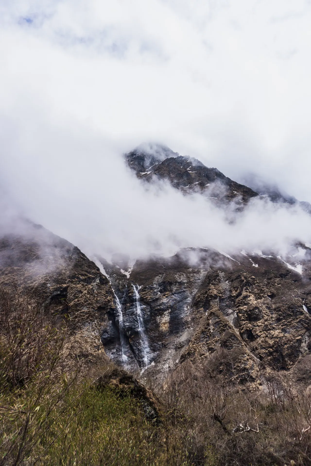
Langtang National Park Entrance Fee and Permits 2026
Langtang National Park entry fee for foreign trekkers is NPR 3,000 (approximately $23 USD) in 2026. SAARC nationals pay NPR 1,500, and Nepali citizens pay NPR 100. Additionally, all foreign trekkers require a TIMS Card (NPR 2,000) and a licensed guide.
The permit system serves two essential purposes: funding park conservation efforts and registering trekkers for safety. Understanding the requirements before arrival eliminates confusion and ensures smooth entry at checkpoints.
Permit Breakdown 2026
| Requirement | Foreign Trekkers | SAARC Nationals | Nepali Citizens |
|---|---|---|---|
| Park Entry Fee | NPR 3,000 | NPR 1,500 | NPR 100 |
| TIMS Card | NPR 2,000 | NPR 1,000 | Not required |
| Guide | Required | Required | Not required |
Total government fees for foreign trekkers: NPR 5,000 (~$38 USD)
Where to Obtain Permits
Langtang National Park permits are available at:
Nepal Tourism Board Office (Kathmandu): The official government office on Pradarshani Marg processes permit applications Sunday through Friday. Bring your passport, passport photos, and cash payment.
Through Registered Trekking Agencies: Agencies like Merriment Treks arrange all permits in advance. This saves time and ensures correct processing. The agency also arranges your guide simultaneously.
Park Office in Dhunche: Permits can be obtained at the Langtang National Park office in Dhunche, but processing hours are limited and staffing can be inconsistent. Obtaining permits in Kathmandu is recommended.
Merriment Treks arranges all permits for our clients before departure, eliminating the need for government office visits. We verify all documentation and ensure correct processing.
Why Permits Matter
Langtang National Park entry fees directly fund conservation work. Your payment supports trail maintenance, wildlife protection, anti-poaching patrols, and community development programs. The permit system also enables authorities to track trekkers and respond effectively in emergencies.
The TIMS (Trekkers’ Information Management System) registration ensures your itinerary is recorded in a central database. In an emergency—natural disaster, injury, missing person report—authorities access TIMS records to determine who is on which trail and where they were heading.
Best Time to Visit Langtang National Park
The best time to visit Langtang National Park is during the spring (March-May) and autumn (September-November) seasons. These periods offer stable weather, clear mountain views, and moderate temperatures ideal for trekking.
Each season in Langtang has its own character, and choosing the right time depends on your priorities. Understanding seasonal variations helps you plan appropriately for weather, trail conditions, and wildlife viewing.
Spring (March-May)
Spring is arguably the best season for Langtang National Park. The weather is generally stable, with clear mornings and occasional afternoon clouds. Rhododendron forests bloom in spectacular color, and bird activity is at its peak.
Advantages: Blooming rhododendrons, active wildlife, pleasant temperatures, long daylight hours, good birdwatching
Disadvantages: Occasional afternoon haze, increased pollen for allergy sufferers, more crowded than autumn
Autumn (September-November)
Autumn offers the clearest mountain views of any season. Post-monsoon air is clean, and the mountains appear in sharp relief. Temperatures are comfortable, though nights become cold at higher elevations.
Advantages: Crystal-clear mountain views, stable weather, excellent photography conditions, comfortable daytime temperatures
Disadvantages: More crowded than spring, colder nights at higher elevations, popular teahouses may be full
Winter (December-February)
Winter trekking is possible but challenging. Snow blankets higher elevations, and some teahouses close for the season. However, the lower sections of the park remain accessible, and the snow-covered landscape is beautiful.
Advantages: Solitude, snow-covered scenery, unique photography opportunities
Disadvantages: Cold temperatures, closed teahouses, potential snow-related trail closures, limited services
Monsoon (June-September)
The monsoon season brings heavy rainfall, particularly from July-August. Trail conditions deteriorate, leeches appear in forest sections, and views are often obscured by clouds. Most trekkers avoid this season.
Advantages: Lush vegetation, fewer crowds, dramatic cloud formations
Disadvantages: Rain, mud, leeches, poor visibility, potential landslides, challenging trail conditions
Merriment Treks recommends spring or autumn for the best Langtang National Park experience. Our guides monitor weather conditions and adjust itineraries as needed to ensure safety and enjoyment.
How to Reach Langtang National Park
Langtang National Park is accessed by road from Kathmandu to Syabrubesi (7-8 hours) or Dhunche (6-7 hours). Both towns serve as gateway communities for the park, with Syabrubesi being the primary trailhead for the Langtang Valley Trek.
The road journey from Kathmandu follows the Trisuli River northward before climbing into the hills of the Rasuwa District. The road is paved for much of the way but becomes rougher in the final sections. Private jeeps and public buses both serve this route.
Transportation Options
Private Jeep: Fastest and most comfortable option. Can be arranged through trekking agencies. Takes 6-8 hours depending on road conditions. Recommended for groups or those seeking comfort.
Public Bus: Most economical option. Buses depart from Kathmandu’s Machhapokhari bus station. Takes 8-10 hours with stops. Less comfortable but authentic experience.
Tourist Bus + Jeep: Some agencies arrange a combination of tourist bus to Trisuli Bazaar followed by jeep transfer to Syabrubesi. This offers a balance of cost and comfort.
Merriment Treks arranges private transportation for all clients, ensuring a comfortable journey with experienced drivers familiar with the mountain roads. We monitor road conditions and adjust departure times as needed.
Road Conditions in 2026
The road to Syabrubesi has been significantly improved in recent years. Paved sections extend further north than in previous decades, and ongoing road construction continues to improve access. However, the final sections remain unpaved and can be rough, particularly after heavy rain.
Travel time variations: The journey can take longer during monsoon season or after landslides. In winter, fog in the Kathmandu Valley may delay morning departures. Merriment Treks builds flexibility into our schedules to accommodate these variations.
Langtang National Park Safety and Altitude Considerations
Langtang National Park is generally safe for trekkers, but altitude sickness, changing weather, and trail conditions require awareness and preparation.
Altitude Sickness Prevention
The park’s high elevations present altitude sickness risk. Trekkers ascending to Kyanjin Gompa (3,870m) and higher viewpoints should:
-
Ascend gradually with proper acclimatization days
-
Stay hydrated (3-4 liters of water daily)
-
Recognize altitude sickness symptoms (headache, nausea, dizziness, fatigue)
-
Descend immediately if symptoms worsen
-
Consider medication if recommended by a healthcare provider
-
Avoid alcohol and sleeping pills at altitude
Merriment Treks guides are trained in altitude sickness recognition and response. We design itineraries with appropriate acclimatization built in, including rest days at Kyanjin Gompa before attempting higher viewpoints.
Weather Awareness
Mountain weather changes rapidly. Even during the best seasons, afternoon clouds and rain are common. Trekkers should:
-
Carry waterproof layers
-
Start early to avoid afternoon weather
-
Be prepared for temperature changes
-
Respect guides’ decisions about weather-related route changes
-
Check weather forecasts when available
Trail Safety
The Langtang trails are well-maintained but do present certain hazards:
-
Rocky and uneven terrain requiring careful footing
-
Suspension bridge crossings (follow guide instructions)
-
Exposed sections at higher elevations
-
Possible landslide areas (particularly after monsoon)
-
Yak traffic on upper sections (stand on uphill side)
Following guide instructions and staying on marked trails ensures safety. The Langtang route is straightforward, but conditions can change, and local knowledge is valuable.
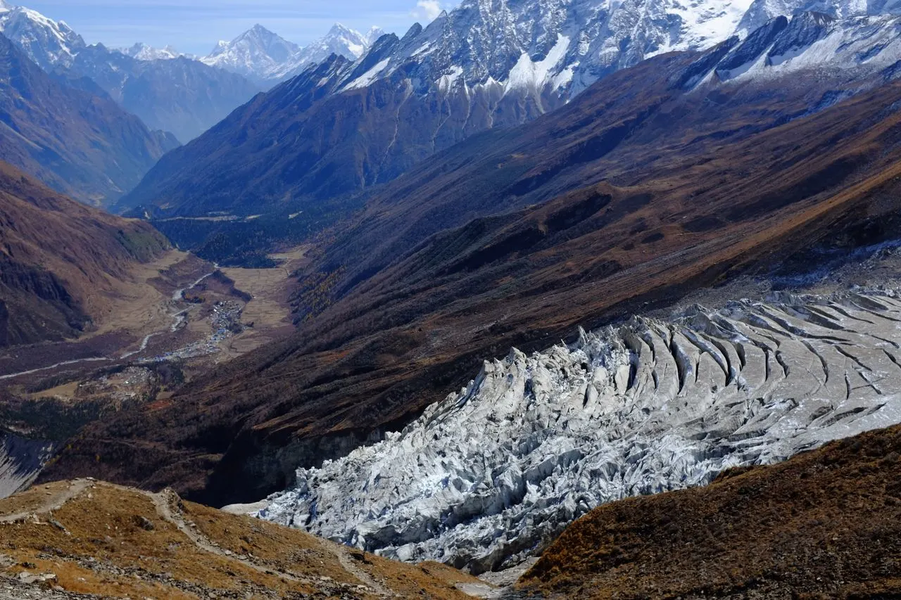
Langtang National Park Conservation and Responsible Tourism
Langtang National Park plays a crucial role in protecting Himalayan ecosystems and wildlife. Visitors contribute directly to conservation through permit fees and indirectly through responsible tourism practices.
The park’s conservation challenges include:
-
Habitat protection for red panda and snow leopard
-
Managing tourism impacts on fragile alpine environments
-
Supporting buffer zone communities
-
Climate change adaptation and glacier retreat
-
Post-earthquake ecosystem recovery
How Visitors Can Help
Responsible tourism practices in Langtang National Park:
-
Stay on trails to prevent erosion and habitat damage
-
Carry out all trash or dispose of it properly at designated sites
-
Respect wildlife by observing from distance and never feeding animals
-
Support local businesses by staying in local teahouses and buying local products
-
Minimize plastic use by carrying reusable water bottles and purification systems
-
Respect cultural sites and local customs (ask before photographing people)
-
Hire licensed guides who understand local conditions and regulations
-
Contribute to conservation through permits and responsible behavior
Merriment Treks follows responsible tourism principles and educates clients about minimizing their environmental impact during treks. We partner with local teahouses and guides who share our commitment to sustainable tourism.
The 2015 Earthquake’s Lasting Impact
The 2015 earthquake and subsequent avalanche fundamentally changed parts of the Langtang Valley landscape. The disaster killed hundreds of people, destroyed villages, and altered terrain. The recovery process continues in 2026.
Visitors to Langtang National Park should understand this history and approach the landscape with respect. The rebuilt villages, visible landslide scars, and memorial sites are part of the park’s current reality—a landscape of recovery and resilience.
Merriment Treks supports local communities through employment and responsible tourism practices. We hire local guides, use local teahouses, and contribute to community development initiatives where possible.
Frequently Asked Questions About Langtang National Park
1. What is Langtang National Park?
Langtang National Park is Nepal’s first Himalayan national park, established in 1976. It protects 1,710 square kilometers of diverse ecosystems across the Langtang Valley, from subtropical forests to high alpine peaks.
2. Where is Langtang National Park located?
Langtang National Park is located in north-central Nepal, approximately 80 kilometers north of Kathmandu, in the Rasuwa, Nuwakot, and Sindhupalchok districts. It borders Tibet to the north.
3. When was Langtang National Park established?
Langtang National Park was established in 1976, making it Nepal’s first Himalayan national park. It predates Sagarmatha National Park (1979) and Annapurna Conservation Area (1986).
4. How large is Langtang National Park?
The park covers 1,710 square kilometers of core area, with an additional 420 square kilometers of buffer zone. The total protected area is 2,130 square kilometers.
5. What animals live in Langtang National Park?
The park is home to red pandas, snow leopards, Himalayan black bears, Himalayan tahr, musk deer, rhesus macaques, ghoral, wild boar, and over 250 bird species including the national bird, the Himalayan monal.
6. Can you see red pandas in Langtang National Park?
Red pandas inhabit the park’s temperate forests between 2,500 and 4,000 meters. They are elusive and difficult to spot. Sightings are possible but not guaranteed. Dawn and dusk in bamboo forest sections offer the best chances.
7. Is Langtang National Park good for trekking?
Yes, Langtang National Park offers excellent trekking with well-established trails, teahouse accommodation, and options ranging from moderate to challenging difficulty. The Langtang Valley Trek is one of Nepal’s most accessible high-altitude treks.
8. What is the Langtang National Park entrance fee?
The entrance fee for foreign trekkers is NPR 3,000 (~$23 USD) in 2026. SAARC nationals pay NPR 1,500, and Nepali citizens pay NPR 100. Additional fees apply for TIMS registration and guide services.
9. Do you need a permit for Langtang National Park?
Yes, all visitors to Langtang National Park need an entry permit. Foreign trekkers also need a TIMS Card and a licensed guide. Permits are available in Kathmandu or through registered trekking agencies like Merriment Treks.
10. What is the best time to visit Langtang National Park?
The best times to visit are spring (March-May) and autumn (September-November). These seasons offer stable weather, clear mountain views, and moderate temperatures ideal for trekking.
11. Is Gosainkunda Lake inside Langtang National Park?
Yes, Gosainkunda Lake is located within Langtang National Park’s boundaries. The lake is at 4,380 meters elevation and holds sacred significance for both Hindus and Buddhists.
12. What is the highest mountain in Langtang National Park?
The highest mountain is Langtang Lirung at 7,227 meters. Other notable peaks include Dorje Lakpa (6,966m) and Kimshung (6,781m).
13. How do you reach Langtang National Park?
The park is reached by road from Kathmandu to Syabrubesi (7-8 hours) or Dhunche (6-7 hours). Private jeeps or public buses serve these routes. Merriment Treks arranges private transportation for clients.
14. Is Langtang National Park safe?
Yes, Langtang National Park is generally safe for trekkers. The main risks are altitude sickness at higher elevations, changing weather, and challenging trail conditions. Hiring a licensed guide significantly improves safety.
15. Can Langtang be combined with other trekking routes?
Yes, Langtang National Park treks can be combined with Gosainkunda, Tamang Heritage Trail, or Helambu routes. These combinations create longer treks (12-20 days) and provide more diverse experiences. Proper planning and permits are required.
Final Takeaway: Why Visit Langtang National Park?
Langtang National Park offers a rare combination of accessibility, ecological diversity, cultural richness, and spectacular mountain scenery. It is Nepal’s first Himalayan national park and remains one of its most rewarding trekking destinations.
The park’s proximity to Kathmandu makes it accessible without compromising the wilderness experience. The Langtang Valley Trek provides high-altitude adventure with comfortable teahouse accommodation. The sacred Gosainkunda Lake adds spiritual dimension. The Tamang Heritage Trail offers cultural immersion. And throughout, the park’s wildlife—from red pandas to snow leopards—reminds visitors of the importance of conservation.
Merriment Treks is proud to guide trekkers through Langtang National Park. We combine local knowledge, responsible tourism practices, and genuine hospitality to create meaningful Himalayan experiences. Our guides know the trails, understand the ecosystems, and respect the communities that call this park home.
Contact Merriment Treks for current Langtang National Park information, trekking packages, and personalized planning assistance. We’re here to help you experience Nepal’s first Himalayan national park with confidence and respect.