What Kalapathar Everest Actually Is
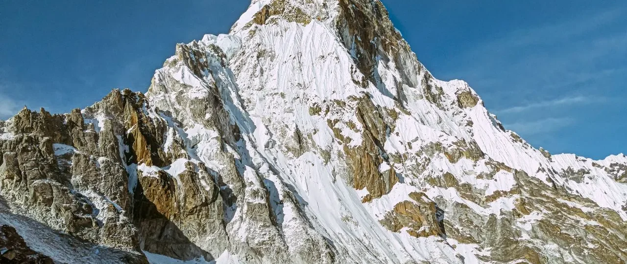
Kala Patthar is not a mountain in the technical sense. Its topographic prominence is only about ten metres, which means it does not qualify as an independent peak. What it is, more precisely, is a ridge feature on the south flank of Pumori, a 7,161-metre mountain that dominates the skyline above Gorak Shep. The “black rock” name comes from the dark, exposed schist and gneiss that contrasts sharply with surrounding snow and ice.
For trekking purposes, Kala Patthar functions as the premier non-technical viewpoint in the Everest region. It sits within Sagarmatha National Park, a UNESCO World Heritage Site, and falls under the Khumbu Pasang Lhamu Rural Municipality. No climbing permit is required. The standard Sagarmatha National Park entry permit and the Khumbu municipality fee that every EBC trekker already carries cover access. The Nepal Tourism Board lists the Sagarmatha permit at NPR 3,000 (roughly USD 22) for foreign nationals, plus 13% VAT, and the Khumbu Pasang Lhamu Rural Municipality permit at NPR 2,000 (roughly USD 15) . A TIMS card is no longer required in the Khumbu region.
The Elevation Question: 5,545 Metres or 5,644 Metres?
Search for Kalapathar Everest elevation and you will find two numbers that appear on authoritative-looking websites: 5,545 metres and 5,644 metres. Trekking operators cite both. Wikipedia lists 5,644.5 metres. Guidebooks often print 5,545 metres. Neither is wrong, but they refer to different points on the same ridge.
The 5,545-metre figure describes the local maxima on the Pumori ridge where most trekkers actually stand. This is the point reached by the standard hiking route from Gorak Shep. It is approximately 381 metres above the village and delivers the classic Everest panorama. Trek and Tour Nepal’s 2026 summit guide, which cites verification through the Sagarmatha National Park Authority and Himalayan Rescue Association, lists the summit elevation at 5,545 metres with Gorak Shep at 5,164 metres . Most itinerary descriptions from established operators — including World Expeditions — also use 5,545 metres when describing the Kala Patthar ascent .
The 5,644-metre figure refers to the higher ridge point on Kala Patthar proper. A 2006 measurement recorded the summit trekkers reach as 5,644 metres, and this number has circulated widely since . Reaching this higher point requires continuing along the ridge beyond the standard viewpoint. Most trekkers do not go that far — the classic view is already achieved at the lower point, and continuing adds exposure and time without a dramatically different perspective.
What this means for your planning: For practical purposes, 5,545 metres is the elevation you will reach on the standard Kalapathar hike. Use this number when planning acclimatisation and assessing difficulty. The 5,644-metre figure is not a competing measurement — it describes a different location on the same ridge system. Some German-language sources describe the 5,545-metre point as the “Lower Kala Pattar” and note that the prayer-flag-covered area where trekkers traditionally stop sits roughly 100 metres higher . This is consistent with the 5,644-metre measurement: the ridge continues upward beyond where most groups stop.
Why Kalapathar Everest Matters More Than Everest Base Camp for the View
The comparison between Kala Patthar and Everest Base Camp is not about which destination is “better.” They offer fundamentally different experiences, and understanding that difference prevents the disappointment many trekkers feel when they arrive at Base Camp expecting a panoramic Everest view.
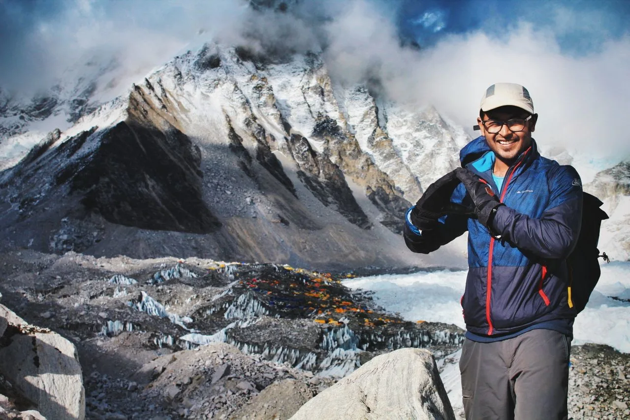
From Everest Base Camp (5,364 metres), you stand at the foot of the Khumbu Icefall — a chaotic jumble of seracs and crevasses that spills down from the Western Cwm. The summit of Everest is hidden behind Nuptse (7,861 metres), the massive wall that runs parallel to the main Everest ridge. You are inside the landscape, surrounded by glacial moraine and expedition tents during climbing season. The experience is atmospheric and historic — you are standing where expeditions begin — but it is not a viewpoint in the traditional sense. Marvel Adventure’s 2026 comparison puts it directly: “Nuptse is what sits right in front of Everest’s summit and blocks the shot most people are chasing” .
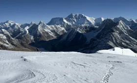
From Kala Patthar (5,545 metres), the geometry changes. You rise above the Nuptse blockage and gain a direct line of sight to Everest’s south face. The full mountain becomes visible — the Hillary Step, the South Col, the Southeast Ridge, the Yellow Band, and the black pyramid of the summit itself. Nuptse, Lhotse (8,516 metres), Changtse (7,543 metres), and Pumori surround the view in every direction. On clear mornings, the light hits Everest first, and you watch the summit turn gold while the valley below remains in shadow.
The geography is simple: altitude solves the problem that proximity creates. Everest Base Camp is closer to the mountain but cannot see it. Kala Patthar is farther away but sees everything.
The Hike from Gorak Shep: Route, Distance, and Realistic Timing
The Kalapathar Everest hike begins in Gorak Shep, the highest settlement in the Khumbu at 5,164 metres. The route is short by distance — 1.5 kilometres one way — but the elevation gain of 381 metres in thin air makes it a genuine physical effort.
Distance: 1.5 km one way, 3 km round trip. Several sources list the round-trip distance as 3 km with an elevation gain of 480 metres, though the net gain from Gorak Shep to the standard viewpoint is approximately 381 metres . The discrepancy likely reflects different measurement points or route variations.
Ascent time: 1.5 to 3 hours, depending on fitness and acclimatisation. Himalaya Guide Nepal’s route guide estimates 1.5 to 2 hours for most trekkers, with a round trip of 2.5 to 3.5 hours . Trek and Tour Nepal lists a slightly longer ascent of 2–3 hours and a total return time of 4–5 hours . The wide range reflects the reality that altitude affects everyone differently.
Descent time: 45 minutes to 1.5 hours.
Total time: 2.5 to 4.5 hours round trip.
The trail starts by crossing the flat, sandy lakebed at Gorak Shep — the remnant of a glacial lake that once filled the valley. It then climbs a series of switchbacks over loose scree and rocky terrain. There are no technical sections, no ropes, no scrambling. But the altitude makes every step feel harder than the distance suggests. At 5,164 metres, the air contains roughly half the oxygen available at sea level. Adding 381 metres of ascent in these conditions is demanding, even for fit trekkers.
Himalaya Guide Nepal’s route description captures the reality: “The 1.5 km walk from Gorak Shep to Kala Patthar may sound short, and most trekkers automatically think of it as a short trek. But Kala Patthar lies very high above sea level, and you’ll get about 50% fewer oxygen molecules per breath compared to sea level, which makes the hike more challenging than it sounds by its distance” .
The Sunrise Experience: What to Expect Before Dawn
Most trekkers climb Kala Patthar before dawn to reach the viewpoint for sunrise. This is not a cliché — it is practical. Morning air is typically clearer and more stable than afternoon conditions, when clouds and wind often build. Sunrise also produces the most dramatic light on Everest’s south face.
Departure time: 4:00 to 5:00 AM from Gorak Shep, adjusted seasonally for sunrise. Trek and Tour Nepal lists a departure window of 4:00–5:00 AM with summit arrival before first light and the best viewing window between 5:30 and 7:30 AM . Next Trip Nepal describes trekkers leaving “in complete darkness, typically between 4am and 5am, specifically to reach the summit of Kala Patthar as the sun rises over the eastern peaks” .
What the first hour is like: You leave Gorak Shep in complete darkness, walking by headlamp. The trail is rocky and uneven. Temperatures at this hour can drop to minus 15°C or lower in late autumn and winter. The first section across the lakebed is relatively flat, but the switchbacks begin quickly. You will see the lights of other trekkers ahead, moving slowly upward.
At the viewpoint: You arrive before first light. The sky transitions from black to deep violet to orange. Then the sun hits the peaks — first a golden line on Everest’s summit, then a flood of light that gradually illuminates the entire south face. If conditions allow, you may see the triangular shadow of Everest cast across the snow below.
Honest caveat: Mountain weather is unpredictable. Cloud cover can obscure the view entirely. Some mornings are perfectly clear; others offer nothing but grey. The experience is still worthwhile when the view is obscured — you are standing at 5,545 metres on the shoulder of Pumori, watching the Khumbu wake up — but the iconic photograph is never guaranteed.
Difficulty and Altitude: The Real Challenge
Kalapathar Everest is not a technical climb. You do not need ropes, crampons, or mountaineering experience. But it is not an easy hike either. The difficulty comes entirely from altitude.
At 5,545 metres, oxygen availability drops to roughly half of sea-level conditions . Your body is already working hard to acclimatise. The 381-metre ascent from Gorak Shep involves sustained uphill walking on loose scree, with no flat sections for recovery. Trek and Tour Nepal rates the difficulty as “Moderate-Strenuous (altitude makes it hard)” .
Who should attempt it: Trekkers who have followed a proper acclimatisation schedule, who feel well at Gorak Shep, and who are prepared to walk slowly and take frequent breaks. Most people who have reached Gorak Shep can reach Kala Patthar, but it requires patience and self-awareness.
Who should reconsider: Anyone experiencing symptoms of acute mountain sickness — headache, nausea, dizziness, or breathlessness at rest. If you feel unwell at Gorak Shep, climbing higher is dangerous. Descending is the correct decision. The Nepal Tourism Board specifically warns trekkers to avoid gaining altitude too quickly because altitude sickness can become dangerous above 3,000 metres .
Acclimatisation matters: Most standard EBC itineraries include two nights at Namche Bazaar (3,440 metres), one night at Tengboche (3,860 metres), and one night at Dingboche (4,410 metres) before reaching Gorak Shep. This gradual ascent allows the body to adapt. If you have skipped acclimatisation days or ascended too quickly, Kala Patthar will feel significantly harder.
Best Time to Visit: Weather, Views, and Crowds
Kalapathar Everest can be climbed year-round, but conditions vary significantly by season.
October–November (autumn): Best overall. Clear skies, stable weather, excellent visibility. Temperatures are cold but manageable. This is peak trekking season, and the viewpoint can be crowded at sunrise.
March–May (spring): Second-best. Rhododendrons bloom lower down, temperatures are milder, but afternoon haze can reduce visibility. March and April can produce the most dramatic single frames for photographers, according to Everest Camp Trek’s 2026 photography guide . Everest views are often clearest in the morning.
December–February (winter): Cold but often clear. Temperatures at Kala Patthar can drop below minus 20°C. Fewer trekkers. Requires proper winter gear.
June–September (monsoon): Not recommended. Heavy cloud cover, rain, and landslide risk on trails. Views are rarely clear.
What to Wear and Carry for the Sunrise Hike
The temperature at Kala Patthar before sunrise can range from minus 10°C to minus 25°C depending on the season. Layering is essential. Alpine Luxury Treks notes that October to December sunrise temperatures at Kala Patthar run between minus 15°C and minus 20°C, and that a camera battery left in a bag overnight at lodge temperatures of minus 5°C will read 60% or less by the time it reaches the viewpoint .
Upper body:
-
Base layer (moisture-wicking)
-
Insulating mid-layer (fleece or down)
-
Windproof/waterproof outer shell
-
Down jacket (essential for the pre-dawn wait)
Lower body:
-
Thermal base layer
-
Trekking trousers
-
Windproof/waterproof over-trousers
Extremities:
-
Insulated gloves or mittens (liner gloves plus outer mittens)
-
Warm hat or balaclava
-
Buff or neck gaiter
-
Wool socks (plus a spare pair)
Footwear:
-
Insulated trekking boots with good ankle support
-
Microspikes (helpful in icy conditions, especially in winter)
Gear:
-
Headlamp with spare batteries
-
Trekking poles (helpful for balance on scree)
-
Sunglasses (high UV protection)
-
Sunscreen and lip balm
-
Insulated water bottle (to prevent freezing)
-
Snacks (energy bars, chocolate)
-
Camera with spare batteries (keep batteries warm inside your jacket)
Photography on Kala Patthar: Timing, Settings, and Cold-Weather Reality
Kalapathar Everest is one of the world’s great mountain photography locations. The combination of altitude, clear morning air, and Everest’s south face creates exceptional conditions — but the cold and darkness make execution harder than most photographers expect.
Best timing: The 20–30 minutes after sunrise, when the peaks are fully illuminated but the sky is still transitioning from blue to daylight. This is when the light is warmest and the shadows are most dramatic. Everest Camp Trek’s photography guide notes that on a clear morning you can stand on Kala Patthar for an hour or more watching the mountains in full daylight before clouds begin to build .
Best vantage points: The prayer-flag-covered ridge at the standard viewpoint offers the classic Everest composition. Moving slightly along the ridge can help you avoid crowds and find a clean foreground.
Camera settings:
-
Aperture: f/8–f/11 for landscape depth
-
ISO: 200–400 for clean images
-
Shutter speed: adjust for light; use a tripod if available
-
Use a polarising filter to cut haze and deepen the sky
Cold-weather battery management: This is where most photographers fail. Camera batteries drain quickly in cold temperatures. Keep spare batteries inside your jacket, close to your body. A battery that reads 60% at lodge temperature may read 20% at Kala Patthar. Alpine Luxury Treks describes the pattern honestly: “The headline photographs of the trek — Kala Patthar sunrise especially — are taken in conditions where most travelers’ batteries have died, their lenses have fogged, and their hands are too cold to operate the controls” .
The Everest shadow: On clear mornings, Everest casts a triangular shadow across the snow to the west. This is a signature shot. It appears shortly after sunrise and lasts only a few minutes.
Practical Planning: Permits, Logistics, and Where to Stay
Permits for 2026: The Sagarmatha National Park entry permit costs NPR 3,000 (roughly USD 22) for foreign nationals, plus 13% VAT. SAARC nationals pay NPR 1,500. The Khumbu Pasang Lhamu Rural Municipality permit costs NPR 2,000 (roughly USD 15). A TIMS card is no longer required in the Khumbu . Both permits are checked at Monjo, on the trail between Lukla and Namche Bazaar. Your trekking operator typically arranges them.
Getting to Gorak Shep: Fly Kathmandu to Lukla (or Ramechhap to Lukla during peak season), then trek through Phakding, Namche Bazaar, Tengboche, Dingboche, and Lobuche. The standard itinerary takes 8–10 days from Lukla to Gorak Shep. The village has basic teahouses — the last accommodation before Everest Base Camp and Kala Patthar. Conditions are spartan: no heating in rooms, shared bathrooms, and limited electricity.
Where to stay: Gorak Shep has a handful of teahouses with basic rooms and communal dining areas. It is the only base for both Kala Patthar and Everest Base Camp. Most trekkers spend two nights: one after arriving from Lobuche, and one after visiting Base Camp, before climbing Kala Patthar the following morning.
How Merriment Treks Can Help
Merriment Treks arranges Everest Base Camp treks that include Kala Patthar as a standard component of the itinerary. Their local Sherpa guides know the trail, understand altitude management, and can adjust plans based on weather and trekker condition. If you want the logistics handled — permits, accommodation, acclimatisation scheduling, and the pre-dawn wake-up call — their team can arrange it. This is particularly useful for trekkers who want to combine the Kalapathar sunrise hike with a broader Nepal itinerary and want to avoid scheduling conflicts.
Their local team can also advise on the best season for your specific schedule, help you choose between the standard EBC itinerary and variations that include Gokyo Ri or the Three Passes, and provide guidance on acclimatisation pacing that reduces the risk of altitude sickness.
Frequently Asked Questions
1. What is Kalapathar Everest?
Kala Patthar is a rocky viewpoint on the south ridge of Pumori in Nepal’s Khumbu region. It is the most accessible non-technical viewpoint for seeing Everest’s south face, and it is included in most standard Everest Base Camp trek itineraries.
2. How high is Kala Patthar?
The standard trekker viewpoint is approximately 5,545 metres. The higher ridge point on Kala Patthar proper is measured at 5,644 metres. Most trekkers reach the 5,545-metre viewpoint.
3. Why do some websites say Kala Patthar is 5,644 metres?
The 5,644-metre figure refers to the higher ridge point, not the standard viewpoint where most trekkers stop. Both elevations describe points on the same ridge system.
4. Is Kala Patthar higher than Everest Base Camp?
Yes. Kala Patthar (5,545 metres) is approximately 181 metres higher than Everest Base Camp (5,364 metres).
5. Can you see Everest from Kala Patthar?
Yes. Kala Patthar offers a direct, unobstructed view of Everest’s south face, from the Khumbu Icefall to the summit pyramid. This view is not possible from Everest Base Camp, where Nuptse blocks the summit.
6. Why is Everest not visible from Base Camp?
The geometry of the Everest massif means Nuptse (7,861 metres) blocks the line of sight from Base Camp to Everest’s summit. Kala Patthar rises above the Nuptse blockage.
7. How far is Kala Patthar from Gorak Shep?
Approximately 1.5 kilometres one way, with 381 metres of elevation gain.
8. How difficult is the Kala Patthar hike?
Moderate to strenuous. The distance is short, but the altitude makes it physically demanding. Most trekkers take 1.5 to 3 hours to ascend.
9. How long does the Kala Patthar hike take?
2.5 to 4.5 hours round trip, depending on pace and acclimatisation.
10. What time do you leave for Kala Patthar sunrise?
Typically 4:00 to 5:00 AM from Gorak Shep, adjusted seasonally for sunrise time.
11. Is Kala Patthar safe?
The trail is not technical, but altitude is a genuine risk. Trekkers should be well-acclimatised and should not attempt the climb if experiencing symptoms of altitude sickness.
12. Do you need climbing experience for Kala Patthar?
No. No technical skills or equipment are required. Fitness and acclimatisation are more important.
13. What can you see from Kala Patthar?
Everest’s south face, Nuptse, Lhotse, Changtse, Pumori, and the Khumbu Glacier. On clear mornings, the view extends across the Khumbu Himal.
14. What should you wear for Kala Patthar?
Layered clothing: base layer, insulating mid-layer, down jacket, windproof outer shell, insulated gloves, warm hat, and insulated trekking boots. Temperatures before sunrise can drop below minus 20°C in winter.
15. When is the best time to visit Kala Patthar?
October–November and March–May offer the clearest views and most stable weather. Winter is cold but clear. Monsoon is not recommended.
Final Takeaway
Kalapathar Everest exists because Everest Base Camp does not offer the view people expect. The short but demanding climb from Gorak Shep — 1.5 kilometres, 381 metres of elevation gain, 1.5 to 3 hours of walking in thin air — is what turns a journey to the mountain’s base into an actual view of the mountain itself.
The elevation confusion is resolved by understanding that most trekkers reach a local maxima on the Pumori ridge at approximately 5,545 metres, while the higher ridge point is measured at 5,644 metres. The view from the standard viewpoint is the one that appears in every iconic Everest photograph.
Prepare for cold, darkness, and thin air. Start early. Walk slowly. And if the weather obscures the view, remember that mountain conditions vary — the experience of standing at 5,545 metres on the shoulder of Pumori, watching the Khumbu wake up below you, is worthwhile regardless.