10 Interesting Facts About Mount Everest That Will Amaze You
Most people know three things about Mount Everest: it is the highest mountain in the world, Edmund Hillary and Tenzing Norgay climbed it first, and it is extremely cold and dangerous. All three are true. But they are also the beginning of the story, not the whole of it.
Behind the altitude record and the famous names lies a mountain packed with geological surprises, human records that continue to be broken in 2026, a naming story that the person it was named after actively opposed, a geological paradox that puts ocean-floor fossils at the top of the world, and a death zone where the human body begins to deteriorate faster than it can recover. These are the facts that most people have never heard — the ones that make the world’s most famous mountain genuinely stranger and more interesting than its headline number suggests.
Every fact in this article has been cross-referenced against multiple authoritative sources. There are no approximations dressed as precision, no legends presented as fact, and no numbers that haven’t been verified.
Fact 1: The Exact Height of Everest Was Only Confirmed in 2020 — And It Changed
The official height of Mount Everest is 8,848.86 meters (29,031.7 feet) above sea level. This figure was jointly announced by the governments of Nepal and China on December 8, 2020, following the most technically sophisticated survey of the mountain ever conducted.
What makes this number interesting is what preceded it and what the survey involved. For decades, the most widely accepted height was 8,848 meters, based on a Survey of India measurement completed in 1954. Various surveys over the intervening decades produced slightly different figures — a 1999 American GPS measurement produced 8,850 meters, while the Chinese had previously used 8,844.43 meters, measuring only the rock height beneath the snow cap rather than the snow-covered summit. The disagreement was not trivial; it became a point of national measurement pride between Nepal and China that took years to resolve.
The 2020 joint survey was Nepal’s first independent official measurement of the mountain it claims as part of its national identity. Nepali surveyors physically climbed to the summit carrying GPS receivers, gravity meters, and ground-penetrating radar equipment. The radar measured ice thickness at the summit — distinguishing the rock height from the snow cap above it — while the GPS equipment recorded precise satellite data. The result: 8,848.86 meters. This is 0.86 meters higher than the previous standard figure — less than the height of a kitchen counter — but scientifically significant because it incorporated both the snow cap and the most precise geodetic instrumentation available.
This is now the globally accepted official height of Everest, used by Nepal, China, and every major geographical authority. It is unlikely to be the final number. The mountain is still growing, measurement technology continues to improve, and the next significant earthquake in the region could shift the figure — as the 2015 Nepal earthquake measurably altered the elevation of land across the Khumbu.
Fact 2: The Mountain Is Still Growing — Approximately 4 Millimeters Every Year
Mount Everest is not a fixed geological structure. It is actively rising. The ongoing collision between the Indian tectonic plate and the Eurasian tectonic plate — the same collision that formed the entire Himalayan range approximately 50 to 60 million years ago — continues today, pushing the mountains incrementally higher at a rate of approximately 4 millimeters per year.
The Indian plate is moving northward at roughly 40 to 50 millimeters per year relative to the Eurasian plate. Where these two massive plates meet, neither can easily subduct beneath the other — both are continental crust, less dense than oceanic crust and therefore more resistant to being pushed downward. The result is that the collision energy converts into upward compression, forcing rock skyward. The Himalayas are the crumple zone of this continental collision, and Everest is its highest expression.
The 4-millimeter annual growth figure is the net upward movement — the tectonic uplift minus the erosion by wind, ice, and weather that simultaneously works against it. Frost weathering, glacial erosion on the flanks, and wind abrasion at the summit all remove material. The net result is a mountain that grows by approximately 4 millimeters per year under most estimates, though the exact figure varies slightly across studies.
Over a human lifetime of 80 years, Everest grows by approximately 32 centimeters — just over a foot. Over the 73 years since Hillary and Tenzing’s first ascent in 1953, the mountain has grown by approximately 29 centimeters. The 2015 Nepal earthquake temporarily reduced the height of some Himalayan peaks, demonstrating that the growth is not linear but subject to seismic interruption. The mountain that future generations measure will be fractionally taller than the one we measure today.
Fact 3: The Summit Rocks Were Once an Ocean Floor
This is the geological fact about Everest that most consistently astonishes people when they first encounter it: the rocks at the very summit of the world’s highest mountain are marine limestone — sedimentary rock formed from the compressed remains of sea creatures that lived in a shallow tropical ocean approximately 450 million years ago.
The ancient Tethys Sea occupied the space between the Indian subcontinent and the Eurasian landmass before the collision began. It was a warm, shallow sea teeming with life — corals, mollusks, cephalopods, and the tiny calcite-shelled organisms whose accumulated remains formed the limestone layers now found at the top of Everest. When the Indian plate crashed into Eurasia and the collision began pushing rock skyward, these ancient sea-floor sediments were lifted along with everything else.
Fossil marine organisms have been found in Himalayan rock at high elevations — ammonites and other sea creatures embedded in stone thousands of meters above sea level. The summit itself is composed of the Qomolangma Formation, a band of grey limestone and dolostone that represents some of the oldest and highest-displaced ocean-floor material on the planet’s surface.
The implication is philosophically striking: the highest point on Earth was not formed from volcanic eruption or any upwelling from the planet’s interior. It was formed at the bottom of a sea, accumulated over hundreds of millions of years of marine biology, then lifted to its current position by the slow-motion violence of continental collision. You can stand at 8,848.86 meters — the summit of the world — and the rock beneath your boots was once on the ocean floor.
Fact 4: The Man It Was Named After Never Saw It — And Didn’t Want His Name on It
Mount Everest was not always called Everest. For the surveyors of the Great Trigonometrical Survey of India who were working to map the subcontinent in the mid-19th century, the peak was designated Peak XV — a catalogue number in a system that treated mountains as geometric problems to be solved rather than objects to be named.
- In 1852, an Indian mathematician named Radhanath Sikdar, working as a human computer for the Survey, completed calculations from measurements taken across the plains of India and determined that Peak XV was the highest mountain on earth. The official announcement came in 1856. The mountain then needed a name.
- In 1865, the Royal Geographical Society named it after Sir George Everest — the former Surveyor General of India who had led the Great Trigonometrical Survey from 1830 to 1843 and who was considered responsible for establishing the methodological framework that eventually allowed Peak XV to be measured. The RGS made this decision to honor his contribution to the survey.
George Everest himself objected. He pointed out several reasons his name was unsuitable: it could not be written or pronounced in Hindi or any other Indian language spoken by the people who actually lived near the mountain — a significant failing for a geographical name — and he felt the honor was unwarranted because he had never personally seen the mountain his name was being attached to. The objections were overruled. The Royal Geographical Society proceeded with the naming anyway, and “Everest” became official.
The pronunciation Everest intended for his own surname, incidentally, was “Eve-rest” rather than the universally used “Ever-est.” This detail has no practical consequence — the universal pronunciation is now firmly established — but it adds a layer of irony to a naming story already defined by the honoree’s reluctance.
The mountain had names long before Western surveyors arrived. In Tibetan and Sherpa tradition it is Chomolungma — meaning “Goddess Mother of the World” or “Holy Mother” depending on the translation. In Nepali it is Sagarmatha — meaning “Goddess of the Sky” or “Peak of the Sky.” Both names reflect the deep cultural and spiritual significance the mountain holds for the communities who have lived in its shadow for centuries. The name Everest, by contrast, was an external imposition that the person it honored explicitly did not want.
Fact 5: The First Ascent Was Made on May 29, 1953 at Approximately 11:30 AM
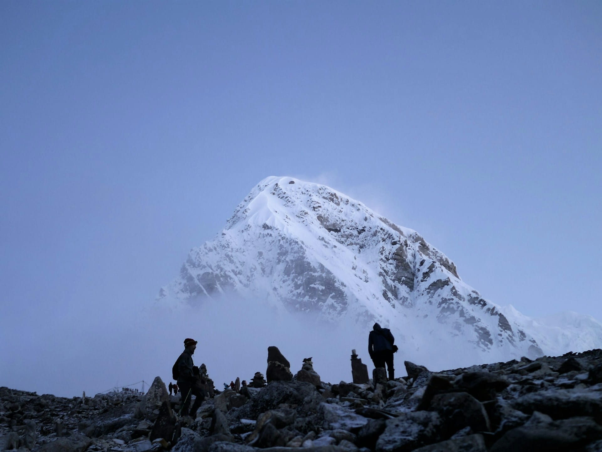
On the morning of May 29, 1953, at approximately 11:30 AM local time, Edmund Hillary of New Zealand and Tenzing Norgay, a Sherpa mountaineer from Nepal, became the first confirmed people to stand on the summit of Mount Everest. Hillary was 33 years old at the time.
- They were part of the ninth British expedition to attempt Everest, led by Colonel John Hunt. The expedition used the South Col route — ascending the Khumbu Icefall, through the Western Cwm, up the Lhotse Face to the South Col, then the Southeast Ridge to the summit — the same route that remains the most commonly used today. Hillary and Tenzing were the second summit pair to attempt the peak on that expedition; the first pair, Tom Bourdillon and Charles Evans, had turned back on May 26, 1953, at the South Summit (approximately 8,750 meters) due to oxygen equipment problems.
- Hillary and Tenzing spent approximately 15 minutes on the summit. During that time, Hillary took photographs — including the now-iconic image of Tenzing holding his ice axe aloft with flags attached. Tenzing left offerings in the snow: chocolates and biscuits as a Buddhist offering. Hillary searched for any evidence that George Mallory and Andrew Irvine, who had disappeared near the summit in 1924, might have reached the top before them. He found none.
- The news reached London on June 2, 1953 — the day of Queen Elizabeth II’s coronation. The coincidence of the two events produced a wave of national celebration in Britain that would be difficult to replicate in any other context.
Tenzing Norgay was a Sherpa born in the Solukhumbu region of Nepal. Whether he was born in Nepal or Tibet is debated in biographical accounts — both countries claim his birth. He had been on six previous Everest expeditions before the successful 1953 attempt. Hillary was a beekeeper from New Zealand whose mountaineering career had developed through climbing in the New Zealand Southern Alps. They were, in background and biography, a study in contrast — united by the specific combination of skill, endurance, and mutual trust that the summit demanded.
Fact 6: One Man Has Summited Everest 32 Times — A Record Set in 2026
The first ascent of Everest took decades of attempts by numerous expeditions and cost multiple lives before it was achieved in 1953. As of May 2026, a single individual has climbed the same mountain 32 times.
Kami Rita Sherpa, a mountain guide from Thame village in the Solukhumbu district of Nepal, reached the summit of Mount Everest for the 32nd time on May 17, 2026, at 10:12 AM local time, setting a new Guinness World Record for the most ascents of Everest by any individual. His Everest career began in 1994, and he has extended his own record repeatedly over three decades of guiding and climbing on the world’s highest mountain.
To understand what 32 summits means physically: each round trip from Base Camp to the summit and back involves crossing the Khumbu Icefall — one of the most objectively dangerous sections of terrain in high-altitude mountaineering, where massive ice seracs can collapse without warning — multiple times.
Kami Rita has crossed the Khumbu Icefall not once or twice but dozens of times over his career.
He operates in the death zone repeatedly, each time subjecting his body to conditions where human physiology deteriorates and recovery is impossible without descent. His record is not merely a number. It is a testament to physical resilience, technical expertise, and the specific high-altitude competence that the Sherpa community of the Khumbu has developed across generations of life and work at extreme elevation.
Fact 7: The Death Zone Begins at 8,000 Meters — Where the Body Deteriorates Faster Than It Can Recover
The term “death zone” is not hyperbole. It is a specific physiological concept describing the zone above 8,000 meters (26,247 feet) where the concentration of oxygen in the atmosphere is insufficient to sustain human life indefinitely — where the body’s cells begin to die faster than they can regenerate, where even supplemental oxygen merely slows the deterioration rather than reversing it, and where no human can survive for more than a limited time regardless of their fitness or prior acclimatization.
At the summit of Everest at 8,848.86 meters, the oxygen level is approximately one-third of what it is at sea level. Each breath at the summit delivers roughly a third of the oxygen molecules that the same breath would deliver at sea level. The body’s response — increased breathing rate, elevated heart rate, cerebral vasoconstriction — can compensate partially, but not indefinitely and not at the rate required for sustained function.
In the death zone, without supplemental oxygen, most people lose consciousness within minutes. With supplemental oxygen — which most Everest climbers use — the effective altitude is reduced by approximately 1,000 to 1,500 meters, making 8,000 meters feel physiologically equivalent to roughly 6,500 to 7,000 meters. This is still well within the extreme altitude zone but makes summit attempts possible.
The practical consequence is that climbers in the death zone must move continuously and efficiently toward either the summit or descent. Resting, sleeping, or being forced to wait — as happens when queues form on the ridge — means the body is deteriorating while stationary. Summit day on Everest typically takes 10 to 18 hours from the highest camp to the summit and back, and every additional hour spent above 8,000 meters compounds the physiological cost. Temperatures at the summit average around minus 36 degrees Celsius in January, with wind chill making effective temperatures considerably lower. The warmest average daytime temperatures at the summit, in the spring climbing season, reach around minus 16 to minus 19 degrees Celsius.
Fact 8: Everest Is Not the Tallest Mountain on Earth — Depending on How You Measure
Mount Everest is unambiguously the highest mountain on Earth above sea level. That is the standard geographical measurement and the one universally used when comparing mountain heights. By this measure, at 8,848.86 meters, nothing else comes close.
But “highest above sea level” is not the only legitimate way to measure a mountain’s size, and by two alternative measurements, Everest is not the record holder.
Measured from base to summit — the total vertical distance from the mountain’s own base to its peak — Mauna Kea, an extinct shield volcano on the island of Hawaii, is significantly taller than Everest. Mauna Kea’s summit sits at only 4,205 meters above sea level, making it unremarkable by Himalayan standards. But the mountain rises from the floor of the Pacific Ocean, approximately 6,000 meters below the water’s surface. Measured from its oceanic base to its summit, Mauna Kea stands approximately 10,200 meters tall in total — nearly a full mile taller than Everest measured the same way.
By a third measurement — distance from the center of the Earth to the summit — Mount Chimborazo in Ecuador holds the record. Chimborazo’s summit is only 6,263 meters above sea level, well below Everest. But the Earth is not a perfect sphere — it bulges at the equator due to its rotation. Ecuador sits near the equator, which means Chimborazo’s base is already farther from the Earth’s center than any point in the Himalayas. From the center of the Earth, Chimborazo’s summit reaches 6,384.4 kilometers — approximately 2.1 kilometers farther than Everest’s summit.
Everest remains the highest point above sea level by a significant margin. That is both the most commonly used and most practically meaningful measurement. But the existence of these alternative measurements reveals something important about how geography depends on what question you are actually asking.
Fact 9: The Mountain Was Not Recognized as the Highest Until 1856 — and Peak XV Was Previously Unranked
Before 1856, the mountain that is now called Everest was known to the surveyors of the Great Trigonometrical Survey of India as “Peak XV” — a catalogue designation with no particular significance. The mountain that was then believed to be the highest in the world was Kangchenjunga, the peak straddling the border of Nepal and the Indian state of Sikkim, which stands at 8,586 meters. Kangchenjunga is the third-highest mountain on Earth — but in the early to mid-19th century, with no reliable way to measure distant peaks across the Indian subcontinent, it was the reigning candidate for highest.
The Great Trigonometrical Survey was an extraordinary undertaking — a multi-decade project to map the entire Indian subcontinent using an interlocking series of precisely measured triangles, working outward from a verified baseline on the plains of India. From fixed surveying stations across the subcontinent, theodolite observations of distant Himalayan peaks were collected, and teams of human computers — mathematicians who performed the calculations by hand — worked through the trigonometric equations to derive the heights and positions of peaks observed from multiple stations.
In 1852, Radhanath Sikdar completed calculations from observations of Peak XV taken from six different survey stations across the plains of northern India. His computation showed Peak XV to be taller than any other measured peak. The announcement was held for several years while the calculations were verified. In 1856, the official announcement was made: Peak XV was 8,840 meters — the highest mountain on Earth. Later surveys refined the number. The mountain was renamed Everest in 1865. The approximately 75-year period during which Kangchenjunga was considered the world’s highest mountain, followed by the computational revelation that a previously unranked peak surpassed it, represents one of the more remarkable reversals in geographical history.
Fact 10: The Summit Sits at the Altitude of Cruising Jet Aircraft — and Is Exposed to Jet Stream Winds
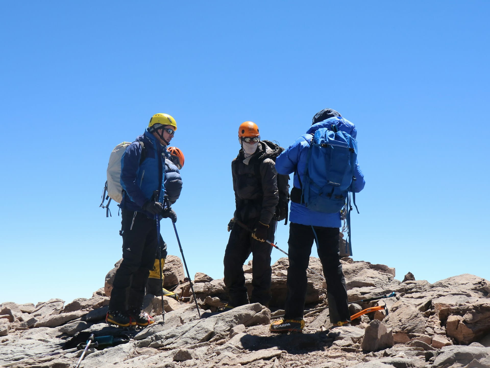
The summit of Mount Everest at 8,848.86 meters sits at approximately the lower cruising altitude of jet aircraft — the thin, cold layer of atmosphere where commercial flights typically operate is between roughly 9,000 and 12,500 meters. Everest’s summit reaches into the upper troposphere, close to the boundary with the stratosphere, placing it in the same layer of atmosphere that passengers experience only through pressurized cabin windows.
At this altitude, the jet stream — a fast-moving band of wind in the upper atmosphere that circles the globe — can intersect directly with the summit. When the jet stream sits on Everest, wind speeds at the summit can exceed 160 kilometers per hour (100 miles per hour). The highest wind speed recorded near the summit was 280 kilometers per hour (175 miles per hour), measured in February 2004. At these wind speeds, exposed skin freezes in seconds and it is physically impossible to move forward.
The brief window that allows summit attempts — typically a narrow period in late May between the departure of winter jet stream positioning and the arrival of the southwest monsoon from India — exists because the jet stream shifts northward seasonally, lifting above the summit and creating a relative calm. This window is typically only a few days to a couple of weeks wide. Nearly all successful Everest summits happen within this window, which is why the calendar of Everest summits shows an extraordinary concentration in the last two weeks of May. When the jet stream drops back onto the summit, the mountain becomes effectively unclimaable regardless of the ability, preparation, or determination of anyone attempting it.
The intersection of this meteorological reality with the summit’s physical characteristics produces the conditions that define Everest: not just altitude, not just cold, but a specific combination of thin air, extreme cold, and potentially lethal wind that all operate simultaneously in a window of opportunity that the atmosphere opens and closes on its own schedule.
Frequently Asked Questions About Mount Everest Facts
- What is the official height of Mount Everest in 2026?
The official height of Mount Everest is 8,848.86 meters (29,031.7 feet) above sea level. This figure was confirmed on December 8, 2020, following a joint survey by Nepal and China using GPS technology, gravity meters, and ground-penetrating radar. It is the current globally accepted standard height. - Who first climbed Mount Everest and when?
Edmund Hillary of New Zealand and Tenzing Norgay, a Sherpa mountaineer from Nepal, became the first confirmed people to reach the summit of Mount Everest on May 29, 1953, at approximately 11:30 AM local time. They were part of the ninth British expedition to Everest, led by Colonel John Hunt. Hillary was 33 years old at the time. They spent approximately 15 minutes on the summit before beginning their descent. - Who has climbed Everest the most times?
Kami Rita Sherpa holds the Guinness World Record for the most ascents of Everest, having reached the summit for the 32nd time on May 17, 2026. His Everest climbing career began in 1994, and he has repeatedly extended his own record over three decades. - Is Mount Everest still growing?
Yes. The ongoing collision between the Indian and Eurasian tectonic plates pushes the mountain upward by approximately 4 millimeters per year. Erosion by wind, ice, and weather partially offsets this growth, but Everest has a net upward growth rate of approximately 4 millimeters annually. - Why is Mount Everest called Everest?
The mountain was named after Sir George Everest, the former Surveyor General of India, by the Royal Geographical Society in 1865 to honor his contribution to the Great Trigonometrical Survey. George Everest himself objected to the naming, arguing that his name could not be written or pronounced in any Indian language spoken by local people. His objections were overruled. The mountain’s local names — Chomolungma in Tibetan and Sagarmatha in Nepali — predate the English name by centuries. - What is the death zone on Mount Everest?
The death zone refers to elevations above 8,000 meters (26,247 feet) where atmospheric oxygen is insufficient to sustain human life indefinitely. Above this altitude, the human body deteriorates faster than it can recover. At the summit of Everest, oxygen levels are approximately one-third of sea level. Even with supplemental oxygen, climbers must minimize time spent above 8,000 meters. - Is Everest the tallest mountain in the world?
Everest is the highest mountain above sea level — the standard and most universally used geographical measurement — at 8,848.86 meters. By two alternative measurements, other mountains rank higher: Mauna Kea in Hawaii is taller from base to summit (approximately 10,200 meters when measured from the ocean floor), and Mount Chimborazo in Ecuador has a summit that sits farther from the Earth’s center due to the equatorial bulge. - What are the rocks at the summit of Everest made of?
The rocks at the summit of Everest are composed primarily of marine limestone — sedimentary rock formed from the compressed remains of sea creatures that lived in the ancient Tethys Sea approximately 450 million years ago. These ocean-floor sediments were lifted to their current position by the tectonic collision between the Indian and Eurasian plates over the past 50 to 60 million years. - When was Mount Everest identified as the highest mountain on Earth?
The announcement that Peak XV — the name surveyors had given what is now called Everest — was the highest mountain on Earth was made in 1856, following calculations by Radhanath Sikdar working for the Great Trigonometrical Survey of India. Before this, Kangchenjunga (8,586 meters) was believed to be the highest peak. The mountain was renamed Everest in 1865. - What are the wind speeds at the summit of Everest?
Winds at the summit of Everest frequently exceed 160 kilometers per hour (100 miles per hour) when the jet stream intersects with the peak, which occurs primarily outside the spring climbing window. The highest recorded wind speed near the summit was 280 kilometers per hour (175 miles per hour), measured in February 2004. The brief summit window in late May — when most successful ascents occur — exists because the jet stream shifts northward seasonally, lifting above the summit and creating relative calm.
The Facts Together: A Mountain Stranger Than Its Reputation
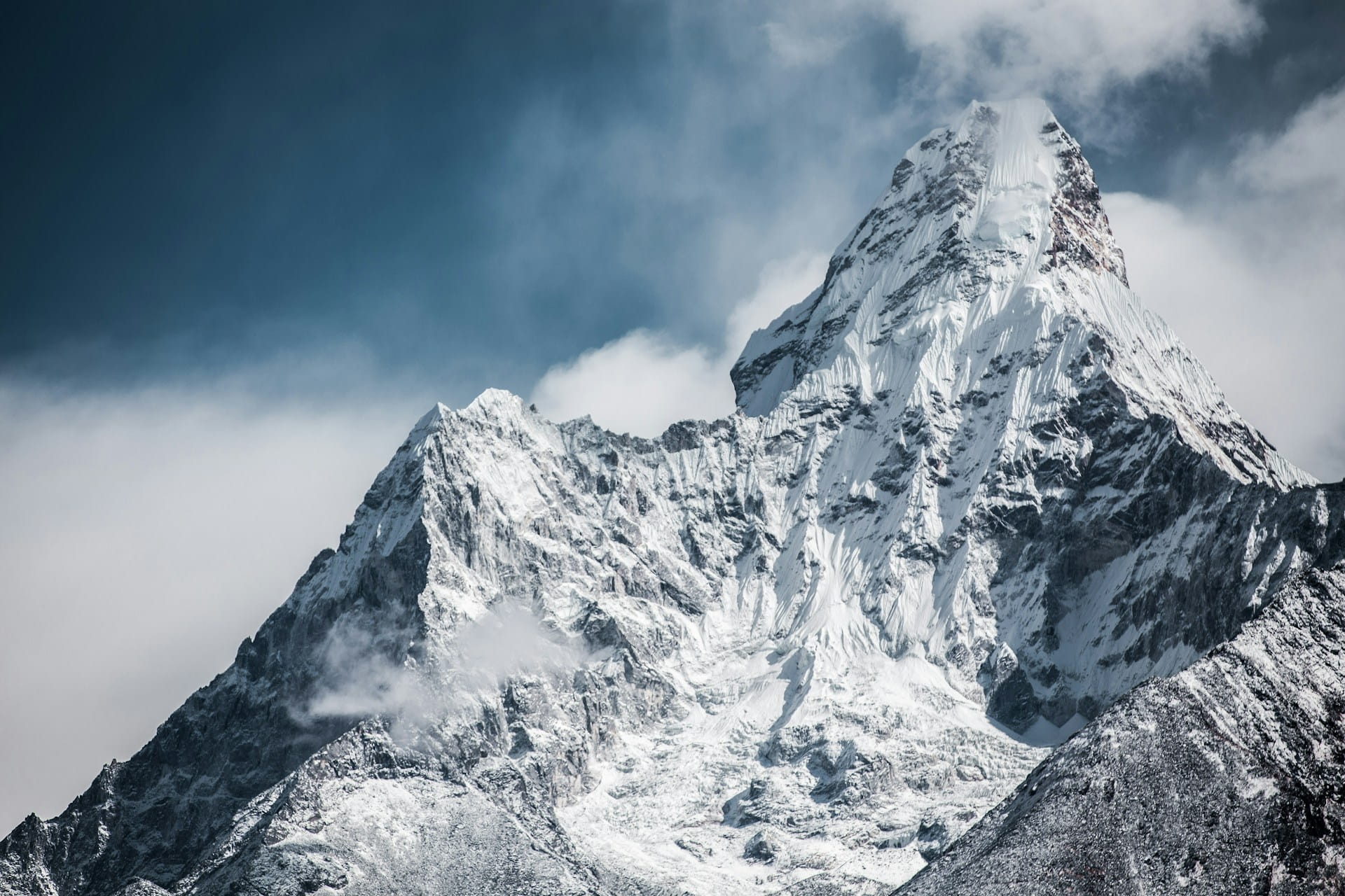
Taken individually, each of these facts is interesting. Taken together, they describe a mountain that is more geologically active, more historically layered, more culturally complex, and more scientifically surprising than its simple superlative — “the highest” — would suggest.
The summit of Everest was an ocean floor. The mountain is still growing. The man it was named after never saw it and didn’t want his name on it. The standard height wasn’t confirmed by Nepal itself until 2020. One man has stood at the top 32 times. The body begins to die above 8,000 meters. By other measurements, two different mountains are taller. The peak was unknown to Western geography until the mid-19th century. The summit intersects the altitude where planes cruise and the winds that carry global weather systems.
These are the facts that the headline number cannot contain. They are also the reason that Everest — after decades of being summited, measured, debated, crowded, commercialized, and photographed from every conceivable angle — continues to generate genuine wonder. Not because it is simply tall, but because what it is and how it came to be that way is considerably stranger and richer than any single number can express.